

- What Earth’s Magnetic Field Has to Do With Climate History - October 7, 2025
- The Science Behind Heat Domes and Their Growing Impact - October 7, 2025
- What Ancient Lake Beds Teach Us About Past Rainfall Patterns - October 6, 2025
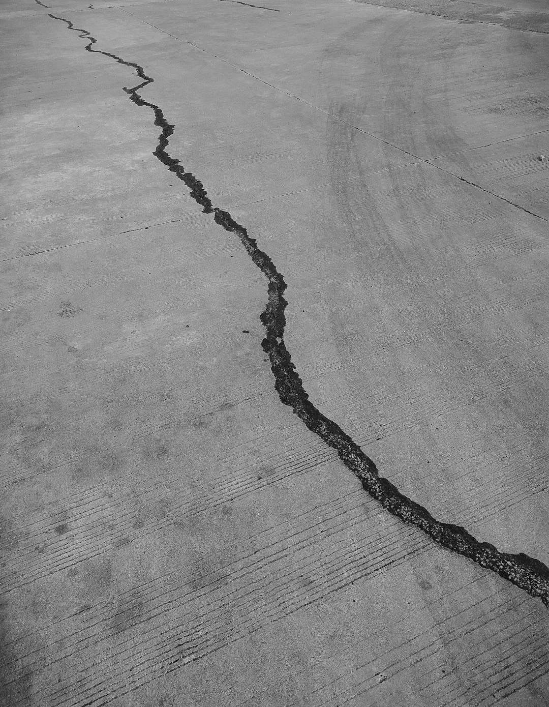
1. Overview of Ground Shifts in Turkey
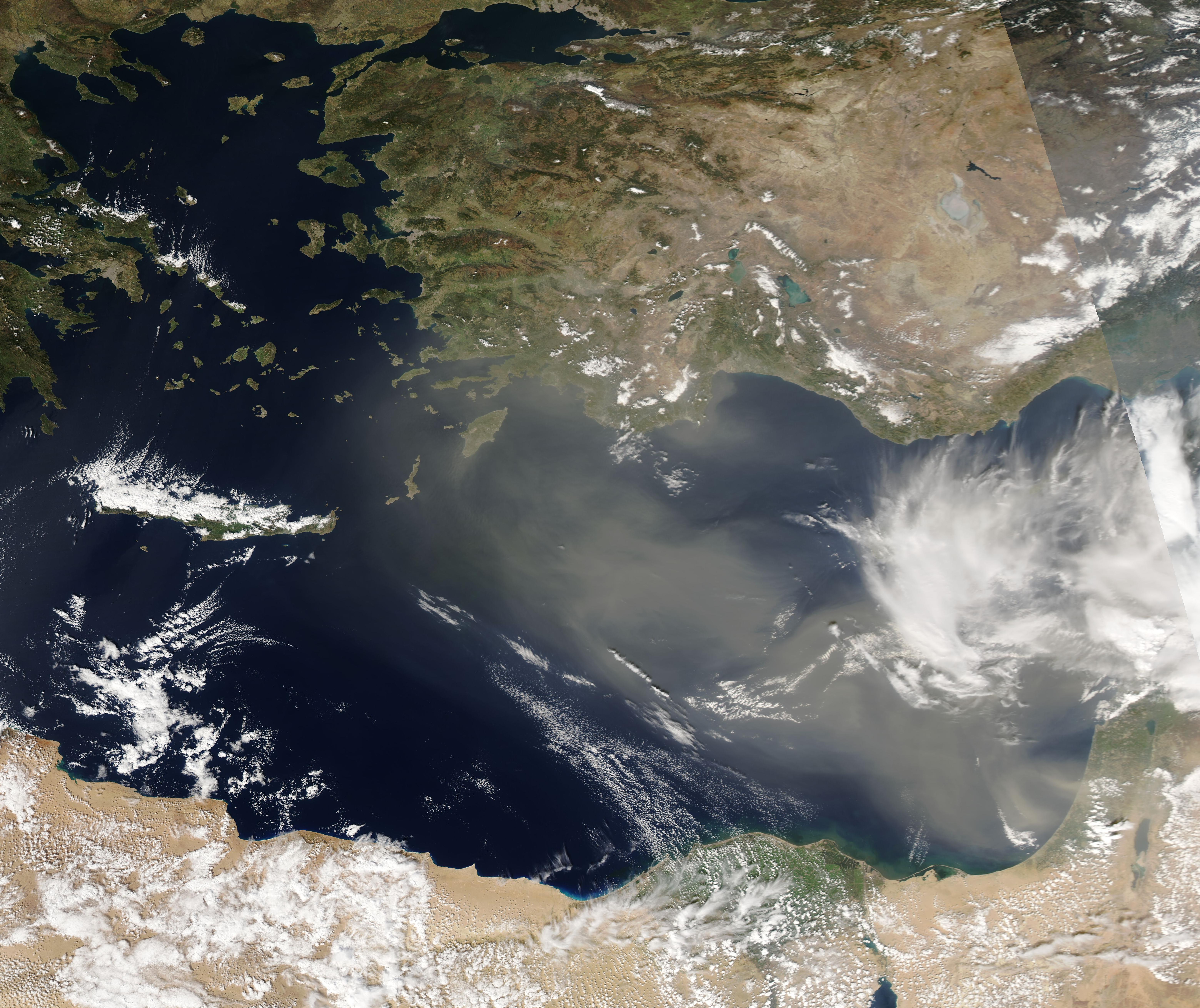
Turkey has been a focal point for geologists due to its dynamic geological activity. Recent satellite imagery has uncovered significant ground shifts, especially in regions prone to seismic activity. These shifts are a result of a combination of natural and human-induced factors, including earthquakes, land subsidence, and urban development. The use of advanced satellite technology, such as Synthetic Aperture Radar (SAR), has been instrumental in detecting these changes. This technology provides scientists with precise data on the earth’s movements, which is vital for assessing risks and crafting disaster preparedness strategies. Such insights are crucial for a country like Turkey, which is no stranger to the wrath of nature.
2. The Role of Satellite Technology
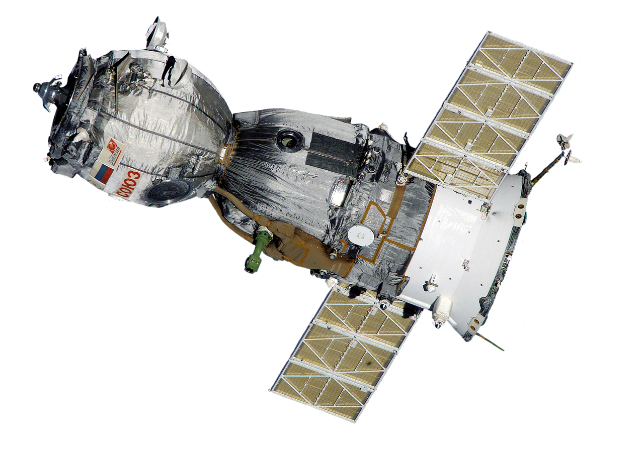
Satellite technology is a game-changer in the realm of geological monitoring. With the ability to capture high-resolution images and detect minute shifts in the earth’s surface, satellites like Sentinel-1 and TerraSAR-X have become indispensable tools for researchers. These satellites can spot ground movements as small as a few millimeters, offering a detailed view of tectonic activity. This level of precision is essential for predicting potential earthquakes and understanding the ongoing geological processes. Moreover, the data collected by these satellites not only aids scientists but also informs policymakers, helping them make informed decisions about infrastructure and safety measures.
3. Recent Earthquakes and Their Impact

Turkey’s seismic activity is a constant reminder of its geological volatility. The 2020 earthquake in Izmir was a stark example of this, registering a magnitude of 7.0 on the Richter scale. This event caused widespread damage, with satellite data revealing noticeable ground deformation in its aftermath. The Kandilli Observatory reported that the earthquake resulted in significant ground shifts, emphasizing the importance of satellite monitoring in assessing the impact of such seismic events. The data not only helped in understanding the immediate effects but also provided insights into potential future risks.
4. Land Subsidence Issues
Apart from earthquakes, land subsidence is a pressing concern in Turkey. This phenomenon, often exacerbated by human activities like excessive groundwater extraction and mining, has been documented in major cities such as Istanbul and Ankara. Satellite imagery has shown that parts of Istanbul are sinking at alarming rates, with some areas experiencing a subsidence of up to 10 centimeters per year. This data, published in the journal “Remote Sensing,” highlights the urgent need for sustainable urban planning and resource management to mitigate the effects of land subsidence.
5. Monitoring Infrastructure Stability
The stability of infrastructure is closely tied to ground shifts. Roads, bridges, and buildings are at risk when significant ground movements occur. Satellite data plays a pivotal role in identifying vulnerable structures, allowing engineers and city planners to take preventive measures. For instance, the Istanbul Metropolitan Municipality has leveraged satellite data to assess the stability of key infrastructures. This proactive approach ensures public safety and minimizes the risk of catastrophic failures, especially in regions prone to seismic activity.
6. Environmental Implications
Ground shifts have far-reaching environmental implications. Changes in the landscape can alter water drainage patterns, leading to increased risks of flooding or drought. Satellite monitoring helps researchers understand these environmental changes and their potential impact on agriculture and local ecosystems. According to the Turkish Ministry of Agriculture, areas experiencing subsidence face higher risks of crop failure due to altered water availability. This underscores the importance of integrating satellite data into environmental management practices to safeguard natural resources.
7. The Importance of Continuous Monitoring
Continuous monitoring of ground shifts is crucial for effective disaster preparedness. In collaboration with international agencies, the Turkish government has established a network of satellite monitoring systems. This initiative aims to provide real-time data to emergency services and local authorities, enabling them to respond swiftly to potential disasters. The European Space Agency (ESA) has played a significant role in supporting these efforts through its Copernicus program. Such collaborations are vital for enhancing Turkey’s resilience against natural calamities.
8. Community Awareness and Education

Raising community awareness about the risks associated with ground shifts is essential. Educational programs that inform residents about the geological characteristics of their regions can enhance preparedness. Local governments are encouraged to utilize satellite data in public awareness campaigns. By doing so, residents gain a better understanding of the importance of being prepared for potential earthquakes and land subsidence. This knowledge empowers communities to take proactive measures, ensuring their safety and well-being.
9. Future Research Directions

The future of geological research in Turkey lies in improving the accuracy of satellite measurements and developing predictive models for ground shifts. Collaborations between universities, government agencies, and the private sector are crucial for advancing this field. Ongoing studies aim to integrate satellite data with ground-based measurements, creating a comprehensive understanding of Turkey’s geological dynamics. Such research endeavors will pave the way for more effective disaster management strategies and infrastructure planning.
10. Conclusion: The Path Forward
The advancements in satellite technology offer a promising path forward for monitoring ground shifts across Turkey. As the nation continues to grapple with geological challenges, leveraging satellite data will be critical in enhancing safety and resilience. By investing in research and community education, Turkey can better prepare for the impacts of natural disasters. This proactive approach will ultimately safeguard its population and infrastructure, ensuring a more secure future for all.