

- Feds Warn La Niña Is Coming – What It Means For Hurricanes And Your Winter - September 19, 2025
- Fireflies Are Thriving In Urban Areas And Even City Parks - September 17, 2025
- When Weather Events Are Confused With Climate Trends - September 8, 2025
La Niña Watch Issued
Forecasters say La Niña is increasingly likely in the coming months, with a 71% chance between October and December. The Climate Prediction Center issued a La Niña Watch on September 11, signaling favorable conditions within six months.
Global Agencies Weigh In
The World Meteorological Organization separately pegs the odds at about 60%. Both outlooks point to a shift toward cooler-than-average equatorial Pacific waters that can reverberate through global weather.
What La Niña Actually Is

La Niña is one phase of the El Niño–Southern Oscillation, a Pacific-based climate cycle. It features cooler-than-normal sea surface temperatures along the equator and often steers U.S. weather in late fall through early spring.
Why Odds Matter Now

A transition to La Niña during October–December can influence both late-fall patterns and early winter setups. Even a weak event can nudge storm tracks, temperature anomalies, and rainfall distributions across regions.
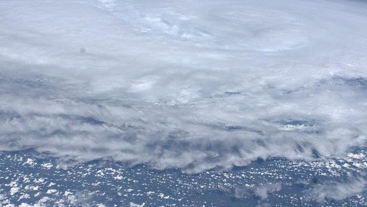
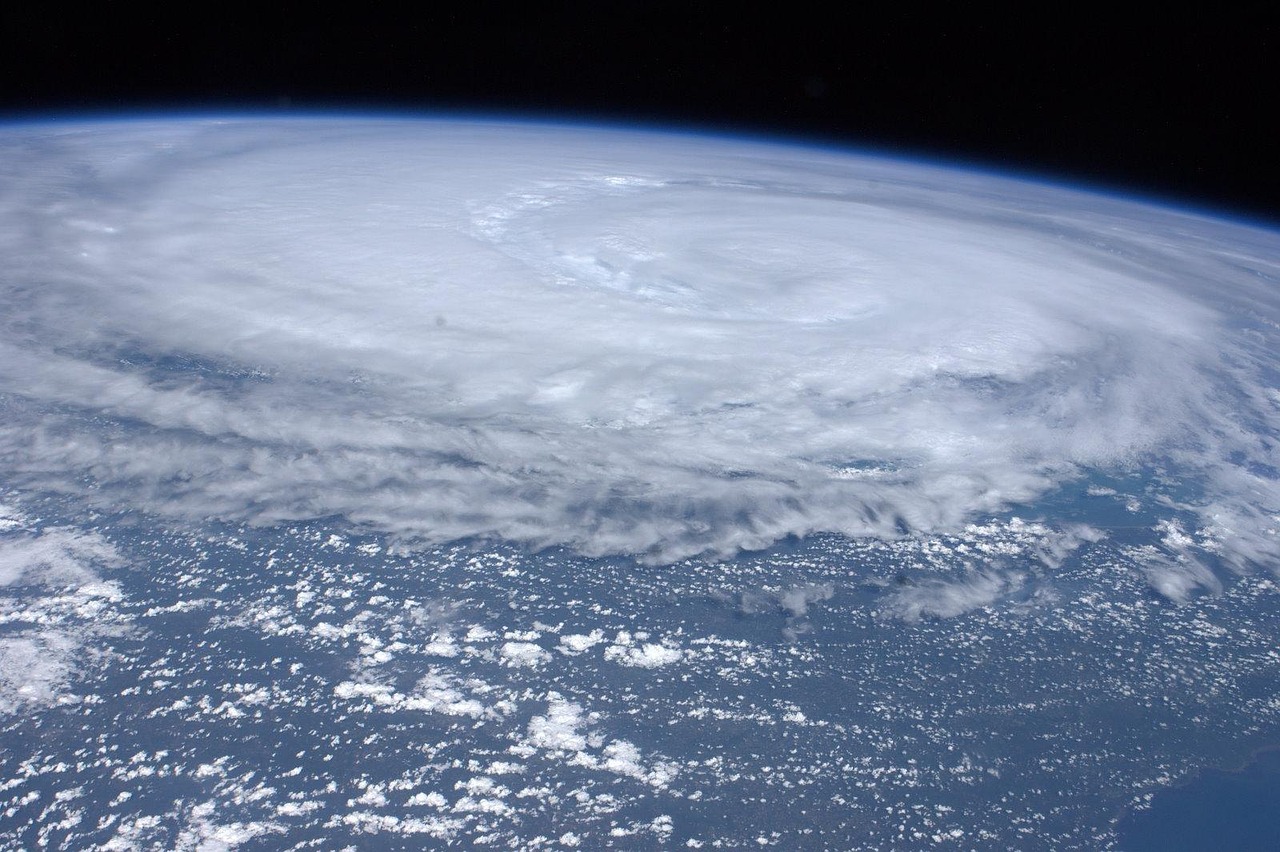
Hurricane Season Implications
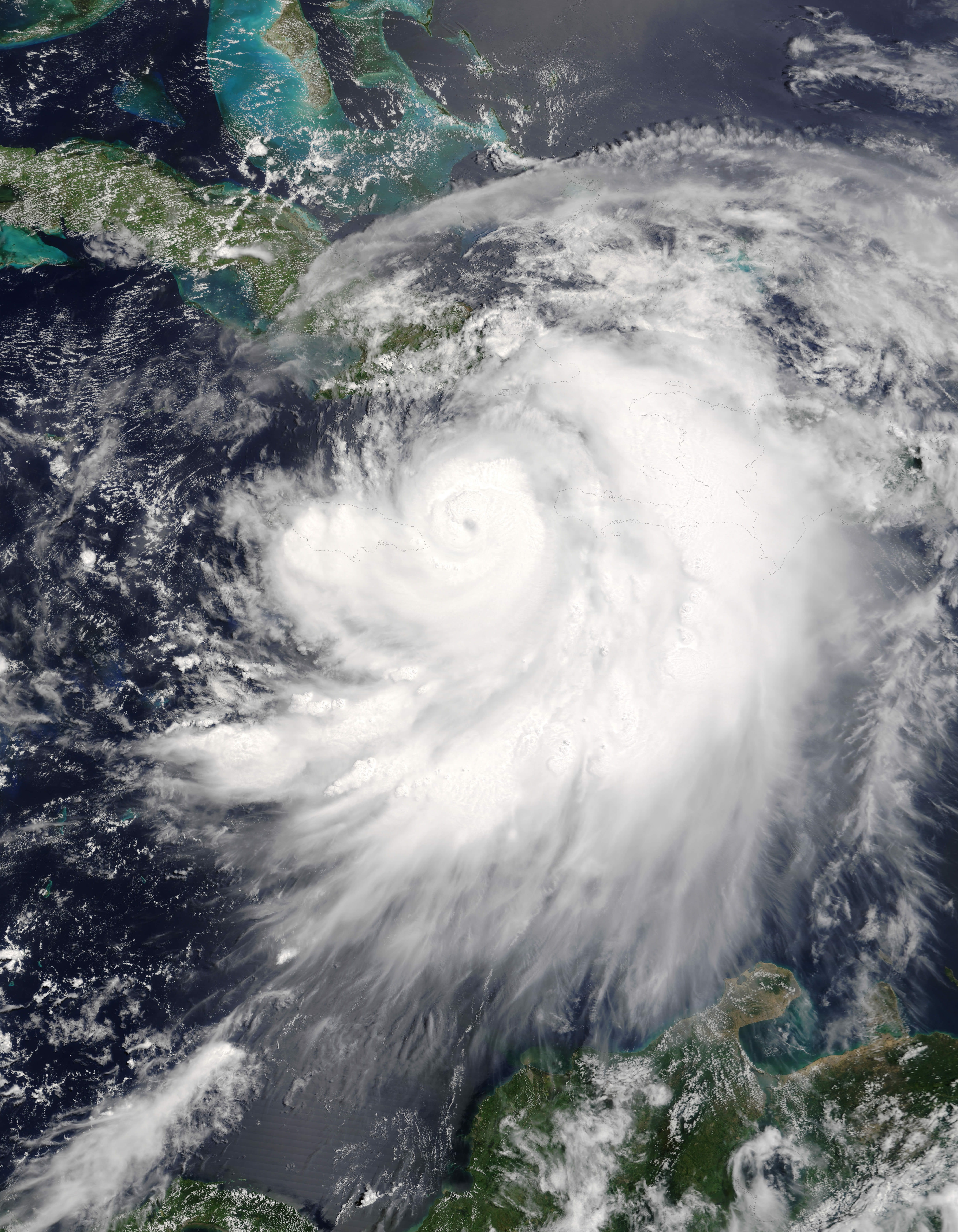
La Niña typically reduces wind shear over parts of the Atlantic, making it easier for storms to form and intensify. Forecasters note November activity often runs higher in La Niña years than during neutral or El Niño phases.
Late-Season Signal

Experts say chances for La Niña conditions grow toward October and November, favoring an active finish. This doesn’t guarantee landfalls, but it raises the ceiling for development during the closing weeks of the season.
Winter Pattern Playbook

In many La Niña winters, the Northwest trends colder and snowier, while the Southern tier skews drier. The Southeast and Mid-Atlantic often lean warmer than average, with faster-moving systems limiting big snow totals.
How Strong And How Long

Early indications suggest a weak, short-lived La Niña that could fade back to neutral by year’s end. Weak events usually yield less reliable impacts than strong, persistent ones, so regional outcomes may vary.
Regional Risks And Relief

A drier South can stress reservoirs and agriculture, while a colder Northwest may see heavier mountain snow. Energy demand, drought risk, and flood potential can all shift depending on how the pattern locks in.
What To Watch Next

Keep an eye on Pacific temperature anomalies, wind shear trends in the Atlantic, and CPC monthly updates. If La Niña verifies, expect tweaks to late-season hurricane guidance and winter outlooks as new data arrives.