

- What Earth’s Magnetic Field Has to Do With Climate History - October 7, 2025
- The Science Behind Heat Domes and Their Growing Impact - October 7, 2025
- What Ancient Lake Beds Teach Us About Past Rainfall Patterns - October 6, 2025
The Science Behind Water Vapor Rising

Ever wondered why clouds look so different from each other? Water vapor can rise into the atmosphere despite being below boiling point due to the process of evaporation, where individual water molecules gain enough kinetic energy to escape the liquid state. This energy is not uniform; some molecules exceed the average temperature, allowing them to vaporize even at lower temperatures. The air can only hold a certain amount of water vapor, depending on the temperature and weight of the air – or atmospheric pressure – in a given area. The higher the temperature or atmospheric pressure, the more water vapor the air can hold. This basic principle sets the stage for the amazing cloud formations we see dancing across our skies.
Condensation happens with the help of tiny particles floating around in the air, such as dust, salt crystals from sea spray, bacteria or even ash from volcanoes. Those particles provide surfaces on which water vapor can change into liquid droplets or ice crystals. Think of these particles as tiny platforms where water vapor can gather and transform into the building blocks of clouds.
How Clouds Form Their Basic Shapes

This process occurs when one or more of three possible lifting agents – cyclonic/frontal, convective, or orographic – causes air containing invisible water vapor to rise and cool to its dew point, the temperature at which the air becomes saturated. The main mechanism behind this process is adiabatic cooling. Atmospheric pressure decreases with altitude, so the rising air expands in a process that expends energy and causes the air to cool, which makes water vapor condense into cloud.
Those objects are called cloud condensation nuclei. These nuclei are minute solid and liquid particles found in abundance in the atmosphere, such as smoke from fires or volcanoes, ocean spray, or tiny specks of wind-blown soil. They are hygroscopic, meaning they attract water molecules, and are about 1/100th the size of a cloud droplet upon which water condenses. It’s fascinating that every single cloud droplet has a tiny speck of dirt at its center. The water droplets in a cloud typically have a radius ranging from about 0.001 to 0.05 mm, with most averaging around 0.01-0.02 mm.
The Ten Basic Cloud Types That Rule Our Skies

Meteorologists classify clouds primarily by their appearance. The eight main cloud families are divided into three groups on the basis of altitude. This research served as the starting point for the ten basic types of clouds we observe. From the World Meteorological Organization’s (WMO) International Cloud Atlas, the official worldwide standard for clouds, the following are definitions of the ten basic cloud types, divided by their height: Cirrus (Ci), cirrocumulus (Cc), and cirrostratus (Cs) are high level clouds. Each of these cloud types tells its own unique weather story.
There are ten main types of clouds, which can be divided into three major families. Each cloud family has its own distinct cloud species, based on the altitude at which they form. High-level clouds (5-13 km): cirrocumulus, cirrus, and cirrostratus. Mid-level clouds (2-6 km): altocumulus, altostratus, and nimbostratus. Low-level clouds (0-2 km): stratus, cumulus, cumulonimbus, and stratocumulus.
Cirrus Clouds: Nature’s Feathery Brushstrokes

Cirrus clouds are delicate, feathery clouds that are made mostly of ice crystals. Their wispy shape comes from wind currents which twist and spread the ice crystals into strands. If you’ve ever looked up at the sky and seen thin, wispy clouds that resemble feathers or horse tails, you were probably looking at cirrus clouds. Cirrus clouds are one of the most common types of clouds that can be seen at any time of the year. They’re thin and wispy with a silky sheen appearance. This type of cloud is always made of ice crystals whose degree of separation determines how transparent the cirrus is.
Weather prediction: A change is on its way! Weather prediction: Rain or snow will arrive within 24 hours! These beautiful clouds might look harmless, but they’re actually nature’s early warning system. The presence of cirrus clouds often indicates that a warm front is approaching. While they do not produce precipitation themselves, they can be a sign of changing weather, with rain or snow expected within the next 24 to 48 hours.
Cumulus Clouds: The Cotton Ball Clouds

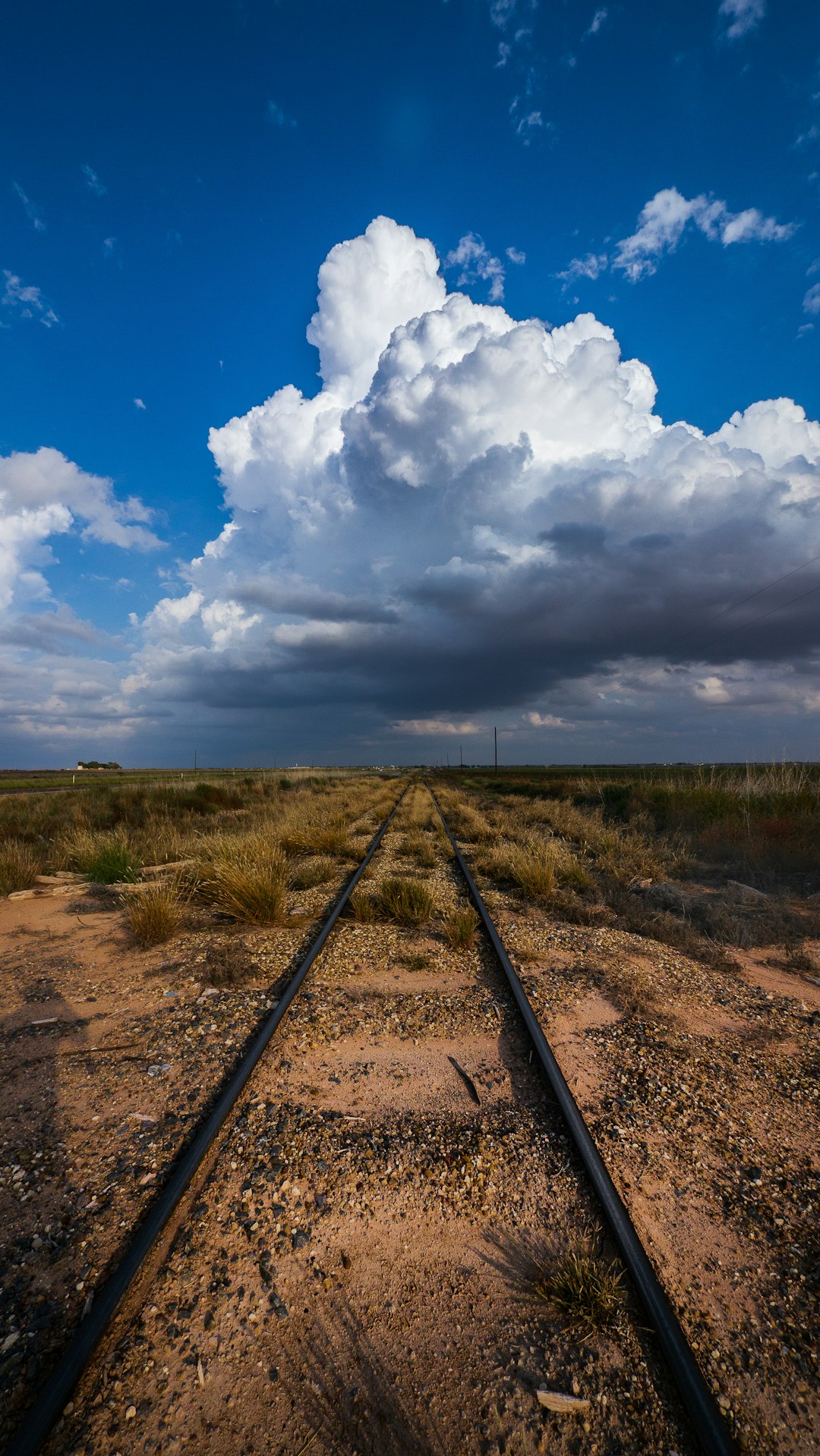
Clouds that look like cartoon cotton balls or cauliflower are made up of tiny liquid water droplets and are called cumulus clouds. Often, these are fair-weather clouds that form when the sun warms the ground and the warm air rises. You’ll often see them on humid summer days. Cumulus clouds are characterized by their fluffy, puffy, and often cauliflower-like appearance. They usually have a flat base and can develop into various shapes.
Cumulus: Fluffy, white, cotton-ball clouds with flat bases and dome-shaped tops. Weather prediction: Fair weather is in store! However, don’t be fooled by their innocent appearance. They are associated with fair weather when small and isolated but can grow into larger, more developed clouds. While cumulus clouds themselves do not indicate immediate precipitation, their growth into cumulonimbus clouds signals the potential for thunderstorms and heavy rainfall. It’s like watching a friendly puppy that might eventually grow into a massive guard dog.
Cumulonimbus: The Sky’s Most Dramatic Performers
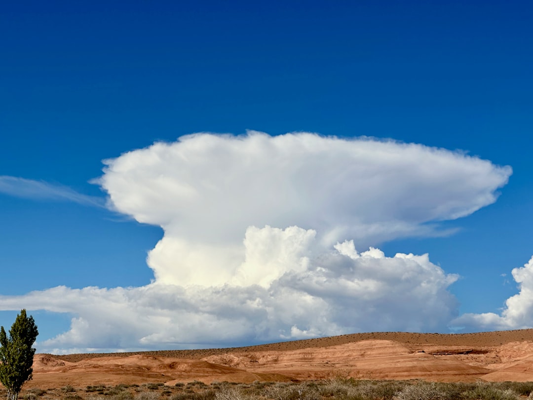
The thunderstorm cloud, this is a heavy and dense cloud in the form of a mountain or huge tower. The upper portion is usually smoothed, fibrous, or striated and nearly always flattened in the shape of an anvil or vast plume. Cumulonimbus clouds are towering, anvil-shaped clouds that can reach high into the atmosphere. They are often dark and foreboding, with a flat, anvil-like top. These are the superheroes of the cloud world, but definitely the dangerous kind!
They produce precipitation, which sometimes is in the form of virga. Cumulonimbus clouds also produce hail and tornadoes. Cumulonimbus clouds grow on hot days when warm, wet air rises very high into the sky. From far away, they look like huge mountains or towers. Weather prediction: Look out for rain, hail, and tornadoes! When you see these towering giants approaching, it’s time to head indoors and watch nature’s most spectacular show from a safe distance.
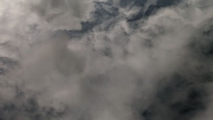
Stratus Clouds: The Sky’s Gray Blanket
Stratus cloud often look like thin, white sheets covering the whole sky. Since they are so thin, they seldom produce much rain or snow. Sometimes, in the mountains or hills, these clouds appear to be fog. Weather prediction: Fair, but gloomy These are the clouds that make you feel like you’re living inside a gray envelope. Stratus clouds are low-altitude clouds that form in uniform, flat, and featureless layers.
Stratus: Thin, gray-white, sheetlike clouds with low bases covering the whole sky. Weather prediction: Fair, but gloomy. They may bring drizzle or snow but won’t dump too much precipitation because they are so thin. Think of stratus clouds as nature’s way of putting a soft filter over the landscape, creating those moody, overcast days that make everything look like it’s been photographed through gauze.
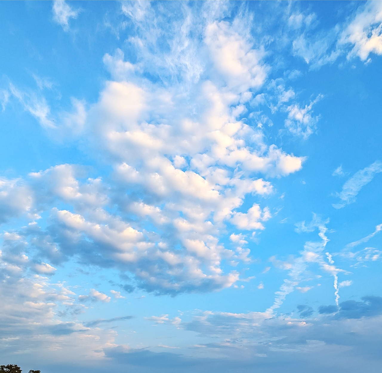
Altocumulus: The Mid-Level Ripples
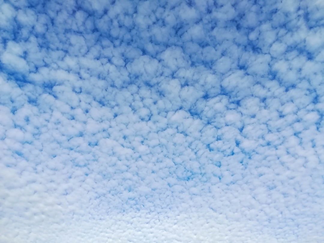
Altocumulus: Gray or white layers or patches of solid clouds with rounded shapes, and they often appear as fluffy ripples. They are made of liquid water, but they don’t often produce rain. Weather prediction: Fair and pleasant! Altocumulus clouds have several patchy white or gray layers, and seem to be made up of many small rows of fluffy ripples. These clouds look like someone took a giant rake and dragged it across cotton batting in the sky.
Altocumulus lenticularis – Lens-shaped clouds that usually form over hilly areas. These are often called spaceship clouds since they often resemble a UFO. The lenticular variety is particularly fascinating because they really do look like flying saucers hovering over mountains, which has led to numerous UFO sightings over the years!
Nimbostratus: The Rain Makers

Nimbostratus: Dark, gray, shapeless cloud layers containing rain, snow, or ice pellets. They are often thick enough to block out the Sun. Weather prediction: Gloomy with persistent rain or snow Nimbostratus clouds are dark, gray clouds that seem to fade into falling rain or snow. They are so thick that they often blot out the sunlight. Weather prediction: Gloomy with continuous rain or snow
These are the clouds that settle in for the long haul, bringing steady, soaking rain or persistent snow. Unlike their dramatic cousin the cumulonimbus, nimbostratus clouds are the marathon runners of precipitation – not flashy, but incredibly persistent. The nimbo- prefix refers to its ability to produce continuous rain or snow over a wide area, especially ahead of a warm front.
Special Cloud Formations and What They Signal
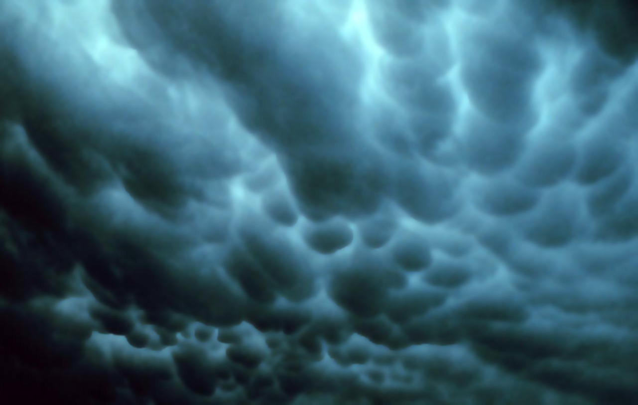
Mammatus clouds are actually altocumulus, cirrus, cumulonimbus, or other types of clouds that have these pouch-like shapes hanging out of the bottom. The pouches are created when cold air within the cloud sinks down toward the Earth. Weather prediction: Severe weather might be on its way! These upside-down clouds look absolutely otherworldly, like nature decided to turn the sky inside out.
In them, experts identified and labeled the shape and motion of “comma-shaped” clouds. These cloud patterns are strongly associated with cyclone formations, which can lead to severe weather events including hail, thunderstorms, high winds and blizzards. Lenticular clouds are shaped like lenses or almonds or…flying saucers! They may get their shape from hilly terrain or just the way the air is rising over flat terrain. Weather prediction: None!
How Modern Technology Reads Cloud Shapes

For the last several years, scientists at NASA’s Langley Research Center in Hampton, Virginia, have been exploring the secrets of clouds to improve weather predictions – everything from daily forecasts to keeping aircraft clear of dangerous conditions. Now, there is a computer model that can help forecasters recognize potential severe storms more quickly and accurately, thanks to a team of researchers at Penn State, AccuWeather, Inc., and the University of Almería in Spain.
Scientists have found that rapid growth and cooling at the tops of clouds are indicators of the potential for severe weather. The ABI can show more detailed changes in cloud-top features, helping scientists assess the potential size and severity of a storm even before it reaches its peak! The researchers found that their method can effectively detect comma-shaped clouds with high accuracy, at an average of 40 seconds per prediction. It was also able to predict 64 percent of severe weather events, outperforming other existing severe-weather detection methods. It’s incredible how artificial intelligence is now helping us decode the language of clouds faster than human eyes can process.
Reading Clouds for Weather Prediction
To predict weather with clouds, you simply have to look at observable patterns like cloud size, cloud shape, altitude, vertical depth, and color shading within the cloud itself. In general, when you see small, isolated clouds surrounded by a blue sky that lacks significant dark areas or signs of active growth, these are all indicators of fair weather ahead: Notice the small size and shallow, wispy appearance of this fair weather cumulus cloud
One of the easiest ways to predict weather is to look at the clouds. There are many different types of clouds in the troposphere (where all weather forms). Different clouds mean different types of weather. Navigators realise you can’t predict the weather from a single snapshot – that is, by noting how the sky looks at one moment in time. Instead, you have to observe changes over time. It’s like watching a slow-motion movie where each frame tells part of tomorrow’s weather story.
Why Clouds Matter for Climate and Earth’s Future

Clouds also produce precipitation from water vapor, releasing heat to the atmosphere in the process (evaporation of water vapor from the surface cools it, so that these two processes serve to transfer heat from the surface to the atmosphere). Thus, any changes in clouds will modify the radiative energy balance and water exchanges that determine the climate. The effect of clouds on this heat budget is immense. The major radiatively active components of the atmosphere are water vapor and so-called layer clouds.
In fact, clouds are considered one of the most challenging aspects of climate science. That’s because truly understanding clouds requires a deep understanding of the entire atmosphere. The ways that clouds respond to changes in the climate are so complex that it is hard to determine their net effect on the energy and water balances and to determine how much climate might change. Scientists are still working to crack the code of how clouds will behave as our planet warms, making them one of the biggest puzzle pieces in understanding our climate future.
The shapes of clouds aren’t just nature’s artwork – they’re a complex language that tells us everything from what weather to expect tomorrow to how our planet’s climate system functions. From the delicate ice crystal brushstrokes of cirrus clouds warning us of approaching weather changes, to the towering anvil-shaped cumulonimbus clouds threatening severe storms, each formation has evolved as a visual telegraph system written across our skies. Modern technology is now helping us read this ancient language faster and more accurately than ever before, but the basic principles remain the same: water vapor, temperature, pressure, and atmospheric movement combine to create these magnificent formations that have guided weather watchers for centuries. What will you see when you look up at the sky tomorrow?