
The Eyes in the Sky That Never Blink
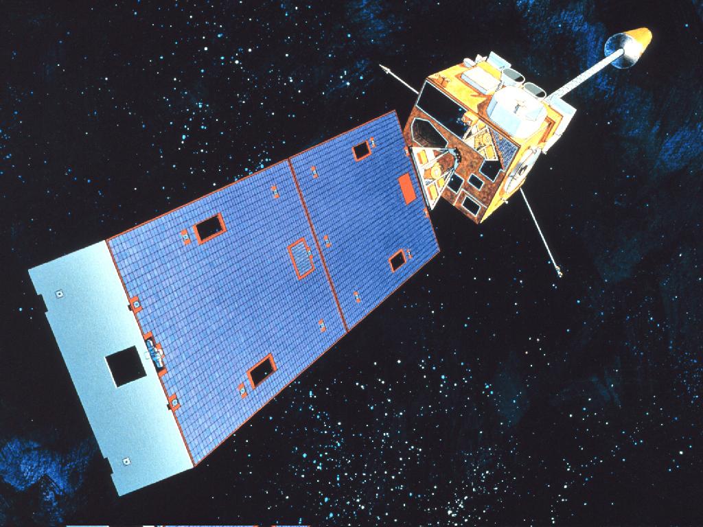
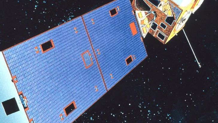
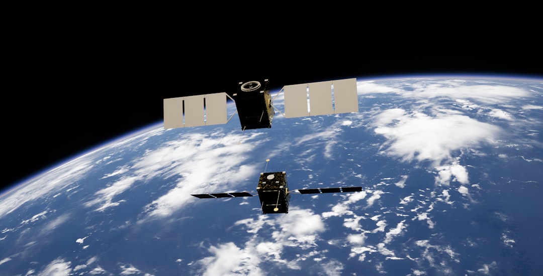
Think about the last time you checked the weather before leaving your house. That forecast you relied on came from an incredible network of satellites orbiting roughly 22,236 miles above Earth. These space-based weather watchers never sleep, constantly monitoring our planet’s atmosphere with sensors that can detect changes invisible to the human eye. GOES East (GOES-19, previously GOES-16) and GOES West (GOES-18, previously GOES-17) show near real-time views of developing storms over the Atlantic from the west coast of Africa across the Americas and much of the Pacific.
From these vantage points, they deliver three times more spectral information, four times better spatial resolution, and five times faster temporal coverage than earlier generations of GOES satellites. It’s like upgrading from an old flip phone camera to the latest smartphone – the difference is remarkable.
When Storms Form Before Anyone Notices
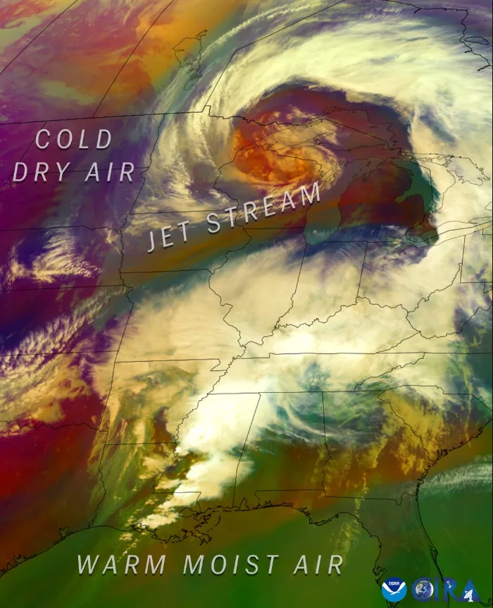
Meteorologists can spot brewing trouble long before clouds even appear on the horizon. The ABI can detect storm features like overshooting tops, gravity waves and above-anvil cirrus plumes (AACP) – signs that a storm may be severe. These subtle atmospheric signatures are like nature’s early warning system, telling scientists that dangerous weather is about to explode into existence.
Modern satellites capture images every few minutes, but when storms develop, they can scan targeted areas as often as every 30 seconds, forecasters can track fast-changing storms in near real-time. That’s faster than most people refresh their social media feeds. This rapid-fire monitoring helps meteorologists watch storms intensify and change direction with incredible precision.
Lightning Strikes Before the Rain Falls
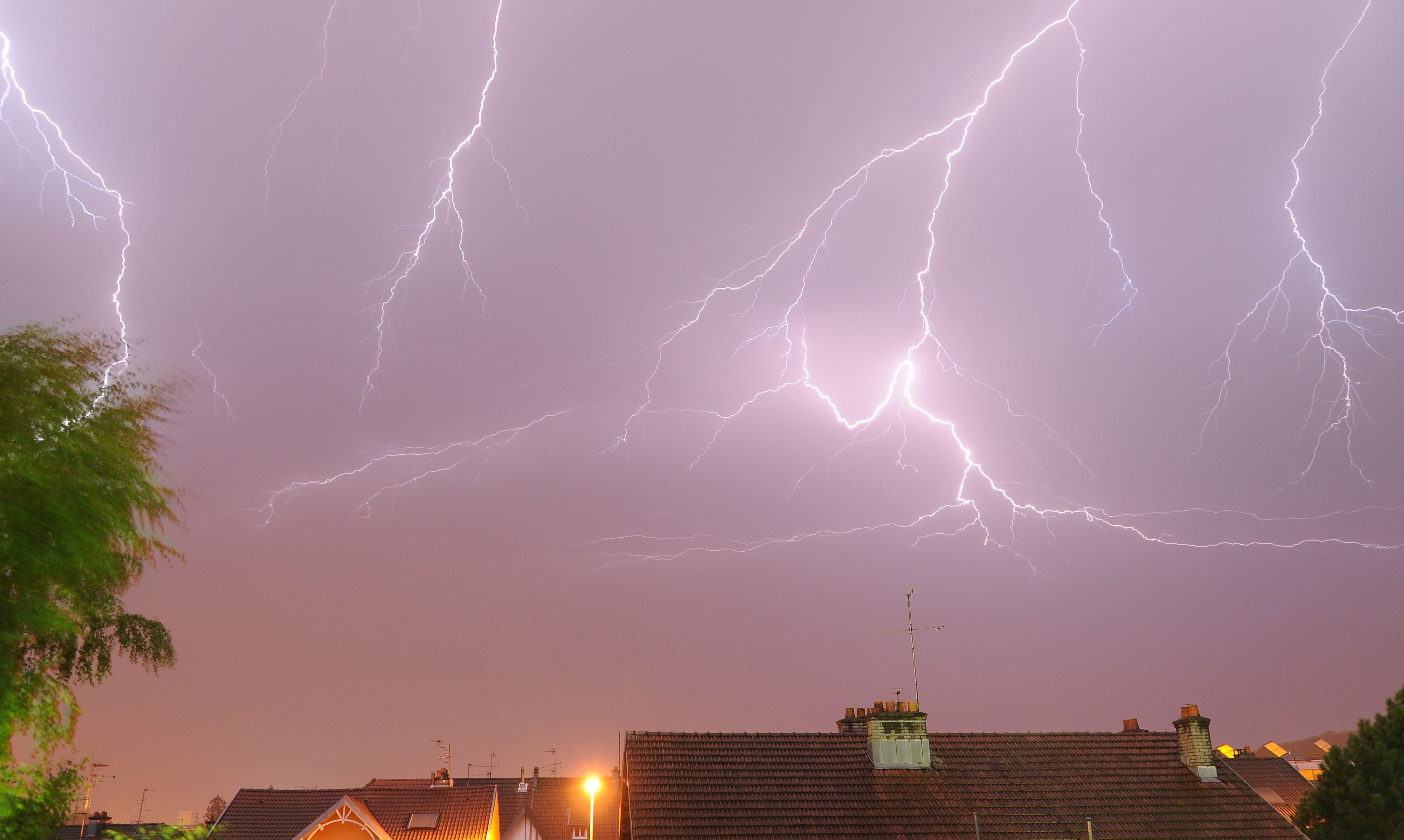
The Geostationary Lightning Mapper (GLM) continuously monitors lightning activity across the Americas and surrounding ocean regions, capturing both cloud-to-cloud and cloud-to-ground flashes. This technology revolutionizes storm prediction because lightning often occurs before heavy rain begins. Scientists use this data to create AI-powered tools like LightningCast, which can accurately forecast lightning up to 60 minutes before the first observed flash.
During severe weather season, this lightning detection becomes crucial for public safety. Emergency managers can issue warnings before storms even produce their first drops of rain, giving people precious extra minutes to seek shelter.
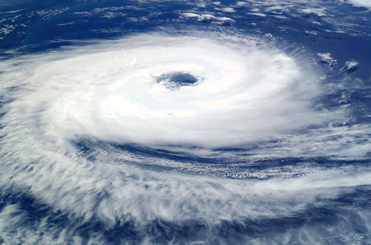
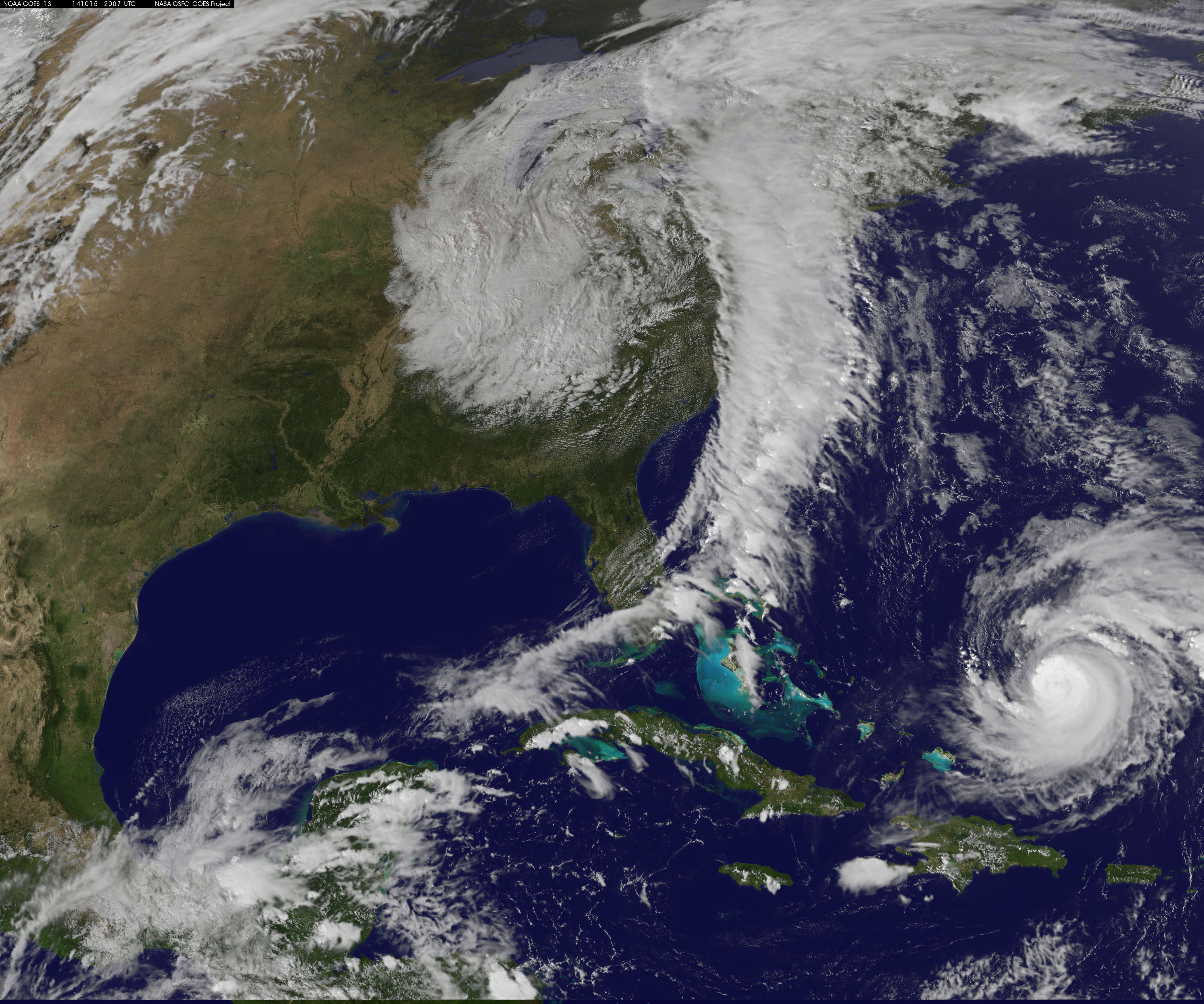
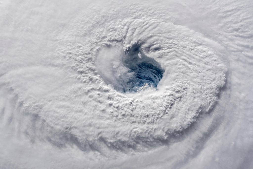
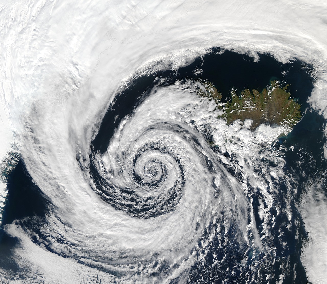
Hurricane Hunting From Space
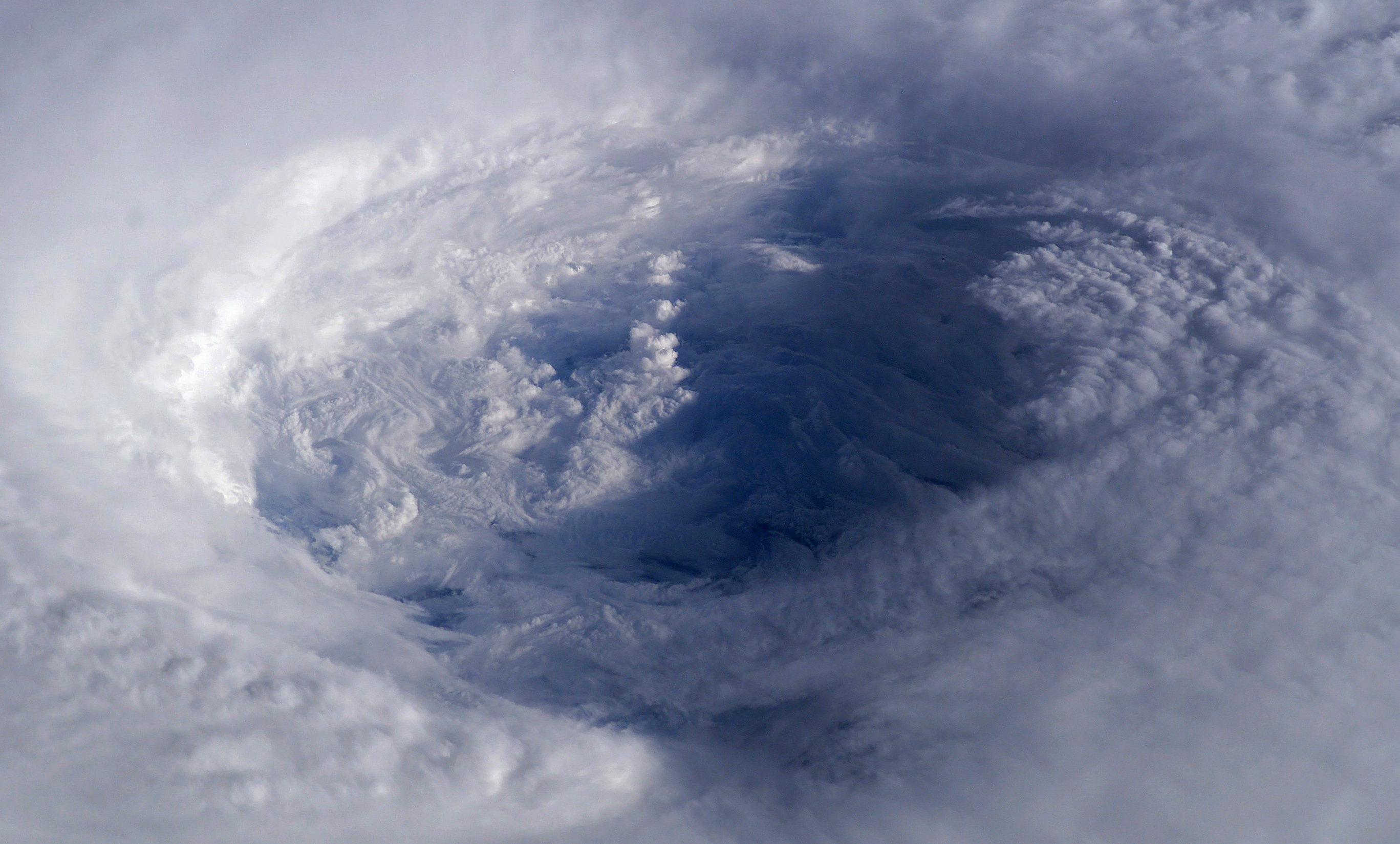
When hurricanes churn across the ocean, satellites provide meteorologists with X-ray vision into these massive storms. With these satellites, meteorologists can identify cloud features and patterns within a tropical system, observe the frequency and changes in lightning activity, detect cloud temperatures, monitor central pressure and visualize storm structure. It’s like having a medical scanner for hurricanes, revealing their internal organs and vital signs.
GOES-19 can scan these big Atlantic Basin storms as frequently as every 30 seconds in order to get up-to-the-minute location, track and intensity information. This rapid scanning capability proved essential during recent hurricane seasons when storms underwent rapid intensification – a dangerous phenomenon that can catch coastal communities off guard.
The Microwave Revolution in Storm Detection
Beyond visible light and infrared, satellites use microwave sensors to peer through storm clouds like Superman’s X-ray vision. They provide imagery across numerous wavelengths – such as visible, microwave, near-infrared and infrared – enabling detailed measurements of atmospheric moisture, wind shear and other key variables within and around tropical systems. These microwave instruments can see through thick clouds that would blind regular cameras.
The Defense Meteorological Satellite Program has been particularly important for understanding when a hurricane is about to rapidly intensify, a dangerous situation for coastal communities. Unfortunately, some of these critical satellites are reaching the end of their operational lives, creating gaps in coverage that concern meteorologists heading into active storm seasons.
Artificial Intelligence Joins the Forecasting Team

Weather prediction is undergoing a quiet revolution as artificial intelligence transforms how meteorologists analyze satellite data. Early results using AI and data-driven models show enhanced skill in predicting extreme life-threatening events like hurricanes, winter storms, and heat waves – highlighting the opportunity of these new models as valuable tools in the suite used to produce forecasts that protect lives and property.
ProbSevere utilizes Numerical Weather Prediction, GOES, NWS radar and ground-based lightning data to estimate the probability that a developing thunderstorm will produce severe weather up to 90 minutes in the future. ProbSevere has been shown to add 13-17 minutes of additional lead-time compared to traditional radar-only methods. Those extra fourteen minutes can mean the difference between life and death during tornado outbreaks.
The European AI Weather Revolution
On June 25, 2024, the European Centre for Medium-Range Weather Forecasts (ECMWF) – a world leader in forecasting global weather conditions up to a few weeks out – quietly went live with the planet’s first fully operational weather forecast system powered by artificial intelligence. This groundbreaking system uses 1,000 times less computational energy than traditional models while producing more accurate forecasts.
The ECMWF says that for some weather phenomena, the AIFS is 20 percent better than its state-of-the-art physics-based models. This isn’t just incremental improvement – it’s a quantum leap that could democratize weather forecasting worldwide, allowing poorer countries to produce their own high-quality forecasts.
When Satellite Data Goes Dark
The loss of critical weather satellites creates blind spots that put lives at risk. On June 25, 2025, the Trump administration issued a service change notice announcing that the Defense Meteorological Satellite Program, DMSP, and the Navy’s Fleet Numerical Meteorology and Oceanography Center would terminate data collection, processing and distribution of all DMSP data no later than June 30. The data termination was postponed until July 31 following a request from the head of NASA’s Earth Science Division.
This data loss concerns meteorologists because The most active part of the season runs from the middle of August to the middle of October, after the DMSP satellite data is set to be turned off. It’s like losing your eyes during the most dangerous part of a journey.
The Next Generation of Storm-Watching Satellites
Scientists are developing revolutionary new satellites that will transform storm prediction. WIVERN, short for wind velocity radar nephoscope, was selected on November 19, 2024 as the European Space Agency’s 11th Earth Explorer Mission. It will provide the first direct measurements of winds within clouds and storms – filling a major gap in current weather observations.
For the first time, we’ll see how winds behave inside these systems, which helps us predict when they’ll become dangerous. This means we can give people better warnings about dangerous weather, whether that’s a hurricane heading for the coast or flash floods from heavy rainfall. This technology will give meteorologists unprecedented insight into the hidden mechanics of deadly storms.
Real-Time Data Processing Challenges
Modern weather satellites generate enormous amounts of data every second, creating a processing challenge that rivals the biggest tech companies. Radiance data from low Earth orbit satellites is crucial for producing accurate and timely short-range weather forecasts. The challenge lies in turning this raw satellite information into useful forecasts quickly enough to save lives.
Our unique data processing approach and quality control allows for 20+% usable observational data as opposed to the roughly 3% usable data that is currently being processed across the industry. This improvement in data utilization represents a massive leap forward in forecast accuracy and timeliness.
Hurricane Season Predictions Using Space Data
The agency is forecasting a range of 13 to 19 total named storms (winds of 39 mph or higher). Of those, 6-10 are forecast to become hurricanes (winds of 74 mph or higher), including 3-5 major hurricanes (category 3, 4 or 5; with winds of 111 mph or higher). NOAA has a 70% confidence in these ranges. These seasonal forecasts rely heavily on satellite observations of ocean temperatures and atmospheric patterns.
The season is expected to be above normal – due to a confluence of factors, including continued ENSO-neutral conditions, warmer than average ocean temperatures, forecasts for weak wind shear, and the potential for higher activity from the West African Monsoon, a primary starting point for Atlantic hurricanes. The higher-heat content provides more energy to fuel storm development, while weaker winds allow the storms to develop without disruption.
The Future of Satellite Storm Prediction
Weather forecasting stands at the threshold of a technological revolution that combines satellite data with artificial intelligence in ways previously unimaginable. One September 2024 study looked at five stand-out A.I.-based weather forecasting systems that are “comparable, and in some cases, superior” to the ECMWF’s numerical prediction system – while being orders of magnitude more computationally efficient.
The marriage of satellite technology and artificial intelligence promises to give us weather predictions that are faster, more accurate, and more accessible than ever before. As extreme weather becomes more frequent due to climate change, these advances couldn’t come at a more crucial time.
The next time you check your weather app and decide whether to carry an umbrella, remember the incredible network of satellites and AI systems working together to keep you safe. These eyes in the sky never blink, never sleep, and never stop watching over us. What would you have guessed about the complexity behind that simple weather icon on your phone?
- How Meteorologists Predict Storms Using Satellite Data - October 3, 2025
- What Causes Rainbows And Why They’re Always Curved - October 1, 2025
- 3 Industries Face Crushing New Tariffs as Trade War Escalates - September 28, 2025