

- The No-Go List: 11 U.S. Places Climate Experts Say May Face Growing Weather Dangers - March 21, 2026
- Warmest Winter Ever: Hong Kong Sets Heat Records - March 21, 2026
- 10 Reasons Some Americans Are Rethinking Travel During Extreme Weather - March 21, 2026
The numbers alone should stop you in your tracks. In 2025, there were 23 weather and climate disasters in the U.S. with at least $1 billion in damages each, causing an estimated 276 fatalities and costing a total of $115 billion. That’s not a bad year – that’s the new normal. In fact, there was an average of just 10 days between billion-dollar disasters in 2025, compared to 82 days during the 1980s.
In 2024 alone, we witnessed the hottest year on record globally, with July marking the planet’s warmest month ever recorded. Scientists, researchers, and insurance analysts are all pointing to the same uncomfortable truth: some American places are becoming genuinely harder to live in. Here’s a close look at 11 of the most climate-exposed locations in the country. Brace yourself.
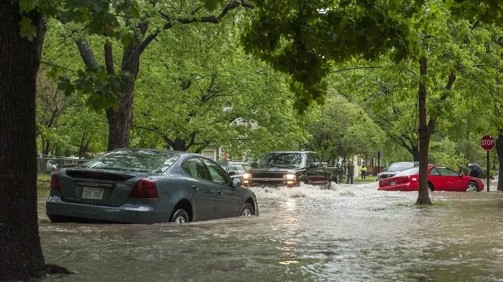
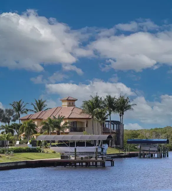
1. Miami, Florida – When the Streets Flood on Sunny Days
Let’s be real: Miami is not just at risk. It is already living the crisis. Miami’s average elevation is just six feet, which is the same amount of sea-level rise expected in Southeast Florida by the end of the century, and the ocean has already risen about six inches since 2000. The city is simultaneously sinking.
The frequency of flooding from high tides, known as “sunny day” flooding, is up over 400% in Miami Beach since 2006. These aren’t hurricane events – these are random Tuesday afternoons. Buildings in Miami face an average 73% chance of a flood about 1.7 feet deep over 30 years, and of 302 census tracts in Miami, there are 288 where more than half of buildings have significant risk from storm surge, high tide, surface flooding, and riverine flooding.
By 2050, people in Miami are projected to experience an average of about 89 days per year over 92.6°F. The heat compounds everything. Researchers at the Organisation for Economic Co-operation and Development listed Miami as one of the 10 most vulnerable cities worldwide relative to the number of people at risk of coastal inundation.
When it comes to the total value of homes at risk of flooding, the greater Miami area ranks first in the country, with a total value of $323.9 billion. Honestly, it’s hard to look at these numbers and not feel a bit unsettled.
2. New Orleans, Louisiana – A City Below the Waterline
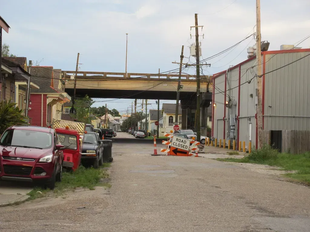
New Orleans has always been a city that defies logic. It sits below sea level, surrounded by water, shaped like a bowl. According to Policygenius, by 2050, 99% of homes in New Orleans will be in a 100-year flood plain, which is a 66% increase from the number of homes currently in flood plains today. This is the biggest predicted risk increase for any American city.
New Orleans leads all U.S. cities when it comes to share of property value at risk from flooding. The implications are staggering. Louisiana also has the most hazardous sites at risk from sea-level rise, with more than 1,000 identified locations facing coastal flooding dangers.
Across the northern U.S. Gulf Coast, the rate of relative sea level rise is greater than the global average, largely due to land subsidence, where the land is sinking due to physical and human activities. In New Orleans, that sinking is so dramatic it’s visible in cracked foundations and tilted telephone poles. The city isn’t just vulnerable to storms – it’s being slowly reclaimed by the water that surrounds it.
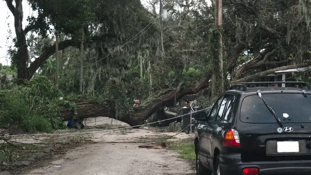
3. Los Angeles, California – Fire Season Has No Off Switch Anymore

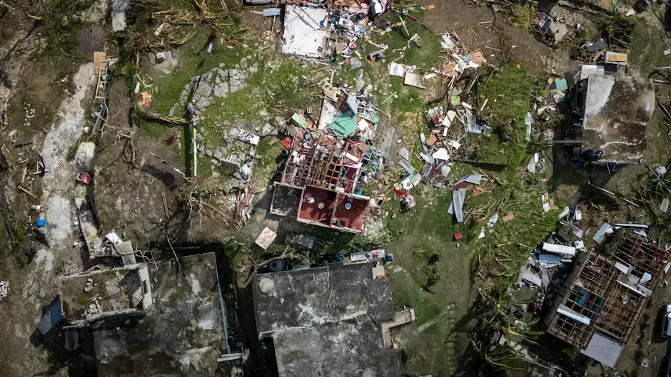
January 2025 changed the conversation about Los Angeles permanently. On January 7, 2025, a handful of wildfires erupted in the Los Angeles metro area and raced through multiple neighborhoods, killing more than two dozen people, razing upwards of 15,000 homes and businesses, and creating unhealthy air quality for millions of people.
The Los Angeles wildfires were the costliest wildfire event on record, exceeding $60 billion, or about twice as much as the previous record. That is a staggering figure. Fueled by severe drought conditions and Santa Ana winds, the Palisades and Eaton fires both erupted on January 7, eventually spreading more than 37,000 acres over the course of 24 days.
As climate change made the wildfire season in California longer, it further overlapped with the season of Santa Ana winds (October through January), and with these severe drought conditions, destructive firestorms are becoming more frequent, with California heading toward a year-round fire season. That last part is what keeps experts up at night. Wildfire burn scar areas are especially prone to dangerous flash flooding and could trigger debris flows and mudslides, and the threshold for triggering flash flooding decreases with burned soil.
4. Phoenix, Arizona – When Heat Becomes a Public Health Crisis

Phoenix routinely registers summer temperatures that, not long ago, would have been considered freakish. In Phoenix and Tucson, Arizona, elevated water stress makes them among the most susceptible to chronic climate risk, even though their inland locations make them immune to sea-level rise. Heat and drought are the weapons here, not floods.
Extreme heat is the deadliest form of extreme weather and, in most years, kills more Americans than floods, tornadoes, and hurricanes combined. More than 21,000 deaths in the United States from 1999 to 2023 were recorded as being related to heat. Phoenix sits at the epicenter of this threat. Think of it like placing a city inside a frying pan and then slowly turning up the gas.
Nearly 210 million Americans live in counties vulnerable to health threats from unexpectedly high summer temperatures, and the June 2025 heat dome subjected more than 255 million Americans to extreme heat. For Phoenix, these dome events are not anomalies – they are the forecast. Other western states like New Mexico and Utah will also endure water stress as drought conditions worsen.
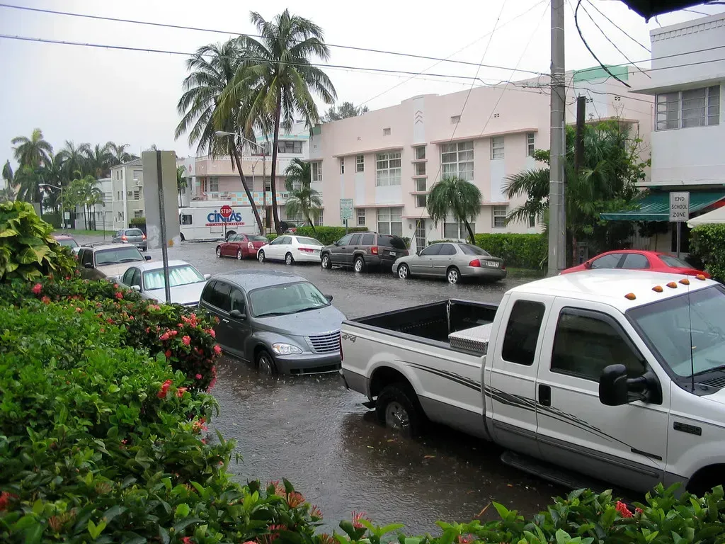
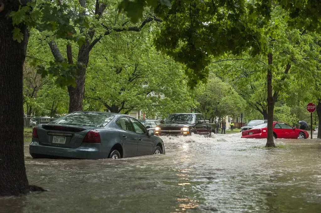
5. Houston, Texas – The City That Won’t Stop Flooding
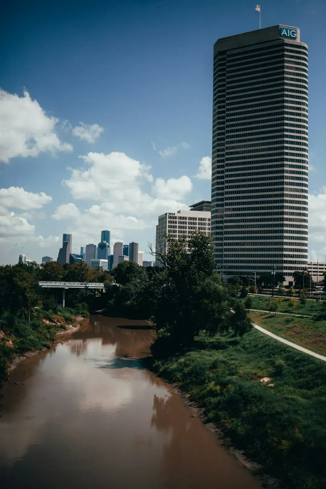
Houston has been hammered by floods so many times, local residents have started describing them with a kind of exhausted familiarity. Each year, more and more homes in Houston enter the flood plains, and during Hurricane Harvey, Houstonians experienced 48 inches of rain in just four days. The memory of Harvey never really faded.
Extreme flooding in a region of Texas known as “Flash Flood Alley” turned to tragedy in 2025 when torrential rains turned the Guadalupe River in Kerr County into a raging wall of water, causing the river to rise 26 feet in less than an hour, with rainfall rates of 2 to 4 inches per hour measured in some spots.
The flash flooding killed more than 130 people, 36 of whom were children, according to officials. The tragedy was devastating and widely seen as a warning sign for the entire Texas Gulf Coast region. For every 1°F of warming, the air can hold 4% more moisture, increasing the chances of heavier downpours that can result in flooding. Houston, surrounded by flat, paved land with limited drainage, is particularly exposed to that math.
6. Tampa, Florida – Hurricane Bullseye on the Gulf Coast
Tampa sits in an odd position. The city has avoided a direct hurricane hit for many decades – but experts consider that a streak of luck that simply cannot hold. Among cities where the vast majority of homes are at extreme risk from wind, Tampa is among 15 major metros spanning Florida, Texas, North Carolina, South Carolina, and Louisiana.
Florida appears on climate risk lists not once, not twice, not three times, but four times, with Miami, Tampa, Jacksonville, and Orlando all holding spots on the worst cities for climate change list. Tampa’s geographic placement makes it especially vulnerable to storm surge – a wall of seawater pushed inland by a hurricane. That surge could, in a worst-case scenario, reach devastating heights in Tampa Bay.
The Tampa metro area ranks third in the country for total value of homes at risk of flooding, at $126.2 billion. The combination of surge risk, rising seas, and intensifying storms makes this a city that climate scientists consistently flag as being seriously underappreciated in the public risk conversation.
7. New York City, New York – Sinking, Flooding, and Still Building
Here’s the thing about New York: the risks are massive, but the city is so huge and so economically central that the dangers often get treated as manageable problems rather than existential ones. New York City is particularly vulnerable to significant losses from sea-level rise. Manhattan is surrounded by water, and frequent flooding could prove crippling to an economy where much activity and the ability to travel is tied to low-lying land or subway tunnels.
Sinking ground and rising sea levels will put more than half a million people at risk of repeated flooding across 32 U.S. coastal cities, including New York, Boston, San Francisco, and Miami. New York’s subway network, built decades ago, was never designed to handle what is coming. The New York metro area ranks second in the country for the total value of homes at risk from flooding, at $265.2 billion.
In 2024, NOAA projected sea levels to rise by about 10 to 12 inches by 2050, exposing coastal areas to more regular flooding, especially during high tides and storms. For a densely packed city like New York, that projection isn’t just a statistic – it’s a transportation crisis, an infrastructure crisis, and a housing crisis all wrapped in one.
8. Norfolk, Virginia – America’s Most Flood-Threatened Naval City
Norfolk doesn’t get the national headlines that Miami or New York attract, but climate scientists place it among the most acutely threatened coastal cities in the country. The land here is literally sinking. Climate scientists predict an intensifying barrage of hurricanes, droughts, wildfires, flooding, and sea-level rise in many places, and these disasters are already threatening, and even demolishing, homes.
Climate modeling firm AlphaGeo analyzes 28 factors, from life expectancy to infrastructure spending, to assess a location’s true vulnerability. Norfolk scores poorly across nearly all of them. The city is home to the world’s largest naval installation, which adds a layer of national security concern to the flooding risk that goes beyond property values.
Residents of low-lying neighborhoods already flood with every significant storm. In the U.S., coastal floods now happen three times more often than they did 30 years ago, and by 2050, floods are expected to happen 10 times more often than they do today. Norfolk is already experiencing what many other American cities are still preparing for.
9. Oklahoma City, Oklahoma – Tornado Country Gets Wilder
Tornadoes have always been a fact of life in Oklahoma. The difference now is frequency, intensity, and the growing unpredictability of when and where they strike. Oklahoma ranks among the country’s least climate-resilient states, largely due to its frequent exposure to severe weather and extreme temperatures, sitting in the heart of Tornado Alley, and residents also face high wildfire potential, persistent drought conditions, and intense temperature fluctuations.
In 2024, Oklahoma residents paid an average of $5,858 per year for home insurance, one of the highest rates in the nation. That financial burden alone tells a story. More frequent hot, dry, and windy fire weather conditions are boosting wildfire risks across the U.S., and as the climate continues to warm, conditions favorable to thunderstorms and tornadoes are occurring more often, with severe weather activity expanding into historically less-active seasons and regions.
Twenty-three rural hospitals in Oklahoma are currently at risk of closing, putting some communities in an even more precarious position when disaster strikes. That infrastructure fragility, layered on top of the raw weather danger, makes Oklahoma City a place where experts increasingly worry about recovery capacity, not just the storms themselves.
10. Cape Coral, Florida – The Fastest-Growing City in America’s Most Dangerous State
Cape Coral is a peculiar story. It has been one of the fastest-growing cities in the United States, and people keep moving there despite clear and present climate danger. Among the metro areas that are the worst off in terms of climate risk, Cape Coral, Florida ranks among cities including San Francisco, New York City, Long Island, Oakland, and Phoenix.
Many insurance companies have pulled out of Florida and California due to the heightened risk of hurricanes and wildfires, leaving homeowners scrambling to find coverage through their state’s Fair Access to Insurance Requirements plans. In Cape Coral, which sits at the mouth of the Caloosahatchee River on the Gulf of Mexico, the storm surge risk during a direct hurricane strike is considered catastrophic by modeling standards.
Coastal states like Florida and South Carolina are most at risk of the impacts of climate change. Cape Coral exemplifies the larger pattern of people choosing to live in demonstrably dangerous places because the weather is warm and the real estate is affordable – at least for now. In 2024, nearly half of U.S. homes faced at least one type of severe climate risk.
11. St. Louis, Missouri – Tornado Alley Moves East, and It Hits Hard
St. Louis might surprise people on a list like this. The Midwest doesn’t scream “climate disaster zone” in the same way Florida or California does. That assumption, however, is becoming dangerously outdated. Tornado outbreaks in Kentucky, Missouri, and Virginia in mid-May 2025 killed at least 28 people, with strong supercell storms tearing roofs off homes and causing several buildings to collapse, and St. Louis was particularly hard hit when an EF-3 tornado with 140 mph winds ripped through neighborhoods.
The first EF-5 tornado in the U.S. in over a decade also occurred in 2025. That is not a coincidence – it reflects a pattern. Conditions favorable to thunderstorms and tornadoes are occurring more often, and severe weather activity is expanding into historically less-active seasons and regions. St. Louis sits squarely in the expanding zone.
According to NOAA data, 2025 was the fourth-warmest year on record for the contiguous U.S., and the nine warmest years on record have all occurred since 2012. Warmer, more unstable air masses mean more fuel for the severe thunderstorm systems that produce damaging tornadoes. St. Louis, with its aging infrastructure and dense urban neighborhoods, faces an expanding window of danger that the city’s planning systems were simply not built to handle.
A Nation at a Crossroads

The last 11 years have been the hottest 11 years on record, the climate monitoring groups found. That’s not a streak – that’s a shift. Climate change could cost a child born in 2024 between $500,000 and $1 million over their lifetime due to increased living expenses and reduced earnings. The price of ignoring these risks is no longer abstract.
Recent studies show that climate change is driving roughly 30% of Americans to consider relocating. That migration is already happening quietly – in rising insurance premiums, in abandoned properties, in families quietly asking themselves whether they should stay. California, Florida, Georgia, North Carolina, Oregon, Texas, and Washington are expected to experience all five major climate change categories over the next few decades.
Several climate monitoring groups predicted that 2026 would be about as hot as 2025. This is not a future problem waiting to arrive; it is already here, playing out in real time, in real communities, with real consequences. The question for every American living in one of these places is no longer whether the risk is real. It’s what they plan to do about it.
What would you do if your city appeared on this list? Have you already felt the effects of a changing climate where you live? Share your thoughts in the comments.