

Most people only think about fault lines after the ground starts shaking. That’s a little like noticing a storm only after the roof blows off. The truth is, active fault lines leave clues, sometimes for months or even years before a major rupture occurs. Seismologists, geologists, and earth scientists have spent decades studying these clues, and what they’ve found is both fascinating and, honestly, a little unsettling.
From invisible gas seeping through soil to strange animal behavior logged thousands of years ago, the warning signs are often right there in front of us. We just need to know what we’re looking for. Let’s dive in.
1. Frequent Small Earthquakes and Seismic Swarms
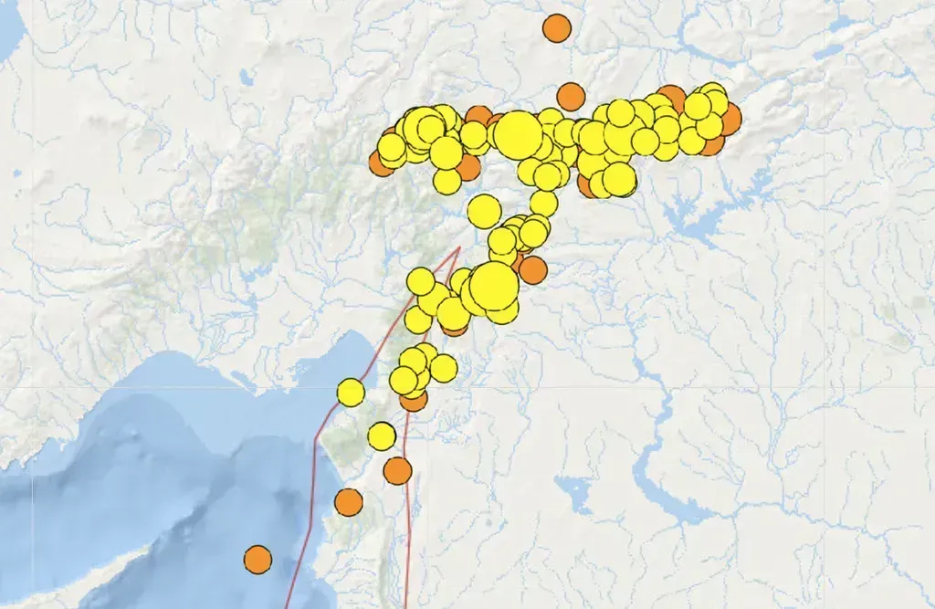
One of the most recognized early red flags is a sudden increase in small, low-magnitude earthquakes clustered in one area. Seismologists caution that while small quakes don’t guarantee a large one will follow, clusters, or seismic swarms, can signal shifting stress along a fault. Think of it like a door hinge that creaks more and more loudly before it eventually breaks entirely.
In the past two years, both major U.S. fault zones have seen a noticeable uptick in minor seismic events. The Hayward Fault in California, for example, experienced a swarm of over 30 low-magnitude earthquakes in late 2024, with the largest measured at 3.8, strong enough to rattle nerves but not cause major damage.
Particularly notable was a swarm of small quakes near Parkfield along the San Andreas Fault in February 2024, prompting the USGS to issue a “heightened alert” for the region. While most of these quakes were minor, researchers warn that such swarms can sometimes serve as precursors to larger, more destructive events.
2. Elevated Radon Gas Levels in Soil and Groundwater
Here’s something that genuinely surprised me when I first came across it: one of the most studied warning signs of fault activity isn’t seismic at all. It’s a radioactive gas. Radon concentrations in the soil, water, and atmosphere vary in response to crustal movement, because radon is a radioactive gas that is released from cracks and cavities in the Earth’s crust as it is strained before an earthquake. Radon concentrations can be abnormally high along active faults, which may be paths of least resistance for the outgassing process.
Research has detected spatiotemporal episodes of increased radon concentration which correlated reasonably well with local earthquakes of magnitudes greater than 4.0. These anomalies were observed across fault segments extending up to 100 km, suggesting large-scale deformation processes that enhance gas exhalation rates from the Earth’s crust.
A 2024 national research project in Turkey investigated soil gas radon as an earthquake precursor, with analysis revealing a potential link between radon anomalies and shallow earthquake activity. Findings suggest that fault type, depth, and distance from the epicenter may influence radon behavior and its suitability as a geophysical monitoring parameter. In short, if your well water is testing unusually high for radon, it may be worth a closer look at what’s happening beneath the surface.
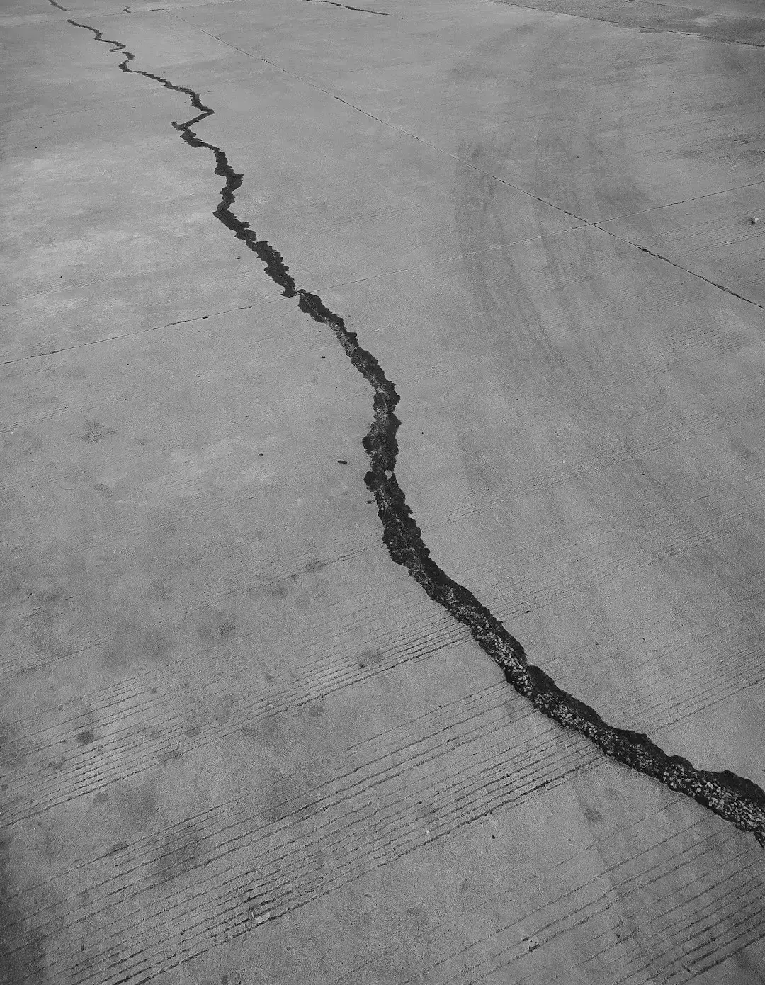
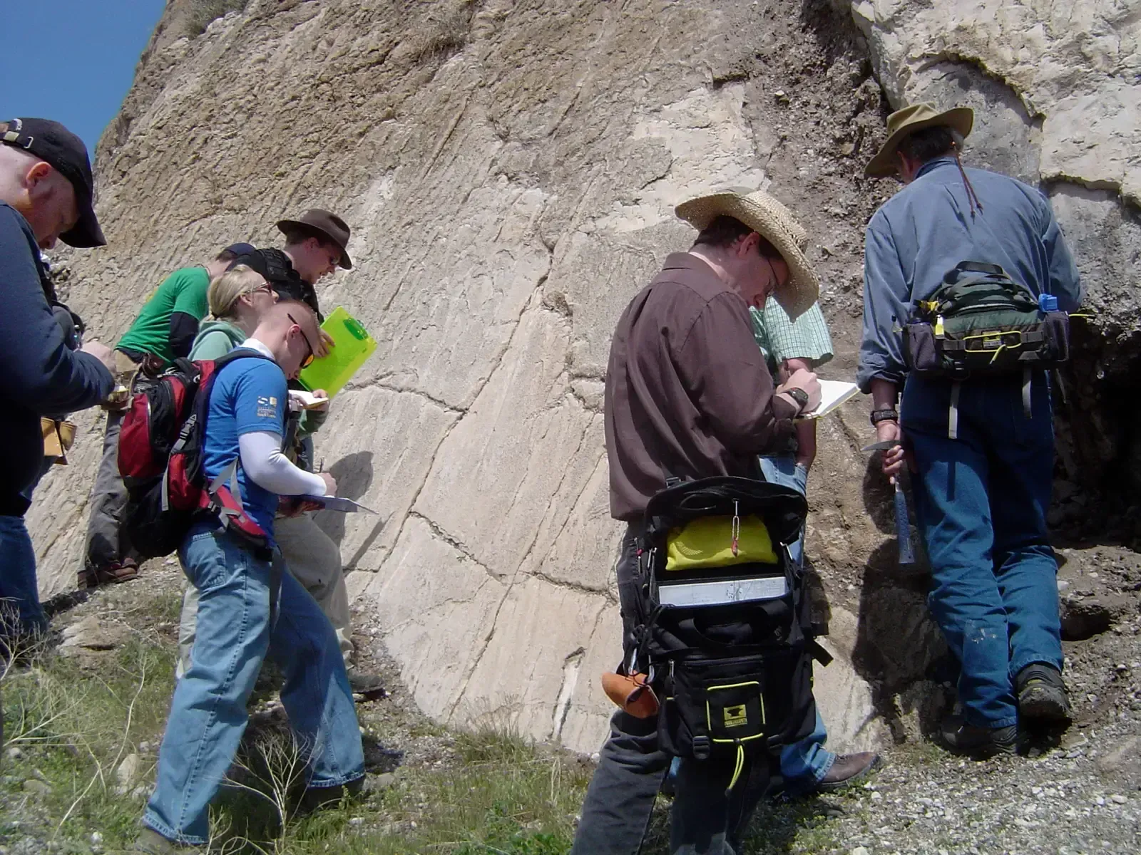
3. Visible Ground Cracks and Surface Ruptures

Sometimes fault lines announce themselves in the most obvious way possible: by literally tearing open the ground. Hazards associated with active faults include earthquake damage due to ground shaking, surface displacement due to fault rupture, triggering of landslides, and liquefaction. Surface cracks that appear without any obvious cause, especially those aligned in a straight or slightly curved pattern across a landscape, are a serious indicator.
Studies using lidar-illuminated topographic lineaments have documented evidence of recent surface fault ruptures and surface ruptures related to distributed deformation along fault zones in the northern San Francisco Bay area. Modern mapping tools now allow scientists to detect these features from the air, even when they’re partially hidden by vegetation or development.
Active faults may generate significant permanent deformation of the topographic surface, making careful evaluation of their spatial and geometric characteristics essential for seismic hazard assessment when planning infrastructure. If you see fresh cracks in roads, foundations, or open land that weren’t there before, and no construction or natural weathering explains them, it’s worth reporting to local geological authorities.
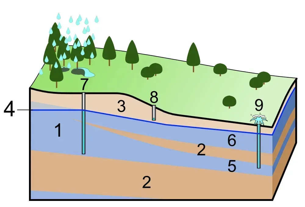
4. Unusual Changes in Groundwater Levels and Well Behavior

Long before modern seismographs existed, people noticed that wells sometimes changed behavior right before major earthquakes. Water levels would drop suddenly, rise unexpectedly, or change in turbidity and temperature. Radon concentration changes have been shown to correlate with variations in groundwater temperature, water level, and crustal deformation. Historical events including the Shizuoka earthquake in 1965 and the Great Kanto earthquake of 1923, saw unusual hydrological phenomena, such as spontaneous eruptions of water from wells and geysers, reported weeks or even months in advance.
Emerging research in 2024 and 2025 suggested that climate change was influencing seismic risk. Studies published in journals such as Nature in September 2024 found that extreme droughts and heavy rainfall in California have contributed to fluctuating groundwater levels, which can increase stress on faults. The relationship between groundwater and fault activity is tighter than most people realize.
Researchers found that the rapid melting of glaciers and shifts in groundwater levels can subtly alter the stress on fault lines. This is not a small detail. Groundwater essentially acts as a kind of lubricant or pressure regulator along fault zones, and any significant change in that pressure can have ripple effects deep underground.
5. Foreshock Activity Before a Major Rupture
Foreshocks are small to moderate earthquakes that precede a larger main event. Distinguishing a foreshock sequence from a random swarm is one of seismology’s most complex challenges. The advanced determination of the type of an ongoing seismic cluster is quite challenging. In the period of January through March 2025, a seismic cluster recorded between Santorini volcano and Amorgos Island in the South Aegean Sea caused considerable social concern, with a rapid increase in both seismicity rate and earthquake magnitudes noted until the mainshock.
Complex fault lines and unique plate movements can produce powerful foreshocks with magnitudes of 7.0 and above, which can either result from individual plate shifts or signal an impending, even stronger earthquake. That’s a genuinely sobering thought. A 7.0 earthquake as a foreshock means something much larger could follow.
Previously it was believed that each earthquake was an isolated event, but data analysis actively collected since early 1992 suggests otherwise. Each major earthquake in California is preceded by tremors resulting from the formation of new faults. Recognizing foreshocks in real time, before the mainshock, remains the holy grail of seismic science.
6. Ground Deformation Detected by GPS and Satellite Technology

You can’t always see a fault line moving with the naked eye. But satellites absolutely can. InSAR technology has been widely recognized for its capability to monitor ground deformation under all-weather conditions with high precision and wide coverage. This radar-based satellite technique compares images taken at different times to detect even millimeter-scale shifts in the Earth’s surface.
Time-series analysis has indicated average preseismic ground subsidence in areas ahead of major earthquakes, suggesting continued slip along the fault before a rupture occurs. In the case of the devastating 2025 Myanmar earthquake, scientists were able to look back and identify pre-seismic deformation captured by satellite data that had occurred in the days leading up to the event.
In February 2024, the USGS announced the expansion of its seismic monitoring network along the Hayward Fault, deploying dozens of new high-precision GPS sensors aimed at capturing minute crustal movements. The goal is straightforward: catch the slow creep before it becomes a catastrophic snap. It’s hard to say for sure how much warning time this can ultimately provide, but it is unquestionably one of the most powerful tools available today.
7. Topographic Lineaments and Scarps in the Landscape
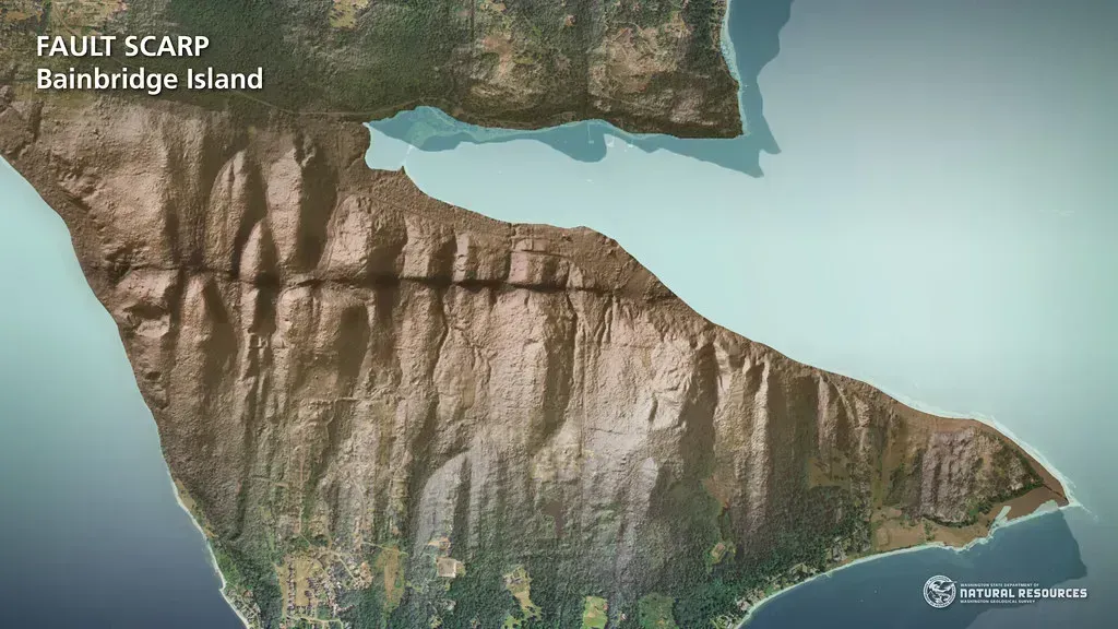
If you’ve ever looked at a landscape and noticed a suspiciously straight ridge, a long narrow valley, or an abrupt change in terrain that cuts across the natural geography, you may have been looking at a fault scarp. These are physical traces left behind by past ruptures, and they’re one of the primary ways geologists map fault locations. New fault mapping, paleoseismology, radiometric dating techniques, and remote sensing techniques using Light Detection and Ranging, known as LiDAR, provide means to identify new active faults and update fault databases used for national seismic hazard maps.
The Ramapo Fault in New Jersey and New York has been a growing focus for geologists in 2024 due to increased microseismic activity. New York State’s recent seismic hazard reports flagged the Ramapo as a “sleeping giant,” with dozens of small tremors detected since late 2023. The fault’s topographic fingerprint, visible in terrain analysis tools, has been there for millions of years. People just weren’t paying close enough attention.
A vast tectonic fault buried beneath Canada’s remote Yukon Territory is drawing urgent attention from seismologists after a landmark study revealed signs of renewed seismic strain. This type of fault behavior is characteristic of large-magnitude earthquakes, particularly in strike-slip systems where lateral movement accumulates gradually before releasing in a single, violent rupture. Landscape reading, it turns out, is a legitimate scientific skill that can save lives.
8. Strange Animal Behavior

I know it sounds a little less scientific than GPS satellites and radon monitors, but hear this one out. The observation of unusual animal behavior before earthquakes is one of the oldest recorded warning signs in human history. The earliest reference to unusual animal behavior prior to a significant earthquake dates to Greece in 373 BC, when rats, weasels, snakes, and centipedes reportedly left their homes and headed for safety several days before a destructive earthquake.
Anecdotal evidence abounds of animals, fish, birds, reptiles, and insects exhibiting strange behavior anywhere from weeks to seconds before an earthquake. However, consistent and reliable behavior prior to seismic events, and a mechanism explaining how it could work, still eludes scientists. The USGS acknowledges the phenomenon without yet confirming it as a reliable predictive tool.
An instinctive response following a P-wave seconds before a larger S-wave is not far-fetched, but what about other precursors that may occur days or weeks before an earthquake? If there are precursors to a significant earthquake that scientists have yet to identify, such as ground tilting, groundwater changes, or electrical and magnetic field variations, it is possible that some animals could detect them. It’s a fascinating frontier, and definitely not something to dismiss entirely.
9. Induced Seismicity from Human Activity

Not all warning signs of an active fault come from nature alone. Human activity, particularly the injection of wastewater deep underground from oil and gas operations, has been shown to trigger earthquakes along pre-existing fault systems. This is called induced seismicity, and it has transformed quiet, non-seismic regions into active hot zones in just a matter of years. Oklahoma’s landscape changed dramatically in the past decade as human activity, particularly wastewater injection from oil and gas operations, triggered hundreds of small earthquakes. In 2024, state agencies reported a slight drop in total quakes, but a few strong jolts still rattled nerves in communities like Cushing and Stillwater.
The Oklahoma Geological Survey responded with a flurry of new monitoring stations and data-sharing agreements with local industry. Recent state legislation now limits how much wastewater can be injected near known faults, reflecting a new sense of urgency. The point is clear: even faults that were considered inactive can be reawakened by human interference.
Intense flooding along the Mississippi River in 2024 raised concerns among geologists at the University of Memphis, who observed minor ground shifts in monitoring stations in the New Madrid Seismic Zone. While climate change is not a direct cause of earthquakes, these environmental changes can load faults, making them more likely to slip. Watch what’s being done to the ground beneath your feet. It matters more than most people think.
10. Long Seismic Silence on a Known Active Fault
Oddly enough, one of the most counterintuitive warning signs of a dangerous fault line is not an abundance of earthquakes, but a disturbing lack of them. Seismologists call it seismic quiescence. Just because a fault is quiet does not mean it is not dangerous. Sometimes that silence is what worries scientists most. New data from the USGS suggests strain may be accumulating on faults that have not experienced a significant event in more than a century.
Based on current strain rates and geological evidence, researchers concluded that a fault region that has not ruptured in thousands of years could be primed for a magnitude 7.5 event, with key infrastructure lying within potential impact zones. The logic is almost painfully simple. Every year that passes without a rupture on a locked, stressed fault is another year of accumulated energy waiting to release.
According to the Utah Geological Survey, the Wasatch Fault has the potential for a magnitude 7 or higher quake, which could be catastrophic in a fast-growing corridor. The seismic hazard there is a question of when, not if. A quiet fault is not a safe fault. In many cases, it’s the most dangerous kind of all.
Conclusion

The science of reading fault lines has never been more sophisticated, or more urgent. From elevated radon gas to silent GPS sensors tracking millimeter-level ground shifts, the tools available to seismologists in 2026 would have seemed like science fiction just a generation ago.
Yet for all the technology, the fundamental truth remains the same: fault lines are living, breathing features of our planet. They accumulate stress over decades, centuries, even millennia, and they release it on their own schedule, not ours. Understanding their warning signs is not about inducing panic. It is about giving people and communities the best possible chance to prepare.
The next time you hear about a minor earthquake swarm in your region, notice your well water behaving oddly, or see a suspiciously straight ridge cutting across an otherwise natural landscape, pay attention. Nature is rarely subtle forever. What warning sign surprised you the most? Let us know in the comments.
- 10 Warning Signs Seismologists Say Could Signal an Active Fault Line Nearby - March 28, 2026
- 9 Unexplained Geological Events That Still Alarm Scientists Today - March 28, 2026
- 8 Unexpected Places in America Becoming Climate Safe Havens - March 27, 2026