
Most people check the weather through an app and move on. What gets lost in that transaction is something older and arguably more useful: the ability to read what the sky, the wind, and the pressure around you are actually doing. Meteorologists spend careers learning to notice things the rest of us walk past without a second thought.
The signs aren’t always dramatic. Some are subtle enough that you’d mistake them for ordinary. That’s exactly what makes them worth knowing. Here are nine weather signals that trained forecasters take seriously – and that most people quietly ignore.
High, Wispy Cirrus Clouds Appearing in a Clear Sky
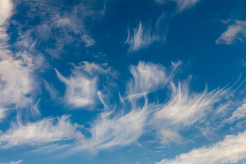
High, wispy cirrus clouds appearing in an otherwise clear sky are nature’s first warning shot. They form at altitude when moisture is being pulled ahead of an approaching front, sometimes twelve to twenty-four hours before conditions deteriorate at ground level. That’s a meaningful window of time, and most people don’t even register those delicate streaks overhead.
These clouds form at extremely high altitudes, often above thirty thousand feet, and are made entirely of ice crystals. Their appearance doesn’t mean a storm is guaranteed, but it consistently signals that the atmosphere is beginning to shift. Pay attention when the sky goes from empty to lightly etched in a matter of hours.
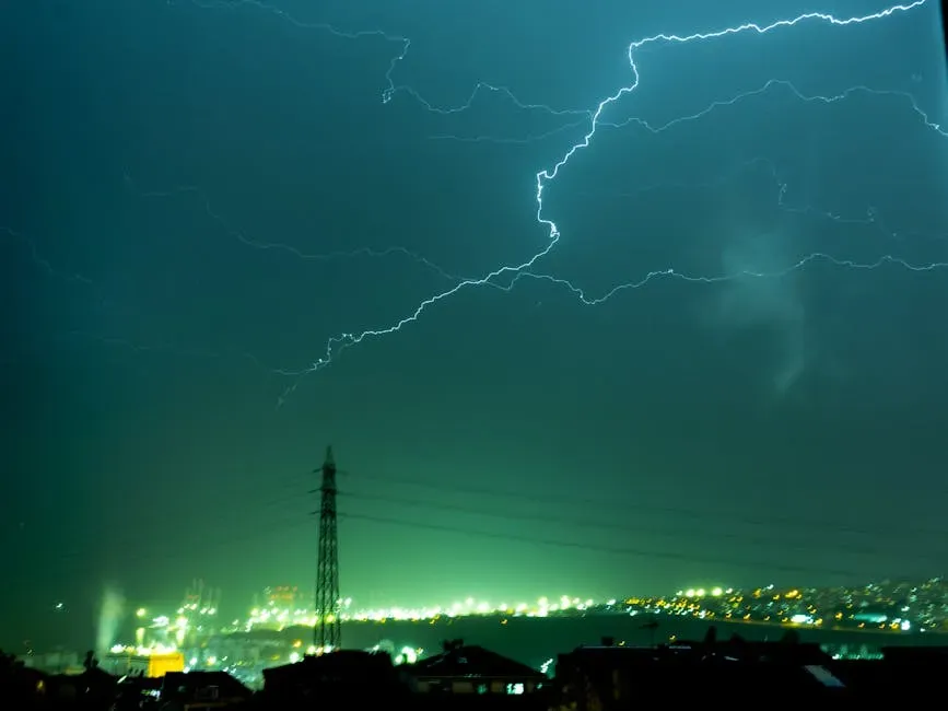
A Rapid Drop in Barometric Pressure
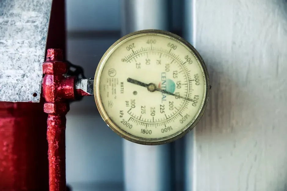
Rapid drops in pressure, sometimes called bombogenesis when pressure falls more than 24 mb in 24 hours, can signal explosive storm development. Tracking these changes helps forecasters alert communities in the storm’s path with greater accuracy and lead time. At a smaller scale, even a drop measurable on a home barometer can carry significance.
A slow, steady drop can suggest an incoming rainstorm or snow system, while a rapid and sharp decline can signal a powerful thunderstorm or tropical cyclone. The faster the pressure falls, the stronger the storm often becomes. It’s one of the oldest signals in meteorology, and it hasn’t lost any of its relevance.
The Eerie Calm Before a Storm
If the wind drops abruptly in conditions that were already overcast or building toward something, that stillness is not a good sign. It often precedes a rapid pressure drop and the arrival of severe weather. Sailors knew this for centuries without any instruments to confirm it.
A noticeable shift in wind direction, accompanied by intense gusts followed by an eerie calm, can be a warning sign. This phenomenon is called windshear, and it often precedes the formation of a tornado. According to NOAA, these sudden wind shifts can indicate that tornado-producing conditions are imminent. When the air goes completely still during an already ominous afternoon, that’s not a moment to relax.
A Sky That Turns Green or Yellowish
A green sky indicates a storm that is large, tall, and contains exceptional amounts of large water droplets and ice – the characteristics of a mature supercell thunderstorm. Supercells are the storms most likely to produce tornadoes, large hail, and damaging winds. It’s one of the more striking visual signals the atmosphere produces.
Popular lore links green skies to tornadoes, but authoritative sources and meteorologists caution that a green sky indicates a severe thunderstorm environment – hail, intense precipitation, strong updrafts – but is not a reliable predictor of a tornado itself. AccuWeather reporting and academic commentary reiterate that while many tornado-producing storms are severe and could include the cloud structures that produce a green tint, the presence of green coloring is neither necessary nor sufficient to forecast tornadic activity; it’s a signal to take severe-weather precautions, not a deterministic tornado forecast.
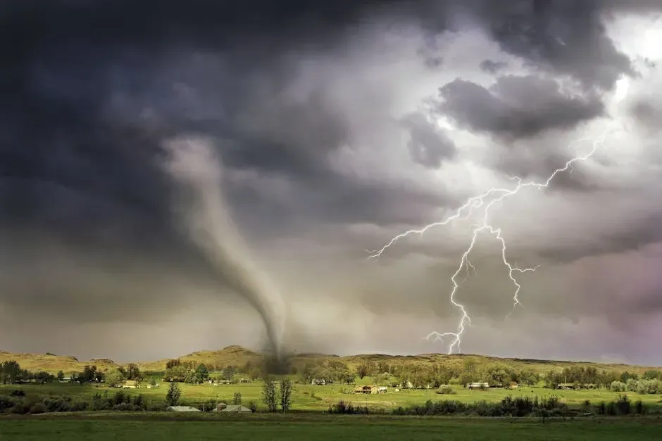
Rotating Wall Clouds
Wall clouds are rotating, lowered sections of storm clouds that indicate the presence of mesocyclones – the rotating updrafts that spawn tornadoes. When meteorologists or storm spotters observe wall cloud formation, tornado warnings often follow within minutes. They’re not common, and their appearance demands immediate attention.
A wall cloud is a large, low-hanging cloud that often rotates, signaling an increased likelihood of tornado formation. While shelf clouds can also precede storms, rotating wall clouds are the most concerning, as they are more likely to produce tornadoes. As noted by NOAA and storm chasers, a rotating wall cloud is one of the strongest indicators that a tornado may form, and it requires immediate attention.
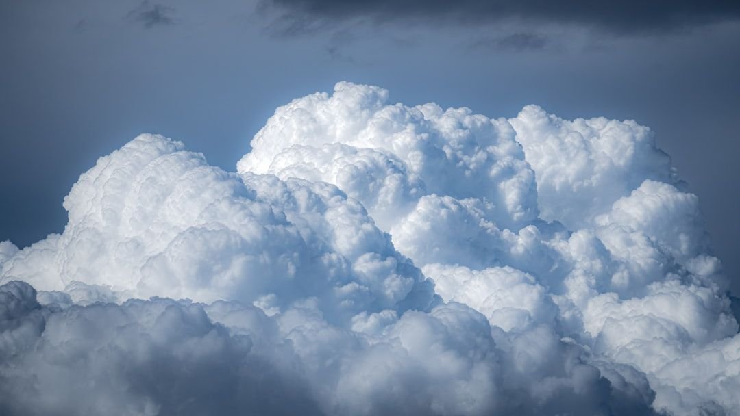
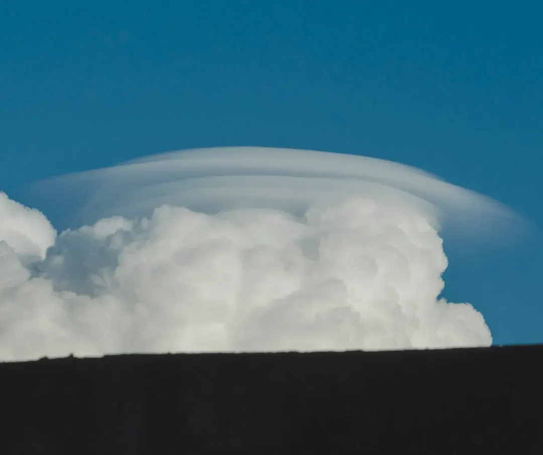
Clouds Growing Rapidly in Height
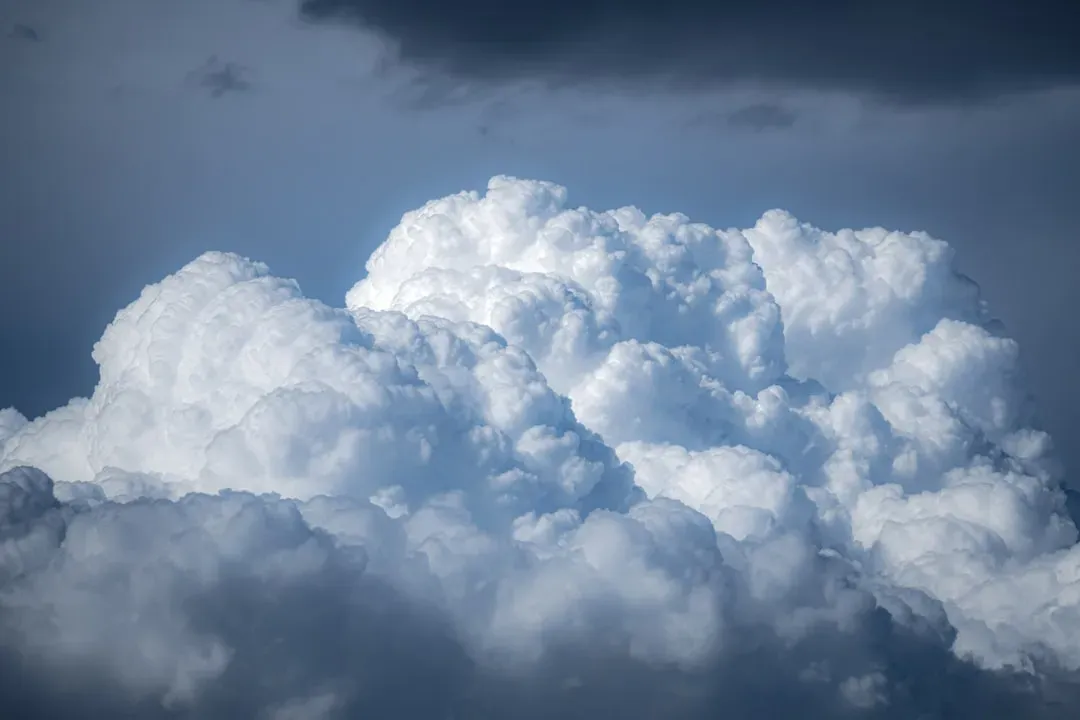
Cumulus clouds – giant, pillowy clouds that appear heaped up in the sky – are a common summer cloud formation that often portends severe thunderstorms accompanied by lightning. Cumulus clouds grow quickly as the day heats up. They often grow faster vertically than horizontally into massive cumulonimbus clouds, which develop into black, anvil-shaped clouds with heavy thunderstorms accompanied by lightning.
Cumulonimbus clouds are the ones that matter most for immediate danger. They are the massive, towering formations that build vertically – sometimes to extraordinary height – with a distinctive anvil-shaped top that spreads horizontally at altitude. When a cumulonimbus is visible and moving in your direction, you have a severe weather system incoming. The speed at which ordinary-looking clouds can transform into these giants is consistently underestimated.
Mammatus Clouds Hanging Below a Storm
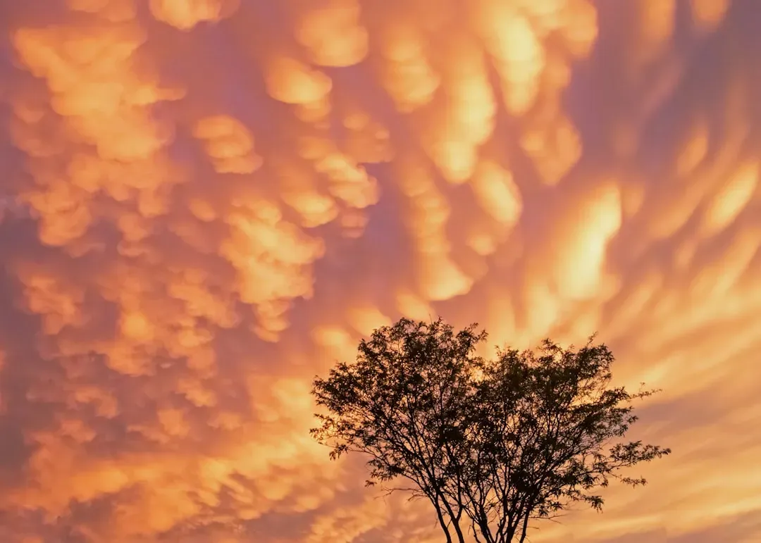
Mammatus clouds, which appear as pouch-like protrusions hanging from the base of storm clouds, signal extreme atmospheric instability and severe downdrafts. These clouds often accompany supercells capable of producing large hail, destructive winds, and tornadoes. They look unusual enough that people often stop to photograph them, which is precisely the wrong instinct.
Mammatus clouds – the strange, lumpy pouches that sometimes form on the underside of a storm system’s anvil – indicate an extremely turbulent atmosphere and are often associated with severe thunderstorm activity. They look otherworldly. If you see them, the system above you is violent. Admire from shelter, not from an open field.
Unusual Animal Behavior
This is not folklore. There is measurable science behind the fact that animals detect barometric pressure changes earlier and more sensitively than human beings do. These drops in air pressure might not be noticeable to humans, but some animals can feel pressure drop and take cover when storms approach.
Birds often sense storms through pressure changes and may feed more aggressively to store energy. This can look like flocks swarming feeders or foraging intensely. Animals are often sensitive to atmospheric changes and may behave erratically before a tornado, such as becoming unusually quiet or huddling together. When the natural world goes quiet or frantic all at once, it’s worth asking why.
A Halo Around the Sun or Moon
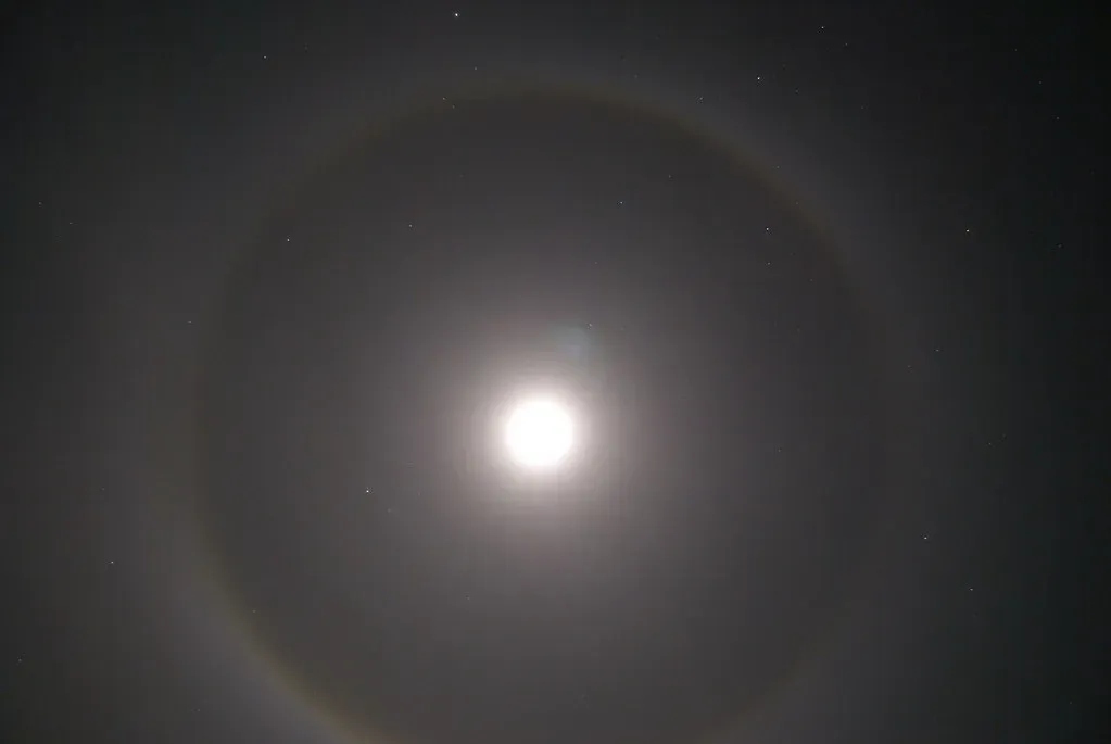
High clouds, often at night, will refract a halo or ring of light around either the sun or the moon. These halos can be a good weather predictor and often signal incoming moisture and fronts. The phenomenon is caused by ice crystals in thin, high-altitude clouds – the same kinds of clouds that appear well ahead of deteriorating weather.
There’s an old rhyme that says “when there’s a ring around the moon, rain or snow is coming soon.” This large ring looks like a halo or dim rainbow around the moon. The halo effect occurs when the moon’s light diffracts, or bends, off small ice crystals in the atmosphere. The ice crystals form thin clouds that you may or may not see. The high clouds occur because of a change in air pressure and generally indicate that storm clouds follow. It’s one of the oldest weather observations in human history, and the physics still holds up.
None of these signs replace a formal weather alert, and no single signal tells the whole story on its own. Better weather forecasts and early warnings are the most effective tools we have to protect people right now. Still, the atmosphere has always communicated in ways that are available to anyone willing to look up. Reading those signals well doesn’t require a meteorology degree – just the habit of paying attention before the sky makes it impossible to ignore.
- Meteorologists Say These 9 Weather Signs Are Quietly Warning of Trouble - May 9, 2026
- 6 Things Schools Got Wrong About the Water Cycle - May 9, 2026
- 11 Winter Weather Mistakes People Keep Making - May 9, 2026