

- Meteorologists Admit: People Often Ignore These 6 Critical Weather Warnings - March 29, 2026
- 10 Weather Patterns Experts Say Signal a Major Storm Is Coming - March 29, 2026
- 10 Everyday Weather Habits That Can Catch You Off Guard - March 28, 2026
Storms don’t just appear out of nowhere. Long before the rain starts battering your windows or the winds send the garden furniture flying, the atmosphere has been quietly flashing warning signs for hours, sometimes days. The problem is that most people don’t know how to read them.
Meteorologists, researchers, and emergency planners have spent decades identifying the telltale signals that a major storm is gathering strength. Some of these patterns are visible to the naked eye. Others require instruments. All of them, taken together, can mean the difference between being prepared and being caught completely off guard. Let’s dive in.
1. A Sudden and Sharp Drop in Barometric Pressure
If there is one single weather signal that forecasters trust above almost all others, it is a rapid fall in barometric pressure. Falling barometric pressure typically indicates that a low-pressure system is approaching or intensifying, and low-pressure systems are associated with clouds, precipitation, wind, and storm development. Think of it as the atmosphere losing its grip, going slack before something violent rushes in to fill the void.
Readings below 29.80 inHg signal unsettled conditions, and the lower the pressure drops, the more significant the weather event is likely to be. The rate of change matters just as much as the absolute reading, and meteorologists consider a fall of more than 0.06 inHg per hour to be a significant rapid change. Honestly, the speed of the drop is what should make you pay attention, not just the number itself.
A slow fall over 24 hours suggests gradual deterioration, while a fast drop of the same amount in just three hours points to a rapidly developing storm system. A minimum of 10 hPa fall in barometric pressure over 3 hours will produce a gale. That is not a small margin. That is a meteorological alarm bell going off.
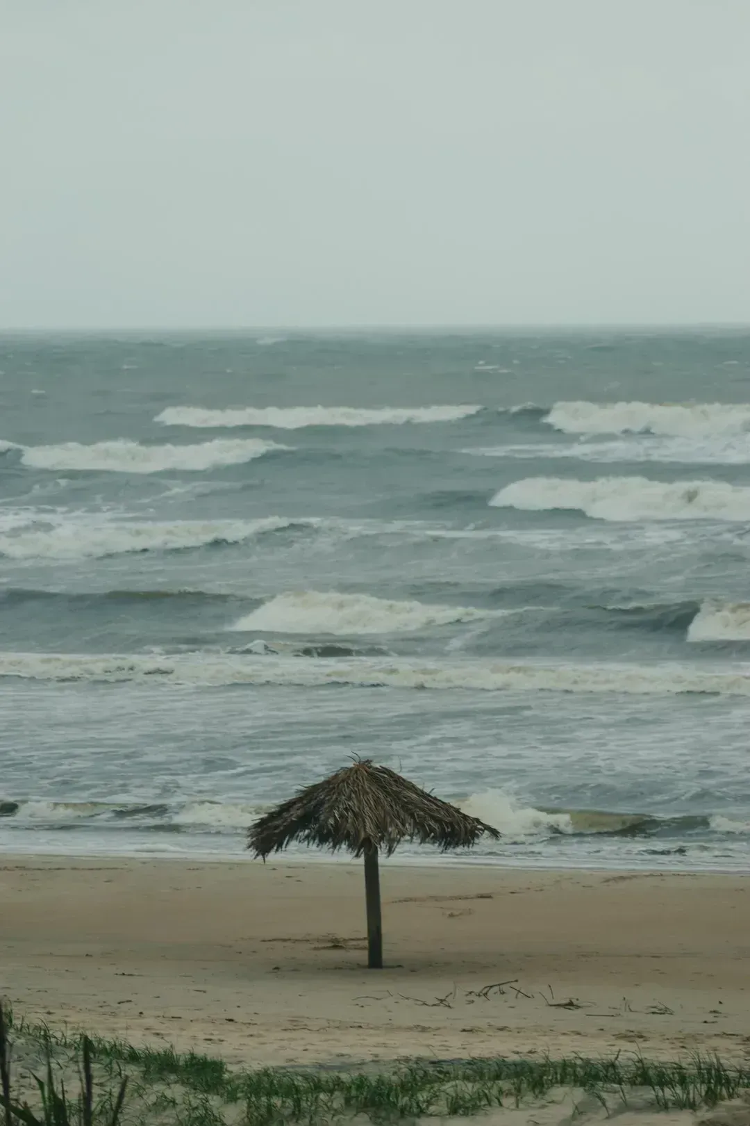
2. Unusually Warm Sea Surface Temperatures

Here’s the thing about ocean heat: it is essentially rocket fuel for storms. Warm ocean waters at or above 27°C provide the essential fuel for tropical cyclones, releasing vast amounts of heat and moisture into the atmosphere as winds move over these warm surfaces, causing air to rise, cool, and condense into driving convection and storm clouds. Once that process kicks off over a large enough area, storms can grow with terrifying speed.
Approximately 70% of hurricanes that formed between 1950 and 2022 were influenced by marine heatwaves, and rapid intensification is, on average, roughly half more likely during marine heatwaves. That is a staggering statistic, one that coastal communities cannot afford to ignore. Global sea surface temperatures have remained at near-record levels in 2025 following a record-shattering jump in 2023 and 2024.
Hurricane Milton in 2024 intensified from a tropical storm to a Category 5 hurricane in just 24 hours over the Gulf of Mexico, with sea surface temperatures exceptionally high above 30°C fuelling its rapid growth. Rapid intensification poses a challenge for forecasters because storms that gather a lot of strength in a short amount of time pose a serious threat to those in their path, giving emergency managers and the public little time to prepare.
3. Rapid Intensification of Wind Speeds
Tropical cyclone rapid intensification (RI) is defined as where a tropical cyclone’s maximum sustained winds increase at least 30 knots, or roughly 35 miles per hour, in a 24-hour period. That definition sounds clinical and contained on paper. In practice, it represents a storm transforming from manageable to catastrophic almost overnight. I know it sounds crazy, but a storm can essentially double in destructive power while you are still deciding whether to evacuate.
Hurricanes Beryl, Helene, and Milton all underwent rapid intensification in 2024, and research shows that climate-fueled ocean warming is leading to an increased number of tropical cyclones that experience rapid intensification. These were not isolated freak events. They were part of an emerging and deeply concerning pattern. Of the 63 tropical cyclones that caused at least $1 billion in damage in the U.S. from 1980 to July 2024, fully 70% underwent rapid intensification.
4. Low Wind Shear in the Upper Atmosphere

Wind shear is the unsung hero of storm prevention. It refers to changes in wind speed or direction at different levels of the atmosphere, and when shear is strong, it essentially tears developing storms apart before they can organize. Low vertical wind shear is a key requirement for tropical cyclone formation: if wind speeds and directions vary little with height, convection can grow vertically, allowing storm clouds to grow taller and strengthen.
Above-normal hurricane activity is driven by a confluence of factors including near-record warm ocean temperatures, development of La Niña conditions in the Pacific, reduced Atlantic trade winds, and less wind shear, all of which tend to favor tropical storm development. When multiple conditions align like this simultaneously, that is when forecasters start losing sleep. The high activity era continues in the Atlantic Basin, featuring high-heat content in the ocean and reduced trade winds, with the higher heat providing more energy to fuel storm development while weaker winds allow storms to develop without disruption.
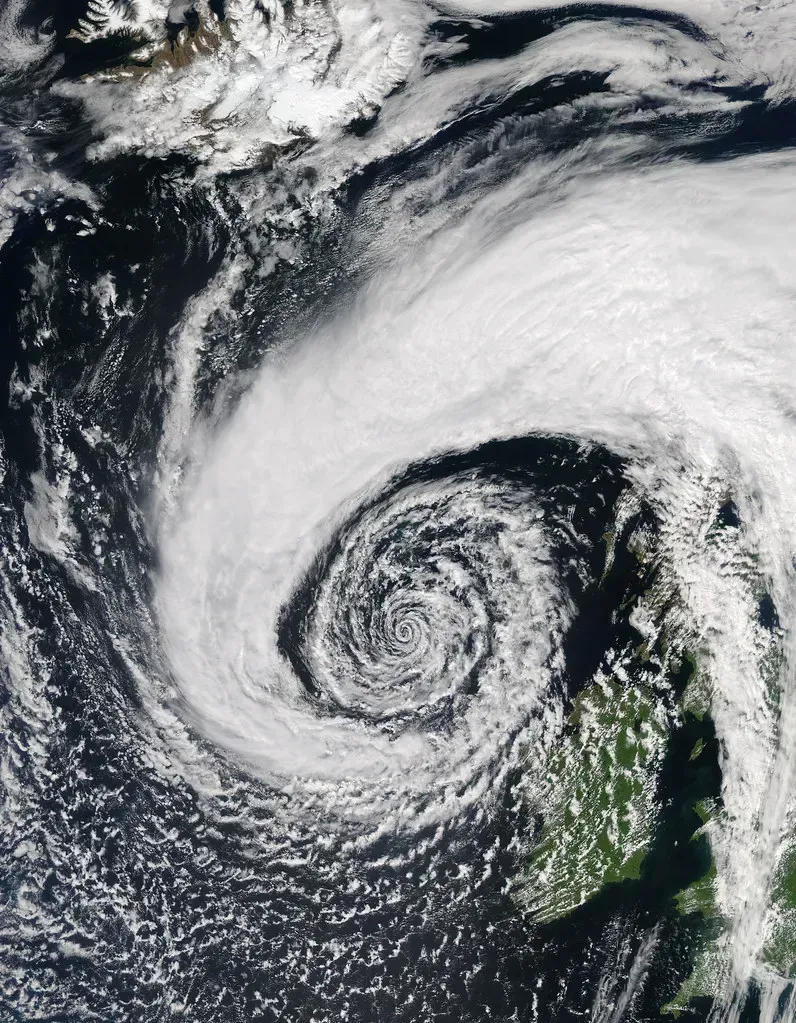
5. The Formation of a Distinct Low-Pressure System
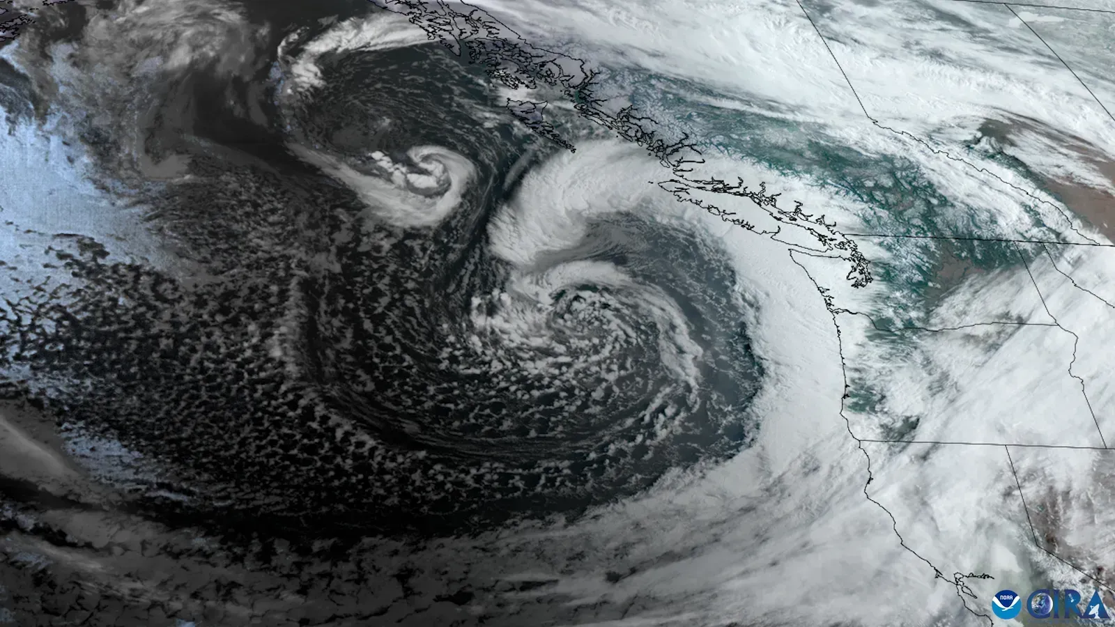
Cold air is denser and drier than warm air in the atmosphere. When cold air encounters warm air, the warm air rises over the cold air, making surface air pressure drop. As a result, a low-pressure system forms and winds begin to blow, and this is how storms form in response to changes in air temperature. That cycle is as old as weather itself, yet it remains one of the most reliable storm precursors we know.
Weather systems with low pressure at their centers, called cyclones, are associated with unsettled weather including clouds, precipitation, and strong winds, and an approaching center of low pressure means the barometric pressure will be decreasing. The moment forecasters spot a deepening low on their models, they start running their worst-case scenarios. NOAA’s GOES satellites tracked a low-pressure system off the West Coast in January 2025 that produced a massive storm, with satellites monitoring clouds and atmospheric conditions in near real-time, allowing forecasters to track rapidly-changing weather conditions and predict where the storm would move next.
6. Abnormally High Atmospheric Humidity and Moisture Levels

Moisture is the lifeblood of any serious storm system. Without an abundant supply of water vapor in the lower and middle atmosphere, a developing system simply runs out of energy. A moist atmosphere provides more water vapor for condensation, releasing latent heat and further fueling the storm. This feedback loop is one of the reasons that storms near warm, moist ocean regions can intensify so spectacularly.
When a low-pressure area develops, it tends to pull moist air upward, leading to cloud formation and precipitation, which is what often produces rain or snow as a storm develops. As air rises, it cools and condenses, which can result in heavy rainfall and strong winds. When meteorologists observe unusually deep moisture plumes stacking up on their radar, that is a critical warning signal. TC intensification rates have increased in near-coastal regions around the globe during 1979 to 2020, related to decreased vertical wind shear and increased environmental relative humidity in those regions.
7. Shifts in Wind Direction at the Surface

A sudden and unexplained change in wind direction at ground level is one of those subtle signals that experienced forecasters treat with real urgency. Strengthening winds and shifting wind direction, commonly toward counterclockwise flow around low-pressure systems in the Northern Hemisphere, are among the key indicators of an approaching storm. Most ordinary people would never think twice about the wind turning a different direction. Meteorologists notice it immediately.
Rapidly falling pressure is often associated with deepening cyclones, fronts, or convective development. When surface wind shifts coincide with that pressure drop, the signal becomes much stronger. Since winds blow from west to east in the Northern Hemisphere, storms generally come in from the west, so a surface wind suddenly backing around to blow from the south or southeast is often one of the earliest observable clues that a front is approaching faster than expected.
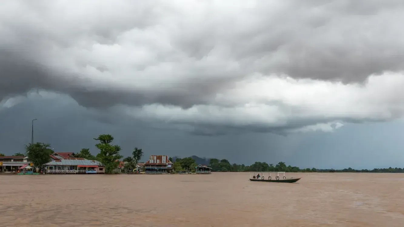
8. Distinctive Cloud Formations and Thickening Sky
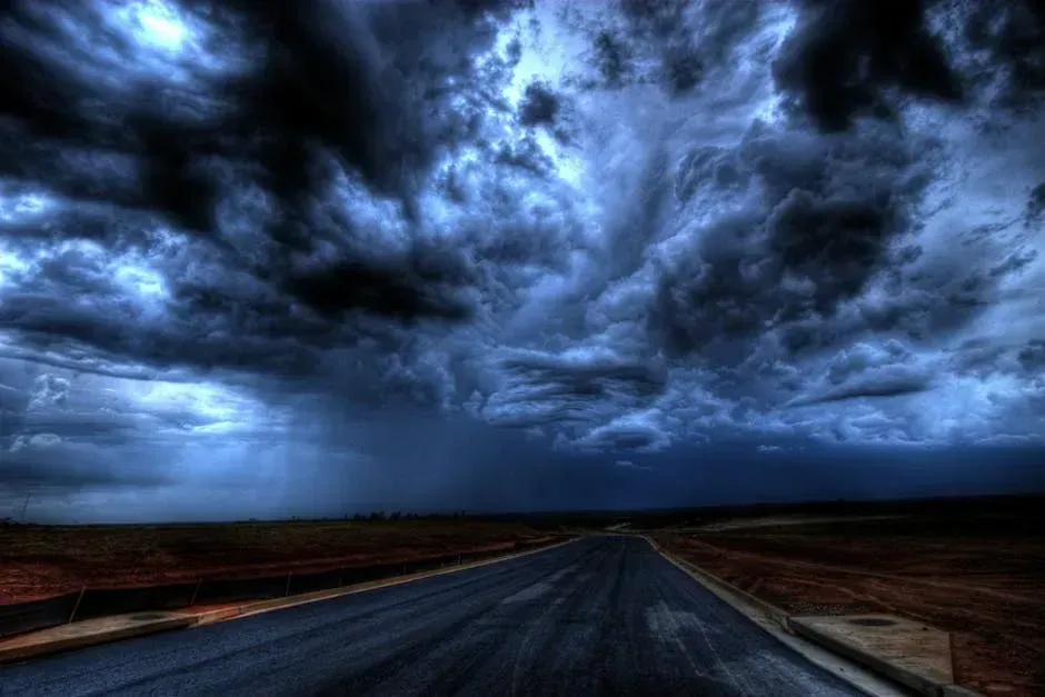
Clouds are essentially the atmosphere’s own messaging system, and they send their most urgent messages well before a major storm arrives. High cirrus clouds stretching thin and wispy across the sky are typically the first visible sign that a warm front is advancing from hundreds of miles away. After that, cloud layers thicken and lower progressively, like a slow curtain descending on a stage.
Atmospheric pressure near the surface drops as a column of air becomes less dense or is replaced by rising air, which cools and condenses to promote cloud and precipitation formation, and is often associated with deepening cyclones, fronts, or convective development, with increasing cloudiness and thickening skies being a visible result. Cumulonimbus towers, the tall anvil-shaped clouds that can reach tens of thousands of feet into the atmosphere, are the final and most dramatic warning. Severe thunderstorms often generate strong wind gusts when rain and hail drag down surrounding air, with evaporation further cooling and accelerating the downdraft, and a severe thunderstorm can give a rainfall rate greater than 50 mm in just one hour.
9. La Niña Conditions and Climate Oscillations

La Niña is a large-scale climate pattern that, counterintuitively, creates some of the most dangerous hurricane seasons in the Atlantic. As one of the strongest El Niños ever observed nears its end, NOAA scientists predicted a quick transition to La Niña conditions, which are conducive to Atlantic hurricane activity because La Niña tends to lessen wind shear in the tropics. Less wind shear, as we already know, means storms can organize and grow without disruption.
The 2025 season was expected to be above normal due to a confluence of factors including continued ENSO-neutral conditions, warmer than average ocean temperatures, forecasts for weak wind shear, and the potential for higher activity from the West African Monsoon, a primary starting point for Atlantic hurricanes, and all of these elements tend to favor tropical storm formation. The big picture signals from climate oscillations can predict elevated storm risk weeks or even months in advance. A so-called “Goldilocks” scenario has emerged where tropical Atlantic waters remain warmer than usual and La Niña conditions could emerge by late summer, reducing wind shear and letting storms thrive.
10. African Easterly Waves and Disturbances Off the Coast
Few storm precursors are as fascinating and underreported as African easterly waves. These are atmospheric disturbances that roll off the West African continent and travel westward across the Atlantic, seeding the development of tropical storms and hurricanes thousands of miles from their origin point. It is a bit like watching sparks blow off a bonfire, with most fizzling out in the open ocean but some catching fire on the way.
This hurricane season also features the potential for an above-normal West African monsoon, which can produce African easterly waves that seed some of the strongest and longer-lived Atlantic storms. Meteorologists track these waves obsessively during hurricane season, because a wave that encounters warm sea surface temperatures and low wind shear is a recipe for rapid development. On July 1, 2024, Hurricane Beryl became the earliest category-5 storm on record in the Atlantic basin, a storm that originated from precisely this kind of easterly wave disturbance, fueled by record-warm Atlantic waters all the way to its devastating landfall.
The atmosphere never acts in silence. It broadcasts its intentions through pressure readings, ocean temperatures, cloud patterns, moisture levels, and wind shifts, all telling the same story before the storm arrives. The science of reading these signals has never been more advanced, yet the 2024 season proved that even accurate forecasts can be outpaced by the sheer speed of nature. Staying aware of these ten warning patterns is not paranoia. It is just knowing how to listen to what the sky is already saying.
What would you have done differently if you had known these signals beforehand? Share your experience in the comments.