

There is something quietly unsettling about living in a place that looks perfectly fine on the surface, while scientists are busy mapping the disaster potential underneath your feet, or above your head, or rushing toward your coastline. The United States is a vast, staggeringly beautiful country. It is also, frankly, one of the most geologically and climatically volatile stretches of land on the planet.
Nearly three quarters of the U.S. could experience damaging earthquake shaking, according to a USGS-led team of more than 50 scientists and engineers. Layer climate risks on top of that, and the picture becomes even more complex. Let’s dive in.
1. The Pacific Northwest: Where the “Big One” Is Already Overdue
Later versions were uploaded by Remember the dot at en.wikipedia., Public domain)
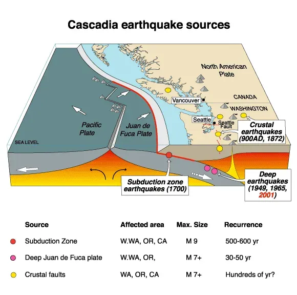
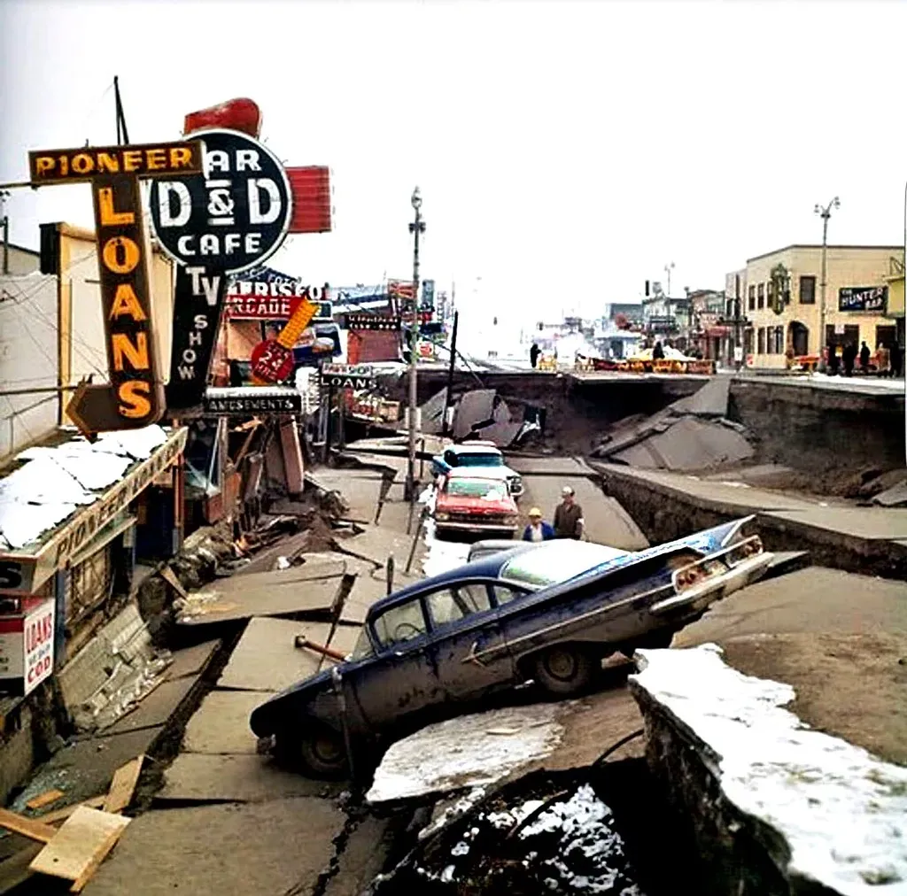
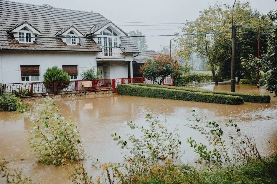
Here’s the thing about the Pacific Northwest – it looks like paradise. Lush forests, dramatic coastlines, vibrant cities like Seattle and Portland. But directly offshore, one of the most dangerous fault systems on Earth is coiling like a spring.
The Cascadia Subduction Zone is a roughly 700-mile-long megathrust fault offshore from Cape Mendocino, California, to Vancouver Island, British Columbia. It is capable of generating a magnitude 9.0 earthquake, comparable to some of the most powerful and violent earthquakes ever observed on Earth.
The Cascadia Subduction Zone has not produced an earthquake since 1700 and is building up pressure where the Juan de Fuca Plate is subsiding underneath the North American plate. Scientists are predicting there is about a 37% chance that a megathrust earthquake of magnitude 7.1 or greater will occur in the next 50 years.
A study published in the Proceedings of the National Academy of Sciences estimates that following an earthquake today, an additional 14,350 residents, 22,500 structures, and 777 miles of roadway would fall within a post-earthquake floodplain, more than doubling flood exposure. Five airports and 18 critical facilities, including public schools, hospitals, police stations, and fire stations, would be affected.
2. Southern California: Fault Lines, Fire, and a Billion-Dollar Nightmare
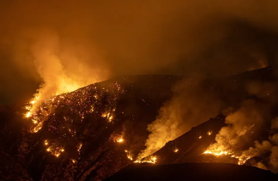
California is not a surprise on this list. Honestly, it would be shocking if it weren’t here. The state combines seismic risk with intensifying wildfire seasons in a way that no other state really matches.
According to the USGS National Seismic Hazard Model, seismic hazard is highest in California, southern Alaska, and Hawaii, with some regions having a 95% probability of suffering a damaging earthquake within a century.
In 2025, about 5.6% of U.S. homes – worth a combined $3.2 trillion – face severe or extreme wildfire risk. California alone accounts for nearly 40% of that exposure, or roughly $1.8 trillion in property value. The state’s insurance market is buckling under pressure: California’s FAIR Plan, a last-resort insurance option, now covers $650 billion in exposure, an increase of 289% since 2021.
The January 2025 Los Angeles wildfires were the costliest event of the year as well as the costliest wildfire on record, with $61.2 billion in damages – about twice as costly as the previous record wildfire. Think about that. A single fire event doubling the previous record cost. That is not a minor escalation.
3. The Gulf Coast and Louisiana: Sinking Into the Sea
New Orleans is one of the most culturally rich cities in America. It is also, geographically speaking, one of the most vulnerable. The city sits below sea level, sustained by a system of levees that Hurricane Katrina already proved can fail catastrophically.
By 2050, 99% of homes in New Orleans, Louisiana, will be in a 100-year floodplain, which is a 66% increase from current flood plain coverage today. This is, according to Policygenius calculations, the biggest predicted risk increase for any city in the United States.
By market share, New Orleans leads the nation with 66% of its housing stock facing severe or extreme flood risk not flagged by FEMA. That gap between official flood maps and reality is enormous. Louisiana insurance costs reflect the elevated risk: in 2024, residents paid an average of $3,548 annually. Many are also turning to state-backed plans like Louisiana Citizens, which can offer limited or more expensive policies in areas where private insurers have pulled back.
4. Miami and South Florida: Racing Against Rising Water
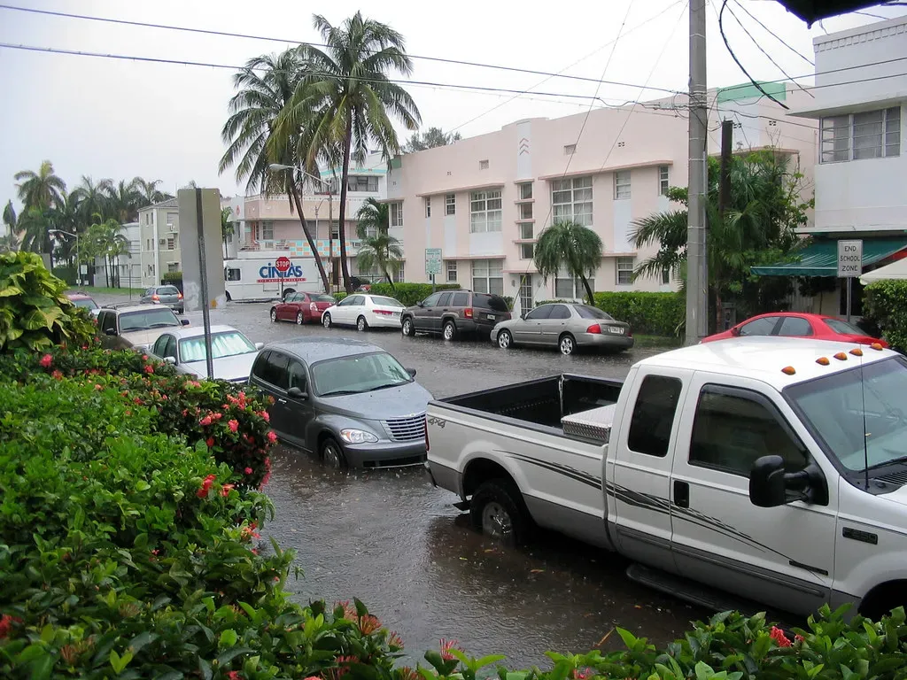
Miami has built an entire global brand around its waterfront glamour. But scientists aren’t exactly impressed by the ocean-view condos when their models show those same buildings partially submerged within decades.
In the next century, it’s all but guaranteed that a vast percentage of Miami will literally be underwater. The reason Miami’s future is so dire has to do with geology: the city sits on a foundation of porous limestone. Water doesn’t just rise around Miami; it seeps up from below.
Predictions show that 60% of Miami could be underwater by 2060 due to rising seas, hurricanes, and coastal erosion. Every home in several Gulf and Atlantic metros faces extreme wind exposure. In 2025, roughly 18.3% of all U.S. homes, representing nearly $8 trillion in property value, face severe or extreme hurricane wind risk.
5. Texas: Flash Floods, Heat, and Hurricane Corridors

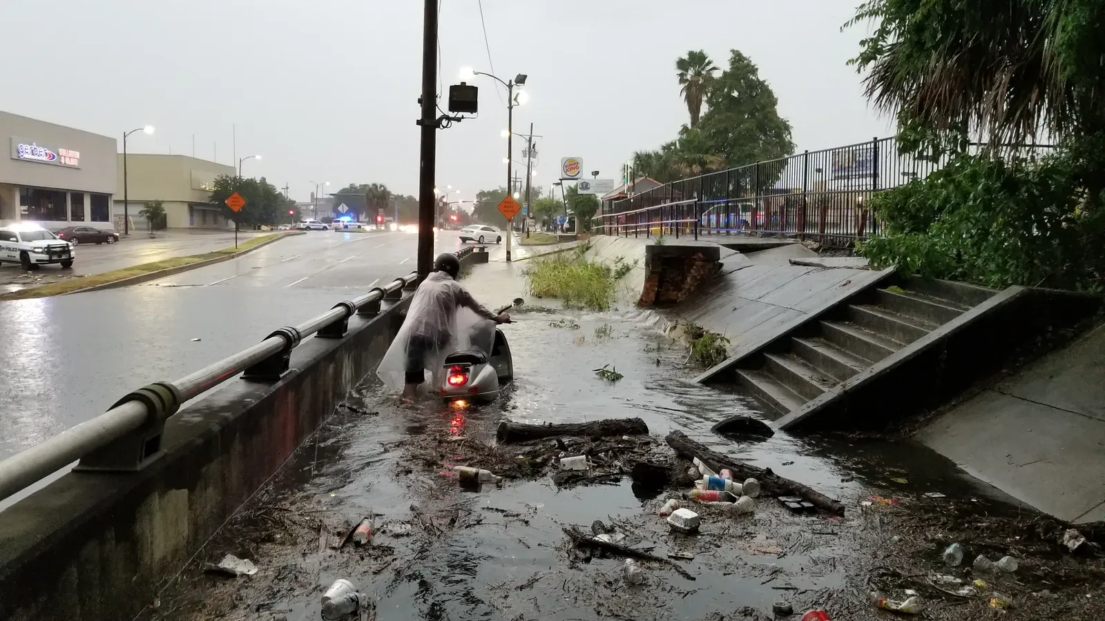
Texas is enormous and enormously varied in its risk profile. The Gulf Coast faces hurricane threats. The interior faces brutal drought cycles followed by catastrophic floods. The power grid, as millions learned in February 2021, can collapse under temperature extremes.
Extreme flooding in a region of Texas known as “Flash Flood Alley” turned to tragedy in 2025 when torrential rains turned the Guadalupe River in Kerr County into a raging wall of water, causing the river to rise 26 feet in less than an hour. In some spots, rainfall rates of 2 to 4 inches per hour were measured.
The flash flooding killed more than 130 people, 36 of whom were children, according to officials. Analysis from NOAA indicates that the extreme rainfall that triggered the floods followed a prolonged extreme drought beginning in 2021 in the affected Texas counties – a pattern known as hydroclimate whiplash.
Texas continues to rank as one of the most climate-challenged states in the country. From Category 3 and 4 hurricanes along the Gulf Coast to widespread drought and record-setting heat waves, the state faces a broad spectrum of environmental risks. Power grid instability has also become a growing concern, particularly during extreme temperature events.
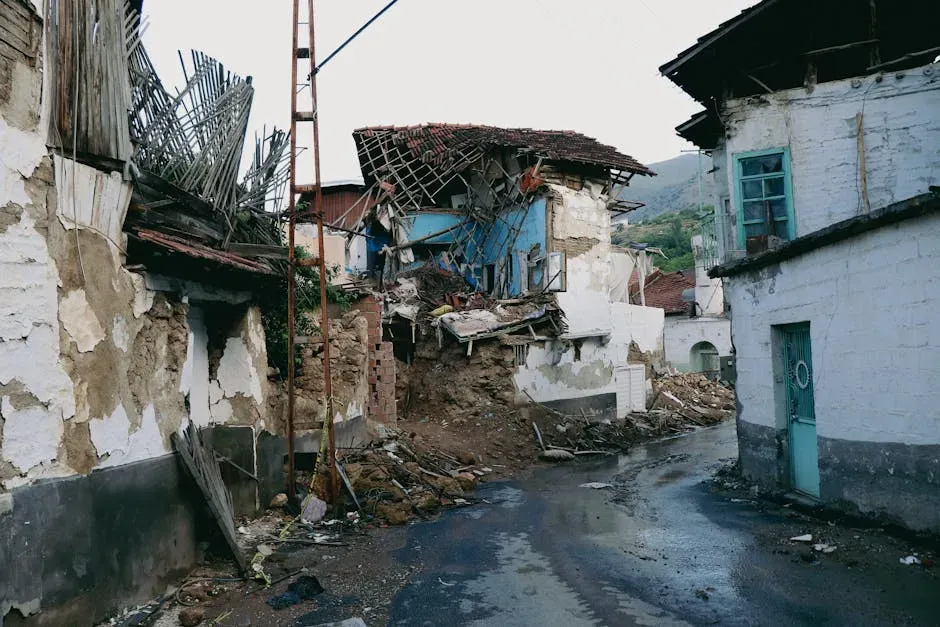
6. The New Madrid Seismic Zone: The Midwest’s Hidden Time Bomb
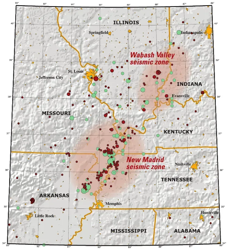
Most Americans associate earthquakes with California. That assumption could get people killed in the middle of the country, where a sleeping giant of a fault system stretches across several densely populated states with almost no earthquake-resistant infrastructure.
The New Madrid Seismic Zone, located in southeastern Missouri, northeastern Arkansas, western Tennessee, western Kentucky and southern Illinois, is the most active seismic area in the United States east of the Rocky Mountains. The area includes major cities such as Memphis, Tennessee, St. Louis, Missouri, Little Rock, Arkansas, and Evansville, Indiana.
According to the USGS, there is a 25 to 40% chance the New Madrid Seismic Zone will experience a magnitude 6.0 or greater earthquake in the next 50 years. Seismic waves travel farther in stable continental crust, meaning a magnitude 7.0 here affects roughly 20 times more area than a California magnitude 7.0. Buildings throughout the region were simply never designed for earthquakes.
Research found that a magnitude 7.6 earthquake in the New Madrid Seismic Zone could cause losses exceeding $43 billion, adjusted for 2024 inflation. The earthquakes of 1811 to 1812 occurred in an area that was sparsely populated. Were those earthquakes to occur today, their effects would be considered catastrophic, directly affecting several million people across eight states.
7. Alaska: Maximum Risk on Nearly Every Front
Alaska is the most seismically active state in the nation, and it doesn’t get nearly enough attention in the lower-48 public conversation about natural hazards. The numbers here are simply staggering.
The greatest seismic risks are in southern Alaska, California and Hawaii, which largely have above a 95% chance of feeling shakes from an earthquake in the next century, according to the government’s latest National Seismic Hazard Model used to inform policies, building codes, and risk assessments.
Arctic temperatures in Alaska warm four times faster than the global average. The state faces threats including thawing permafrost, coastal erosion, and ocean acidification that affect traditional activities and infrastructure alike. It’s a triple threat of seismics, climate change, and accelerating permafrost collapse. I think it’s safe to say no other state carries quite this combination.
8. The Atlantic Coastal Corridor: An Underestimated Risk From Boston to D.C.
When people think about earthquake risk, the East Coast rarely comes to mind. That casual dismissal is exactly what scientists are now urgently pushing back against. Densely packed megacities along the northeast corridor are more exposed than their residents likely realize.
New USGS data highlights the possibility of more damaging earthquakes along the central and northeastern Atlantic coastal corridor, which includes the cities of Washington D.C., Philadelphia, New York, and Boston. The updated National Seismic Hazard Model ups the possibility of damaging earthquakes in the Atlantic coastal corridor. Although the seismic hazard in the area is still generally low, the corridor is so densely populated that an increased hazard affects a large number of people.
Residents in the New York City region were reminded of this on April 5, 2024, when a magnitude 4.8 earthquake centered nearby in New Jersey shook the area. New York, Los Angeles, and San Francisco show the biggest gaps between FEMA’s flood zones and actual risk, totaling $95.3 billion, $65.6 billion, and $54.9 billion in unrecognized exposure, respectively.
9. The Appalachian Region: Western North Carolina and the Hidden Flood Belt

Western North Carolina does not fit the typical image of a disaster zone. Mountain towns, autumn foliage, hiking trails. Yet 2024 delivered a brutal wake-up call to the entire region and to anyone who assumed inland, elevated terrain meant safety.
Hurricane Helene was the deadliest Atlantic hurricane since Maria in 2017, and the deadliest to strike the U.S. mainland since Katrina in 2005. Landslides, debris flows, and historic levels of flooding inundated and destroyed homes, businesses, parks, hospitals, the electrical and cellular and water system infrastructure, and damaged thousands of roads, highways, and bridges.
Between September 23 and 28, 2024, the highest 3-day rainfall totals across the higher elevations of the southern Appalachian Mountains were so extreme that the statistical chances of them being exceeded in any given year were 1 in 1,000. It’s hard to say for sure whether events like this will become the new normal, but climate scientists are increasingly pointing that direction.
10. The Central U.S. Tornado Belt: A Season That Never Really Ends

The tornado belt stretching through Oklahoma, Kansas, Missouri, and Kentucky has always been dangerous. What is changing now is the geographic reach, the intensity, and the creeping extension of severe weather into months that were previously considered off-season.
The past three years rank highest for the annual number of billion-dollar disasters: 2023 saw 28 events, 2024 saw 27, and 2025 saw 23. The number of billion-dollar severe storms set a new record in 2025, with 21 such events, reflecting near-record numbers of damaging high wind and tornado reports during the spring and summer.
Tornado outbreaks in Kentucky, Missouri, and Virginia in mid-May 2025 killed at least 28 people. Strong supercell storms spurred tornado activity, tearing roofs off homes and causing several buildings to collapse. In Missouri, St. Louis was particularly hard hit when an EF-3 tornado with 140 mph winds ripped through neighborhoods.
The time between billion-dollar disasters is shrinking. The average length of time between them has fallen from 82 days during the 1980s to just 16 days during the last 10 years. The average time between billion-dollar disasters in 2025 was just 10 days. Think of it like a drumbeat that keeps getting faster.
11. The Colorado Front Range and Mountain West: Wildfire, Drought, and Seismic Exposure
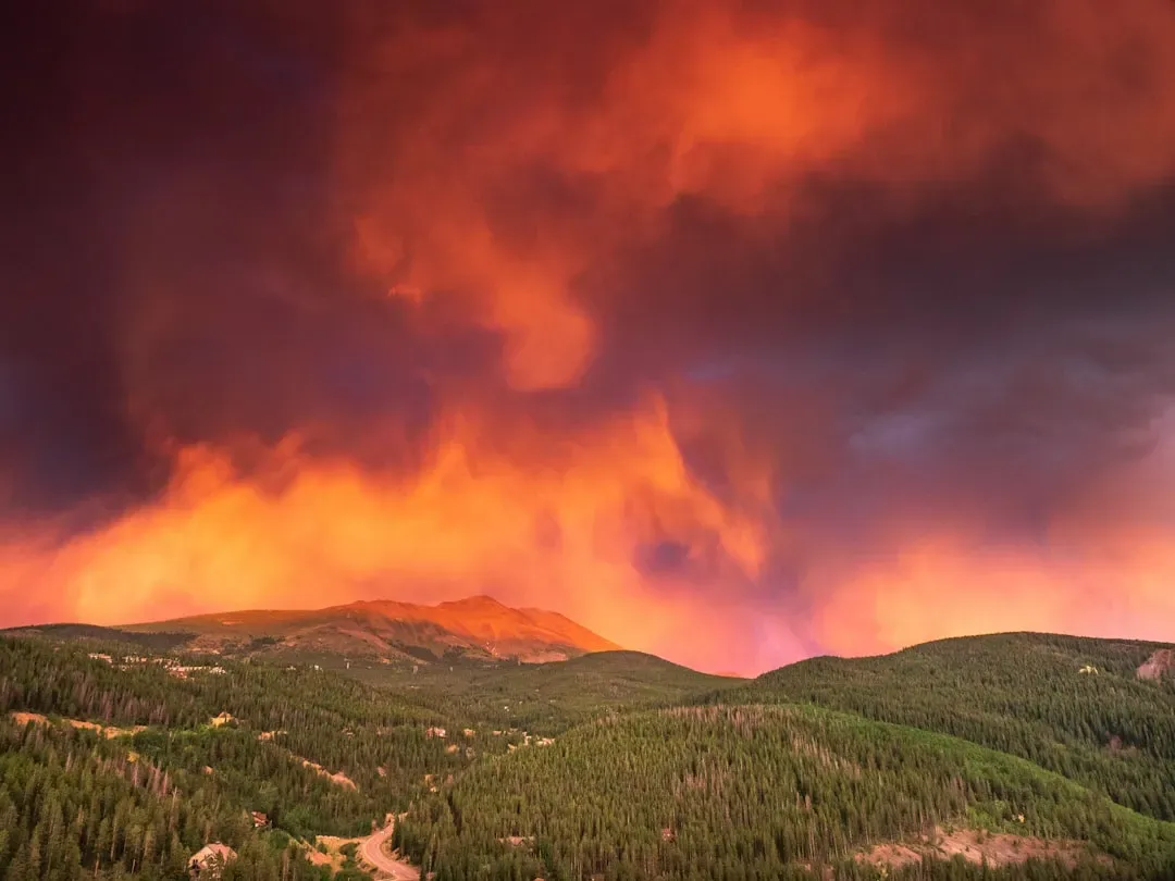
The Mountain West has always carried wildfire risk, but the scale of the threat has shifted dramatically over the past decade. Meanwhile, seismic exposure in this region is higher than most people realize.
Western Nevada, the Wasatch Range in Utah, the Yellowstone region, and the New Madrid Seismic Zone are all likely to experience strong shaking in the future, according to the USGS National Seismic Hazard Model. Damaging earthquakes can occur where there is no recent history of seismic activity. In 2020, a magnitude 5.7 earthquake near Magna, Utah, took many by surprise, causing considerable damage and raising concerns about seismic preparedness in the Salt Lake Valley.
Wildfire danger is intensifying in western metros like Colorado Springs, where more than three quarters of home value is at risk, and Tucson, where 60% of homes face high fire danger. A billion-dollar drought affected the western U.S. in 2025. This event was primarily driven by heat rather than a lack of precipitation, consistent with an emerging trend of heat-driven drought in the western U.S.
12. The Gulf Coast of Mississippi and Alabama: Climate Vulnerability and Low Resilience
This stretch of Gulf Coast carries perhaps the most underreported combination of climate vulnerability and low recovery capacity in the entire country. When storms hit here, the damage lingers far longer than in wealthier coastal regions.
Mississippi ranked lowest in one major climate resilience analysis due to the combined weight of climate vulnerability, economic instability, and limited market resilience. According to the U.S. Climate Vulnerability Index, it holds the worst overall score in the nation, driven by factors like flooding, heat stress, poor infrastructure, and low socioeconomic resilience.
Mississippi is increasingly susceptible to extreme heat, hurricanes, and inland flooding. These risks have already contributed to multiple federally declared disasters, and the state also faces serious challenges in housing quality, with older homes often less equipped to handle climate stressors.
Coastal metros dominate the list of areas with the highest concentration of home value exposed to severe flood risk, revealing how outdated maps and intensifying weather leave both homeowners and insurers vulnerable. In 2024, nearly half of all U.S. homes faced at least one type of severe climate risk. Not only do these events pose a real threat to homeowners, but they also drive up insurance costs and put pressure on home values and maintenance budgets.
The data from scientists, USGS, NOAA, FEMA, Climate Central, and independent research institutions all point in the same direction: risk in the United States is not shrinking. It is spreading, intensifying, and showing up in places that once felt safe. Since 1980, the U.S. has sustained 426 billion-dollar disasters, with a total cost exceeding $3.1 trillion. The frequency of those disasters has increased dramatically due to the rise in extreme weather and a growing number of people, homes, and businesses in harm’s way. Which of these regions surprised you most?