

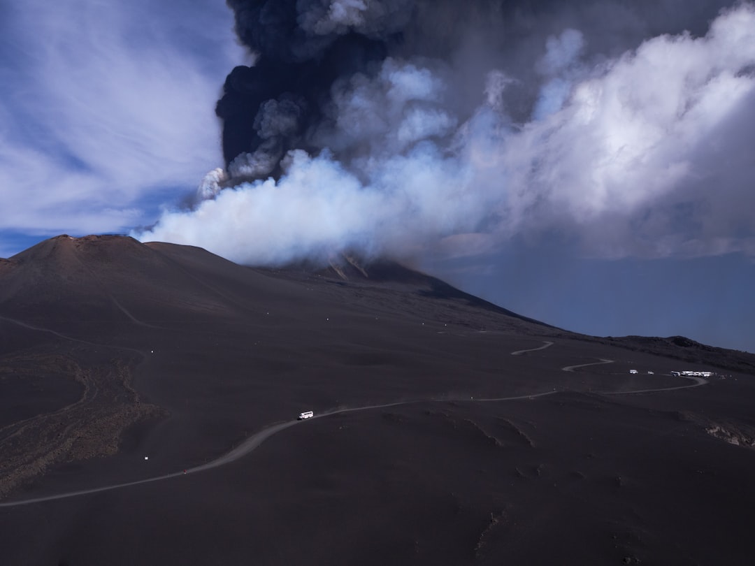
Mount Agung’s Devastating Return to Activity

Mount Agung, Bali’s sacred volcano that towers 3,031 meters above sea level, has transformed from a spiritual landmark into a source of international concern. The volcano’s recent eruptions have sent ash clouds soaring up to 4,000 meters into the atmosphere, creating a dangerous scenario for aviation across the region. Indonesian authorities reported increased seismic activity beginning in late 2023, with tremors registering up to 4.2 on the Richter scale occurring daily around the volcanic zone. The Center for Volcanology and Geological Hazard Mitigation raised the alert level to the second-highest category, affecting over 100,000 residents in surrounding areas who depend on tourism and agriculture for their livelihoods.
Immediate Flight Disruptions Across Southeast Asia
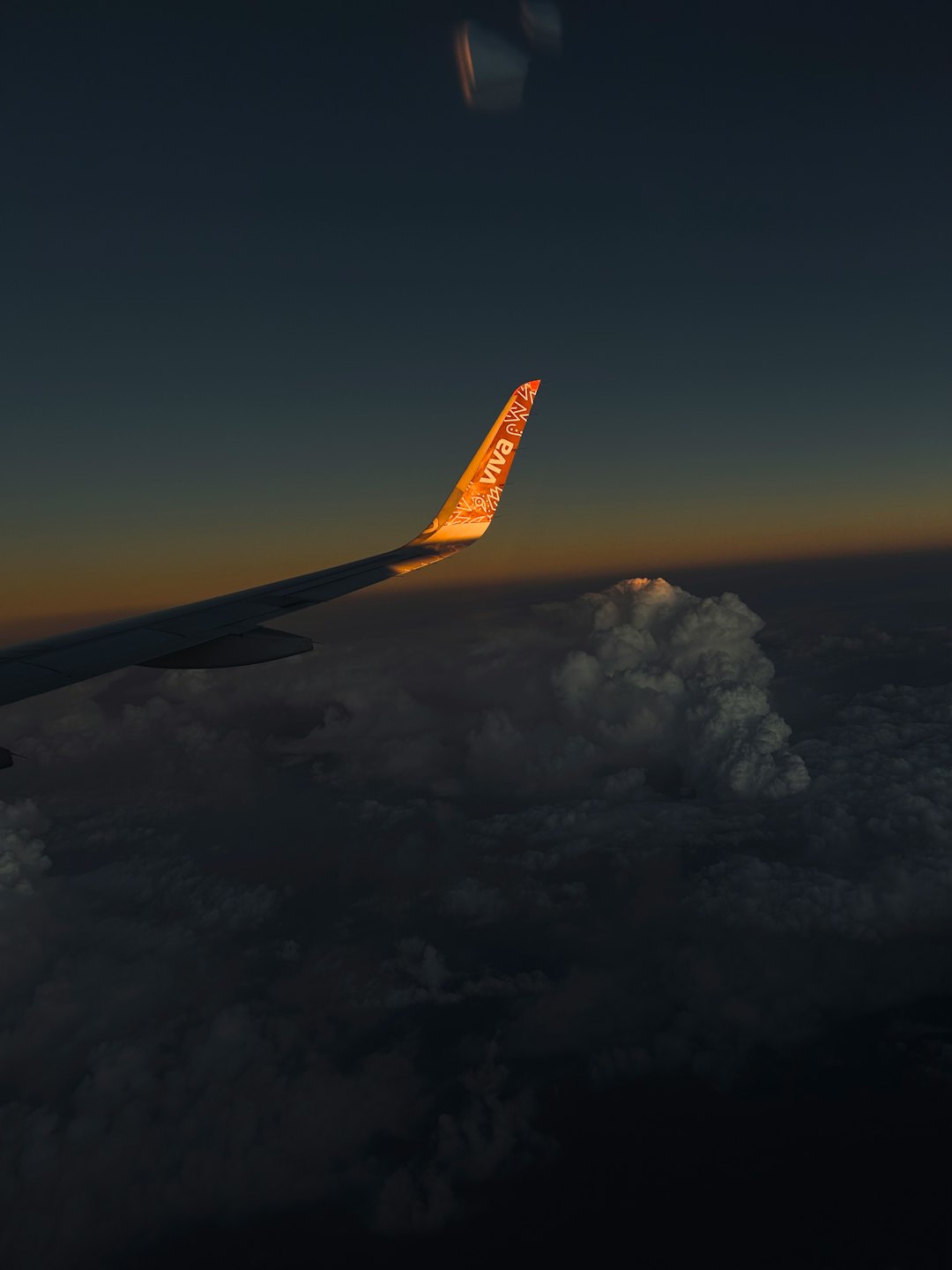
Major airlines including Jetstar, Virgin Australia, and AirAsia have canceled over 400 flights to and from Ngurah Rai International Airport since the eruption intensified in early 2024. The volcanic ash poses severe risks to aircraft engines, with particles capable of causing complete engine failure when ingested during flight operations. Airport authorities estimate that approximately 65,000 passengers have been stranded across various Southeast Asian airports, with some travelers facing delays exceeding 72 hours. The economic impact on Indonesia’s tourism sector has reached an estimated $2.1 billion in losses during the first quarter of 2024, according to the Indonesian Tourism Ministry’s latest reports.
Scientific Monitoring and Eruption Patterns

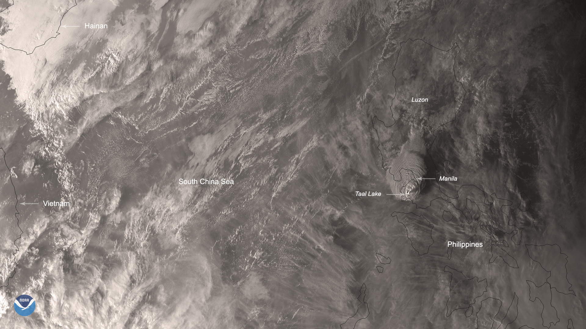
Volcanologists from the Indonesian Geological Survey have deployed advanced seismographic equipment around Mount Agung, recording over 800 volcanic earthquakes in a single week during peak activity periods. The current eruption cycle shows similarities to the devastating 1963 event that killed over 1,100 people and displaced 200,000 residents from their homes. Satellite imagery from NASA’s Earth Observatory reveals that ash plumes have reached altitudes of 6,000 meters, with wind patterns carrying volcanic debris across vast areas of the Indonesian archipelago. Research teams have documented surface temperatures exceeding 800 degrees Celsius near the crater rim, indicating sustained magmatic activity that could continue for several months.
Tourism Industry Faces Unprecedented Challenges

Bali’s tourism sector, which contributes approximately 60% of the island’s GDP, has experienced its most severe disruption since the COVID-19 pandemic. Hotel occupancy rates have plummeted from 85% to just 23% in affected regions, forcing many establishments to implement temporary closures and staff reductions. The Indonesian Hotel and Restaurant Association reports that over 15,000 tourism workers have been temporarily laid off due to mass cancellations and travel advisories. International tour operators have redirected bookings to alternative destinations like Lombok and Java, creating a ripple effect that extends far beyond Bali’s immediate borders.
Emergency Response and Evacuation Procedures
The Indonesian National Disaster Management Agency has established 47 emergency shelters capable of housing up to 50,000 evacuees within the established danger zone. Emergency response teams have distributed over 200,000 face masks to protect residents from volcanic ash inhalation, which can cause severe respiratory complications. Local authorities have implemented a 10-kilometer exclusion zone around the volcano’s crater, requiring the relocation of entire villages that have existed for generations. The Indonesian military has deployed helicopters and ground vehicles to assist with evacuations, while international aid organizations have contributed medical supplies and temporary housing materials to support displaced communities.
Long-term Recovery and Prevention Strategies
Government officials have announced a comprehensive $500 million reconstruction plan aimed at improving volcanic monitoring systems and developing more resilient infrastructure in high-risk areas. The plan includes upgrading early warning systems with real-time data transmission capabilities and constructing reinforced evacuation routes that can withstand future volcanic events. Insurance companies have begun reassessing coverage policies for properties within volcanic hazard zones, potentially affecting thousands of homeowners and businesses across the region. Aviation authorities are also implementing new protocols for ash cloud detection and flight path management, utilizing advanced radar technology and satellite monitoring to prevent future large-scale disruptions to air travel throughout Southeast Asia.
- Experts Say Homebuyers Are Now Avoiding These 7 Storm-Prone States – A Concerning Climate Shift - March 21, 2026
- How Meteorologists Predict Storms Using Satellite Data - October 3, 2025
- What Causes Rainbows And Why They’re Always Curved - October 1, 2025