


- Nights Are Warming Faster Than Days in Many Regions. Climate Scientists Explain Why - October 15, 2026
- How Weather Forecasts Are Made Using Satellites, Balloons, and Computer Models - October 15, 2026
- The Sea Breeze Effect: Why Coastal Afternoons Feel Cooler Than Inland Ones - October 15, 2026
A record-breaking ocean signal driving the forecast
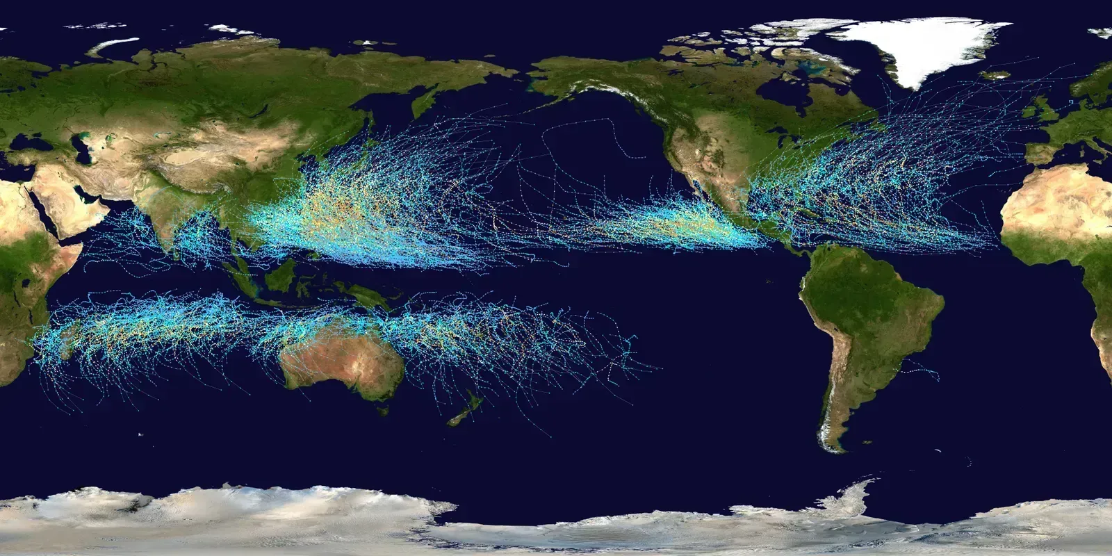
The starting point for almost every winter outlook this year is the same: the tropical Pacific is unusually warm, and it’s warming fast. Sea surface temperatures in the central and eastern tropical Pacific are rising faster than meteorologists have ever seen before. That pace alone has forecasters paying closer attention than they normally would at this point in the year.
Model projections show this event peaking around December, with sea surface temperatures anywhere from 5.4 degrees Fahrenheit to 8.1 degrees above average. Even at the low end of that range, this El Niño would be the strongest on record by a long shot. That’s a striking statement, considering meteorologists have been tracking this pattern since the middle of the last century.
What actually makes an El Niño “super”
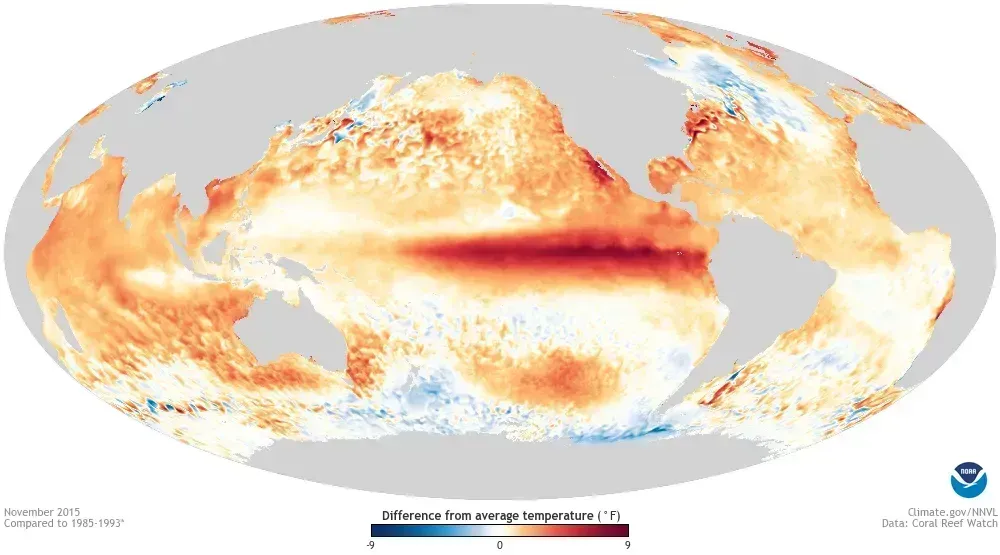
The term gets used loosely in headlines, but it has a technical basis. Meteorologists generally use the informal term “super El Niño” to describe exceptionally strong El Niño events. It’s not an official government classification so much as shorthand among forecasters for a rare tier of intensity.
When surface waters climb more than two degrees Celsius above normal, meteorologists classify the event as a Super El Niño, a far less common and more intense version of the pattern. This year’s numbers are already brushing past that threshold with room to spare, which is part of why the forecasting community has been so vocal about it.
NOAA’s confidence numbers tell their own story

Government forecasters aren’t hedging much on this one. The National Oceanic and Atmospheric Administration’s Climate Prediction Center says there is a greater than 90 percent chance of a very strong El Niño this fall and winter. That’s an unusually high confidence level for a seasonal outlook issued this far in advance.
What’s more notable is how it compares historically. NOAA has even calculated a 69 percent chance that the October to December period will reach a level exceeding previous El Niño events in records dating all the way back to 1950. If that verifies, this wouldn’t just be a strong El Niño, it would be the strongest ever documented for that stretch of the calendar.
The Southwest and southern Rockies stand to gain the most
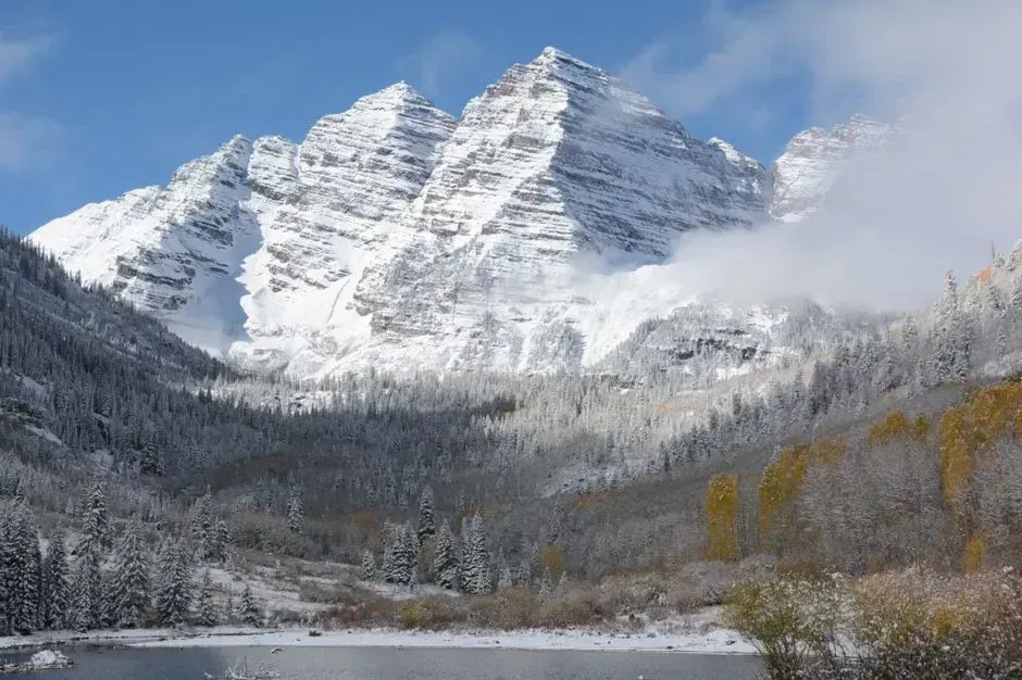
Snow lovers in certain parts of the country have real reason for optimism. NOAA analyses show that moderate-to-strong El Niño winters have, generally, produced increased snowfall across parts of the southern half of the country, most common at higher elevations. That pattern shows up again and again in past strong events.
Recent independent forecasts back this up with specifics. Arizona’s high country has recorded above-normal snowfall in the three strongest El Niño winters on record, and the strongest and most consistent signal extends across the Southwest and Southern Rockies, including areas around northern Arizona and Colorado, offering a potentially favorable setup for mountain snowpack and ski conditions. Utah’s mountains are also frequently mentioned in this conversation. Meteorologists say the central Sierra Nevadas in California has historically benefited from strong El Niño events, while Utah’s Wasatch Range is often well positioned to receive frequent snowstorms.
The northern tier could be left out in the cold, literally
Not every region benefits from this setup, and the divide runs roughly along a west-to-east line. The pattern flips farther north, where the Pacific Northwest and Northern Rockies have consistently leaned toward below-normal snowfall during strong El Niño winters. That’s a familiar storyline for anyone who has followed past El Niño events.
Longer-range seasonal outlooks are painting a similar picture for this year specifically. NOAA’s August 2026 assessment places the October to December sea surface temperature anomaly at approximately 2.5 to 2.7 degrees Celsius, meeting the criteria for a strong to potentially super El Niño event, and this developing pattern is one of the most significant factors shaping the 2026 to 2027 winter outlook. Drier and milder conditions in the north are a near-constant feature of that broader shift.
Rain instead of snow could be the real complication
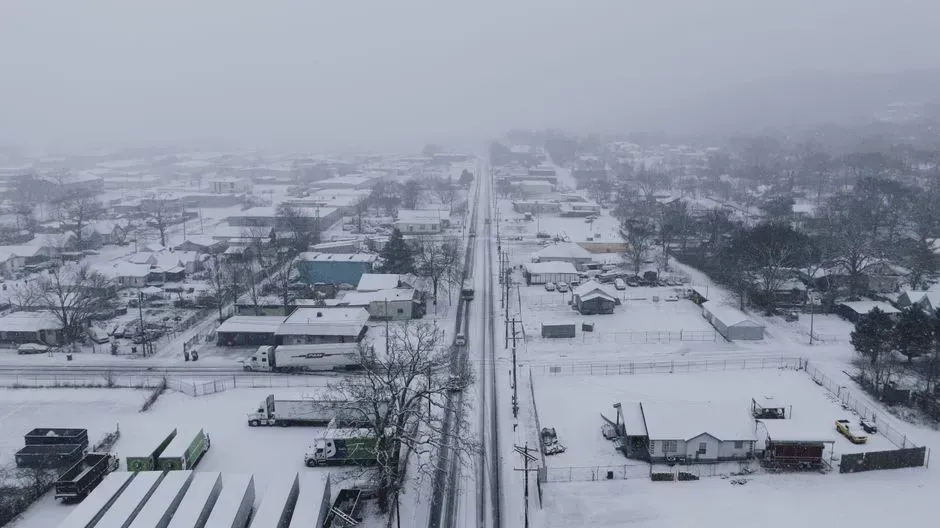
One of the trickier wrinkles this winter involves temperature more than moisture. Forecasters keep circling back to the risk that storms arrive with plenty of energy but not enough cold air behind them. There is a very strong chance that the Super El Niño will bring with it higher than average temperatures, meaning that the rain and snowline will creep higher up, making it so that a lot of precipitation will fall as rain at ski areas instead of snow, and if that is the case, a lot of ski areas will not have high season snowfall totals.
That distinction matters more than raw storm counts. Meteorologist Chris Tomer also said there could be issues with freezing levels, meaning storms bringing rain rather than snow, because warm air is being drawn into North America. A wet winter and a snowy winter are not automatically the same thing, and this year’s setup makes that gap especially important to watch.
History offers a rough but useful guide
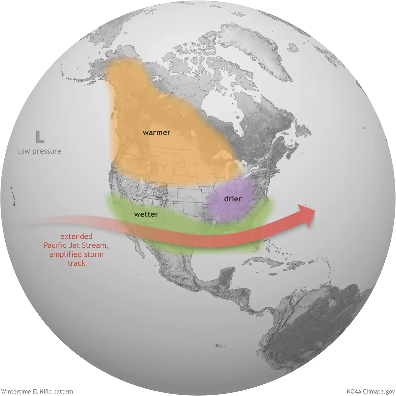
Forecasters lean heavily on past strong El Niño winters because direct comparisons are limited. The three strongest El Niño winters on record, 1982 to 1983, 1997 to 1998 and 2015 to 2016, show a remarkably consistent regional signal. That consistency is part of why confidence is relatively high for certain regions this year.
Still, the sample size is small, and this event may not fit neatly into the old pattern. The sample size for strong El Niño winters is smaller than most people assume and about to get a new, possibly record-breaking entry. The last El Niño this strong was in 1997, but this one is expected to be significantly stronger. That combination of thin historical data and unprecedented ocean warmth is exactly why meteorologists keep describing this winter as uncharted territory.
Central and eastern states could see a real boost too
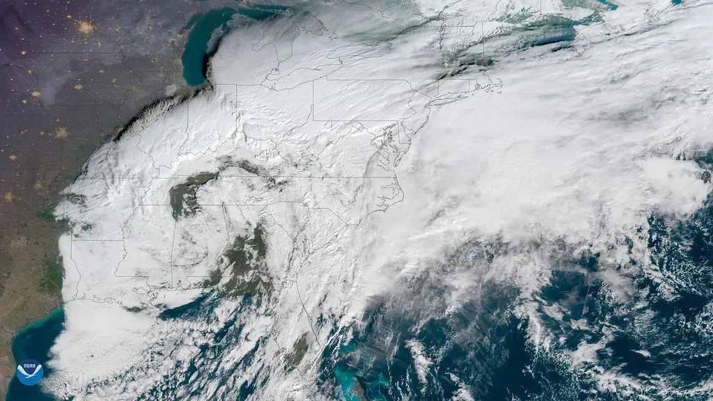
It isn’t just the Southwest getting attention. Forecasters see potential for increased snow well beyond the Rockies if cold air cooperates. This combination can really increase the snowfall potential across the central and eastern United States, if enough cold air is available.
Other outlooks echo a similarly broad footprint. One meteorologist expects significant snowfall deficits across much of the northern U.S., but above-average snowfall across most western, southern, central, and eastern states. That’s a wider band of potential winners than some earlier, more cautious forecasts suggested, though the outcome still hinges on whether Arctic air shows up at the right moments.
Meteorologists keep repeating the same caution
Despite the historic numbers, nobody in the forecasting community is treating this as a sure thing. Crystal Egger, meteorologist and president of Monarch Weather Consulting, said the strength of the event could substantially tilt the odds toward characteristic El Niño weather, but cautioned that a strong El Niño can tilt the odds toward certain temperature and precipitation patterns without determining exactly how every storm, or the entire winter, will play out. That’s a fairly consistent message across multiple sources this year.
Other forecasters frame it the same way. Stronger El Niños increase the odds that expected global weather shifts will happen, but they do not guarantee any single local outcome, and every El Niño unfolds differently. Probability, not certainty, remains the operative word throughout this outlook.
What it means for ski resorts and water supplies
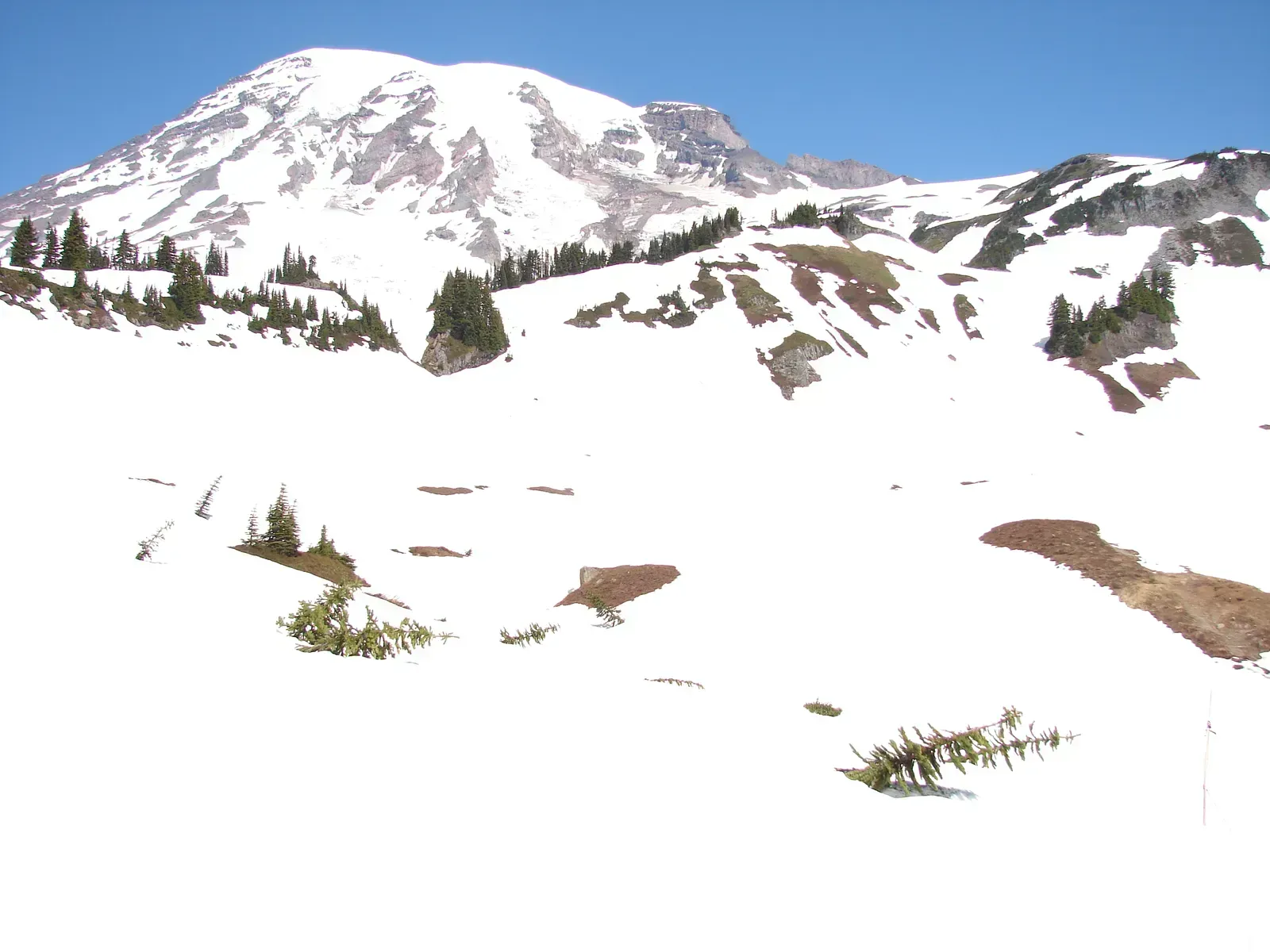
The stakes go beyond weekend ski trips. Mountain snowpack functions as a natural reservoir across much of the western U.S., feeding rivers and water systems well into summer. Any increase in snowfall would be particularly important in the mountains, where winter snowpack acts as that seasonal storage system.
Resort operators in the Southwest have extra reason to watch this outlook closely after recent seasons of inconsistency. The West as a whole endured one of its worst snow seasons on record in 2025 to 2026, though it was a good snow season for the East. A strong rebound in the southern Rockies would be a welcome change of pace, but it depends heavily on whether the cold air and moisture line up the way past strong El Niño years suggest they might.
The bottom line for this winter
What’s clear so far is that the tropical Pacific is behaving in a way that hasn’t been recorded before, and forecasters across multiple organizations are treating that seriously rather than dismissing it as noise. The regional split, better odds for the Southwest and southern Rockies, tougher prospects for the Pacific Northwest and northern tier, has shown up consistently across independent outlooks this summer. Whether it delivers snow or simply rain at unusually high volumes will come down to details that won’t be settled until the cold air actually arrives.
