

- 12 Simple Weather Signs That Often Mean a Storm Is Coming - March 23, 2026
- 9 Bizarre Weather Phenomena Scientists Still Can’t Fully Explain - March 23, 2026
- 10 Climate Solutions Everyone Talks About but Few Fully Understand – Are You One of Them? - March 22, 2026
Most of us have been caught off guard by a sudden downpour or a sudden burst of thunder at least once. You glanced up at a clear sky thirty minutes earlier and thought nothing of it. Nature, though, had already been sending signals. Long before meteorologists had satellites and Doppler radar, farmers, sailors, and travelers relied entirely on the world around them to read what the sky was about to do. And here’s the thing: many of those old signs hold up surprisingly well under modern scientific scrutiny.
Some of these signals are visible to the naked eye. Others you feel in the air, hear in the trees, or notice in the behavior of the animals around you. Whether you’re an outdoor enthusiast, a hiker, or just someone curious about the world, knowing these signs could one day keep you dry or, better yet, keep you safe. Let’s dive in.
1. A Sudden Drop in Barometric Pressure

Of all the warning signals a storm can send, this is probably the most reliable one. Rapid drops in barometric pressure are often a sign that severe weather is imminent. You don’t need to be a meteorologist to notice this either. A simple household barometer, or even a weather app, can show you this shift in real time.
A falling air pressure generally means there is an approaching storm that will arrive within the next 12 to 24 hours, and the farther the barometric pressure drops, the stronger the storm. Think of pressure like the sky’s mood ring. When it starts plunging, the atmosphere is telling you it’s about to get very unsettled.
A minimum of 10 hPa fall in barometric pressure over 3 hours will produce a storm and gale. That’s a dramatic shift, and if you were outdoors with a portable weather meter, that kind of reading would be a clear message to head for shelter fast.
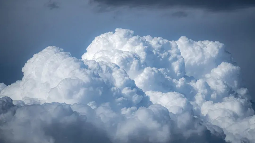
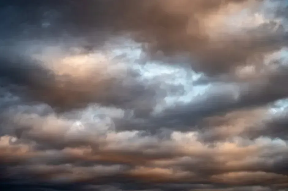
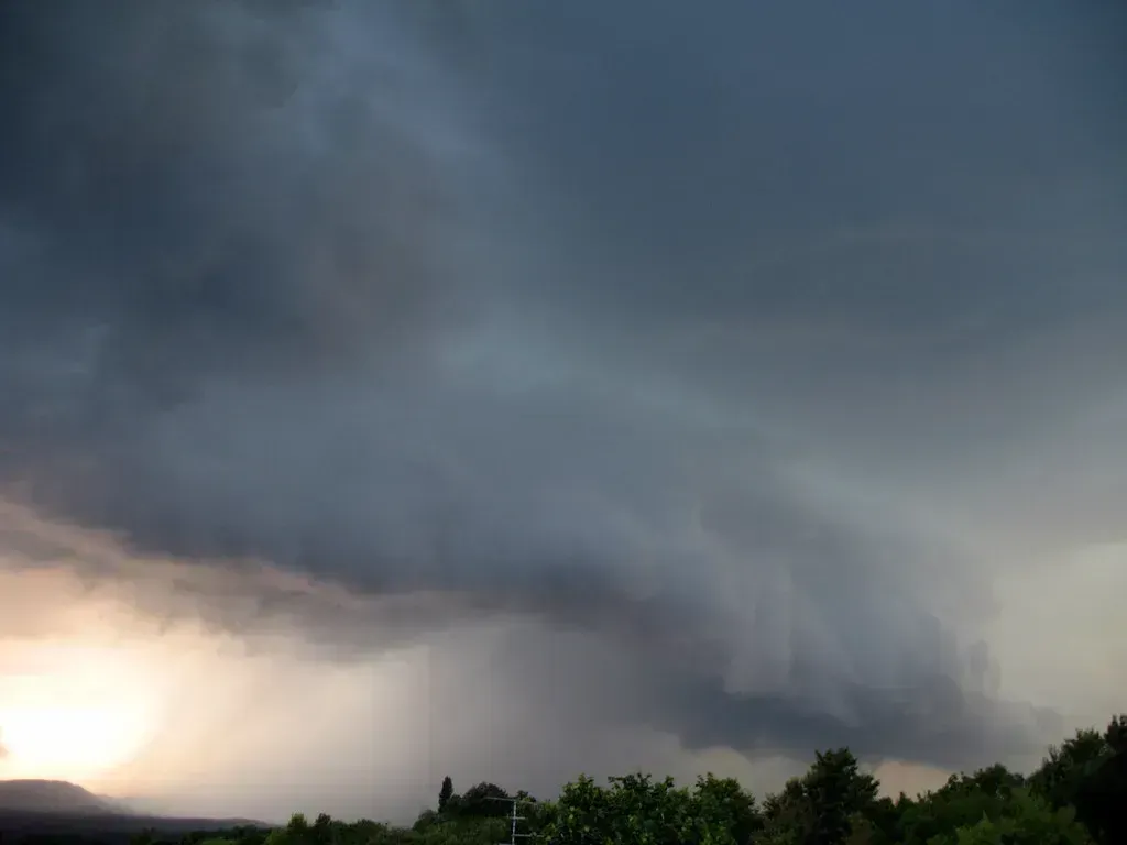
2. Rapidly Building Cumulonimbus Clouds
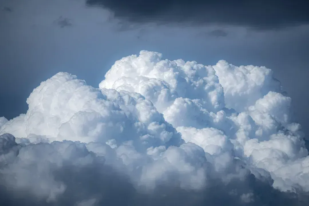
Have you ever watched white, fluffy clouds grow taller and taller throughout a summer afternoon, almost like someone is inflating them? That’s not just pretty to look at. It’s one of the most visible storm warnings nature provides. When those towers start developing an anvil-shaped top that spreads horizontally, the storm is already well underway overhead.
Reading cloud formations and paying attention to their height and spread can give insights into the weather forecast. Cumulonimbus clouds, in particular, are the classic thunderstorm engines of the atmosphere. They form when warm, moist air rapidly rises and cools, building tall, dark, explosive-looking towers in the sky.
Severe thunderstorms often generate strong wind gusts when rain and hail drag down the surrounding air, and evaporation further cools it, accelerating the downdraft, producing gusts of at least 90 km/h. So when you see that signature anvil cloud building overhead, you should be moving indoors already.
3. A Red Sky in the Morning
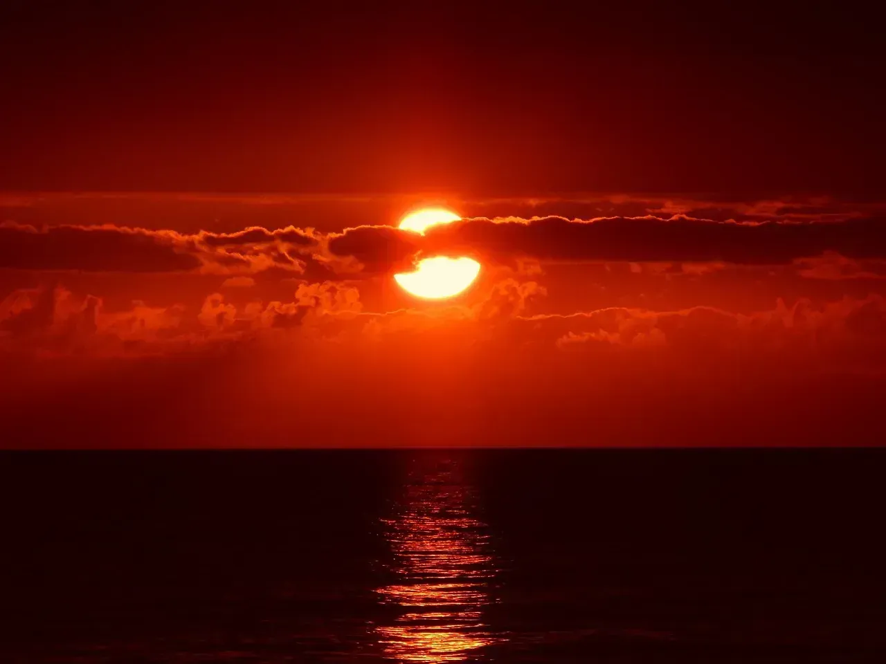
Sailors knew this one for centuries, and science eventually caught up with them. If the sky is red when the sun rises, the high-pressure system has already passed to the east and a low-pressure system, bringing rain and storms, is moving in from the west. That’s a beautiful sky with a not-so-beautiful message attached.
The colors we see in the sky are the result of sunlight being split into different colors of the spectrum as it passes through water vapor and particles in the atmosphere, and the amount of particles in the atmosphere is both an indication of weather conditions and what colors we will see. When the morning sky blazes red or orange, moisture and dust are already thick in the air to the east.
There is one catch to this clever saying: it only holds true in the middle latitudes of the planet, which include North America, because weather systems generally move from west to east. So if you’re reading this from Australia or parts of Asia, you may need to flip the logic slightly depending on your local weather patterns.
4. A Ring Around the Moon
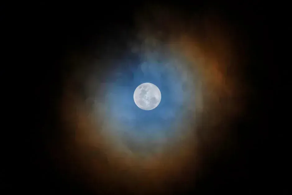
There’s an old rhyme that says rain or snow is coming soon when you see a halo around the moon. It sounds like pure folklore, but it’s actually grounded in solid atmospheric physics. The ring around the moon, called a lunar halo, is caused by high, thin cirrus clouds which often precede a storm, and these clouds are usually more than 20,000 feet up in the atmosphere, containing millions of ice particles.
The halo effect occurs when the moon’s light diffracts, or bends, off small ice crystals in the atmosphere. The ice crystals form thin clouds that you may or may not see, and these high clouds occur because of a change in air pressure and generally indicate that storm clouds follow. It’s like the sky wearing a warning badge before the storm arrives.
The halo around a bright object is caused by refraction of the light through the ice crystals of high cirrus clouds, and cirrus can be the first cloud to appear ahead of a front. This is one of those rare signs where folklore and meteorology agree completely, no argument needed.
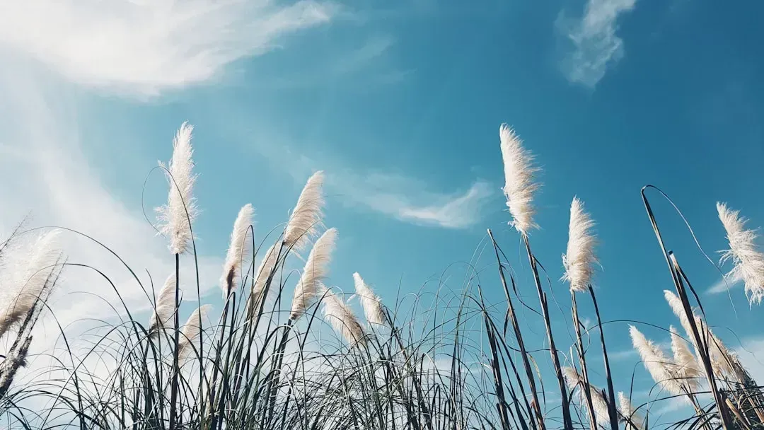
5. Wispy Cirrus Clouds That Thicken Over Time
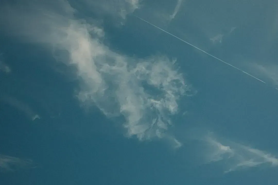
Cirrus clouds are those thin, feathery streaks high in the sky. On their own, a few of them don’t necessarily spell trouble. The problem comes when you start watching them thicken and multiply throughout the day. That’s your cue to start paying closer attention. These high-level ice clouds often precede the approach of a storm system.
Sailors even nicknamed specific cirrus formations “mares’ tails,” because of their resemblance to a horse’s flowing tail. Neither cirrus nor altocumulus cloud types will bring rain or snow themselves, but they do precede an approaching storm front by a day or two. Think of them as scouts sent ahead of the main weather army.
Halos typically evolve into what is known as “milk sky,” when the sky appears clear but the typical blue is either washed out or barely noticeable, and this high, thick cirrostratus cloud is a clear indicator of an approaching low. If your bright blue sky slowly turns a milky white over the course of a morning, a storm system is likely on the way.
6. Birds Flying Low and Unusually Quiet Forests
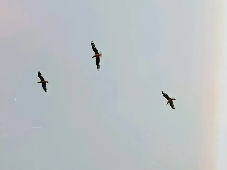
Here’s something worth paying attention to next time you’re outdoors. Watch the birds. Specifically, watch how high they’re flying. Birds may be the best weather predictors of them all, and they tend to fly low when a storm is coming and higher in good weather due to changes in air pressure. In fact, birds seem to know when to evacuate an area before storms and bad weather arrive.
The science behind this is genuinely fascinating. Scientists studying a group of Tennessee-based golden-winged warblers documented that the birds flew south in advance of a devastating tornado and made their way back a few days later. The scientists hypothesize that the birds heard infrasound coming from an approaching storm system days in advance.
Insects are also sensitive to changes in humidity and atmospheric pressure, and increased insect activity near water sources may indicate changes in weather conditions, such as approaching storms or changes in temperature. When the forest goes eerily still and the birds disappear, nature is essentially clearing the stage before the main act begins.
7. The Air Smells Unusually Strong or Earthy
You’ve probably noticed it before without quite naming it. Just before rain, the air takes on a rich, earthy, almost sweet smell. That’s not your imagination. The amplification of smells serves as a subtle yet unmistakable indicator of impending weather changes, and stronger scents often herald the arrival of rain or stormy conditions.
In fair weather when air pressure is high, earthly smells tend to get stored in their source. When low air pressure arrives before rain, the scents are released and odors can be smelt. It’s almost poetic, isn’t it? The ground releases its hidden perfumes precisely when things are about to get wet.
The smell of rain is known as petrichor. Even on days without rain, we may still detect this fragrance if there has been recent digging nearby, and this tells us that moisture is present in the air and that rain might be on its way. If you catch that distinctive damp-soil smell on a dry afternoon, it might be worth keeping one eye on the horizon.
8. Leaves Turning Their Undersides Upward

This one sounds almost too simple to be real, but it’s genuinely backed by plant science. When humidity and moisture in the atmosphere is increasing, a sign of wet weather, stalks of leaves are softened, and this causes the leaves to turn over, which is noticeable in trees such as poplar, lime, sycamore, and lilac.
Some trees, such as oak and maple, have leaves that will curl when the humidity is very high and the wind is blowing strongly. It’s honestly one of my favorite natural signs precisely because it’s so easy to spot. You don’t need any equipment. Just look up at a tree in a rising wind and see which way the leaves are flipping.
Plant-based beliefs, such as the observation that flowers close before rain, have a moderate degree of accuracy, because plants are sensitive to changes in humidity and atmospheric pressure, which can trigger physiological responses. The natural world has its own internal barometers, and trees and flowers happen to be two of the most visible ones.
9. Smoke That Hangs Low Instead of Rising

If you’ve ever sat by a campfire and noticed the smoke drifting lazily downward instead of climbing into the sky, you were actually watching a weather signal in real time. It’s an old sign that has been part of weather lore for generations, and it has a perfectly logical explanation. Smoke particles tend to absorb moisture from the air, and the more moisture present in the air, the more a particle of smoke will absorb and the heavier it gets. Heavy, moisture-laden smoke particles do not disperse as easily as the lighter, dry ones do.
When air pressure is dropping ahead of a storm, the atmosphere loses its ability to lift things efficiently. Instead of dispersing upward, smoke, mist, and even sound travel horizontally or sink downward. In summer, warm moist air is a good sound conductor and a sign of summer rain. If sounds from a distance seem unusually crisp and clear, that’s another subtle cue worth noting.
Think of it like this: high pressure acts like a tight lid, pushing everything down and keeping conditions stable. When that lid lifts, everything starts to behave differently. Smoke hangs, scents amplify, and the air feels heavier. Taken together, these are unmistakable signs the atmosphere is changing gears.
10. Sticky Doors, Swelling Wood, and Clumping Salt

This one happens right inside your own home, and most people never connect it to the weather outside. Moisture in the air causes wood to swell, making doors and windows sticky, and salt is a very effective absorber of moisture. With a high level of moisture in the air, the likelihood of precipitation is increased.
If you wake up and find your wooden door harder to open than usual, or your salt shaker has mysteriously clumped overnight, it might be worth checking the sky. Human hair, especially blonde hair, has a tendency to expand in length as humidity rises, which may cause naturally curly hair to droop, or cause straight hair to curl up slightly, and the higher the humidity, the more likely it is to rain.
Honestly, the idea that your own hair is a weather instrument is equal parts amusing and accurate. Pre-digital hygrometers, the devices used to measure humidity, were actually made using human or animal hair precisely because of this property. Nature builds its instruments into everything, even the stuff you style in the mirror each morning.
11. Wind Direction Shifting or Picking Up Suddenly
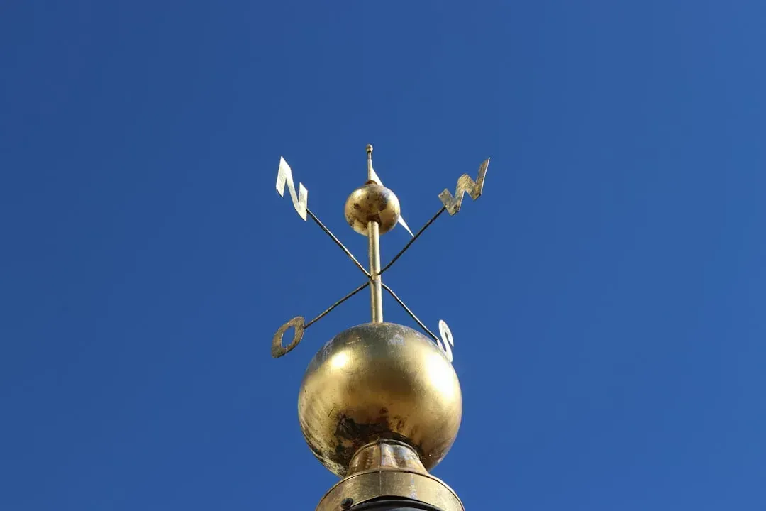
Wind direction is influenced by pressure gradients and the rotation of the Earth, and observing wind patterns can provide clues about approaching weather systems. Wind strength is related to pressure differences between air masses, and strong winds suggest significant atmospheric disturbances, potentially signaling approaching storms.
A sudden, unexplained shift in wind direction is often one of the earliest physical sensations of a cold front moving in. Clouds that are moving in a direction that differs from the way the wind is blowing indicates a condition known as wind shear. This sometimes indicates the arrival of a cold front, and weather fronts usually bring rain. If the upper clouds and the surface wind seem to be heading in different directions, that mismatch is worth noting.
When cold air encounters warm air, the warm air rises over the cold air and makes surface air pressure drop. As a result, a low-pressure system forms and winds begin to blow. This is how storms form in response to changes in air temperature. That freshening wind you feel before a thunderstorm is literally physics happening in real time, right on your skin.
12. Clouds Moving in Different Directions at Different Heights
This is one of the more underappreciated storm signals, and it’s genuinely worth understanding. When you look up and notice that low clouds are moving in one direction while high clouds drift in a completely different direction, that’s a sign of wind shear in the atmosphere. Wind shear is a key ingredient in storm development, particularly for severe thunderstorms and even tornadoes.
Ahead of a warm front, warm, moist air rides over cooler air and rises gently, with surface pressure falling as the warm air mass moves in. In a thunderstorm or squall line, strong convection produces vigorous updrafts that remove mass from the column locally, producing rapid pressure falls. The sky is basically layered like a cake when a major weather system approaches, and you can read those layers if you know what to look for.
A cloud with a ragged bottom is trying to tell us something. We’re all used to the idea that clouds give us rain, but it is less well known that rain creates clouds. When the base of a cloud looks torn, shredded, or uneven, it means precipitation is already actively falling from it somewhere. If that cloud is heading your way, so is the rain. The sky, it turns out, is one of the most detailed weather forecasts you’ll ever read, and it’s entirely free.
Conclusion
It’s easy to dismiss these signs as old folklore or coincidence, but the science consistently backs up what generations of people observed long before weather satellites existed. A study by the University of Reading found that some traditional weather proverbs have a surprisingly high degree of accuracy, and after analyzing hundreds of proverbs from around the world, found that many of them were based on sound scientific principles.
The sky, the trees, the birds, and even your kitchen salt shaker are all connected to the same atmosphere. Once you start watching for these signs, you’ll be surprised how often they show up right before conditions change. Barometric pressure is one of the most reliable early indicators that a storm is developing, and while most people focus on snow totals or temperatures, pressure trends often reveal changes before impacts begin.
Nature has never stopped communicating. Most of us just stopped listening. Next time you step outside, take thirty seconds to actually look around: at the clouds, the leaves, the birds, the color of the sky. You might just save yourself from getting caught in the next storm. What sign surprised you the most? Tell us in the comments.