

- 12 Simple Weather Signs That Often Mean a Storm Is Coming - March 23, 2026
- 9 Bizarre Weather Phenomena Scientists Still Can’t Fully Explain - March 23, 2026
- 10 Climate Solutions Everyone Talks About but Few Fully Understand – Are You One of Them? - March 22, 2026
We think we understand the sky. We have satellites, supercomputers, and atmospheric models that can predict rain three weeks out. Yet nature keeps pulling the rug from under us. There are weather events happening right now, today in 2026, that have stumped researchers for decades. Some of them have thousands of eyewitness accounts. Others have been filmed from the International Space Station. Still, scientists shrug their shoulders and say “we’re not entirely sure.”
If that surprises you, buckle up. These are the atmospheric mysteries that keep meteorologists up at night, and honestly, they should keep the rest of us curious too. Let’s dive in.
1. Ball Lightning: The Floating Orbs That Shouldn’t Exist
Imagine a glowing sphere of light, maybe the size of a basketball, drifting silently through your living room during a thunderstorm. Ball lightning is one of the most baffling weather events ever recorded. These glowing spheres of light appear during thunderstorms and sometimes float through the air before vanishing with a bang, with witnesses reporting orbs the size of basketballs moving unpredictably, even entering homes through windows. That’s not a sci-fi plot. That’s a real, documented phenomenon.
Ball lightning is a rarely observed phenomenon whose existence is attested to by thousands of eyewitness reports, but which has so far evaded a widely accepted scientific explanation. Despite this, the research community hasn’t given up. A paper published in November 2024 presents an analysis of research conducted across many countries on the so-called Gatchina discharge, with findings indicating that this discharge exhibits the majority of the characteristics of natural ball lightning.
The lifetime of ball lightning varies widely, ranging from a few seconds to several minutes, with an average duration of about 25 seconds. The lifetime tends to increase with size and decrease with brightness. There are even historical fatalities attributed to it. On July 26, 1753, in St. Petersburg, Russia, while conducting an experiment to measure the electric field strength under a thundercloud, Professor Georg-Wilhelm Richmann was killed by ball lightning. That’s not a myth. That’s documented history.
Ball lightning remains one of the most enigmatic phenomena in atmospheric science, with existing theories ranging from silicon nanoparticle oxidation to electromagnetic standing waves, all failing to account for its unique characteristics. In 2025, a new theory was even published proposing ball lightning as a possible future energy storage mechanism. Still no consensus. Still no lab-created match. Honestly, for something that may have killed a professor in the 18th century, you’d think we’d have cracked this by now.
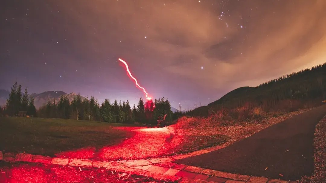
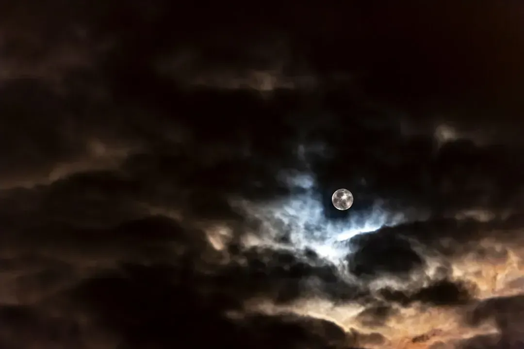
2. Red Sprites: Ghost Lightning Above the Clouds
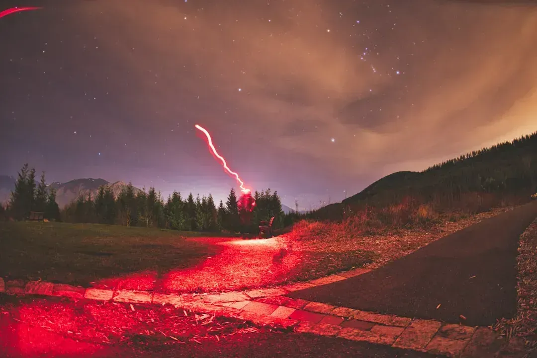
NASA astronaut Matthew Dominick photographed red sprites in Earth’s upper atmosphere from the International Space Station on June 3, 2024. The bright red flashes are a less-understood phenomenon associated with powerful lightning events and appear high above the clouds in the mesosphere. If trained astronauts are documenting these from space, you know they are no ordinary weather quirk.
Red sprites are an enigmatic form of lightning that appears high in the atmosphere, between 40 to 55 miles above the Earth’s surface, far above conventional thunderstorm clouds. Unlike typical lightning, which is visible as flashes of light near the ground, red sprites occur in the upper layers of the atmosphere, triggered by intense lightning strikes that release vast amounts of electrical energy. They look like jellyfish made of red fire dancing at the edge of space.
On the night of May 19, 2022, two Chinese astrophotographers captured a spectacular display of over one hundred red sprites over the Himalayas. The observation site was located on the southern Tibetan Plateau near Pumoyongcuo Lake. Among the phenomena captured were dancing sprites, rare secondary jets, and the first-ever recorded case in Asia of green airglow at the base of the nighttime ionosphere. That is extraordinary. Over a hundred sprites in a single night.
Today, scientists are still working to understand these curious phenomena: what causes them, how often they happen, and what they can tell us about Earth’s atmosphere. The community effort driving sprite research could help answer one of the most pressing questions around these events, including how climate change may impact their occurrence, since rising global temperatures will impact thunderstorm intensity and frequency, leading to stronger lightning activity, all of which are precursors for sprite activity. This is exactly the kind of mystery that gets more complicated the closer you look.
3. Catatumbo Lightning: Earth’s Permanent Storm
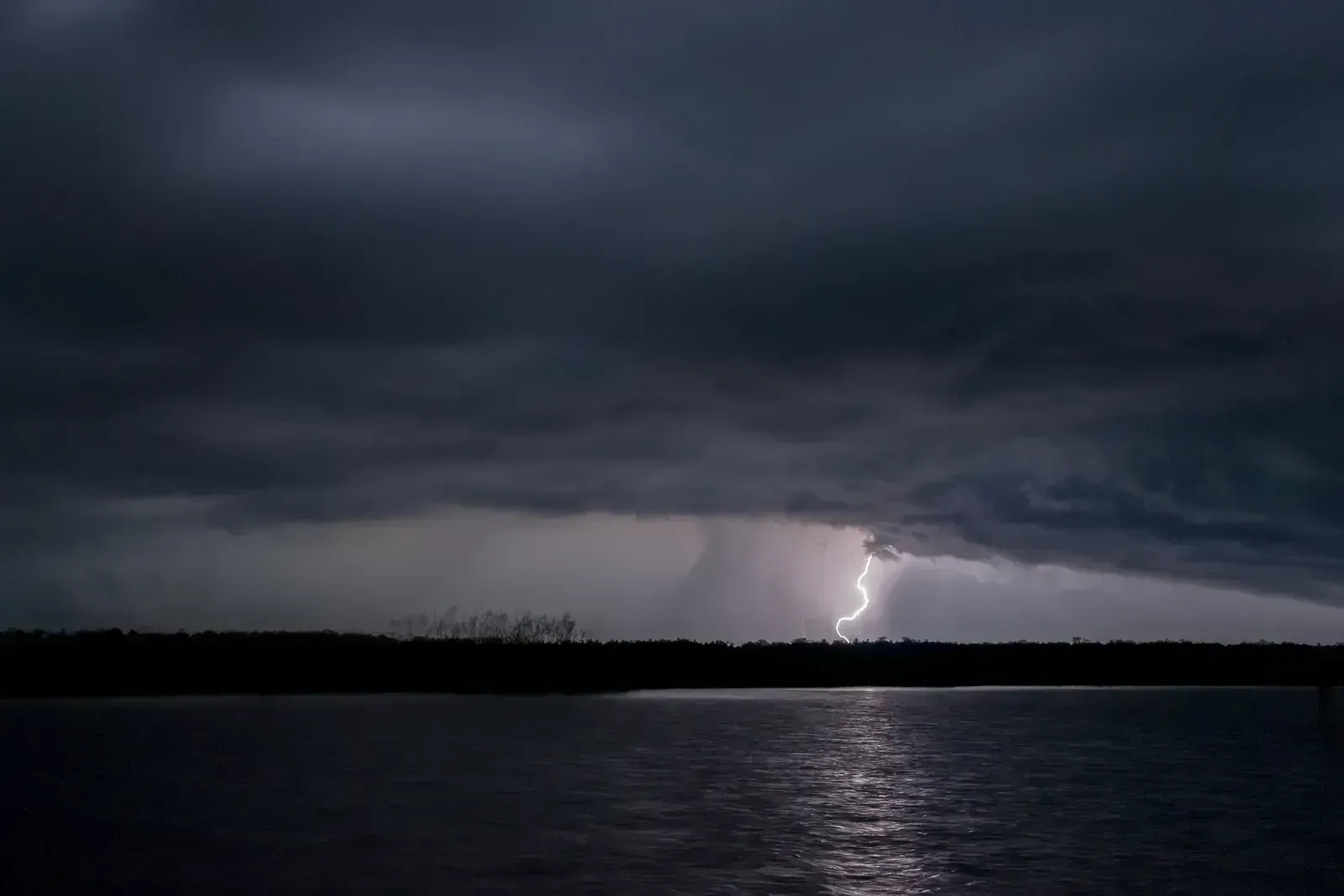
Most storms last a few hours. This one has lasted for centuries. Catatumbo lightning is an atmospheric phenomenon that occurs over and around Lake Maracaibo in Venezuela, typically over a bog area formed where the Catatumbo River flows into the lake. “Catatumbo” means “House of Thunder” in the language of the Barí people. It originates from a mass of storm clouds and occurs for 140 to 160 nights a year, nine hours per day, with lightning flashes from 16 to 40 times per minute.
The phenomenon sees the highest density of lightning in the world, at 250 strikes per square kilometer. That is not a typo. The most lightning-dense spot on the entire planet, and it has been going on since before Spanish colonial times. The Spanish poet Lope de Vega mentioned this unusual phenomenon in his classic poem “La Dragoneta” in 1597, telling the story of how the lightning lights prevented the attack of English pirate Sir Francis Drake on Maracaibo.
While it is known that local geography and weather patterns play a role, scientists are still unsure why this area is so prone to nearly nonstop lightning activity. The interaction between warm, moist air from the Caribbean and the cold Andes air might be part of the cause. However, it is not entirely clear why this combination leads to such persistent and powerful lightning storms. There is something frustrating and thrilling about that admission at the same time.
The lightning changes its flash frequency throughout the year, and it differs from year to year. For example, it ceased from January to March 2010, apparently due to drought, leading to speculation that it might have been extinguished permanently. It came back. It always comes back. The lightning produces a great quantity of ozone, though whether or not this contributes to the ozonosphere is a topic of disagreement.
4. Morning Glory Clouds: The Sky’s Rolling Cylinders
Picture waking up in a remote part of Australia to see what looks like a massive, slowly rolling tube in the sky stretching as far as the eye can see. That is the Morning Glory cloud, and it is as surreal as it sounds. Morning Glory is a rare and spectacular meteorological phenomenon observed primarily in the Gulf of Carpentaria in northern Australia. It consists of one or more massive roll-shaped clouds that can extend up to nearly 1,000 kilometers in length, with a height varying from 100 to 300 meters only. This phenomenon usually occurs between September and November, when weather conditions are optimal. The formation of these roll clouds results from complex interactions between sea breezes, large-scale atmospheric circulation, and the particular topography of the region.
A Morning Glory cloud resembles a giant moving tube and can travel at speeds of up to 60 km/h. People actually travel to Burketown, Queensland, just to see these things. Glider pilots and paragliders even attempt to “surf” the powerful air currents they generate. It’s extreme weather tourism at its most unusual.
Here is the thing: while scientists have partial theories involving sea breeze collisions and temperature inversions, Morning Glory clouds are rare, tubular-shaped clouds that can stretch up to 1,000 kilometers in length, and their precise triggering mechanisms remain only partially understood. Seasonal forecasting for when they will appear is still more art than science. Think of them like the aurora borealis of the cloud world. Breathtaking, partially explained, and with a stubborn list of unanswered questions.
The Morning Glory is a very rare type of cloud that takes on a rolling appearance, looking like a massive tube in the sky. These clouds measure up to 620 miles long and can even occasionally appear consecutively. The consensus is that the clouds are formed when an updraft pushes through the cloud, creating its signature rolling appearance, while moist cooler air at the back of the clouds causes them to sink downward. Still, that explanation leaves open why the phenomenon concentrates so reliably in one corner of Australia and virtually nowhere else on the planet.
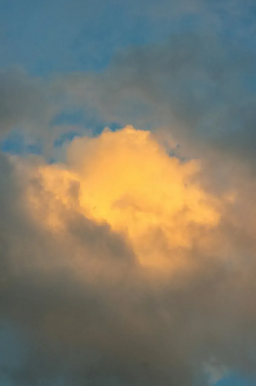
5. Mammatus Clouds: The Sky That Hangs Upside Down
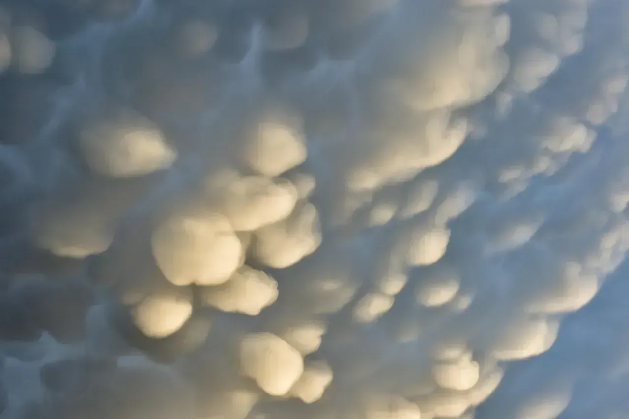
Most clouds float upward. Mammatus clouds do the opposite, hanging in bulging, downward-facing pouches that genuinely make the sky look like it is about to fall on you. Mammatus clouds are unusual formations that appear as bulbous, pouch-like shapes hanging from the base of clouds, often following severe thunderstorms. Their appearance is striking, resembling a sky filled with cotton balls. That description undersells it. They look genuinely apocalyptic.
Mammatus clouds form as pouch-like protrusions hanging from the underside of larger cloud formations, often cumulonimbus clouds associated with thunderstorms. Unlike most clouds, which rise due to convection, mammatus formations involve sinking air. Ice crystals and precipitation in the upper cloud layers cool the air beneath them. As this cooled air becomes denser, it sinks in bulbous pockets, creating the characteristic lumpy underside.
Their formation results from complex mixing processes between cold, dense air laden with ice crystals or water droplets and the surrounding warmer, less dense air. These pouches slowly descend into the atmosphere, creating the characteristic structure. The stability of these formations depends on a delicate balance between gravitational force and air resistance. When you see them lit up orange at sunset, they look like a painting from another world.
Although their formation mechanism is now better understood, mammatus clouds continue to captivate scientists, photographers, and casual observers alike. Their presence often signals the end of a period of intense thunderstorm activity. I think that is what makes them so compelling. They appear right after chaos, like nature exhaling. They are sculpted by turbulence, temperature gradients, and moisture variations, and they are a natural expression of atmospheric instability resolving itself.
6. Fallstreak Holes: Perfect Circles Punched Through the Sky
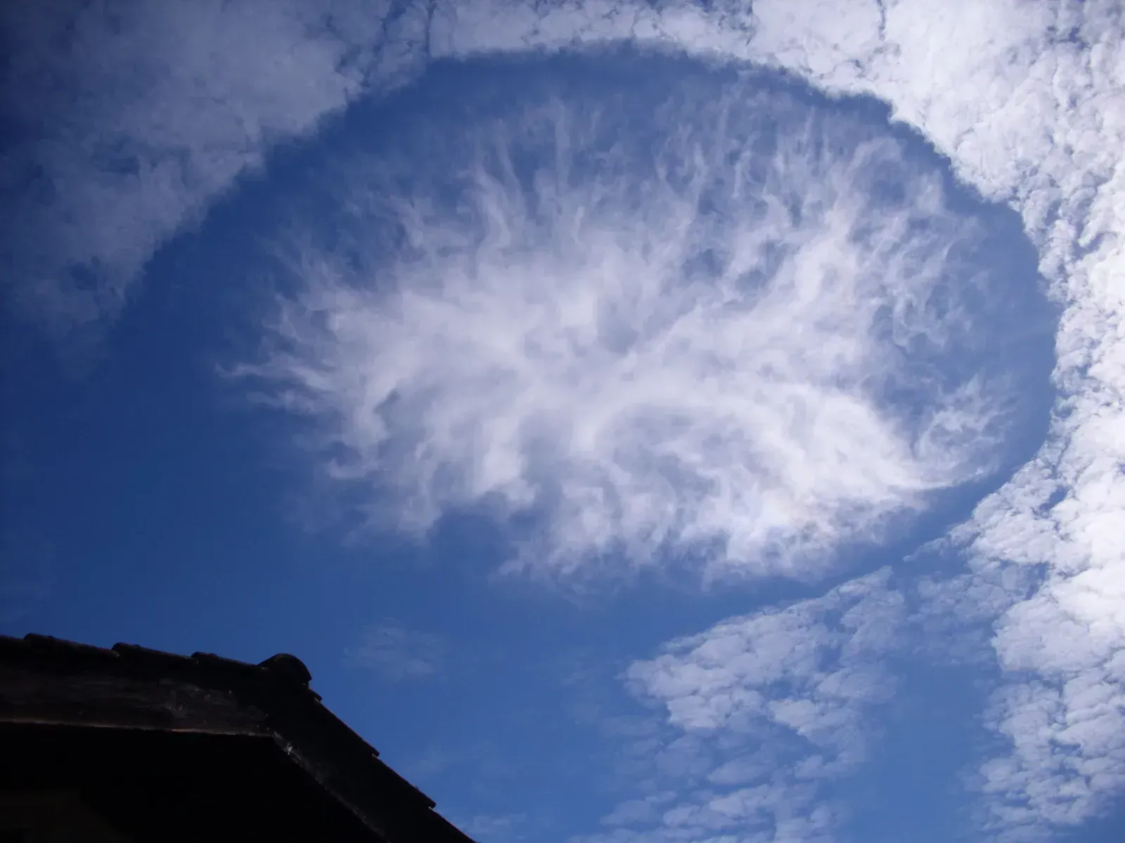
You look up and there is a perfectly circular gap in the clouds, blue sky showing through like someone took a hole punch to the atmosphere. Welcome to one of the more aesthetically bizarre weather events out there. Sometimes, perfect circular openings appear in cloud layers, revealing the blue sky above in a nearly symmetrical shape. These “fallstreak holes” are sometimes attributed to aircraft or rapid temperature changes, but many sightings have no flight activity nearby. The phenomenon looks like a hole punched through the sky, and some witnesses describe strange lights or sounds accompanying it.
The basic explanation involves supercooled water droplets in high-altitude clouds suddenly freezing and falling away, leaving a clear gap. Fair enough. But that still leaves the question of why the freezing is so dramatically localized, producing such a geometrically clean circle rather than a messy smear across the cloud. Even with hypotheses, these gaps remain oddly unexplained.
Fallstreak holes have been getting more attention from researchers in recent years because they occur more frequently near airports, suggesting aircraft are sometimes the trigger. Aircraft disturb air pressure and temperature as they pass through thin cloud layers, potentially triggering the crystallization cascade. The problem is that many confirmed sightings occur in areas with no flight traffic nearby, which throws a wrench in that clean explanation.
It is hard to say for sure what triggers the ones that appear spontaneously, far from airports, over open ocean or uninhabited land. Despite all the advancements in science and technology, there are still many weather phenomena that continue to puzzle experts. From glowing tornadoes to ice circles, these strange occurrences defy complete explanation, leaving researchers with more questions than answers. Fallstreak holes are a perfect, literal symbol of that.
7. St. Elmo’s Fire: The Haunted Glow of Sailors

For centuries, sailors watched a ghostly blue or violet glow creep along the tips of ship masts during storms. They took it as a divine sign. It turns out the truth is nearly as strange. During thunderstorms, St. Elmo’s Fire is a bluish or violet glow that appears on the tips of pointed objects, like ship masts, airplane wings, or church spires. It is believed to be a plasma phenomenon caused by air ionization when a strong electrical field is present.
Think of St. Elmo’s Fire as the atmosphere leaking electricity. When a powerful electric field surrounds a pointed object, the air around the tip becomes ionized, creating a visible plasma discharge. It is essentially a slow, constant version of a lightning bolt happening right in front of you. Modern pilots still report seeing it dance across cockpit windows during storms.
What remains poorly understood is the full range of conditions that trigger St. Elmo’s Fire, the exact chemistry of different-colored variations, and why it occasionally appears in places with no apparent electrical storm nearby. It has been documented on mountain peaks during clear weather, on aircraft mid-flight, and even inside certain underground caves. Several bizarre events have occurred, ranging from glowing skies to raining fish and even blood rain, leaving people in awe of nature’s capacity. These events truly reflect how puzzling nature can be; sometimes, even scientists fail to explain them.
Let’s be real: something that made ancient sailors believe their ship was protected by saints deserves a far more complete scientific explanation than we currently have. Most atmospheric physicists can describe the mechanism in broad strokes, but predicting when and where it will appear is still essentially impossible.
8. The Kerala Red Rain: When It Rained Something Alive

This one is genuinely unsettling. Between July 25 and September 23 in 2001, the people of Southern India witnessed one of the most unusual weather phenomena in recorded history. Following a reported loud boom in the sky, it started to rain in the region. However, this was not a typical rainstorm. The rain was blood red, with some reports saying there was also black, green, and even yellow rain. Not dye, not dust. Something far stranger.
Some people who witnessed the odd weather phenomena stated that the trees in the region started to shed their leaves and turn grey, looking as if they were burned. Though some events during that day may have been exaggerated, the incident sparked a lot of scientific curiosity. Scientific analysis of the red rainwater revealed the presence of red particles that appeared to be biological cells. This sent researchers down a rabbit hole that has never fully closed.
Various studies proposed the particles were spores from a local algae species, possibly lofted into the atmosphere by an unusual weather event or microexplosion. There are recorded cases of blood rain from all over the world. Historical records from Europe, Asia, and the Middle East describe similar red rain events going back thousands of years. The Kerala incident was just the most extensively documented one in modern times.
What makes this particularly haunting is that some researchers proposed the particles contained no DNA and could survive extreme temperatures, prompting a fringe scientific debate about their possible extraterrestrial origin. The mainstream scientific consensus landed on algae spores. Still, the question of exactly what triggered the mass atmospheric seeding of those spores, and where they came from so suddenly, has never received a fully satisfying answer. Some of these events are rare and hard to predict, while others happen in specific regions under unique conditions. What is clear is that nature still holds plenty of mysteries.
9. Sudden Stratospheric Warming: When the Upper Atmosphere Breaks the Rules
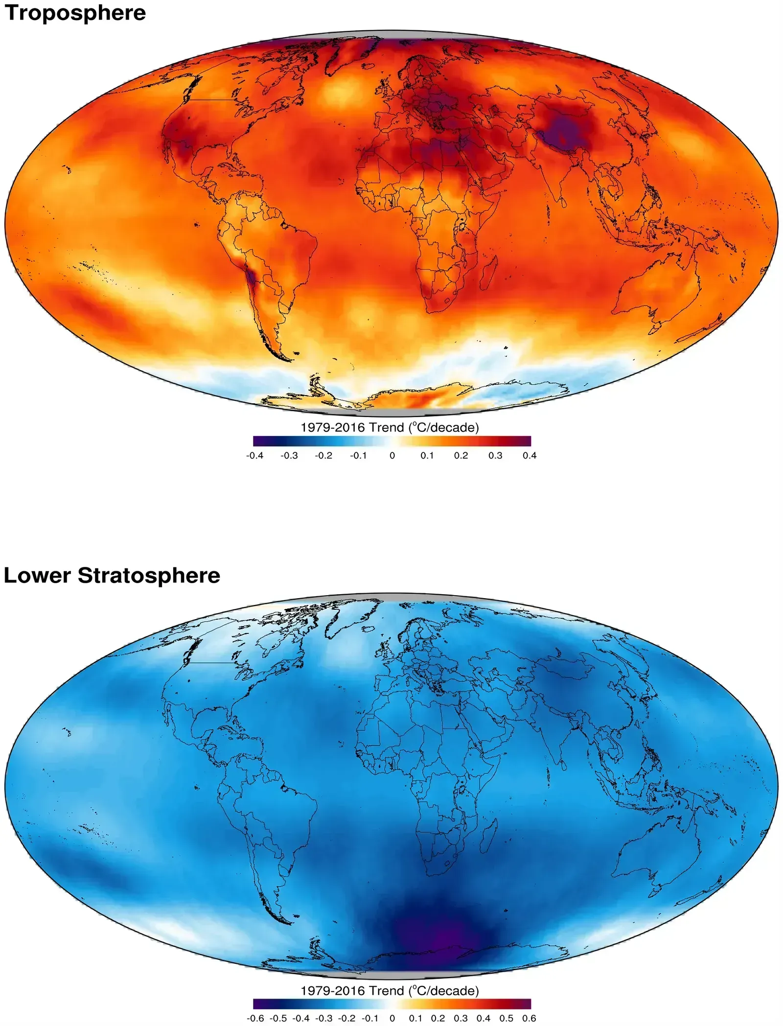
The stratosphere is supposed to be cold, stable, and predictable. Then every so often, it just isn’t. About 30 kilometers above Antarctica’s icy surface, in the layer known as the stratosphere, a series of warming events took place starting in July 2024. July temperatures in the stratosphere above Antarctica are typically around minus 80 degrees Celsius. On July 7, temperatures in the middle of the stratosphere jumped 15 degrees Celsius, setting a record for the warmest July temperatures observed in the stratosphere in the Antarctic region.
The temperature then cooled off on July 22 before rising 17 degrees Celsius on August 5. These sudden stratospheric warming events surprised Lawrence Coy and Paul Newman, atmospheric scientists at NASA’s Goddard Space Flight Center. A temperature swing of 17 degrees Celsius in the stratosphere in a matter of weeks is extraordinary. This is not a small fluctuation. This is the upper atmosphere behaving in a way that violates what models predict.
The polar vortex had elongated and weakened, and the flow of wind was shaped like a peanut instead of its usual circular pattern. Unlike in the Arctic, which experiences sudden stratospheric warming events about once a year, the polar vortex in the Southern Hemisphere is typically much less active. When the polar vortex breaks down or distorts, cascading weather effects ripple down to ground level weeks later. Cold snaps, disrupted jet streams, unusual rainfall. All from an invisible shockwave in the stratosphere.
Researchers continue to investigate the origin of disturbances at the surface that end up disrupting the stratosphere. Variations in sea surface temperatures and sea ice can perturb large-scale weather systems in the troposphere that propagate upwards. But the attribution of why these systems develop is really difficult to do. That last sentence from NASA scientists says it all. We can observe it, track it, and feel its consequences on the ground. We just cannot fully explain it yet.
Conclusion: The Sky Has More Secrets Than We Admit
Here is what strikes me most about all of these phenomena. None of them are hidden in some obscure corner of the Earth. Red sprites have been photographed from the International Space Station. Catatumbo lightning has been going on for over 500 years in a known location. Ball lightning has been described in thousands of documented reports. Yet the explanations remain incomplete, contested, or outright absent.
There is something deeply humbling about that. We have mapped the surface of Mars, sequenced the human genome, and built AI systems that can hold a conversation. Yet a glowing orb floating through someone’s kitchen window during a thunderstorm still baffles the scientific community. Despite all the advancements in science and technology, there are still many weather phenomena that continue to puzzle experts. From glowing tornadoes to ice circles, these strange occurrences defy complete explanation, leaving researchers with more questions than answers.
The sky we think we know is full of mysteries we haven’t solved yet. That’s not a reason for alarm. It’s a reason to stay curious. Which of these nine phenomena surprised you the most? Drop your thoughts in the comments below.