

- 10 Everyday Weather Habits That Can Catch You Off Guard - March 28, 2026
- Glacier Death: Mexico’s Final Glacier on Citlaltépetl Expected to Vanish by 2030 - March 28, 2026
- The No-Go List: 10 Cities Facing the Worst Weather Risks in the U.S. - March 27, 2026
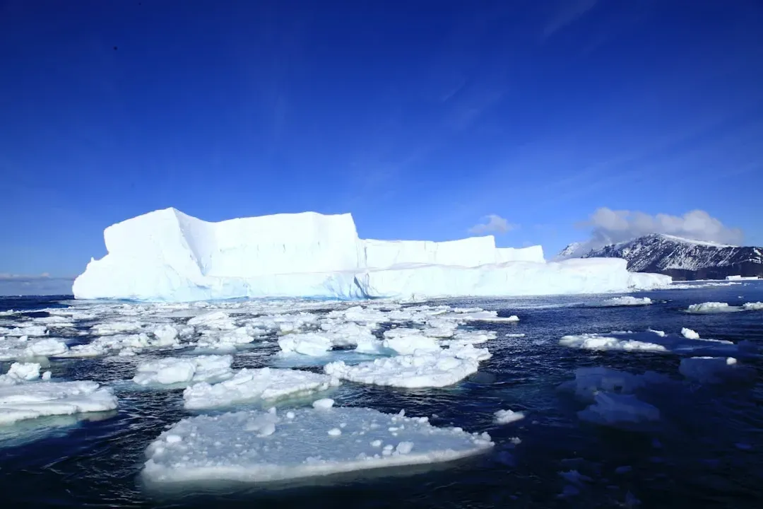
There is something deeply unsettling about watching a country lose its last glacier. Not in a century. Not in fifty years. By the end of this decade. That is exactly what scientists are now saying about Mexico’s Jamapa Glacier, sitting high on the slopes of Citlaltépetl, and the latest research leaves very little room for optimism.
The numbers are stark, the timeline is short, and the consequences stretch far beyond the mountain itself. Rivers, coral reefs, farming communities, and millions of people who rely on the water that begins as ice at nearly 5,500 meters above sea level are all part of this story. It is worth knowing before it is too late to witness.
The Mountain at the Center of It All
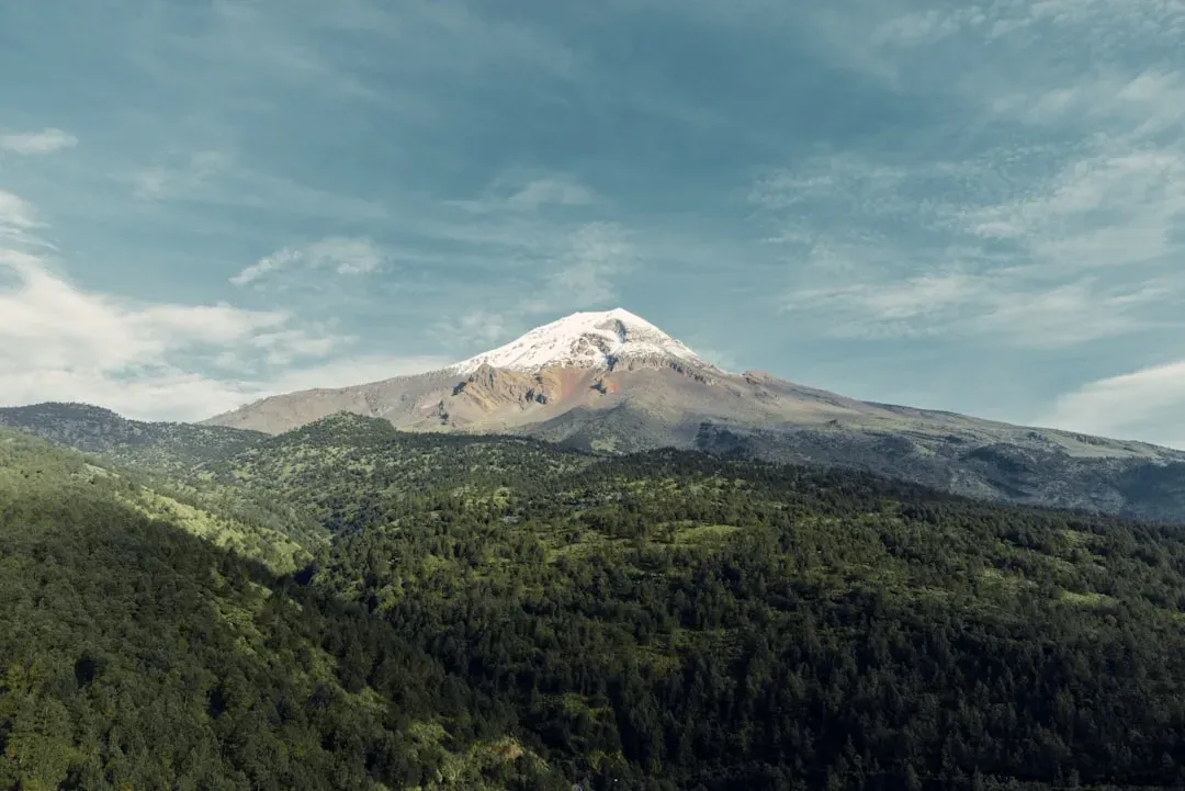
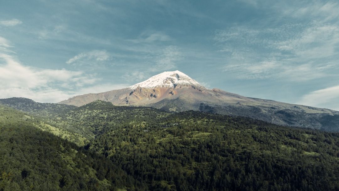
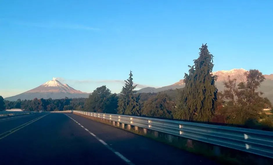
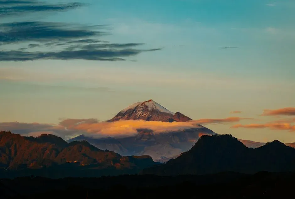
Also known as Citlaltépetl, a Nahuatl word meaning “star mountain,” Pico de Orizaba rises to 5,636 meters, making it Mexico’s highest peak and the tallest volcano in North America. It is a genuinely colossal landform. Standing on the border of the states of Puebla and Veracruz, it has a presence that can be seen from hundreds of kilometers away on a clear day.
Pico de Orizaba held deep significance in pre-Hispanic cultures, including those of the Nahuatl-speaking Mexica and the Totonacs. The volcano is part of many native mythologies, defining Nahua folklore, cosmology, and eschatology. In other words, long before climate scientists showed up with their instruments, local peoples had been watching this mountain with reverence for thousands of years.
Orizaba has nine known glaciers: Gran Glaciar Norte, Lengua del Chichimeco, Jamapa, Toro, Glaciar de la Barba, Noroccidental, Occidental, Suroccidental, and Oriental. Most of these are now shadows of what they once were, and the Jamapa Glacier has become the defining symbol of their collective fate.
How Big Was the Glacier System, and What Remains Now
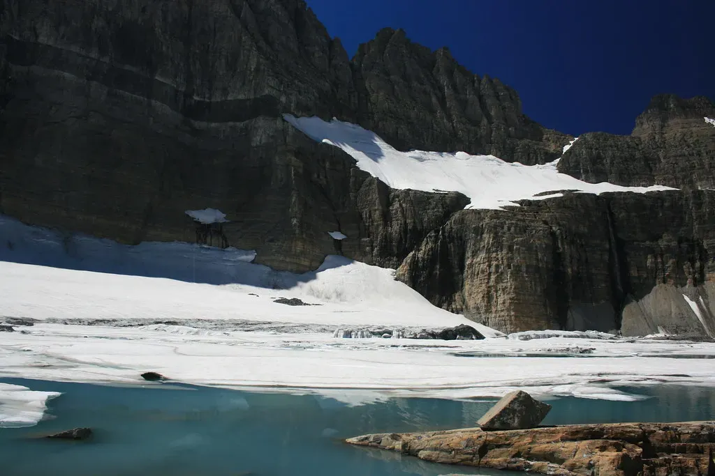
At Citlaltépetl, nine glaciers once covered an area of 2.04 square kilometers. By 2007, they had shrunk to an area of just 0.62 square kilometers, and by 2019 the bedrock was exposed, faster than previously anticipated. That is a staggering rate of loss. Think of it like a block of ice in a warm room. Once enough of the surface is exposed, it starts melting from every direction at once.
The surface of the glacier in 2019 was approximately 0.46 square kilometers, and by 2024 the current extent had shrunk to only about 0.37 square kilometers. Every measurement taken in recent years brings a worse result than the one before.
In 1960, Pico de Orizaba had roughly 204 hectares of ice distributed across several glacier tongues. Today, only about 37 hectares remain, just 18 percent of the original area, and they are shrinking rapidly. Losing more than four-fifths of your glacial cover in roughly sixty years is not gradual decline. It is collapse.
The UNAM Study That Announced an Approaching Death
A 2024 study by the National Autonomous University of Mexico (UNAM), poetically titled “Announcement of an Approaching Death,” compared past projections for the glacier’s evolution with current reality. It concluded that by the end of this decade, the climatic conditions necessary for Jamapa to continue functioning as a glacier would only occur at altitudes similar to Citlaltépetl’s peak. There is no higher ground left to retreat to. That is what makes this situation different from many other glacier loss stories.
Two dynamic models of glacier thickness evolution were developed based on a network of stakes and ground-penetrating radar, complemented by geometrical characterizations of the glacier bed shape. Calculated mean annual mass balance leads the equilibrium line altitude to be increasingly higher, and eventually even higher than the mountain summit itself.
During a UNAM symposium titled “Glaciers, Climate Change and Local Water Management,” UNAM volcanologist Hugo Delgado Granados explained that conservation is no longer viable due to a warming climate. The equilibrium line, where snow accumulation offsets melting, now sits above 5,300 meters, which is higher than any Mexican glacier. That detail is critical. It means the glacier is no longer able to replenish itself at all.
The Bedrock Problem: A Feedback Loop Nobody Wanted
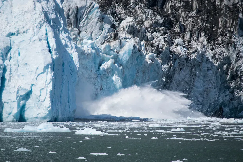
Since 2019, portions of the bedrock in the accumulation zone of the glacier have been exposed to solar radiation, resulting in the accumulation of energy. Temperature values obtained on the bare rock surface indicate that, from a thermodynamic perspective, the stored energy is causing the melting of the adjacent ice. Here is a useful way to think about it. Dark rock absorbs heat the way a black t-shirt heats up in summer sun. Once that rock is exposed, it becomes a heat source sitting right next to the ice it used to be buried beneath.
The accumulation zone of the glacier system has not existed since 2019. Exposure of the bedrock increases solar energy transference as heat to the adjacent ice and snow, causing increasing melting. At the same time, it prevents the flow of ice towards the ablation zone, causing an accelerated retreat of the glacier front.
This leads to the conclusion that, in addition to the retreat of the glacier front, ice melting is also occurring in what should be the solid precipitation accumulation area, resulting in an overall more pronounced retreat. It is a self-reinforcing spiral, and once it begins, it becomes nearly impossible to reverse.
Mexico’s Broader Glacier History: A Pattern of Loss
Mexico historically harbored three glaciated peaks: Iztaccíhuatl, Popocatépetl, and Pico de Orizaba. Around the middle of the 20th century, the trio of volcanoes held a little over two dozen glaciers between them. The vast majority of these are now gone. Two dozen glaciers, reduced to fragments within a single human lifetime. That is a remarkable and sobering fact.
Popocatépetl’s last glaciers disappeared over 20 years ago, hastened by volcanic activity. As for Popocatépetl, an active volcano and Mexico’s second-highest peak, its glaciers disappeared entirely by 2001, their demise hastened by eruptions. Volcanic heat and global warming proved to be a deadly combination on that mountain.
A 1920s image shows Iztaccíhuatl and Popocatépetl blanketed in snow. By 2018, only bare rock remained. That year, the Ayoloco Glacier on Iztaccíhuatl was declared extinct and marked with a commemorative plaque. A plaque for a dead glacier. Honestly, there are few more sobering images of what climate change actually means in practice.
The Role of Rising Temperatures and Mexico’s Climate Crisis
Since 2023, global temperature has risen above 1.5 degrees Celsius, and in Mexico’s specific case, the national average temperature has increased by 1.8 degrees Celsius from the pre-industrial period to 2024. This means Mexico’s warming rate is higher than the global average. That extra fraction of a degree makes a real-world difference when you are talking about tropical glaciers that are already on the thin edge of survival.
The air temperature at the lower part of the ice body and within its accumulation zone has increased steadily, whilst precipitation has decreased during the months when solid precipitation commonly occurs in the country. Less snow falling, more heat arriving. It is an equation that only ends one way.
With temperatures continuing to rise, and 2024 being the warmest year on record, nations such as Argentina and Chile have enacted laws protecting glaciers from industrial activities like mining. Mexico has yet to follow with similar legislation, and researchers now say that for Citlaltépetl’s glaciers, legal protection would arrive too late anyway.
The Coral Reefs Nobody Expected to Be Connected
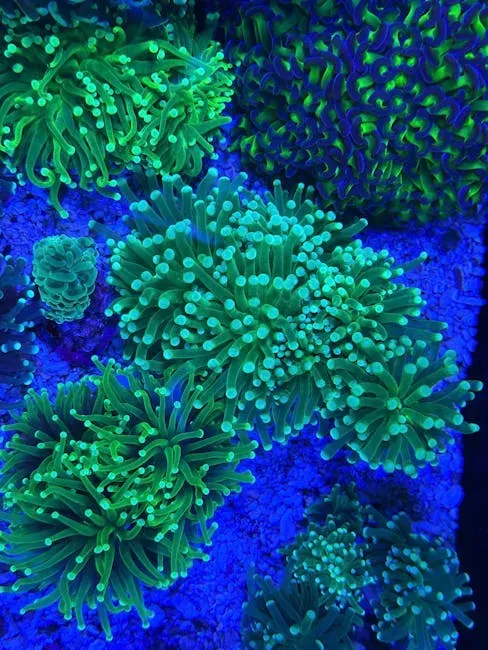
The Jamapa flows into the Gulf of Mexico at the edge of its coral reef system. The linear distance between Citlaltépetl and this point is 110 kilometers, but the stream of water that began as meltwater, becoming a torrent of sediment, nutrients and energy feeding coral reefs and sustaining rich marine biodiversity, has been on a winding 368-kilometer journey. It is hard to believe that a glacier on top of a mountain and a coral reef at the bottom of a river are part of the same ecological story. Yet they are.
As Leonardo Ortiz, a biologist at the University of Veracruz, noted, the glacier and the reefs have been connected for about 10,000 years. That kind of deep-time connection does not unravel gently.
Today, these reefs are facing the disappearance of Jamapa, which will reduce the river’s nutrient supply. What happens to the reefs when that supply disappears entirely is still being studied, but researchers are not optimistic. The reef ecosystem depends on a balanced flow of nutrients, and that balance is about to be permanently disrupted.
Deforestation as an Accelerant
The volcano, once covered in pine forests, is pockmarked by fields where crops are grown and sheep graze. A 2014 report found that over a 25-year period, Orizaba lost a dramatic portion of its vegetation cover. Forests act like a cooling blanket over mountainsides. Remove them, and the mountain heats up faster. It is as simple and brutal as that.
Experts with decades of experience in the area say there are at least 30 clandestine logging routes within the 20,000 hectares that make up the Pico de Orizaba National Park’s protected area. Logs are transported through here to cities in the two states that divide the mountain, Puebla and Veracruz. Illegal logging inside a national park. It sounds like something from a different era, yet it continues in 2026.
Mexico’s National Forestry Commission has established forest loss as a factor that directly contributes to global heating. The carbon that would have been absorbed by felled trees becomes atmospheric, and this heating melts glaciers. The connection between deforestation and glacier loss is not metaphorical. It is a documented, measurable chain of cause and effect.
What Comes Next: Adaptation Over Preservation
UNAM volcanologist Hugo Delgado argues that Mexico must focus on adaptation rather than preservation, since the remaining glaciers are already beyond saving. That is a difficult thing to say. It is also, based on everything the evidence shows, the honest thing to say. I think the hardest part of this story is not the loss itself, but the clarity with which scientists now describe it as inevitable.
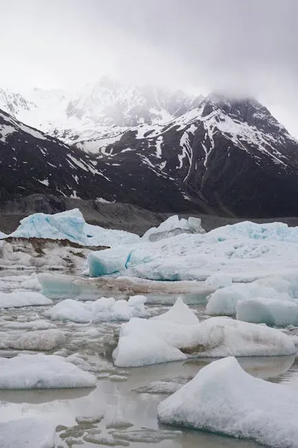
The rapid retreat and likely disappearance of these glaciers within the coming decades represents a significant loss for Mexico and the global scientific community. Their disappearance will eliminate unique ecosystems, reduce water security for downstream communities, and remove important cultural landmarks that have defined the Mexican landscape for generations.
The “Glaciar Norte” of Pico de Orizaba is one of the last glaciers in Mexico and the only one located at 19 degrees north latitude in the world, making it crucial to observe its retreat and eventual disappearance to document its spatio-temporal evolution and identify the factors driving these changes. Even in death, this glacier has scientific value. Its final years are being watched, measured and recorded so that the world can understand what was lost, and perhaps learn something for what remains.
Mexico is about to become a country with no glaciers at all. That is not a distant warning or a worst-case scenario. It is the current scientific consensus, documented in peer-reviewed studies, presented at international conferences, and confirmed in the field by researchers watching the ice crack and drip away in real time. The question worth sitting with is this: what does it mean for a nation, a culture, and millions of people who depend on that ice, when the last glacier finally goes silent?