


- 11 Historic Wildfires That Changed Fire Management Data Reveals - October 4, 2025
- The 1883 Krakatoa Event And Its Global Weather Effects Records Show - October 2, 2025
- How Scientists Use Climate Models To Forecast The Future - October 2, 2025
Explosive Growth Trigger: The Power of Warmer Seas
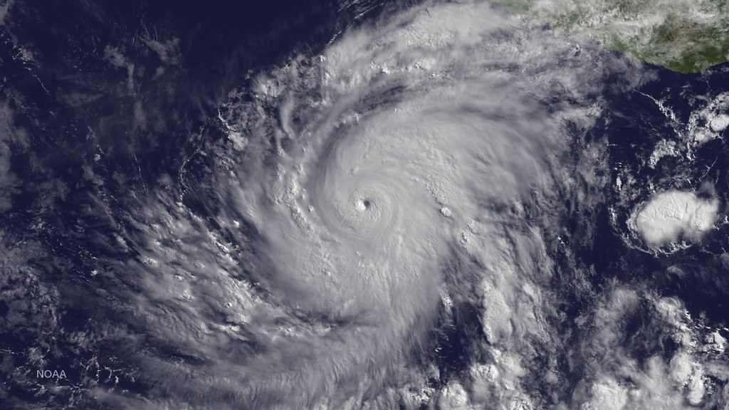
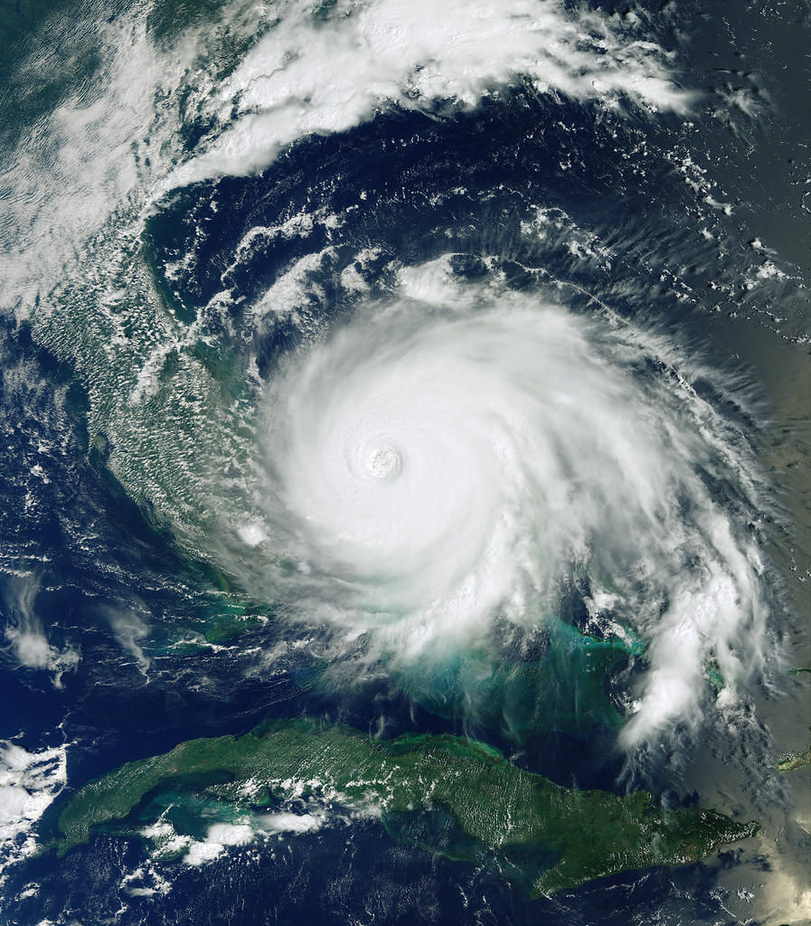
Hurricanes thrive on heat, and the ocean is serving up more of it than ever before. Recent investigations published by National Geographic paint a striking picture: even a slight rise in sea surface temperatures (SSTs) can supercharge storm growth, triggering what scientists now call “explosive intensification.” This phenomenon means hurricanes can jump a full category—sometimes within just 24 hours. The warming isn’t just out at sea; beach-level readings confirm the trend, with coastal waters feeling almost tropical even during what was once considered off-season. These warmer waters act like high-octane fuel for storms, helping them swell in size and fury at alarming speeds. Meteorologist Dr. Kendra Mason explains, “Every extra degree Celsius can mean a much more dangerous hurricane.” People living along the coastline are seeing firsthand how these hotter waters can turn a tropical storm into a monster overnight. It’s like hurricanes are gulping down energy shots, and that’s making them harder to predict and much more deadly.
Fuel Source Expansion: More Moisture, More Mayhem
Tropical cyclones need two main ingredients: heat and moisture. As global temperatures climb, the atmosphere can hold more water vapor—about 7% more per degree Celsius, according to climate models highlighted by news.uchicago.edu. This means hurricanes now have access to a richer fuel source than ever before. More moisture in the air doesn’t just feed the storm; it also guarantees heavier rainfall, increasing the risks of catastrophic flooding. The cycle is self-reinforcing: warmer air holds more moisture, which in turn powers stronger storms, which then pull up even more moisture from the ocean surface. Meteorologist Dr. Javier Morales notes, “We’re seeing storms not just grow bigger, but dump far more rain than people expect.” For cities and towns already dealing with saturated ground, this means every storm season packs a bigger punch. The science here is clear—when the air is loaded with extra moisture, hurricanes become rain-making machines with devastating consequences.
Ocean Heat as Driver: NASA’s Alarm Bells

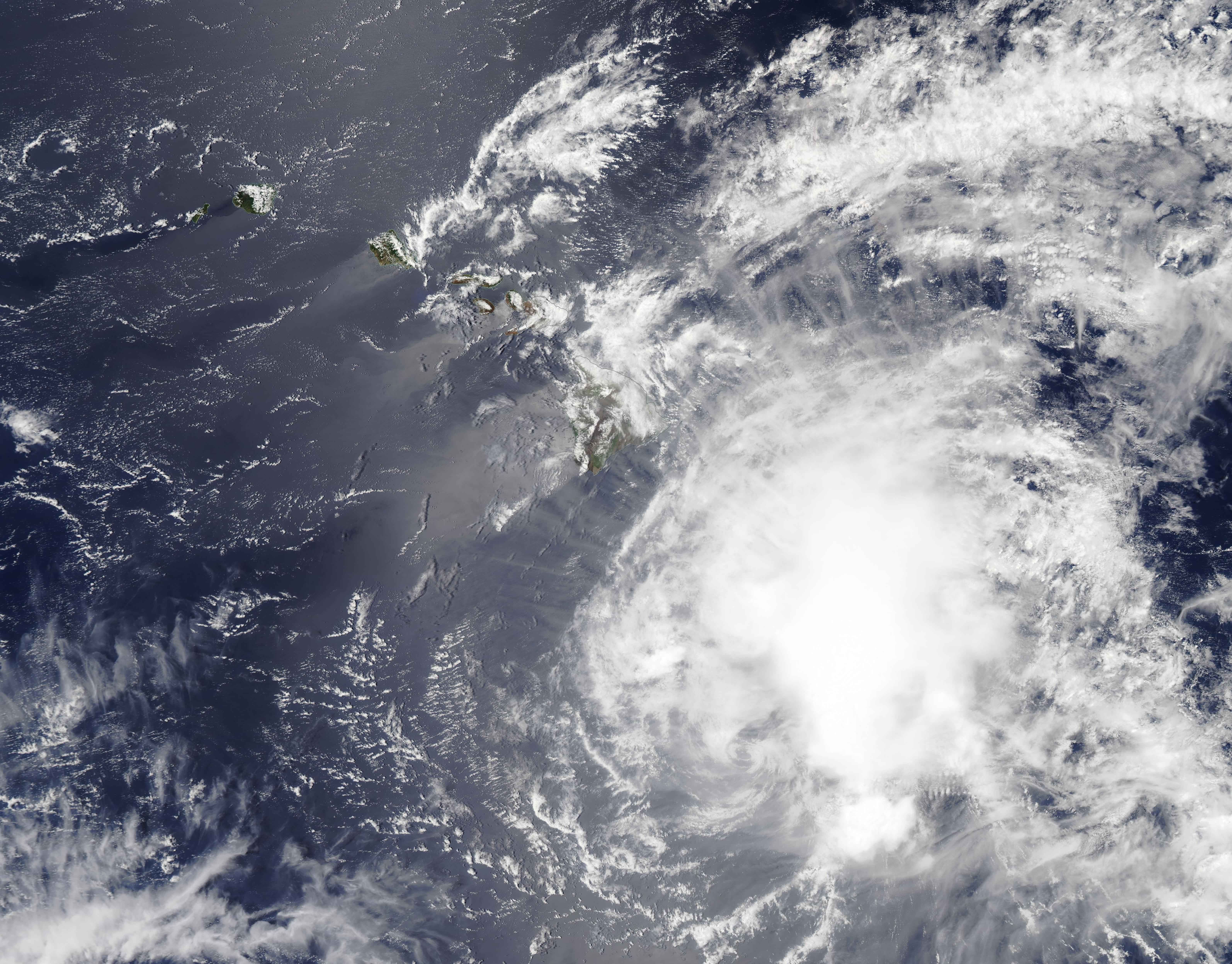
NASA has been raising red flags about the role of ocean heat in intensifying hurricanes. Their latest satellite data reveals that warmer seas accelerate evaporation, which in turn turbocharges the heat transfer into the atmosphere. This process not only fuels higher wind speeds but also leads to more intense rainfall and larger storm surges. The result is a hurricane season where “normal” no longer means safe. According to NASA’s climate experts, even modest increases in ocean temperature can push storms to Category 4 or 5 status. The Gulf of Mexico and the Atlantic are both seeing record-breaking water temperatures, creating a perfect environment for rapid intensification. In the words of NASA scientist Dr. Lena Hoffman, “The ocean is no longer a barrier—it’s a launchpad.” This explosive combination of heat and moisture is rewriting the playbook for hurricane forecasting and survival.
Poleward Shift: Hurricanes Are Heading North
One of the most surprising findings in recent hurricane research is the poleward migration of storm intensity. Studies now show that the zone of maximum hurricane strength has shifted northward by about 60 kilometers per decade. This means regions previously thought to be out of harm’s way—like parts of the Northeast U.S. or even southern Canada—are now facing greater risks. Communities that rarely worried about hurricanes are scrambling to update their emergency plans and infrastructure. Researchers speculate that as tropical waters warm farther north, hurricanes can sustain their energy over a much broader area. Dr. Anna Kim, a climate geographer, observes, “We’re seeing storm impacts in places our parents never imagined.” This migration is expanding the map of hurricane danger, making preparedness a priority for millions more people than ever before.
CDC and Climate Data: More Category 4–5 Beasts
The federal Centers for Disease Control and climate researchers have both sounded the alarm about the increasing power of hurricanes. Their models predict that, with just a 2°C rise in global temperature, the number of Category 4 and 5 storms could jump by 13%. These are the storms that do the most damage: ripping roofs off houses, knocking out power for weeks, and flooding entire neighborhoods. What’s more concerning is that the same models forecast more frequent “intense rainfall events,” meaning not only will storms be stronger, but they’ll also be wetter and more destructive. Cities that haven’t updated their flood defenses could face disaster. Dr. Michael Stewart from the CDC states, “Every extra notch on the thermometer raises the odds of a big one.” This data puts a new urgency on climate adaptation and disaster planning, especially in vulnerable coastal areas.
Intensity vs. Frequency: Fewer Storms, But Stronger Ones
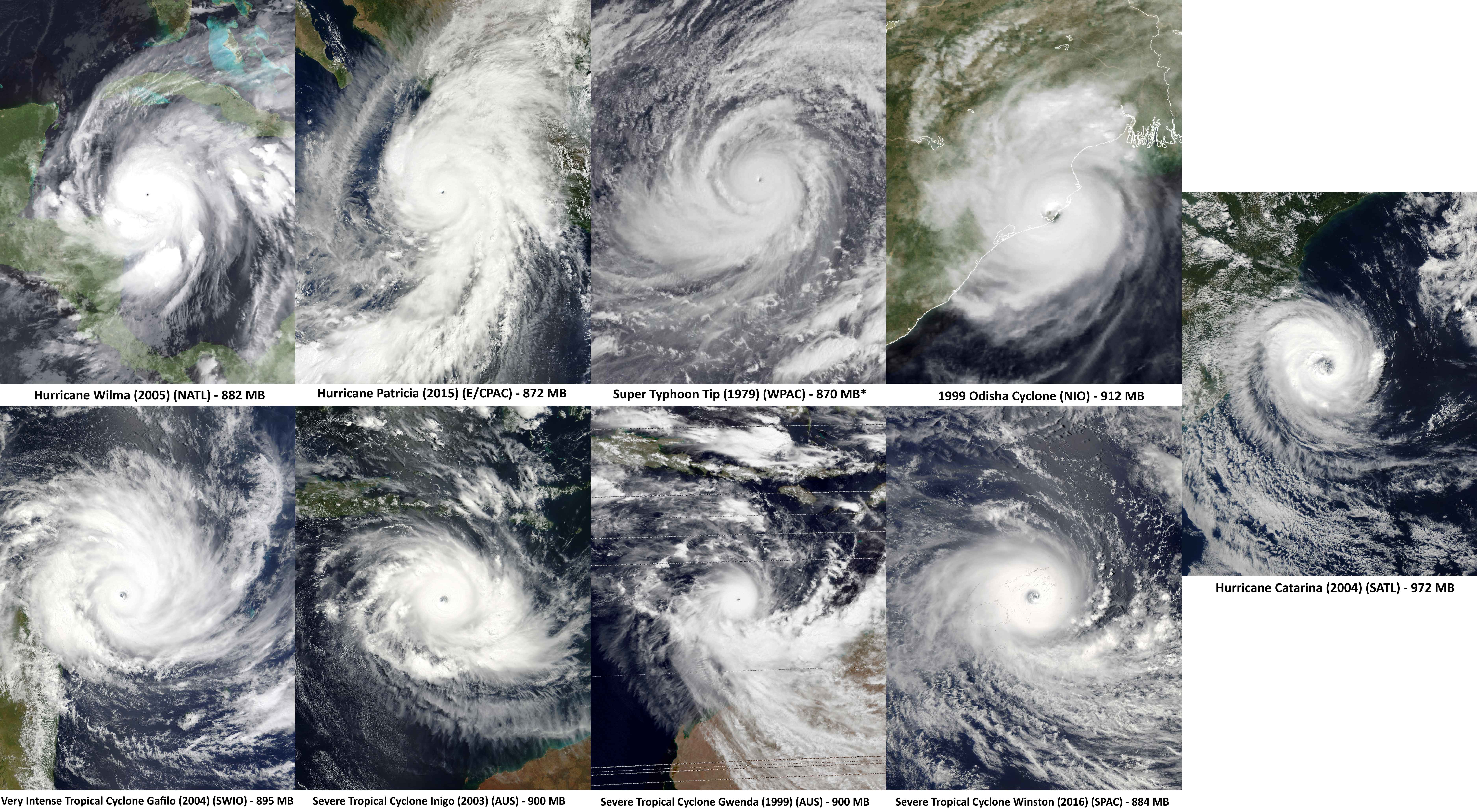
There’s a twist in the hurricane story: while the overall number of tropical cyclones hasn’t changed much, the share of major hurricanes—those Category 3 and higher—has gone up dramatically. In the North Atlantic, the portion of these major storms has increased by about 49% each decade. This means that while there aren’t necessarily more storms, the ones that do form are much more likely to be monsters. It’s a shift that’s catching even seasoned meteorologists off guard. Instead of a steady drumbeat of minor storms, we’re seeing fewer but far more dangerous hurricanes. This new pattern is forcing emergency responders and city planners to rethink how they prepare for storm season. As storm expert Dr. Emily Cross puts it, “It’s not the number that matters anymore—it’s the strength. And the strength is off the charts.”
Forecasting Impacts: The Threat of Slower Storms
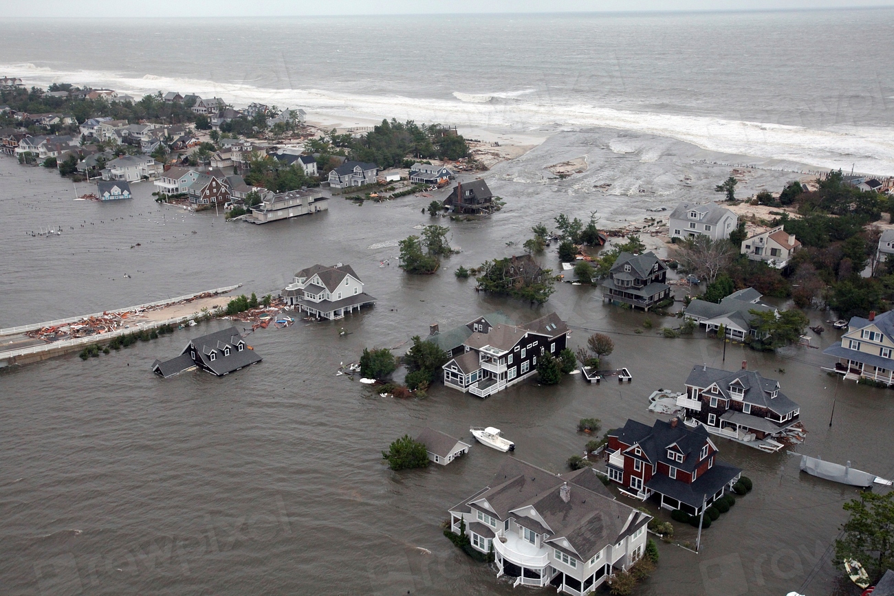
Another unsettling trend is that hurricanes are moving more slowly as they approach land. Research shows a steady decline in the average forward speed of storms, especially near the coast. This slowdown means communities are exposed to high winds, torrential rain, and storm surge for much longer—sometimes for days instead of hours. The longer a hurricane lingers, the greater the risk of catastrophic flooding and infrastructure collapse. Floodwaters can rise fast and stay high, making rescue and recovery much harder. Meteorologist Rachel Lin says, “A slow-moving hurricane can be even more dangerous than a fast one, simply because it won’t go away.” This new reality is prompting cities to rethink evacuation routes and emergency supplies, since people may need to shelter in place for longer periods.
Changing Risk Zones: Who Is Now in the Crosshairs?
As hurricanes intensify and migrate, the map of risk is being redrawn in real time. Areas that once considered themselves safe—like the Carolinas, New Jersey, and even parts of Europe’s Atlantic coast—are now seeing storm warnings pop up on their weather apps. Insurance companies are already adjusting their risk models, and homeowners are facing rising costs and sometimes even losing coverage. Local governments are launching urgent updates to building codes and disaster plans. The emotional toll is rising, too, as families worry about the future of their homes and neighborhoods. Dr. Marcus Allen, a risk analyst, warns, “If you think you’re out of harm’s way, think again. The danger zone is expanding faster than we imagined.” People everywhere are realizing they can’t rely on the old rules anymore.
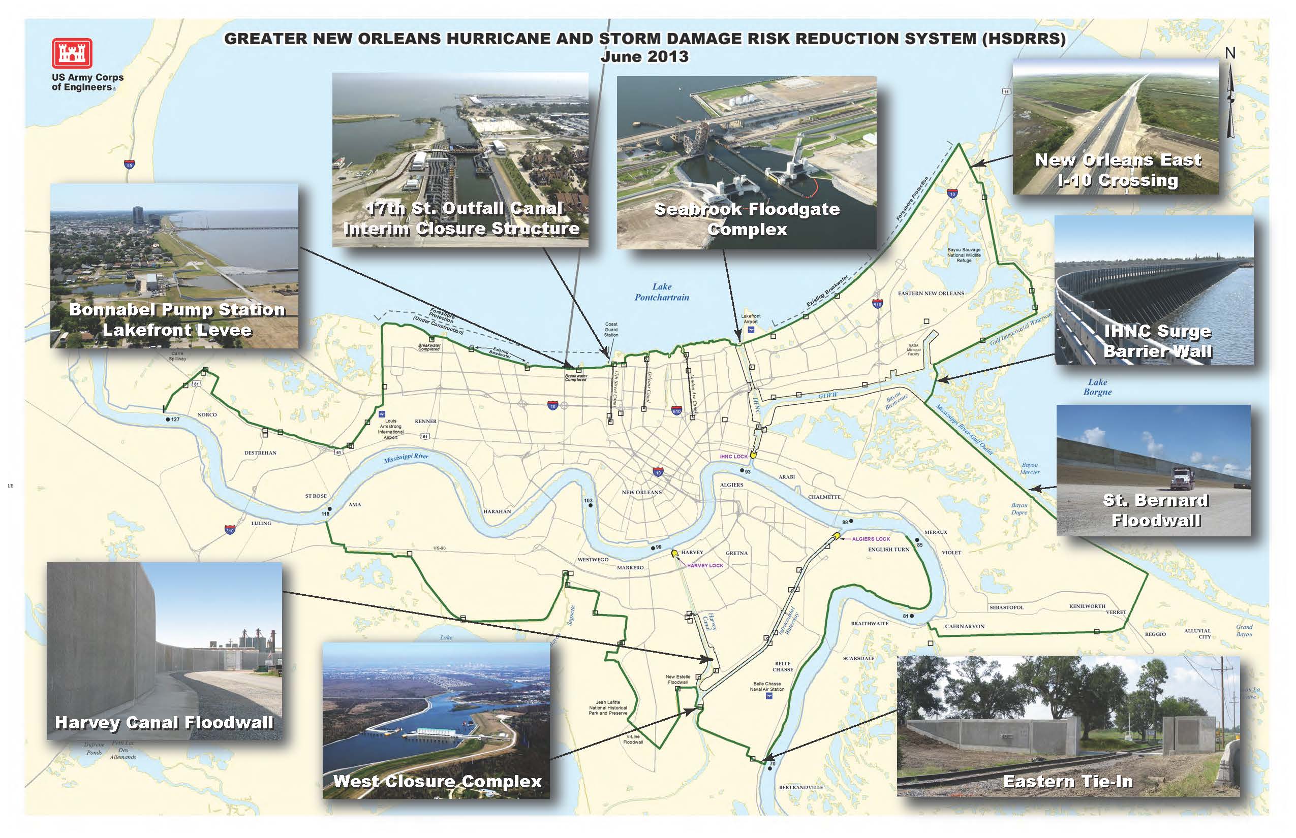
Infrastructure Under Strain: Are We Ready?
With more powerful hurricanes battering wider areas, questions about resilience are front and center. Many cities’ floodwalls, drainage systems, and power grids were designed for a world where Category 4 or 5 storms were rare. Now, those “once-in-a-century” storms are happening with frightening regularity. Local officials are racing to upgrade infrastructure, but budgets and political willpower often lag behind the pace of change. Residents are being urged to prepare for longer outages and tougher recovery periods. The strain is showing in everything from emergency shelters to supply chains. As Dr. Priya Desai, an urban planner, puts it: “We’re playing catch-up with a moving target.” The question looming over every hurricane season is whether our communities can adapt quickly enough to survive the next big storm.
Human Stories: Facing the Hurricane Future
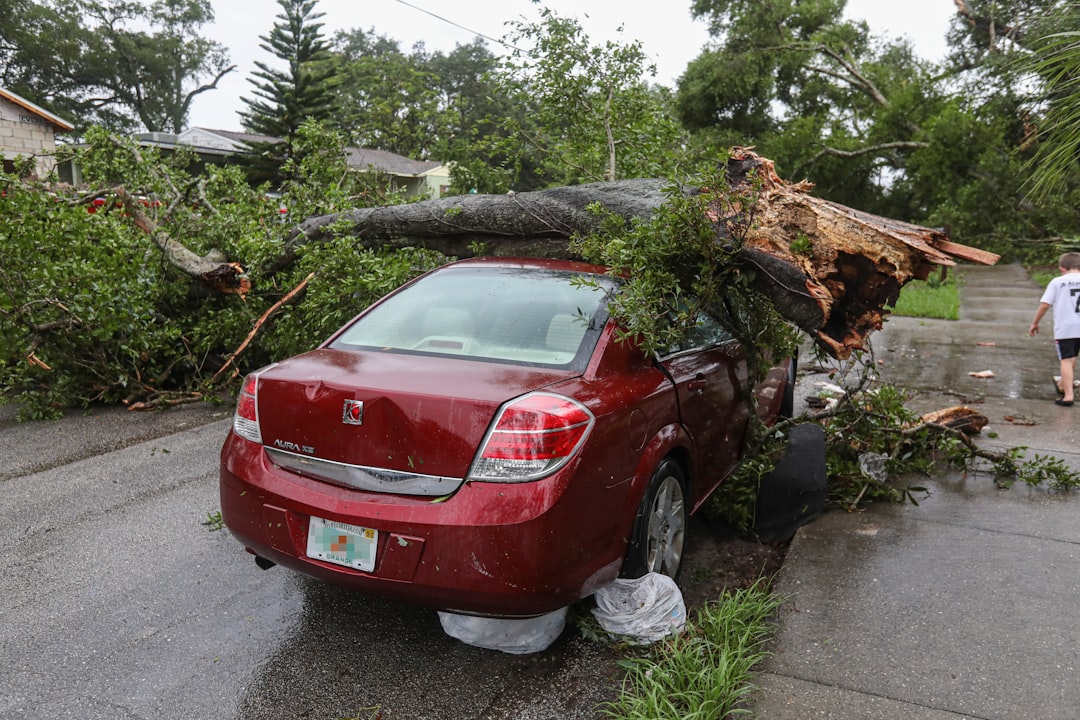
Behind all the science and statistics are real people facing real fear. Coastal residents swap stories of storms that seemed to come out of nowhere, of floods that reached higher than anyone remembered. Neighborhoods that once felt safe now brace for every warning siren, every storm watch. Families are choosing whether to rebuild or relocate, a decision that’s both practical and deeply emotional. Community leaders are trying to keep hope alive, even as the odds grow more daunting each year. One survivor, Maria Torres from Fort Myers, said after last season’s storm, “We thought we knew hurricanes—now, it’s like they’re different animals.” The human cost of stronger hurricanes is measured in lost homes, shattered routines, and the constant, gnawing worry of what’s coming next.