

- The History and Future of the San Andreas Fault - August 14, 2025
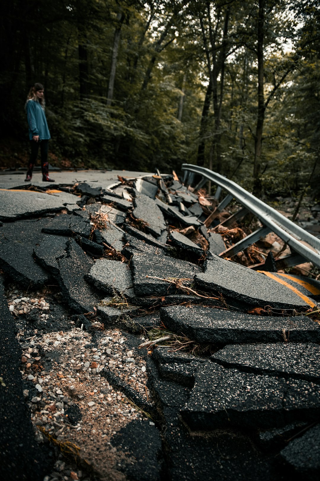
- Two Die in New Jersey Flash Floods as Roads Go Under Water - August 11, 2025
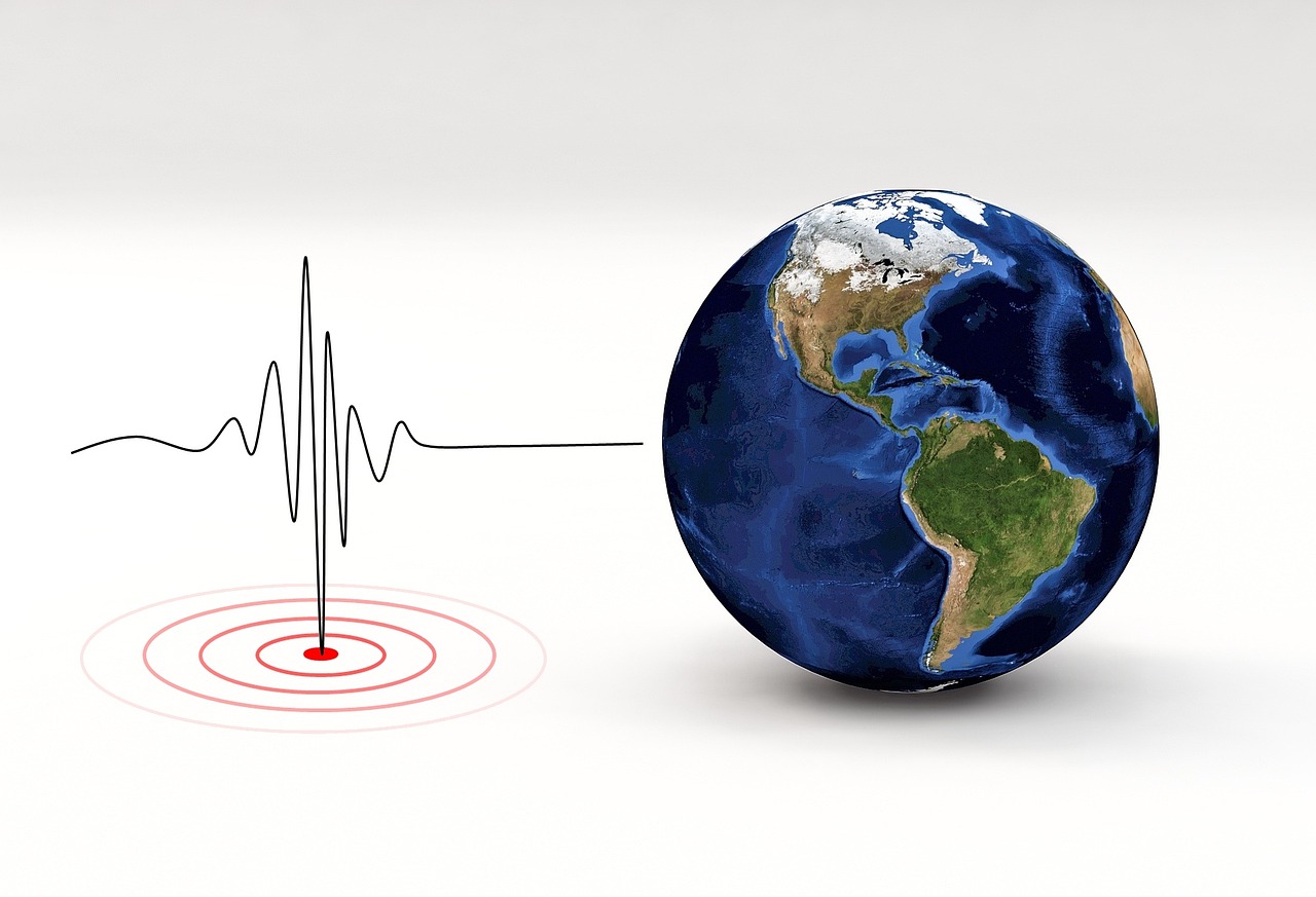
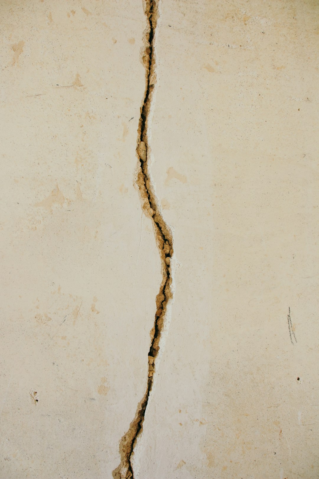
- Chile Shaken by 5.7 Magnitude Earthquake, According to GFZ - August 11, 2025
Birth of a Giant: How the San Andreas Fault Came to Be
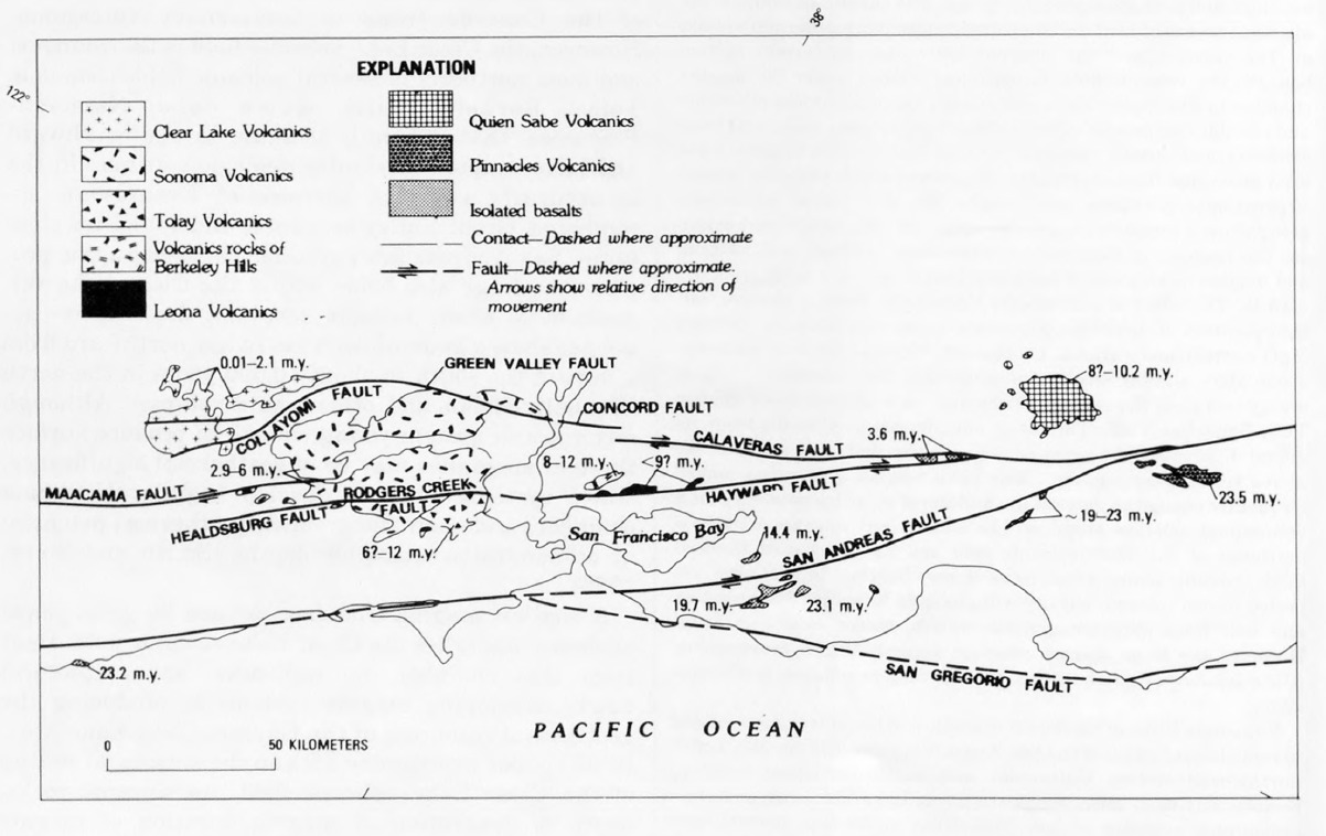
The San Andreas Fault began to form in the mid-Cenozoic about 30 million years ago, when a spreading center between the Pacific plate and the Farallon plate was beginning to reach the subduction zone off the western coast of North America. It wasn’t always the massive crack we see today. Around 30 million years ago, the mid-ocean ridge between the Pacific and Farallon Plates started to subduct. The main southern section of the San Andreas Fault proper has only existed for about 5 million years.
Picture two massive tectonic puzzle pieces grinding against each other for millennia. That’s essentially what happened when the Pacific Plate began its relentless dance with the North American Plate. The first known incarnation of the southern part of the fault was Clemens Well-Fenner-San Francisquito fault zone around 22–13 million years ago, which later added the San Gabriel Fault as a primary focus of movement between 10–5 million years ago.
Andrew Lawson’s Earth-Shattering Discovery
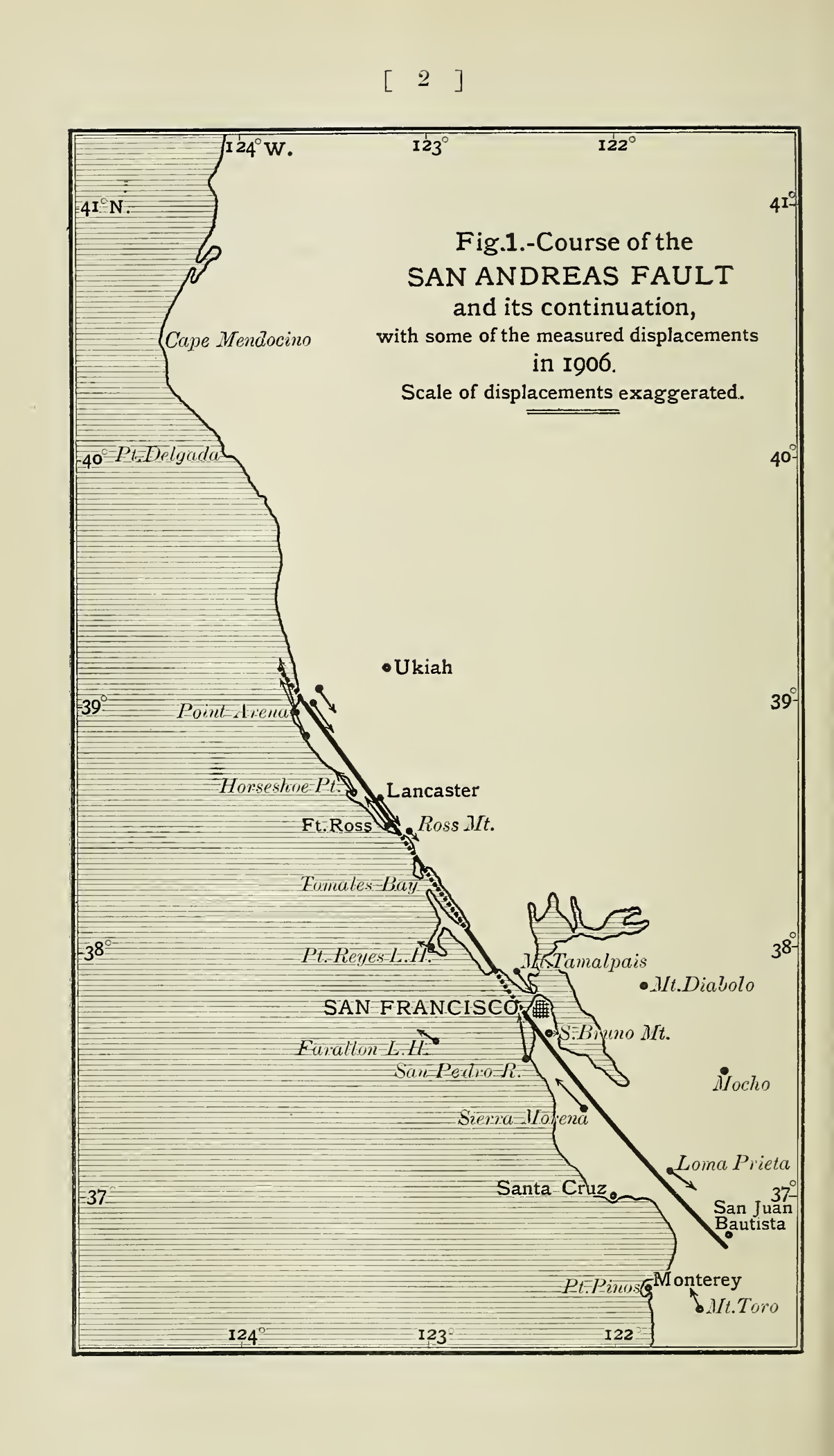
The fault was first identified in Northern California by UC Berkeley geology professor Andrew Lawson in 1895 and named by him after the surrounding San Andreas valley. Lawson had no idea he was discovering what would become California’s most notorious geological feature. According to some of his reports from 1895 and 1908, he actually named it after the surrounding San Andreas Valley. A common misconception is that Lawson named the fault after this lake. However, according to some of his reports from 1895 and 1908, he actually named it after the surrounding San Andreas Valley.
Eleven years later, Lawson discovered that the San Andreas Fault stretched southward into southern California after reviewing the effects of the 1906 San Francisco earthquake. This realization transformed what seemed like a local geological curiosity into a continental-scale phenomenon. The 1906 earthquake became Lawson’s eureka moment, revealing the fault’s true scope and power.
A Continental Crack: The Fault’s Massive Scale
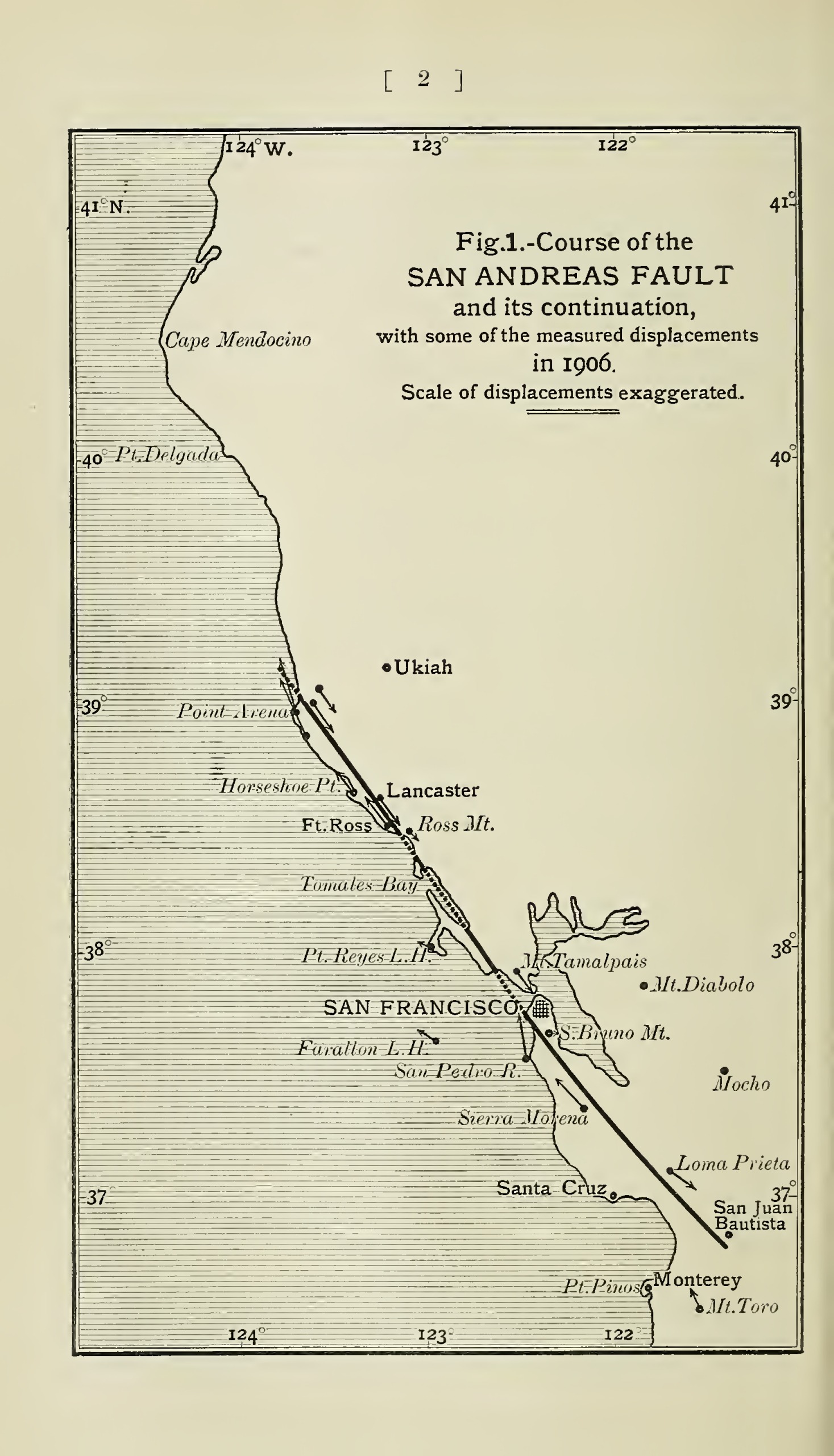
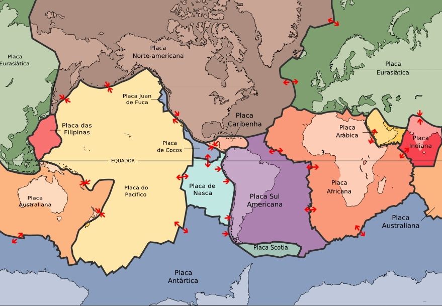
The fault trends northwestward for more than 800 miles (1,300 km) from the northern end of the Gulf of California through western California, U.S., passing seaward into the Pacific Ocean. To put this in perspective, imagine a crack running from San Diego all the way past San Francisco. It slices California in two from Cape Mendocino to the Mexican border.
The San Andreas Fault is a continental right-lateral strike-slip transform fault that extends roughly 1,200 kilometers through the U.S. state of California and forms part of the tectonic boundary between the Pacific plate and the North American plate. San Diego, Los Angeles and Big Sur are on the Pacific Plate, while San Francisco, Sacramento and the Sierra Nevada are on the North American Plate.
Three Segments, Three Personalities
Traditionally, for scientific purposes, the fault has been classified into three main segments (northern, central, and southern), each with different characteristics and a different degree of earthquake risk. Each segment behaves like a different creature entirely. The middle section of the San Andreas is known as the “creeping section,” which stretches between the California cities of Parkfield and Hollister in central California where the fault “creeps,” or moves slowly without causing shaking.
The southern segment presents the most ominous threat. This Southern Segment is capable of triggering intense disruptions that could trigger quakes with a magnitude of 8.1, which could result in tragic losses in crucial areas, such as Riverside, San Bernardino, and Los Angeles. Meanwhile, the northern section of the San Andreas spans from Hollister to a special spot called the “triple junction” off the coast of Mendocino where the North American tectonic plate, Pacific plate, and undersea Gorda plate meet.
The Relentless Grind: How Fast the Plates Move
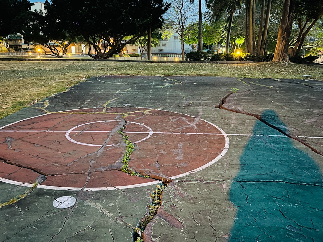
The movement of the plates relative to each other has been about 1 cm (0.4 inch) per year over geologic time, though the annual rate of movement has been 4 to 6 cm (1.6 to 2.4 inches) per year since the early 20th century. That might seem slow, but it’s like having a geological time bomb ticking away. The plates are slowly moving past one another at a couple of inches a year – about the same rate that your fingernails grow.
If that rate continues, Los Angeles and San Francisco will be next-door neighbors in 15 million years! The average slip rate along the entire fault ranges from 20 to 35 mm (0.79 to 1.38 in) per year. This seemingly insignificant movement accumulates tremendous stress over decades and centuries, building up to catastrophic releases of energy.
Historic Earthquakes: When the Fault Unleashed Its Fury
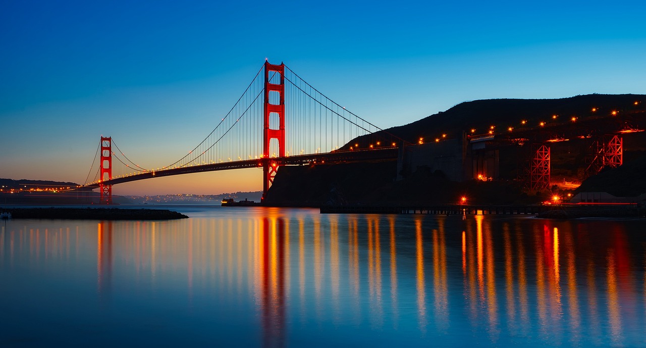
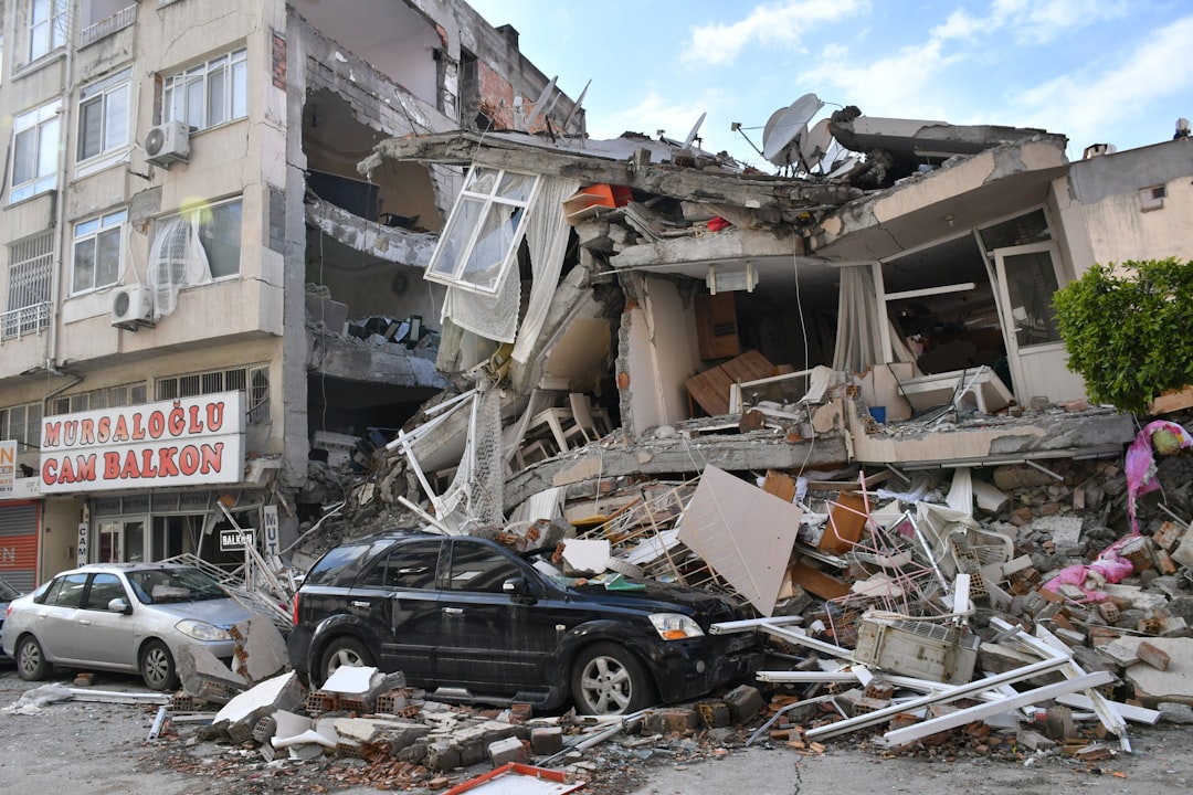
In 1906, the northern section of the fault shook San Francisco and the Bay Area with a 7.9 magnitude quake, which caused a devastating fire in the city and killed more than 3,000 people. This wasn’t just an earthquake – it was a civilization-altering catastrophe. During the 1906 earthquake in the San Francisco region, roads, fences, and rows of trees and bushes that crossed the fault were offset several yards, and the road across the head of Tomales Bay was offset almost 21 feet.
In 1857, the southern section of the fault shook and created a quake thought to be just as large, though only two people died, because California had a tiny population at the time. The largest historical earthquakes that occurred along the San Andreas fault were those in 1857 and 1906. These events demonstrated the fault’s capacity for unleashing tremendous destructive power across vast distances.
The Parkfield Experiment: A Natural Laboratory
Seismologists discovered that the San Andreas Fault near Parkfield in central California consistently produces a magnitude 6.0 earthquake approximately once every 22 years, following recorded seismic events in 1857, 1881, 1901, 1922, 1934, and 1966. Scientists thought they had found nature’s clockwork. It eventually occurred in 2004. Due to the frequency of predictable activity, Parkfield has become one of the most important areas in the world for large earthquake research.
In 2004, work began just north of Parkfield on the San Andreas Fault Observatory at Depth (SAFOD) with the goal to drill a hole nearly 3 kilometres into the Earth’s crust and into the San Andreas Fault where an array of sensors will be installed to record earthquakes that happen near this area. This ambitious project represents humanity’s attempt to peer directly into the Earth’s restless interior.
Recent Discoveries: Water’s Role in Earthquake Activity
A 2023 study found a link between the water level in Lake Cahuilla (now the Salton Sea) and seismic activity along the southern San Andreas Fault. This groundbreaking research suggests that even something as seemingly unrelated as lake levels can influence when earthquakes occur. Researchers say ubiquitous evidence for ongoing geological carbon sequestration in mantle rocks in the creeping sections of the San Andreas Fault is one underlying cause of aseismic creep.
Scientists are also discovering that the fault’s behavior is far more complex than originally thought. Recent investigations focus on the dynamic interactions between the Southern San Andreas Fault and a proximal normal fault beneath the Salton Sea in southern California. These findings reveal an intricate underground network of geological interactions that could influence future earthquake patterns.
2024 Research: Are We Approaching Critical Stress?
The Parkfield transitional segment of the San Andreas Fault is characterized by the production of frequent quasi-periodical M6 events that break the very same asperity, with the last Parkfield mainshock occurring on 28 September 2004, 38 years after the 1966 earthquake. Based on the analysis of the variance of daily seismic activity along the SAF calculated on a moving time window, Sebastiani and Malagnini (2020) forecasted the occurrence of the next mainshock in mid-2024.
Recent seismic monitoring has revealed concerning patterns. According to updated data from the U.S. Geological Survey (USGS) in 2024, the San Andreas Fault is currently under close scrutiny due to an uptick in microseismic activity over the past 18 months, with the USGS estimating there is now a 20% chance of a magnitude 7.0 or higher earthquake along this fault within the next 30 years. This represents a significant increase in seismic concern among researchers.
The Big One: What Scientists Predict
Maybe you’ve heard that the “Big One is overdue” on the San Andreas Fault, though no one can predict earthquakes. Scientists say there is more than a 99 percent chance of at least one earthquake of magnitude 6.7 or greater striking anywhere in California in the next 30 years. The statistics are sobering, but they’re based on solid geological evidence rather than fear-mongering.
Recent predictions limit the possible maximum earthquake magnitude along the San Andreas fault system to 8.0, although with a 7% probability estimate that such an event could occur in Southern California in the next 30 years; over the same period, there is a 75% chance of a magnitude 7.0 event. A USGS study in 2008 predicted that a magnitude 7.8 earthquake along the southern San Andreas Fault could cause about 1,800 deaths and $213 billion in damage.
Modern Monitoring: Technology Watching the Fault
California’s extensive network of over 1,000 seismic sensors is crucial in monitoring seismic activity with sensors strategically placed across the state to detect the initial fast-moving P-waves that precede the more destructive S-waves, using real-time data analysis and algorithms to sift through the noise and identify these seismic signals. This network represents one of the most sophisticated earthquake monitoring systems in the world.
Recent efforts have been made to improve earthquake early warning systems, including the development of apps like ShakeAlert. However, despite technological advancements, earthquake prediction must catch up to other scientific fields like meteorology, where high-resolution atmospheric data allows accurate storm forecasts, as seismologists still need help collecting comprehensive data about the Earth’s subterranean realm.
Future Challenges: Climate Change and Seismic Activity
A groundbreaking study published in Nature Geoscience in March 2024 highlighted a surprising link between climate change and earthquake risk. This research opens entirely new avenues for understanding how human activities might indirectly influence seismic patterns. The implications are profound, suggesting that our changing climate could interact with geological processes in unexpected ways.
As of early 2025, it is estimated that more than 200,000 buildings in the Bay Area alone still require upgrades, and the slow pace of these improvements leaves millions of residents facing avoidable risks should a major quake strike. The race between geological inevitability and human preparedness continues, with infrastructure improvements lagging behind scientific understanding.
The Fault’s Future: What Lies Ahead
Projected motion indicates that the landmass west of the San Andreas Fault, including Los Angeles, will eventually slide past San Francisco, then continue northwestward toward the Aleutian Trench, over a period of perhaps twenty million years. A ‘new’ San Andreas appears to be forming in eastern California and western Nevada, called the Eastern California Shear Zone and Walker Lane Fault Zone, which accounts for about 25% of modern plate motion.
Currently, it is believed that the modern San Andreas will eventually transfer its motion toward a fault within the eastern California shear zone due to complicated evolution, especially along the southern segment, mostly caused by either the “Big Bend” and/or a difference in the motion vector between the plates. The fault itself is evolving, constantly reshaping California’s geological future. Nature never stays static, and neither will the San Andreas.
Conclusion: Living with Geological Uncertainty
The San Andreas Fault represents one of Earth’s most dramatic ongoing geological experiments. From its birth thirty million years ago to its inevitable future transformations, it continues to shape California’s landscape and challenge human understanding. Recent technological advances have given us unprecedented insight into its behavior, yet the fundamental unpredictability of earthquakes remains humbling. With about 45 years between the historic earthquakes but about 160 years since the last one, it is clear that the fault does not behave like a clock with a regular beat. As we move forward, our survival depends not on predicting exactly when the next big earthquake will strike, but on preparing for its eventual arrival. How long will our technological advances keep pace with this sleeping giant beneath our feet?