

- Why Scientists Track Atmospheric Carbon With Giant Towers - October 7, 2025
- The Link Between Melting Ice and Rising Sea Levels Explained - October 6, 2025
- How Ocean Currents Help Regulate Global Climate - October 5, 2025
1. The Hayward Fault: An Underestimated Threat
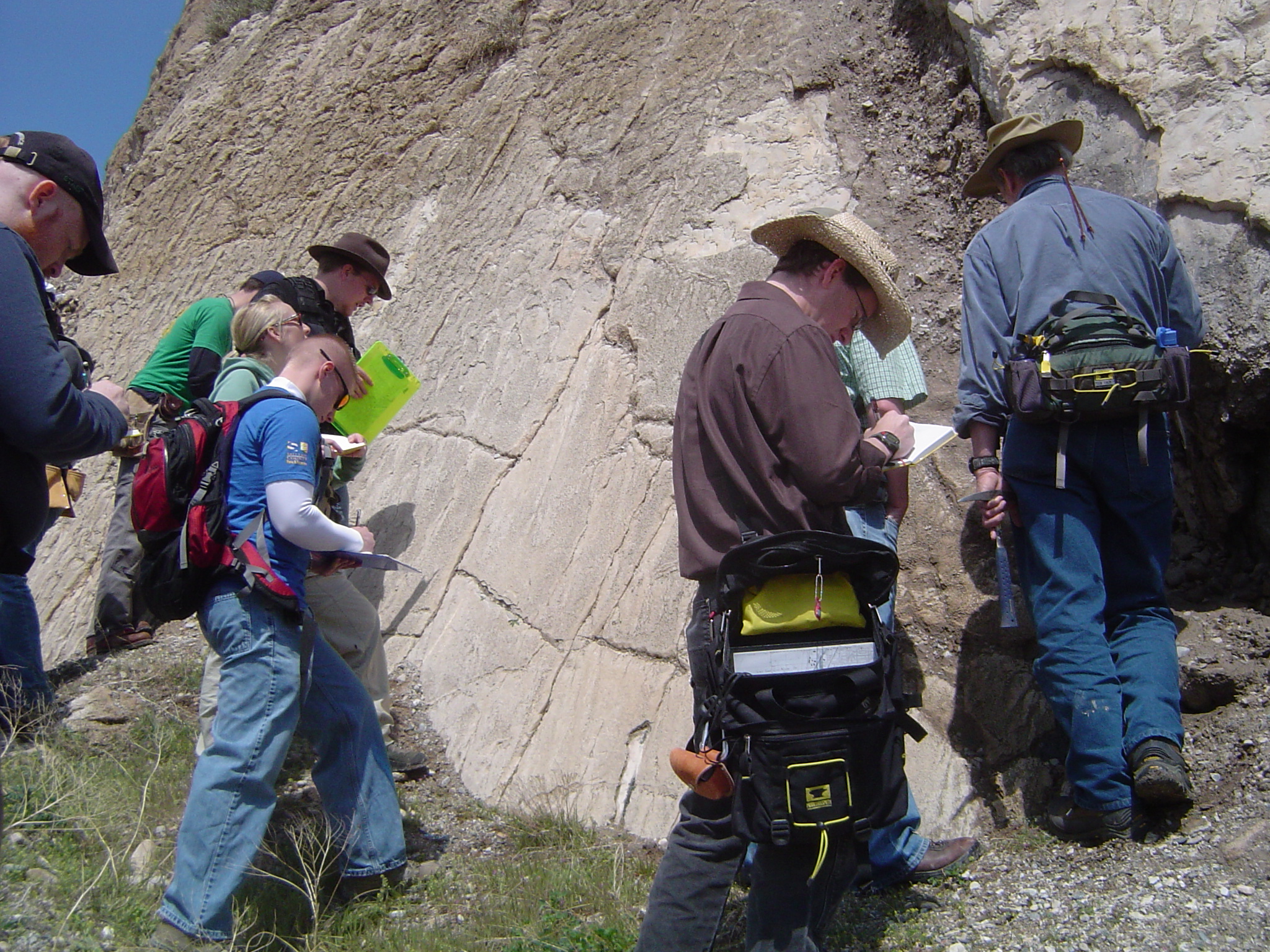
The Hayward Fault, running straight through the heart of California’s East Bay, is a seismic giant hiding in plain sight. Unlike the headline-grabbing San Andreas, the Hayward Fault slices beneath cities like Oakland, Berkeley, and Fremont, putting over two million people at risk. According to a 2024 United States Geological Survey (USGS) assessment, this fault has a 30% chance of producing a magnitude 6.7 or greater earthquake in the next 30 years—a probability that rivals the infamous San Andreas. In 1868, the Hayward Fault unleashed a quake estimated at magnitude 6.8, causing destruction that would be catastrophic today due to population growth. Infrastructure, including BART tunnels and major highways, crosses the fault, making the potential for disruption immense. In 2025, researchers at UC Berkeley mapped previously unrecognized offshoots—further raising the risk of a multi-segment rupture. Experts warn that housing built before modern seismic codes is especially vulnerable, highlighting the urgent need for retrofitting initiatives. The Hayward Fault might not make national headlines, but scientists insist it’s primed to be the Bay Area’s “tectonic time bomb.”
2. The New Madrid Seismic Zone: A Historical Perspective
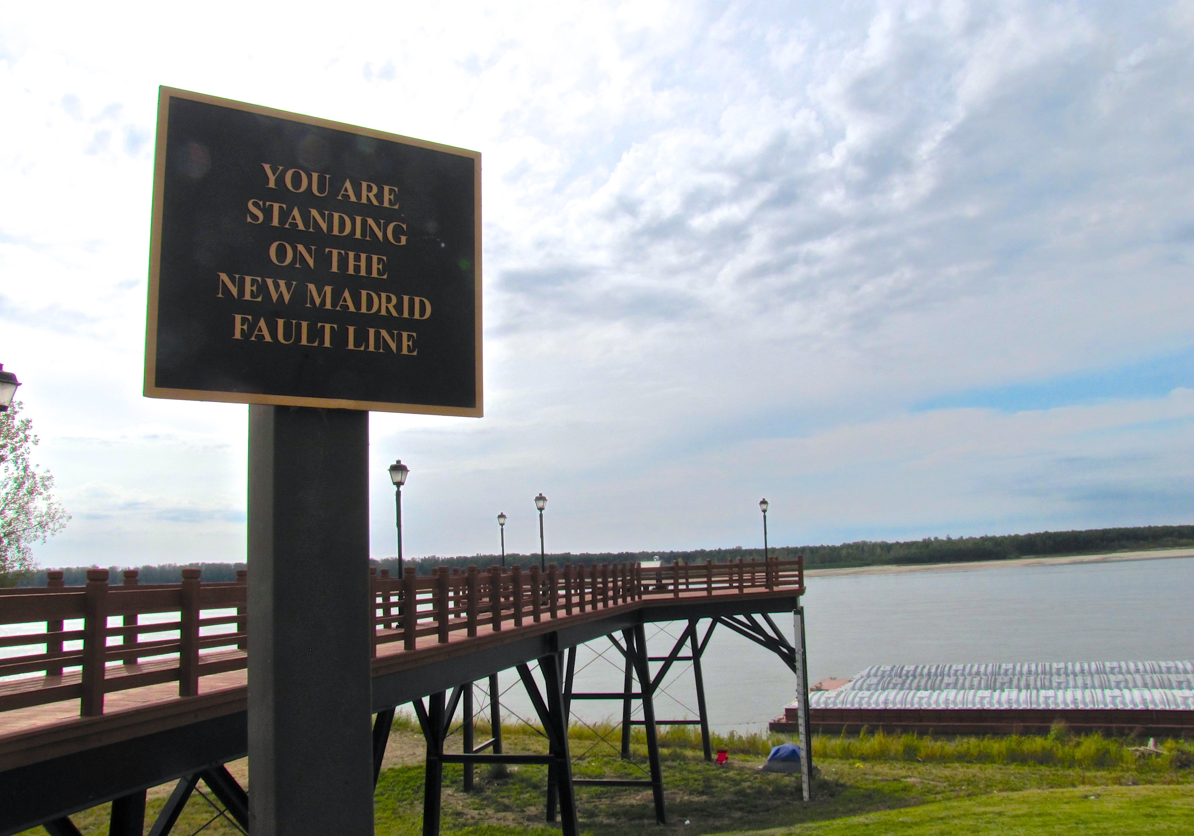
Deep in the central United States, the New Madrid Seismic Zone stretches across southeastern Missouri, northeastern Arkansas, western Tennessee, and Kentucky. Though less famous than California’s faults, this region was the site of the most powerful earthquakes in U.S. history, with a catastrophic series in 1811-1812 estimated between magnitude 7.0 and 8.0. The shocks were so intense that they rang church bells in Boston and reportedly caused the Mississippi River to run backward. A 2024 report from the National Earthquake Hazards Reduction Program (NEHRP) reveals that the zone remains seismically active, with a 7% probability of a magnitude 6.0 or greater quake in the next 50 years. Recent GPS-based studies confirm that tectonic strain continues to accumulate, contradicting earlier theories that the zone was dying out. Urban centers like Memphis and St. Louis, with millions of residents and aging infrastructure, would face enormous risk if a major quake struck today. Emergency planners worry about widespread liquefaction and the limited earthquake preparedness in the region. The New Madrid’s quiet fields hide a restless giant, and the stakes are higher than most Americans realize.
3. The Cascadia Subduction Zone: A Ticking Time Bomb
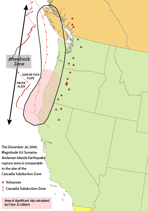
The Cascadia Subduction Zone, stretching from northern California through Oregon and Washington up to British Columbia, is infamous among geologists as North America’s most dangerous under-the-radar fault. Unlike the more visible faults of California, Cascadia is a massive offshore system where the Juan de Fuca plate dives beneath the North American plate. The last megaquake here, in 1700, was so powerful it sent a tsunami racing across the Pacific to Japan. A 2025 study published in the Journal of Geophysical Research estimates a chilling 37% probability of a magnitude 8.0-9.0 earthquake in the next 50 years. This “full-margin rupture” would devastate coastal cities like Seattle, Portland, and Vancouver, triggering both ground shaking and deadly tsunamis. Scientists have uncovered new evidence of “slow slip events” that relieve only a fraction of the built-up stress, suggesting the region is due for another massive event. Emergency managers in Oregon and Washington have updated tsunami evacuation routes and warning systems as recently as March 2025. Despite these efforts, experts warn that millions remain unprepared for the devastation a Cascadia event would unleash.
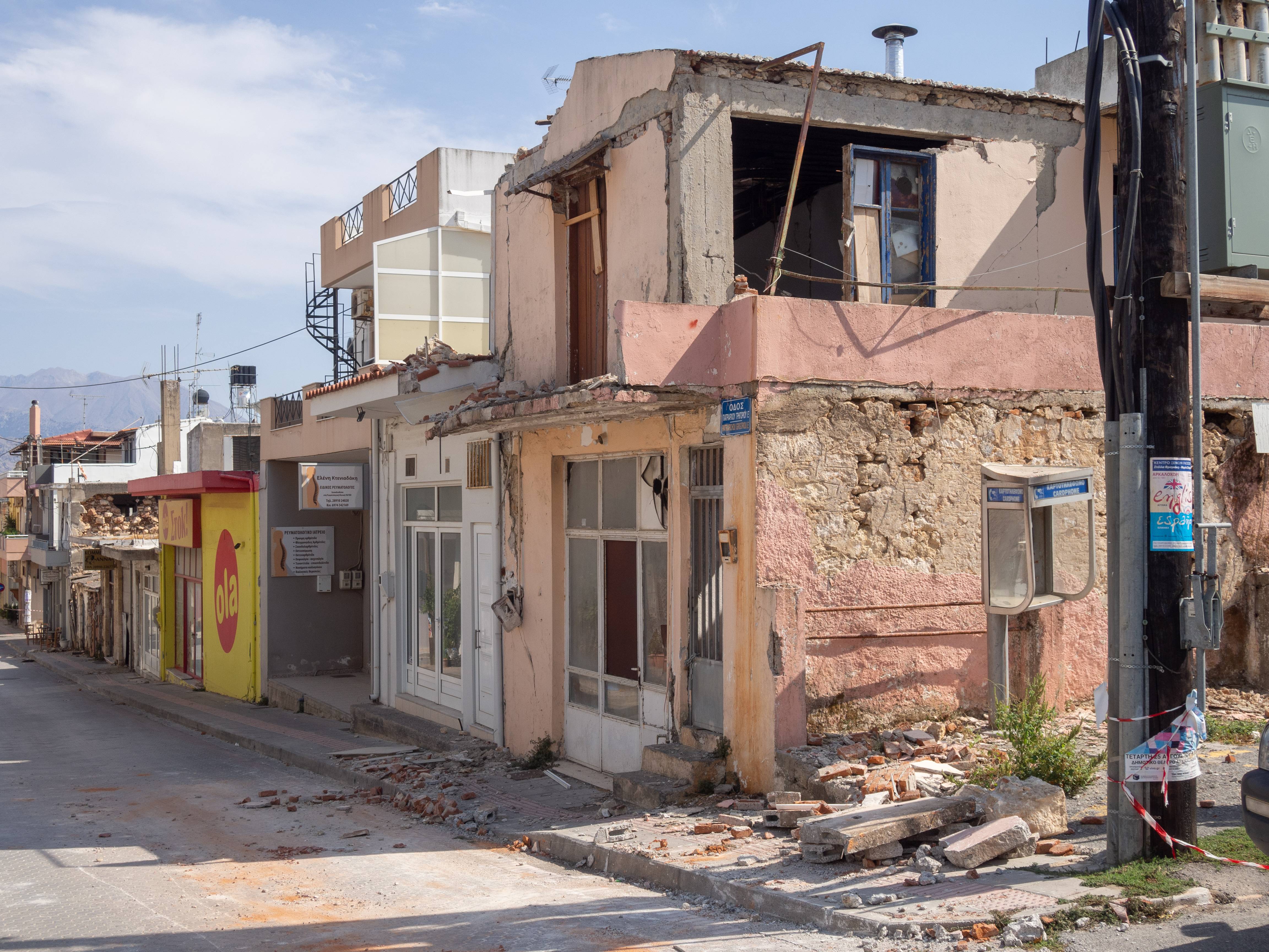
4. The Charleston Fault: A Southern Surprise
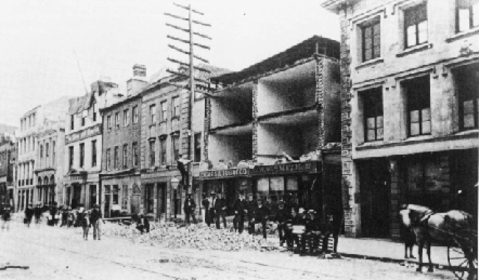
South Carolina’s Charleston Fault is a stark reminder that the eastern U.S. is not immune to powerful quakes. The 1886 Charleston earthquake, estimated at magnitude 7.0, remains one of the most destructive seismic events in eastern North America, flattening buildings and leaving the city in ruins. A 2024 report from the South Carolina Seismic Network confirms ongoing microseismic activity beneath the region, with a 10% chance of a similar event occurring within the next 50 years. Unlike California, South Carolina’s soft soils and brick buildings amplify shaking, increasing the risk of collapse. Recent research in 2025 uncovered subtle ground deformation, suggesting the fault remains active. Charleston’s historic district, filled with unreinforced masonry, is especially at risk. State lawmakers have responded by funding new seismic retrofitting grants and public awareness campaigns. Despite these efforts, many residents remain unaware of the threat beneath their feet, making the Charleston Fault a silent danger in the American South.
5. The Wasatch Fault: A Growing Concern

Utah’s Wasatch Fault, stretching over 240 miles along the base of the Wasatch Mountains, is the backbone of seismic risk in the Intermountain West. The Utah Geological Survey’s 2024 update projects a 25% chance of a magnitude 7.0 or higher earthquake along this fault within the next 50 years. The Salt Lake City metropolitan area, with over 1.2 million residents, sits directly atop this restless fault. A 2025 study using high-resolution LIDAR mapping revealed new fault segments capable of independent rupture, raising the risk for multi-fault events. Many public schools, hospitals, and historic buildings in Salt Lake Valley were built before the adoption of modern seismic codes, putting thousands at risk. Emergency planners have launched the “Great Utah ShakeOut” drills, with over 900,000 participants in April 2025, aiming to boost preparedness. The Wasatch Fault’s slow movement means frequent reminders in the form of minor tremors, but experts stress that the “Big One” is a matter of when, not if.
6. The San Andreas Fault: Not the Only Player
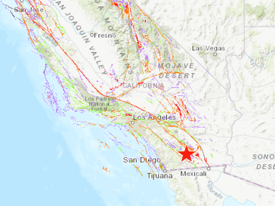
The San Andreas Fault, California’s seismic celebrity, often dominates headlines and disaster scenarios. However, the 2024 USGS report emphasizes that the state’s earthquake risk is a complex “fault network,” where secondary faults like Hayward and Calaveras could interact with the San Andreas itself. Recent stress modeling shows that a rupture on one fault could trigger movement on adjacent faults, potentially resulting in a “cascade” of earthquakes much larger than a single event. The 2025 California Earthquake Authority study found that nearly 40% of the state’s population lives within 10 miles of an active fault, highlighting the interconnectedness of the region’s seismic danger. Urban planners are increasingly factoring in this networked risk, updating building codes and zoning regulations to account for multi-fault scenarios. The lesson: while the San Andreas might be the star, it shares the stage with a complex cast of equally dangerous faults.
7. Advances in Seismic Monitoring Technology
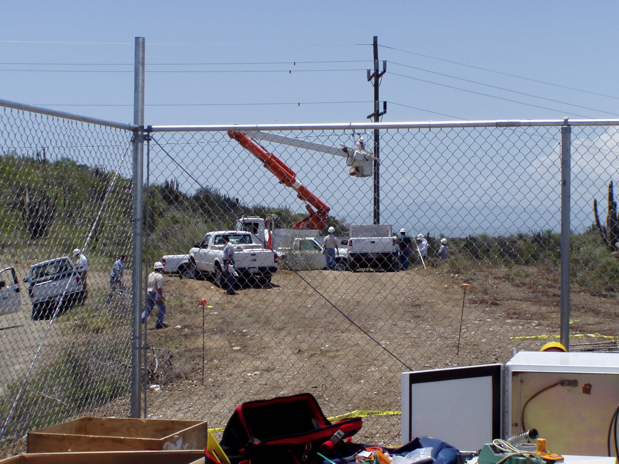
Seismic science has entered a new era, with technology dramatically improving the ability to detect and forecast earthquakes. In February 2025, California rolled out its upgraded Earthquake Early Warning System (EEWS), now powered by artificial intelligence and real-time data from over 1,500 ground sensors. This system can send alerts to millions of smartphones and critical infrastructure up to 30 seconds before strong shaking hits. Machine learning algorithms process seismic data faster than ever, allowing for better identification of foreshocks and aftershocks. The USGS reported a 15% increase in detection of small tremors on previously “quiet” faults in 2024, improving risk forecasting. Remote sensing satellites are now routinely used to track tiny surface deformations, offering early clues to rising tectonic stress. These advances mean communities get more warning—and scientists gain deeper insight into America’s most overlooked fault lines.
8. Public Awareness and Preparedness Initiatives

Public education is at the frontline of earthquake risk reduction. FEMA’s 2024 report highlighted a 20% jump in participation in community earthquake drills and preparedness workshops nationwide. States like California and Utah have introduced new school curricula that teach children how to “Drop, Cover, and Hold On” during a quake. In 2025, the “ShakeAlert” app surpassed 10 million downloads, with user surveys showing increased confidence in responding to earthquake warnings. Local governments have distributed millions of emergency preparedness kits, particularly targeting low-income and high-risk neighborhoods. FEMA’s “Ready Campaign” now partners with influencers and sports teams to reach younger audiences. Despite these gains, gaps remain: a 2025 Pew Research Center survey found that only 32% of Americans in the central and eastern U.S. believe they are at risk from earthquakes. Bridging this awareness gap is a growing focus for both federal and local agencies.
9. The Economic Impact of Earthquakes
The financial cost of a major earthquake in urban America could be staggering. The National Institute of Building Sciences’ 2025 analysis projects that a magnitude 7.0 quake in the Bay Area would cause losses exceeding $200 billion, factoring in property damage, lost business, and infrastructure repair. Insurers have raised premiums in regions close to active faults by an average of 14% since 2024, citing increased risk data. Recent FEMA modeling shows that only about 12% of California homeowners carry earthquake insurance, leaving millions exposed to catastrophic loss. Major companies are now required to have business continuity plans, with some investing in seismic retrofits for critical facilities. Federal and state governments have boosted disaster recovery funds, but experts warn it’s not enough to cover worst-case scenarios. The economic ripple effects could last for years, disrupting everything from housing markets to supply chains.
10. Future Research Directions and Policy Implications
Scientific understanding of America’s overlooked fault lines is evolving rapidly, driving new policy discussions. The National Earthquake Hazards Reduction Program (NEHRP) in 2024 called for a $150 million annual increase in research funding, targeting improved hazard mapping and early warning systems. Interdisciplinary teams now blend geology, engineering, and computer science to refine risk assessments. In 2025, Congress considered new legislation requiring seismic resilience standards for all federal buildings in high-risk zones. Local governments in cities like Seattle and Memphis are piloting “seismic safety districts” with stricter building codes and mandatory retrofits. Researchers are also developing next-generation sensors to pinpoint micro-faults previously undetected. Policy experts stress that closing the gap between science and public safety will require continued investment and political will. The future of earthquake resilience in America depends on paying attention to these overlooked dangers—before they make headlines.