

- Southwest Faces Rare March Heatwave as Temperatures Near 110°F - March 24, 2026
- I Asked ChatGPT Which States Might See the Biggest Flood Risks – Here’s the List - March 24, 2026
- 10 Natural Resources Experts Say We’re Using Too Fast - March 24, 2026
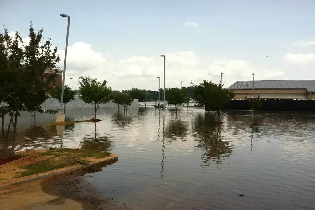
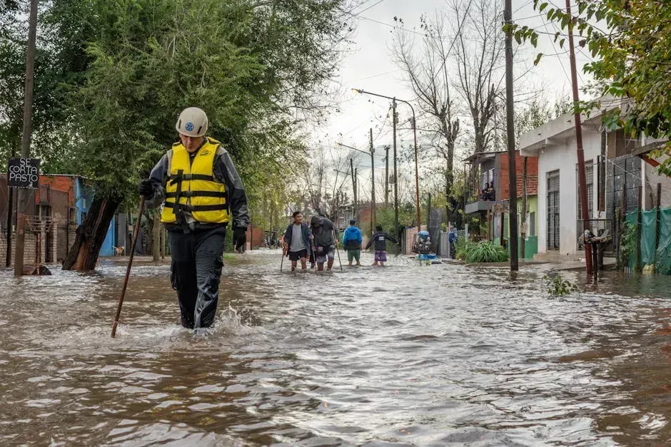
Flooding is not a distant threat on the horizon. It is happening right now, reshaping communities, hiking insurance premiums, and quietly pushing millions of Americans toward a very uncomfortable question: is my home safe? I decided to dig deeper, cross-referencing what AI tools like ChatGPT outline with the latest research from FEMA, NOAA, and independent risk analysts to find out which states are truly sitting on the edge.
Flooding remains the most common and most expensive natural disaster in the United States, and updated 2024 to 2025 assessments from FEMA, NOAA, and the National Weather Service now classify millions more properties as vulnerable than earlier models suggested. The picture that emerges is both striking and, honestly, a little alarming. Let’s dive in.
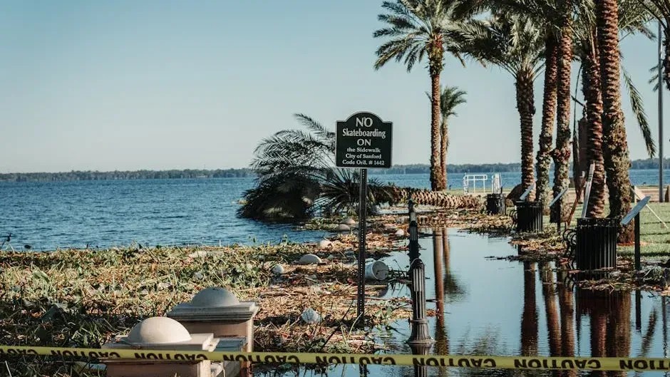
1. Florida – The Nation’s Flood Capital
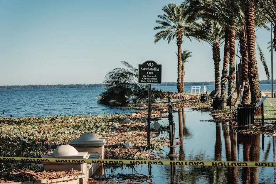
If there is one state that earns its reputation every single hurricane season, it is Florida. Florida ranks first among the most flood-prone states, with over 2.7 million residents living in high-risk flood zones. That is a staggering number, and it keeps growing.
Its geography and climate create near-perfect conditions for severe flooding, including low elevation, flat terrain that allows water to spread rapidly, and a long exposed coastline that is highly vulnerable to storm surge and sea-level rise. NOAA’s 2024 to 2025 data showed sharp increases in high-tide flooding and even so-called “sunny-day flooding,” particularly along Florida’s Atlantic and Gulf coasts.
Florida has the best access to flood insurance providers among all states, yet only roughly one in eight Sunshine State residences is actually insured against flooding. That gap between risk and coverage is what keeps emergency managers up at night.
2. Texas – Where Flood Risk Is Everywhere and Unpredictable
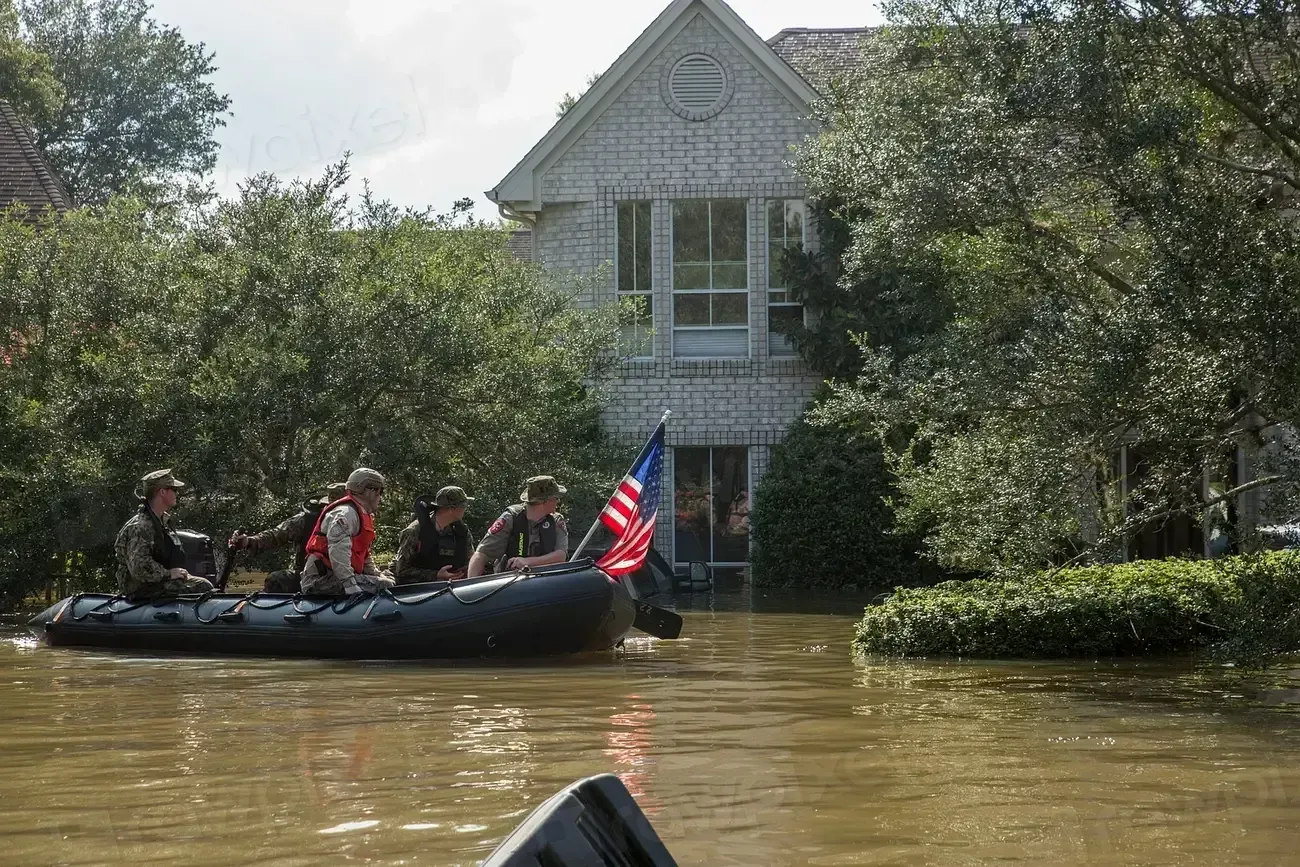
Texas is one of the states most at risk for flooding due to its enormous geographic variety and extreme weather, with approximately 1.8 million residents living in areas with substantial flood exposure. The state is essentially a whole country unto itself, with Gulf Coast lowlands, wide river basins, and dry Hill Country terrain that funnels rainwater with terrifying speed.
Texas regularly experiences some of the deadliest and most expensive flood disasters in the U.S., and the 2025 Central Texas flash floods, which devastated areas outside FEMA-designated flood zones, demonstrated how unpredictable and widespread the state’s flood risk has become.
Collectively, just five counties soak up an estimated $1.4 billion in annual river-flood losses, and three of those counties are in Texas. That alone tells you everything you need to know about the scale of the problem here.
3. Louisiana – Sinking, Literally
Louisiana’s situation is, in some ways, unique to any other state. Louisiana is dominated by low-lying wetlands, bayous, and the Mississippi River Delta, making it one of the most flood-prone states in the U.S., with a humid subtropical climate that leaves it highly vulnerable to coastal flooding from hurricanes and storm surges.
The state’s average annual financial losses due to flooding are expected to increase by nearly 150 percent between 2020 and 2050, reaching almost $2.5 billion – the highest increase tracked in Fathom’s U.S. Flood Risk Index and well above the national average.
Nearly two in five Louisiana residents are exposed to coastal flooding risk, giving the state the highest proportion of coastal flood-exposed residents in the nation at roughly 38 percent. This is a state where the ground itself is slowly sinking, a process known as land subsidence, which makes every flood event worse than the one before it.
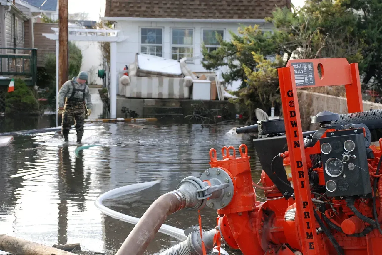
4. New Jersey – Dense Population, Enormous Coastal Losses
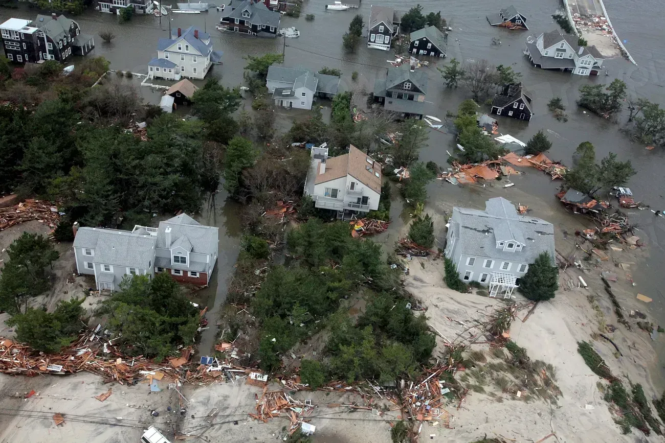
New Jersey might surprise some people on this list, but the data is hard to argue with. With 1.2 million residents exposed to flood hazards, New Jersey is consistently ranked among the top states most at risk for flooding, especially along the Atlantic Coast. The sheer density of its population magnifies every flood event into an economic catastrophe.
Research shows that New Jersey’s 17 counties could account for a staggering majority of all U.S. coastal flood losses annually, amounting to around $634 million per year. Expected annual losses per 10,000 residents are highest in New Jersey, at roughly $682,000.
New Jersey has one of the densest coastal populations in the nation, placing more homes and businesses in harm’s way, and recent 2024 to 2025 studies identify several New Jersey counties among the highest-risk coastal zones in the entire United States. Here’s the thing: those beach towns and waterfront neighborhoods that look so appealing in the summer are the exact ones most exposed in October.
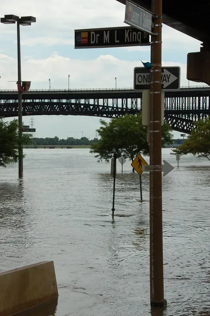
5. New York – Flash Floods in the City That Never Sleeps
New York has approximately 1.1 million residents living in high-exposure flood zones, and the state faces a combination of coastal, urban, and inland flood hazards. That diversity of flood type is what makes New York so difficult to protect – there is no single solution for a state this complex.
New York’s flood risk is increasing as storms become more intense and rainfall totals rise, with major events in 2023 and 2024 demonstrating how easily severe rain can cripple drainage systems in New York City and surrounding suburbs.
In August 2024, NBC News reported that parts of Connecticut and Suffolk County in New York were engulfed by flash floods, with Suffolk County declaring a flash flood emergency that lasted two days. Two deaths were reported and the governor declared a state of emergency, a grim reminder that urban infrastructure is simply not built for the kind of rainfall events now becoming routine.
6. North Carolina – Mountains Are No Protection
Most people assume that living away from the coast means living away from flood risk. North Carolina is a sharp lesson in why that assumption is dangerous. With roughly 1 million residents exposed to flood hazards, North Carolina is consistently ranked among the most flood-prone states in the U.S.
Mountain counties in western North Carolina, including Buncombe, Haywood, and Madison, absorbed more than 14 inches of rain during Hurricane Helene. The resulting destruction in those communities was catastrophic, wiping out roads, bridges, and entire neighborhoods that had never flooded before.
Projections of coastal flood hazards for North Carolina show that future sea-level rise combined with increasingly intense storms will create detailed new flood risk zones along the coast that did not previously exist. The state is battling on two fronts simultaneously: the mountains and the sea.
7. South Carolina – Three Major Floods in a Single Year
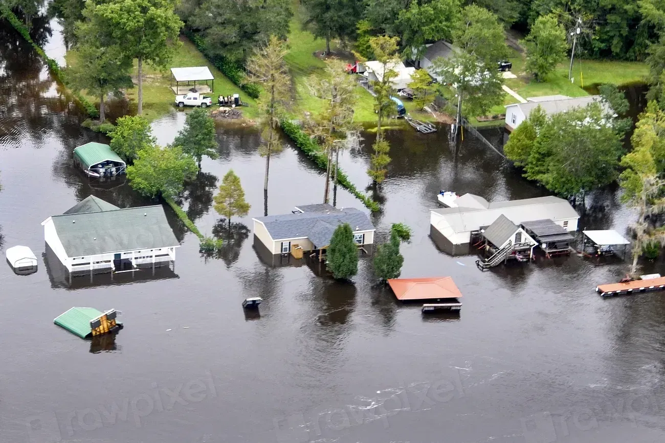
South Carolina had one of the most relentless years of flooding in recent memory. Riverine flooding has become one of South Carolina’s more common hazards, with three major events affecting the state since August 2024, including Hurricane Debby, which deposited over 15 inches of rain in Dorchester, Charleston, and Colleton counties.
Hurricane Helene then deposited over 15 inches of rain in Greenville, Pickens, and Oconee counties, causing record-breaking flooding on multiple rivers, before a non-tropical system in November 2024 dropped between 12 and 15 inches of rain in Orangeburg County over just 12 hours.
Several variations of flood hazards occur in South Carolina due to severe thunderstorms, hurricanes, seasonal rains, and other weather-related conditions, with the state’s low-lying topography and humid subtropical climate making it highly vulnerable to inland and riverine flooding. Three major flood events in under six months is not a coincidence. It is a pattern.
8. Missouri – Proving You Don’t Need an Ocean to Flood
Missouri is landlocked. No coastline, no beachfront property, no storm surge. Yet it keeps appearing on every serious flood risk list you will find. Missouri experiences some of the nation’s most severe inland flood events, and 2024 to 2025 data confirmed that rainfall intensity is rising, placing the state firmly within the group of most flood-prone states despite having no coastal exposure.
Outside of St. Louis, flooded rivers can flow at a rate of over 1.27 million gallons per second, overtaking multiple highways, knocking out utilities, and causing significant damage. That is less like a flood and more like a force of nature on an industrial scale.
Think of it this way: Missouri sits at the convergence of major American river systems, and when those rivers get too much water too fast, the results are devastating. Between 2015 and 2019, a single St. Louis suburb experienced three flood events each classified as 100-year floods. That is not bad luck. That is a changed climate.
9. Virginia – The Most Coastal Flood Events Annually
Virginia rarely tops national conversations about flood risk, which is exactly why it deserves attention here. Virginia has the most coastal flood events annually of any state, at nearly 159 events per year, leading by a wide margin over every other state. That is an extraordinary figure when you let it sink in.
The Hampton Roads region, home to one of the largest naval bases in the world, sits on some of the fastest-sinking ground on the entire East Coast. According to updated 2024 to 2025 FEMA, NOAA, and NWS flood assessments, millions more properties are now classified as vulnerable than earlier models had suggested, and the states facing these challenges are dealing with growing threats driven by extreme weather and infrastructure strain.
FEMA has been actively issuing new Letters of Final Determination for Virginia, with updated flood maps effective throughout 2025 reflecting revised flood zone designations across the state. New maps mean new realities for thousands of homeowners who previously thought they were safe.
10. Alabama – The Underestimated Risk
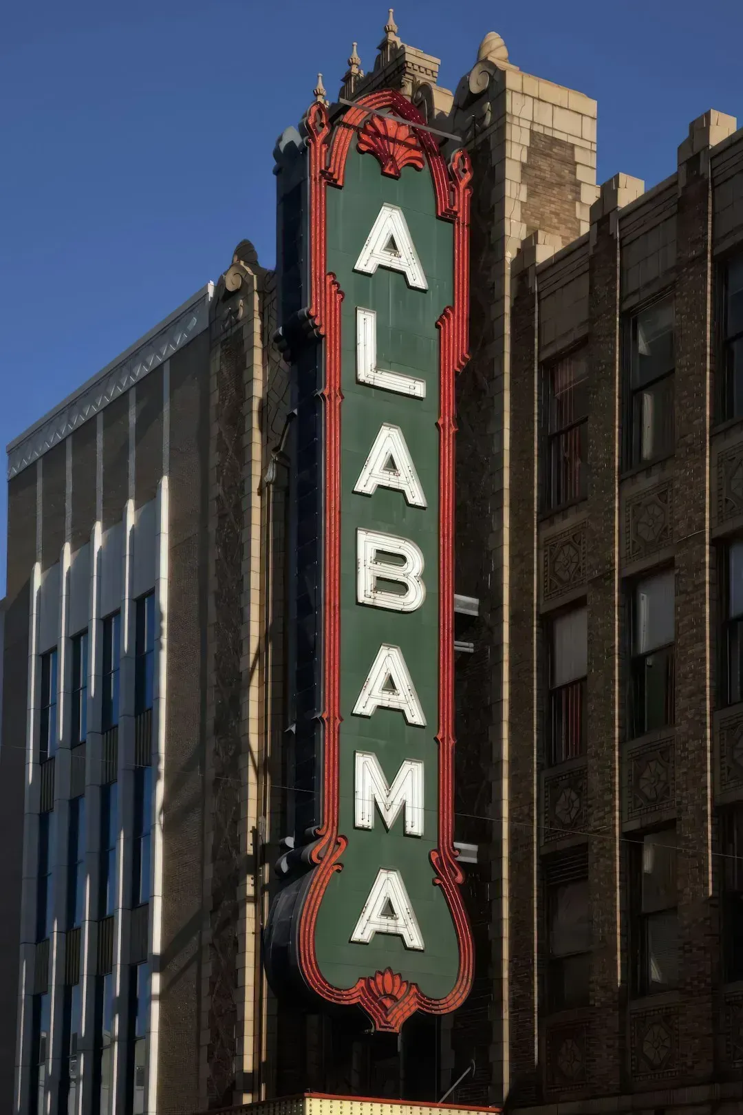
Alabama is perhaps the most underestimated state on this entire list, and that underestimation is itself part of the danger. Alabama has a varied geography ranging from sea level to over 2,400 feet in elevation, and its warm, humid climate makes it susceptible to severe weather including tropical cyclones, hurricanes, and coastal storm surges from the Gulf of Mexico.
While FEMA map coverage across Alabama is technically complete, nearly three quarters of those maps are more than 10 years old, and the average annual population exposure to flood risk is expected to increase by a dramatic 172 percent between 2020 and 2050.
Currently, only about 45 percent of Alabama’s average annual financial flood losses sit within the FEMA Special Flood Hazard Area, meaning more than half of its financial risk comes from areas where flood insurance is not mandatory and the exposure could be severely underestimated. Outdated maps, rising exposure, and low insurance rates are a dangerous combination that could leave Alabama communities deeply unprepared when the next major storm arrives.
The Bigger Picture: What the Numbers Really Mean
Updated assessments now show that 14.6 million U.S. properties face substantial flood risk, roughly 67 percent more than traditional FEMA maps had previously identified. That is not a minor correction. That is a fundamental rethinking of how exposed America really is.
Research published in Scientific Reports in 2025 found that 26 million residents in the continental United States live in federally-overlooked 100-year floodplains, with lower-income populations bearing elevated risk across all flood types. The flood crisis is also, quietly, an inequality crisis.
Flooding is responsible for roughly two-thirds of the total cost of all natural disasters in the United States. The year 2024 alone recorded 45 major flood-related billion-dollar events. When one year produces that kind of damage, it stops being an anomaly and starts being the new baseline.
The truth is uncomfortable but important: wherever you live in this country, the odds of encountering a serious flood in your lifetime are higher than they have ever been. Not every state on this list will flood tomorrow. What the data does say, loudly and clearly, is that the risk is real, it is accelerating, and far too many Americans are not prepared for it. What would you do if your home was in one of these states and the water started rising?