


- 10 Things You Didn’t Know About Ancient Climate Records Hidden in Geological Layers - March 9, 2026
- Why Scientists Track Atmospheric Carbon With Giant Towers - October 7, 2025
- The Link Between Melting Ice and Rising Sea Levels Explained - October 6, 2025
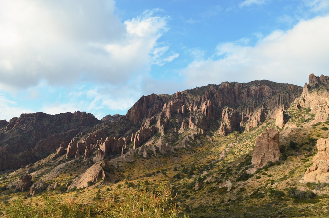
Antarctica Takes the Crown as Earth’s Ultimate Desert
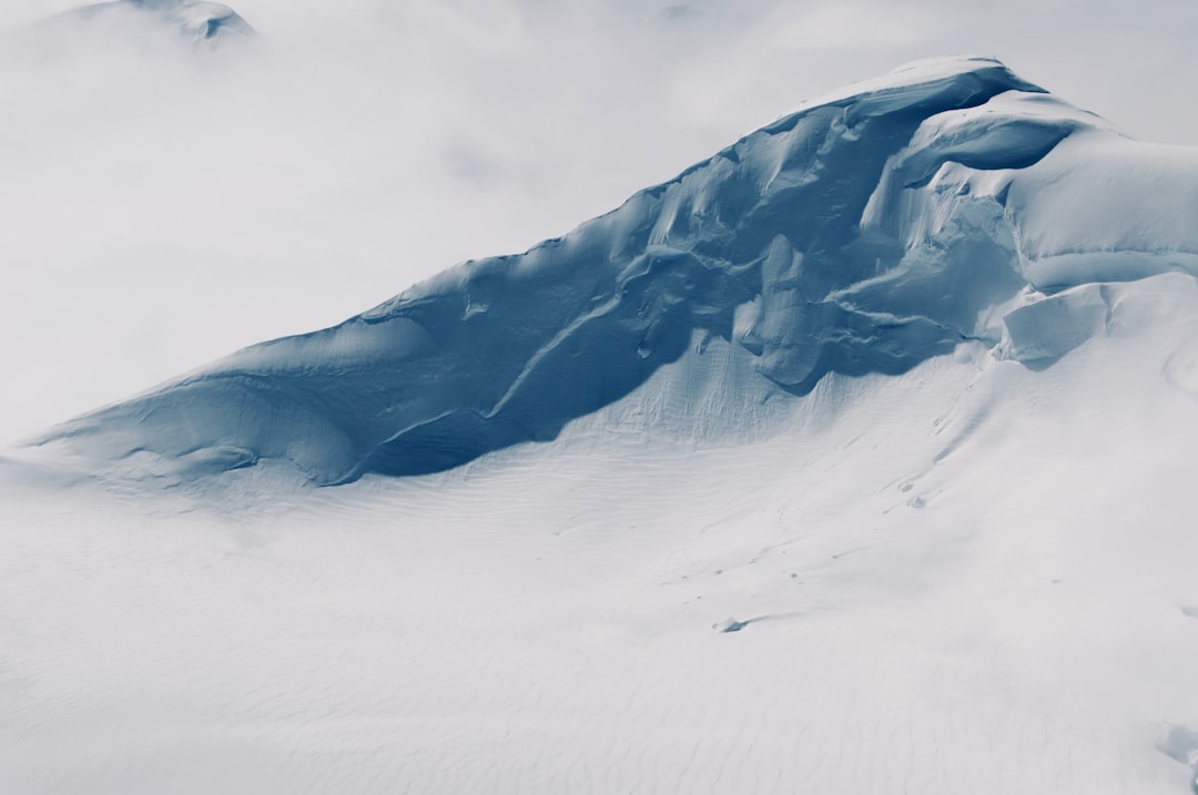
When most people picture a desert, they imagine endless sand dunes under a blazing sun. But measuring 5.5 million square miles (14.2 million sq. km), Antarctica is actually the largest desert in the world. This massive continent covers 14,000,000 kilometres and is located in the southern hemisphere. What makes Antarctica qualify as a desert isn’t heat, but rather the lack of precipitation. Although it’s covered in snow and ice, it receives extremely low amounts of precipitation, typically less than 50 millimeters per year, which qualifies it as a true polar desert.
The conditions here are absolutely brutal. The climate is dry, icy, and extremely windy, with average winter temperatures plunging below minus 60 degrees Celsius. The temperatures in the Antarctic are among the coldest on Earth, with the record low reaching -89.2°C (-128.6°F). Despite these harsh conditions, this frozen wasteland supports unique life forms and holds roughly 70 percent of the world’s fresh water, locked in its glacial ice sheets.
The Arctic Desert Dominates the North
The Arctic Desert spans a vast area of 13,900,000 square kilometers (5,366,820 square miles), making it the second-largest desert on the planet. It spans numerous northern countries, including Canada, Greenland, and Russia, measuring a whopping 5.4 million square miles (13.9 million sq. km). This polar desert experiences conditions that are equally harsh as its southern counterpart. Known for its frozen landscapes, this desert experiences long, harsh winters and brief, cool summers.
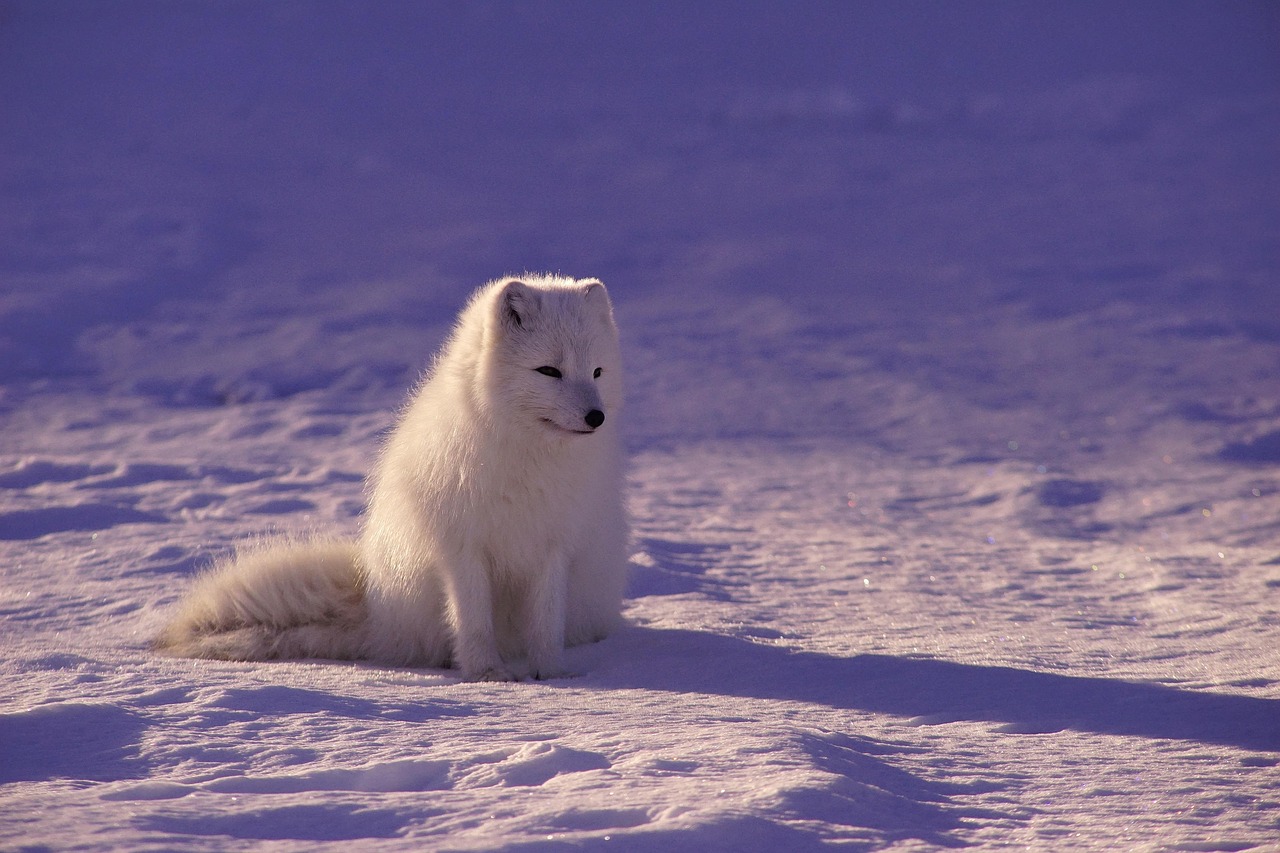
The Arctic region faces significant environmental challenges. The Arctic Desert is particularly vulnerable to climate change, with rising temperatures causing ice to melt at unprecedented rates, which has profound implications for global sea levels and ecosystems worldwide. It is characterized by permafrost, extremely cold temperatures, and a short summer season that barely thaws the icy ground, and is home to polar bears, arctic foxes, and various species of migratory birds.
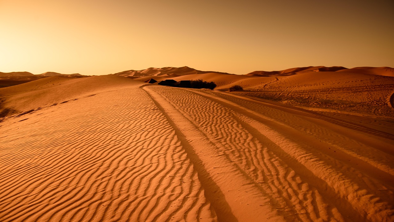
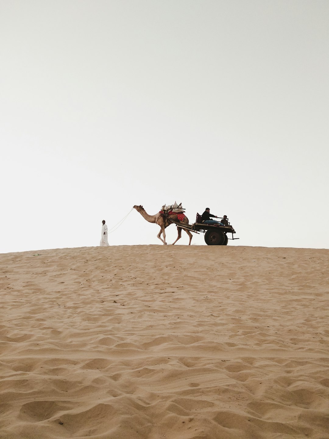
Sahara Desert Rules the Hot Desert World
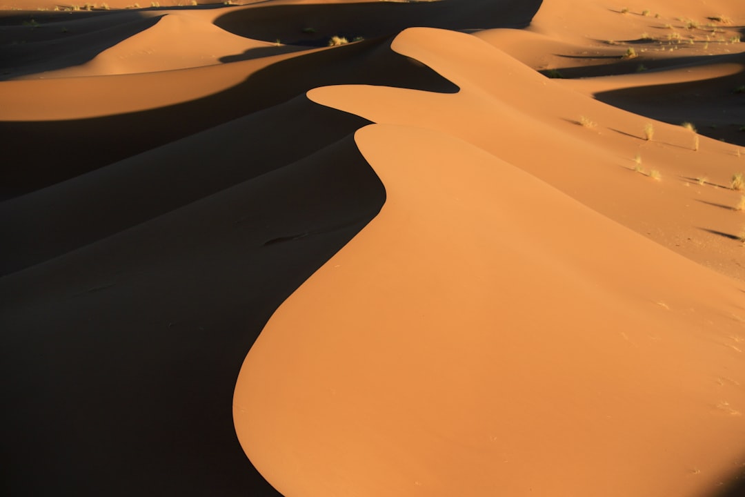
The Sahara is the largest subtropical desert in the world, clocking in at 3.5 million square miles (9 million sq. km). Spanning eleven countries, it covers nearly an entire third of Africa. This is what most people think of when they hear the word “desert” – endless golden sand dunes stretching to the horizon. It is most known for its scorching hot climate and mountainous sand dunes that reach as high as 183 meters.
The Sahara is growing larger each year. A 2018 study found that the Sahara has grown 10 percent since 1920, a trend that is expected to continue with rising global temperatures. Despite the extreme conditions, it is home to numerous desert animals, including camels, lizards, and scorpions. Water sources are rare, but the Sahara does have two rivers and twenty seasonal lakes.
Arabian Desert Holds Vast Oil Reserves

Spanning most of the Arabian Peninsula in Asia, the Arabian Desert measures approximately 1.0 million square miles (2.6 million sq. km). Covering most of the Arabian Peninsula, the Arabian Desert extends through Saudi Arabia, Oman, the United Arab Emirates, Yemen, and parts of Jordan and Iraq. It is a barren and sandy landscape, but is surprisingly rich in natural resources, such as oil and sulfur.
It includes the Rub’ al Khali, or Empty Quarter, one of the driest and most inhospitable places on Earth. The temperature extremes here are remarkable. Summer temperatures can go as high as fifty degrees Celsius during the day, but drop drastically at night. The Arabian Desert has dramatic sand dunes, rock outcrops, and extreme daily temperature shifts, and despite its harsh environment, it plays a crucial role in global energy, sitting atop vast oil reserves.
Great Australian Desert Spans Multiple Regions
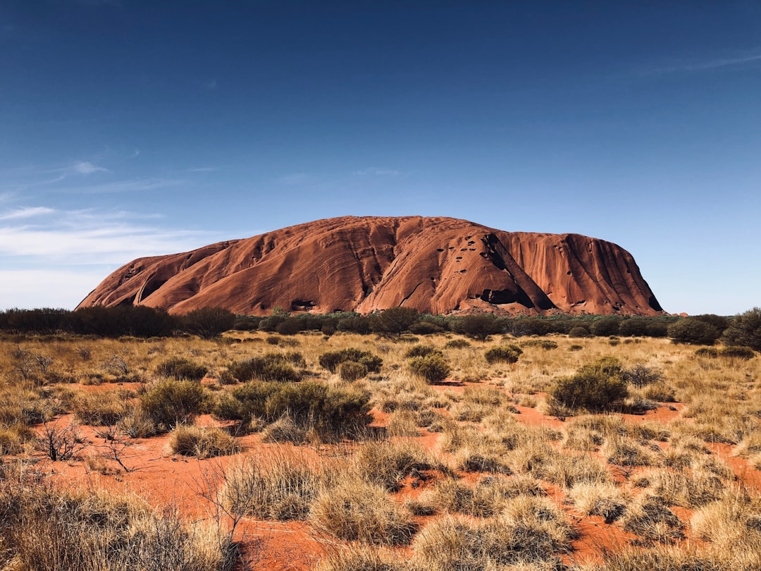
The Great Australian Desert covers an area of 1,371,000 square kilometers (529,346 square miles). The desert regions of Australia include the Great Victoria Desert, Gibson Desert, Simpson Desert, and Great Sandy Desert, which collectively form one of the largest arid zones in the southern hemisphere, located in the central and western parts of the country and known for red sands, spinifex grasses, and unique wildlife like kangaroos and desert lizards.
This massive desert complex has deep cultural significance. It is home to species like kangaroos and dingoes, alongside Indigenous Australian communities who have sustainably lived there for millennia. They are also deeply tied to Aboriginal culture, with ancient traditions and rock art linked to the land. Within this vast region, The Great Victoria is the largest desert in Australia, consisting of many small sandhills, grassland plains, areas with a closely packed surface of pebbles, and covers an area of 348,750 km2 (134,650 sq mi).
Gobi Desert Stretches Across Two Nations
The Gobi Desert spans 1,295,000 square kilometers (500,002 square miles) across China and Mongolia and is a cold winter desert, experiencing freezing winters and hot summers. Its terrain is mostly rocks and hard-packed earth, which made it a valuable trade route throughout history, and like all traditional semiarid deserts, the Gobi experiences extremely high temperatures during the summer and frigid temperatures during the winter.
It is also considered a rain shadow desert because the Himalayas block out all rainy weather. Unlike many deserts, it is mainly composed of bare rock and supports snow leopards, Bactrian camels, and unique flora. This vast rain shadow desert lies between the towering peaks of the Himalayas and the frigid steppes of Siberia; it’s an extremely cold desert with little vegetation or precipitation apart from ice and snowstorms.
Kalahari Desert Defies Traditional Desert Rules
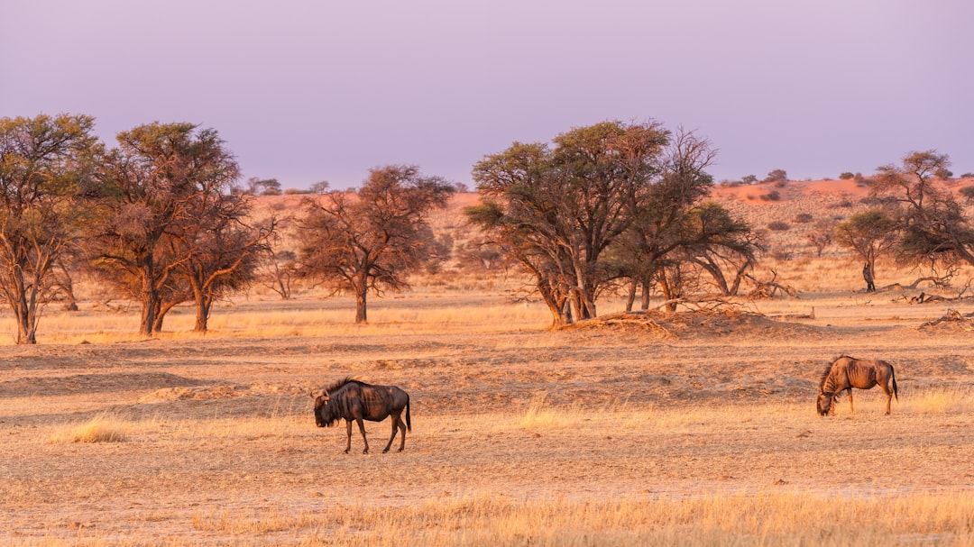
The Kalahari Desert is a large semiarid sandy savanna in Southern Africa covering 900,000 km2 (350,000 sq mi) including much of Botswana as well as parts of Namibia and South Africa. What makes the Kalahari unique is that it is not a desert in the strictest sense of the word – it is a semi-desert, with the driest areas receiving 110–200mm of rain per year and the wettest areas can receive more than 500mm in very wet years.
It is the second-largest African desert after the Sahara and the sixth-largest in the world in terms of area. The name itself tells a story. Kalahari is derived from the Tswana word Kgala, meaning “the great thirst”, or Kgalagadi, meaning “a waterless place”. Perhaps unexpectedly, all three African big cats can be found here – cheetah, leopard and the famous black-maned Kalahari lions.
Patagonian Desert Sits Between Mountains and Ocean
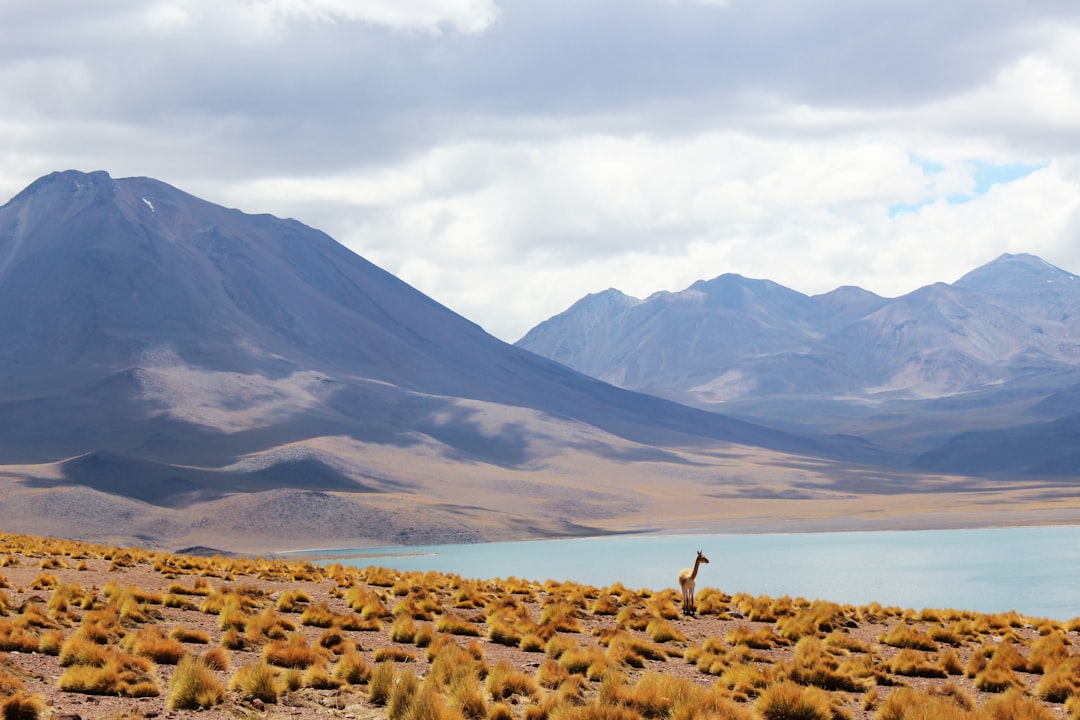
Located in Argentina, the Patagonian Desert – also known as the Patagonian Steppe – is the sixth largest desert in the world, measuring roughly 0.26 million square miles (0.67 million sq. km). To the west lie the Andes, the world’s longest mountain range, and to the east, the Atlantic Ocean. This positioning creates unique weather patterns that define the desert’s character.
The Patagonian Desert in South America covers an area of 260,000 square miles (673,000 square kilometers) across Argentina and Chile, backdropped by the imposing Andes Mountains and the Patagonian Steppe, and this semi-arid desert teems with diverse plants and animals, including the Southern Beech Tree and the Patagonian Cypress. As a semiarid desert, it shares similar characteristics with the Gobi desert, with frost covering the ground during the winter season, but snow is unusual due to the dryness of the region.
Great Basin Desert Dominates the American West
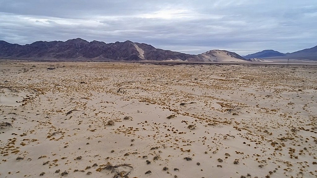
The Great Basin Desert, the largest U. S. desert, covers an arid expanse of about 190,000 square miles and is bordered by the Sierra Nevada Range on the west and the Rocky Mountains on the east, the Columbia Plateau to the north and the Mojave and Sonoran deserts to the south. Encompassing the better part of 200,000 square miles, the Great Basin Desert is the largest desert in the United States and the second-largest in North America after the Chihuahuan, covering most, but not all, of the physiographic realm of the Great Basin itself.
It takes up most of Nevada, while its fringes lie in northeastern California, southeastern Oregon, southwestern Idaho, and western Utah, and is a cold desert. Wildfires caused by lightning are common in this desert, and you’ll find many endangered species such as the Least Tern, Sodaville Milkvetch, Ute lady’s tresses, Lahontan cutthroat trout, Desert dace, White River spinedace and the Utah prairie dog.
Chihuahuan Desert Claims North American Size Record
With an area of about 501,896 km2 (193,783 sq mi), it is the largest hot desert in North America. The Chihuahuan Desert is a desert ecoregion designation covering parts of northern Mexico and the southwestern United States, occupying much of far West Texas, the middle to lower Rio Grande Valley and the lower Pecos Valley in New Mexico, and a portion of southeastern Arizona, as well as the central and northern portions of the Mexican Plateau.
This desert holds remarkable biodiversity. According to the World Wide Fund for Nature the Chihuahuan Desert may be the most biologically diverse desert in the world as measured by species richness or endemism. The Chihuahuan Desert boasts 3,000 plant species, including more than 500 of the world’s 1,500 species of cactus, and also harbors North America’s largest prairie dog colony as well as nesting sites and migratory habitats for more than 500 bird species.
Thar Desert Bridges Two Nations
Also known as the Great Indian Desert, the Thar Desert covers an area of 200,000 km2 (77,000 sq mi) on the Indian sub-continent and is often considered a natural boundary between India and Pakistan, with about 85% of it being in India. Temperatures range from freezing in winter to over 50º C in summer.
Despite the harsh conditions, the Thar supports diverse wildlife and human communities. There are several protected areas in the Thar Desert that are home to the great Indian bustard, blackbuck, chinkara, fox, Bengal fox, wolf, caracal, sand grouse, and partridge, with human settlements often near wells or streams. The extreme temperature variations make survival challenging, but both animals and humans have adapted over thousands of years to thrive in this environment.
Understanding What Makes These Regions Deserts
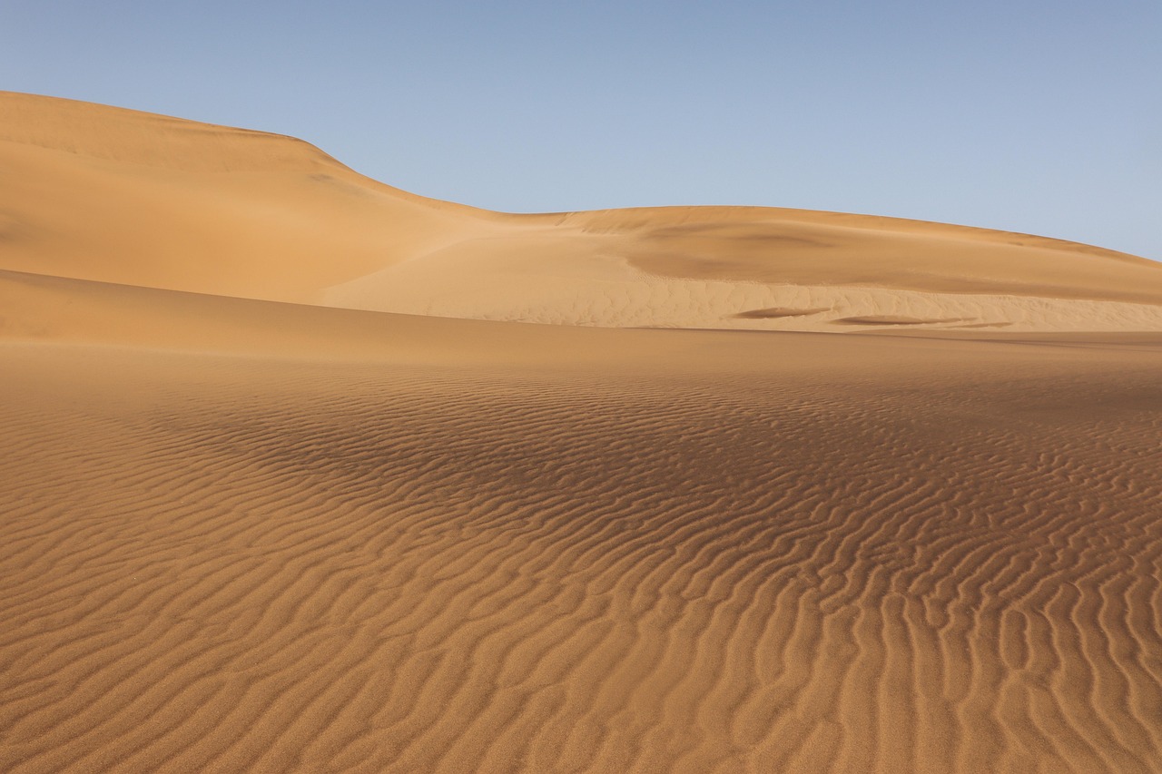
A desert is a landscape or region that receives very little precipitation – less than 250 mm per year (about ten inches). Approximately 1/3 of Earth’s land surface is a desert. What’s fascinating is how diverse these environments can be. Deserts are often envisioned as wide, open stretches of sand under a blistering sun, but in reality, they are much more diverse, spanning across every continent, presenting a variety of climates and ecosystems.
The largest deserts challenge our preconceptions about what these environments look like. The two largest deserts on Earth are in the polar areas, with the Antarctic Polar Desert covering the continent of Antarctica and having a size of about 5.5 million square miles. These measurements remind us that Earth’s largest deserts aren’t necessarily the hottest places – they’re simply the driest, where life must adapt to the fundamental challenge of finding and conserving water.