


- The Overlooked Downsides of Massive Solar Farm Expansion - May 29, 2026
- Why These 8 Once-Predictable U.S. Weather Patterns Are Rapidly Changing - May 29, 2026
- How Unusual Weather Is Bringing Rare Animals Into View - May 29, 2026
For most of the 20th century, American weather had a kind of rhythm to it. Winters arrived on schedule in the upper Midwest, spring brought steady rains to the plains, and hurricane season peaked reliably in September. Farmers, city planners, and emergency managers built their routines around that predictability. That rhythm is now breaking down in ways that scientists are only beginning to fully understand.
The changes are not subtle adjustments at the margins. From 1980 to August 2024, the U.S. experienced 396 weather and climate disasters where overall damages reached at least $1 billion. That number alone tells you something fundamental has shifted. What follows is a look at eight weather patterns that Americans once took for granted, and why each of them is now behaving differently.
1. The Polar Jet Stream: From Steady River to Erratic Meander
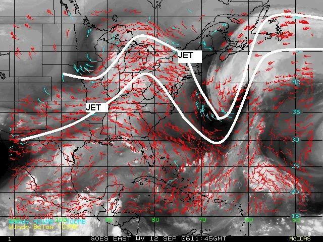
The polar jet stream is a high-altitude air current flowing at elevations between 8 and 12 kilometers that moves at very high speeds across the Northern Hemisphere. Its role is to separate cold air masses from warm ones. Under normal conditions, it follows a relatively straight path, but for several decades it has been slowing down and losing its shape, its once subtle undulations becoming increasingly pronounced.
A recent study found that amplified planetary waves in the jet stream, which can cause weather systems to stay in place for days or weeks, are occurring three times more frequently than in the 1950s. When the jet stream flows steadily west to east, weather systems move predictably. When it develops large waves, weather becomes more extreme and unpredictable. The consequences of that shift ripple across almost every other pattern on this list.
2. Winter Temperatures: The Season That Is Warming Fastest

Meteorological winter is the fastest-warming season for most of the U.S., with locations across the Northeast and the Great Lakes region seeing some of the highest rates of winter warming since 1970. Since 1970, average winter temperatures have increased in nearly all of the 244 cities analyzed, with winters warming by 3.9°F on average from 1970 to 2025.
Winters have warmed most dramatically in cities across the Upper Midwest, where the average rise has been about 5.4°F, Alaska at 4.8°F, and the Northeast at 4.8°F. The top warming locations include Burlington, Vermont at 8.1°F and Milwaukee, Wisconsin at 7.3°F. Warming winters affect snowfall, water supplies, winter sports, spring allergies, summer fruits, and more. The downstream effects touch nearly every corner of daily life.
3. Summer Heat Waves: More Frequent, More Extreme

Record highs now occur twice as often as record lows across the continental United States, while the average rate of heat waves has tripled since the 1960s. All 10 of the warmest years on record occurred between 2014 and 2023, until 2024 shattered global heat records and became the hottest year yet.
Nearly 210 million Americans live in counties vulnerable to health threats from unexpectedly high summer temperatures. The June 2025 heat dome subjected more than 255 million Americans to extreme heat. Extreme heat is the nation’s deadliest weather-related threat, straining hospitals and power grids and hitting older adults and low-income communities the hardest. What once ranked as a rare, memorable summer event now arrives with regularity.
4. The Jet Stream’s Effect on Flash Flooding
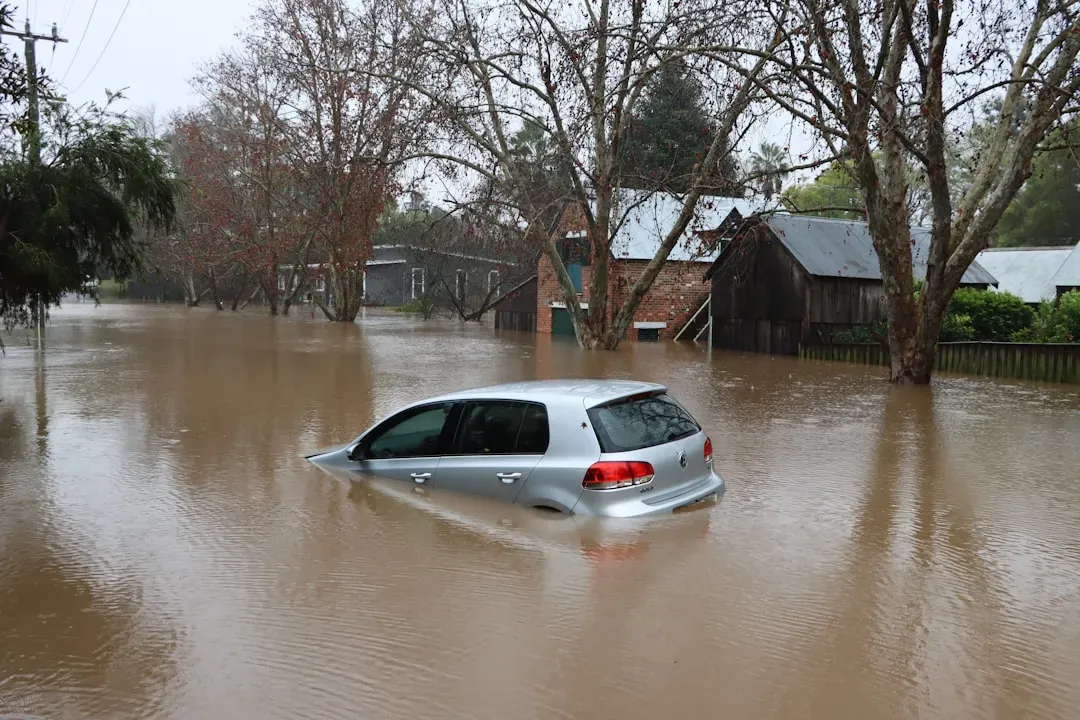
The summer of 2025 brought unprecedented flash flooding across the U.S., with the central and eastern regions hit particularly hard. These storms claimed hundreds of lives across Texas, Kentucky, and several other states and caused widespread destruction. During the summer of 2025, the jet stream formed a large southward loop over the southern United States, steering extremely violent storm systems toward the country’s mid-latitudes. Trapped within the loop, these storms produced stationary torrential rainfall.
U.S. weather services recorded humidity levels described as “extraordinary” in 2025. Climate warming increased evaporation from the Gulf of Mexico, and this moisture became locked inside jet stream loops, with the warm, humid air also fueling summer thunderstorms. Compared to the beginning of the 20th century, precipitation events are stronger, heavier, and more frequent across most of the United States.
5. Western Drought: The Old Rules No Longer Apply
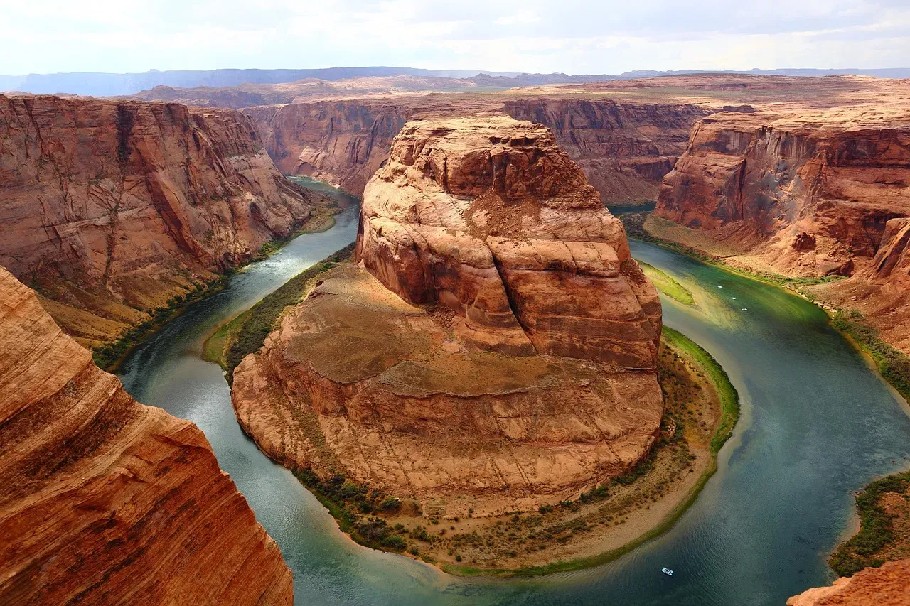
In the last century, the principal causes of drought in the western U.S. were periodic deficiencies in rainfall and snowfall. Since 2000, however, the principal driver of drought has become the steadily warming atmosphere. Research found that climate change accounts for roughly four-fifths of the increase in evaporative demand since 2000, and during drought periods that figure rises to more than 90 percent, making it the single biggest driver of increasing drought severity.
By late 2025, the U.S. Drought Monitor showed 100 percent of the Colorado River Basin in drought. The Colorado River Basin lost about 27.8 million acre-feet of groundwater between 2002 and 2024, roughly equal to the storage capacity of Lake Mead. Droughts can now form even if precipitation patterns remain within a normal range, as higher temperatures and evaporation remove water from soils. They last longer, cover wider areas, and grow more severe with every incremental rise in temperature.
6. Atlantic Hurricane Intensity: Fewer Storms, But Far More Powerful
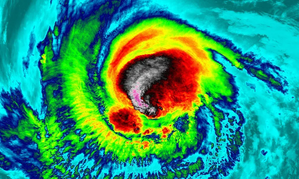
The 2024 Atlantic hurricane season became the third-costliest on record, behind only 2017 and 2005. It featured 18 named storms, 11 hurricanes, and five major hurricanes, and was the first since 2019 to feature multiple Category 5 hurricanes. Climate Central found that the wind speeds of those storms were increased by 9 to 28 miles per hour by water that was as much as 2.5°F warmer because of the changing climate.
Researchers found that all 2024 hurricanes rapidly intensified due to ocean heat. Category 5 Hurricane Milton’s winds intensified by 95 mph in just 24 hours in the Gulf of Mexico. Human-caused climate change has generally made storms more intense, wetter, and slower-moving, so they drop more rain. The hurricane of a given category today is a fundamentally more dangerous storm than one carrying the same label several decades ago.
7. Autumn: A Season That Is Effectively Lengthening Summer

Fall has warmed in 237 U.S. cities by 2.8°F on average from 1970 through 2024. Unusually warm fall days now happen more often in nearly all of the 243 cities analyzed, with 98 percent of locations recording that trend. When summer heat lingers into fall it extends health risks to athletes and outdoor workers from extreme heat, and those most at risk for heat-related illness include children. An extended peak heat season also brings higher cooling demand.
Hotter falls mean a longer wildfire season. Wildfire risk, as measured by the frequency of hot, dry, and windy fire weather, is getting longer and more intense, particularly in the western U.S. In November 2025, temperatures were above to much above average throughout most of the western and central U.S., with Idaho, Nevada, Oregon, Texas, and Utah setting new statewide records for November average temperatures.
8. Arctic Amplification and Its Knock-On Effects Across the Country
The Arctic has been warming two times faster than the planetary average, which increases the risk of persistent extreme rainfall events. Weaker jet streams also meander more, producing larger waves and more erratic behavior. By winter, high-altitude warming over the North Pole can disrupt the polar vortex, affecting the lower-altitude jet stream and leading to episodes of intense winter weather affecting eastern North America.
A study published in Nature Communications found a correlation between the loss of Arctic ice and jet stream oscillations between 1979 and 2022. Snow and ice cover at the poles have a proven influence on atmospheric behavior, and if Arctic ice continues to melt, the jet stream is likely to become even more unstable, with its waves growing larger, particularly in winter, leading to stronger weather blocks and more extreme events.
As the global climate continues to warm, extreme weather events driven by erratic jet stream behavior are expected to become more common. Combined with additional moisture that warmer oceans and air masses supply, these events will intensify, producing storms that are more frequent and more destructive to societies and ecosystems. The patterns that once made U.S. weather broadly foreseeable are now in a state of genuine, measurable flux, and what replaces them is still being written.
