


- I Asked AI Which Coastal Towns Won’t Exist in 50 Years – Here’s the List It Gave Me - August 21, 2026
- 8 Energy-Saving Habits That Take Only Minutes to Start - August 21, 2026
- 12 Sustainable Home Improvements That May Add Long-Term Value - August 21, 2026
Curiosity got the better of me one evening while reading about rising sea levels for the third time in a week. I wondered what would happen if I simply asked an AI system to name the coastal towns most likely to vanish within the next half century. Not as a party trick, but as a real question grounded in flood maps, government reports, and the kind of slow-motion disasters that rarely make front-page news.
What came back wasn’t science fiction. It was a list built almost entirely from places that scientists, engineers, and local councils have already flagged, sometimes for decades. Some of these towns have residents who have voted to leave. Others are still fighting, one seawall at a time.
Isle de Jean Charles, Louisiana
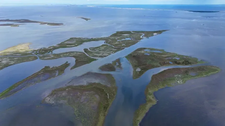
This narrow strip of land in Terrebonne Parish is often cited as the starting point for any conversation about American climate displacement. Isle de Jean Charles, a narrow strip of land about 90 miles southwest of New Orleans in Terrebonne Parish, Louisiana, has lost 98 percent of its landmass to rising waters of the Gulf of Mexico since 1955, when tracking began. Scientists predict the island will disappear in 50 years. The island’s shrinkage is not a mystery; oil and gas canals let saltwater into once-freshwater marsh, and upstream levees cut off the sediment that used to rebuild the land naturally.
In 2016, the federal government stepped in with real money rather than just warnings. In January 2016, the U.S. Department of Housing and Urban Development awarded the state of Louisiana $48.3 million to rebuild a new town about 40 miles north of Isle de Jean Charles — aptly named “New Isle.” Progress has been slower than anyone hoped, and many longtime residents remain reluctant to leave the only home their families have known for generations.
Fairbourne, Wales
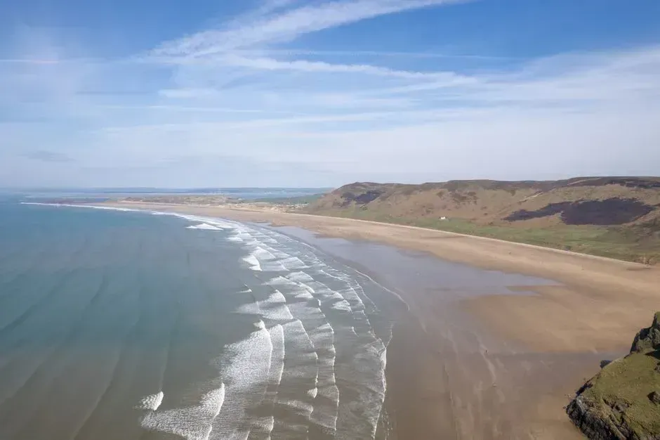
Fairbourne sits on the North Wales coast, home to roughly seven hundred people who built their lives on land that was never particularly friendly to begin with. Built in the 1850s on a low-lying saltmarsh, Fairbourne already lies beneath sea level at high spring tide. Local authorities decided back in 2014 that maintaining flood defenses indefinitely simply would not make financial sense, and they set a target date for what planners call managed retreat.
Authorities say that by 2054, it would no longer be sustainable to keep up flood defenses there because of faster sea level rises and more frequent and extreme storms caused by climate change. The announcement alone caused property values to fall almost overnight, long before a single wave actually reached anyone’s front door. Villagers describe a strange kind of limbo, waiting for a deadline that keeps shifting while nobody has offered a clear resettlement plan.
Happisburgh, Norfolk, England
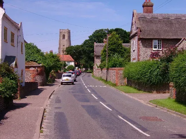
Happisburgh has become something of a textbook case for coastal erosion in the United Kingdom, and not the kind anyone wants to teach from. Happisburgh is experiencing the most dramatic loss of coast. The ground is going at a rate of 10 metres a year and sudden subsidence can lead to a dramatic loss of ground overnight. The soft, layered cliffs here simply cannot hold their ground against North Sea storms the way harder rock formations elsewhere manage to.
The scale of the loss becomes clear when you look at recent history rather than centuries-old records. During the last 20 years, 34 homes have crumbled into the water in Happisburgh because of coastal erosion. Government funding for coastal defenses has largely dried up here, leaving residents to watch their gardens, and sometimes their neighbors’ entire houses, disappear one storm at a time.
Shishmaref, Alaska
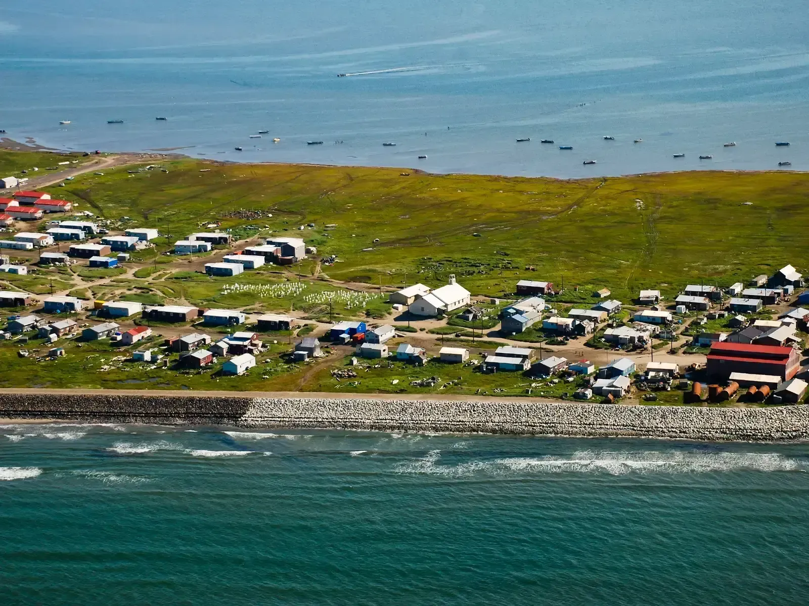
This Inupiat village sits on a barrier island just north of the Bering Strait, closer to Siberia than to most of mainland Alaska. Residents of Shishmaref, Alaska voted to relocate their coastal village due to erosion, which is expected to worsen as a result of climate change. The four-mile long island is losing shoreline at a rate of 10 to 30 feet per year. Warmer temperatures have melted the permafrost that once anchored the island and thinned the sea ice that used to blunt storm surges.
Moving an entire community is never cheap, and Shishmaref’s case proves it. More recent estimates are that over $25 million has been spent to attempt to hold back the sea in Shishmaref. Despite a formal vote in favor of relocation, funding for an actual move has remained frustratingly out of reach for years.
Newtok, Alaska
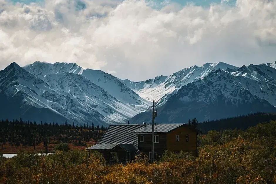
Newtok holds a somewhat unusual distinction: it was one of the earliest communities anywhere to recognize its own predicament and start planning around it. In 1994, Newtok was one of the first villages to consider relocating to a new, less vulnerable site. In 2003, Newtok negotiated a land exchange that eventually led to a new settlement called Mertarvik, located about nine miles away on more stable ground.
The relocation has actually been happening, slowly, which sets Newtok apart from many of its neighbors. Moving the entirety of Newtok to its new location is anticipated to cost an estimated $80–130 million. Thawing permafrost and worsening storm surges continue to eat away at the old village site even as families gradually shift to the new one.
Kivalina, Alaska
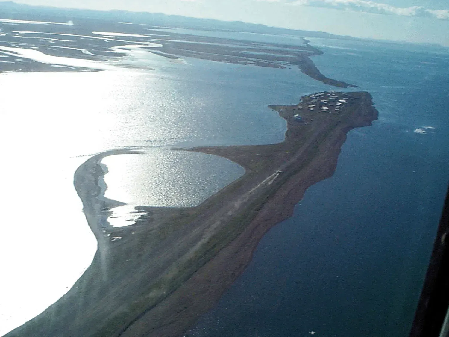
Kivalina rarely gets the same media attention as Shishmaref, but it faces nearly identical pressures on a similarly exposed barrier island. Federal auditors have grouped it among the most urgent cases in the state. The U.S. Government Accountability Office has identified thirty other coastal villages in Alaska that may need fast-paced relocations to escape erosion and melting permafrost. At least 12 Native Alaskan villages have elected to explore relocation as a viable alternative as their towns are swallowed by the sea. These sites include Newtok, Kivalina, Shishmaref, Shaktoolik and several others further inland.
What makes Kivalina’s situation particularly difficult is the lack of an obvious relocation site with the right combination of stable ground and access to traditional hunting and fishing grounds. Researchers studying the region note that biophysical stability alone isn’t enough; any new location also has to preserve the cultural and subsistence practices that define daily life. Until a workable site is agreed upon and funded, Kivalina’s residents remain in a holding pattern, watching the shoreline retreat a little more with each storm season.
South Tarawa, Kiribati
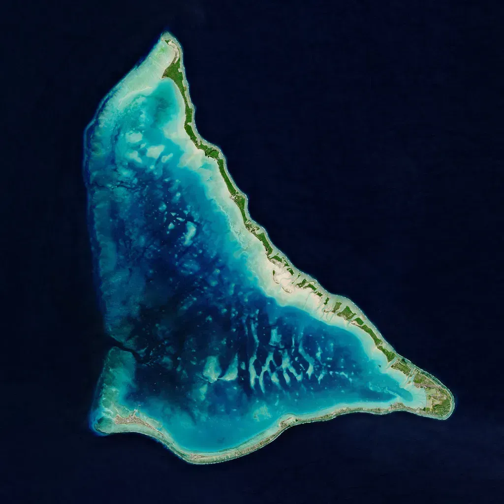
South Tarawa is the crowded capital atoll of Kiribati, a Pacific nation where the highest ground in many areas sits only a few meters above sea level. Unlike most towns on this list, the entire country shares the same vulnerability, which has pushed Kiribati’s government to think decades ahead rather than town by town. Officials have spent years exploring contingency options abroad, including purchasing land in nearby Fiji, in case large-scale relocation ever becomes unavoidable.
What makes South Tarawa stand out globally is less about any single dramatic event and more about the sheer narrowness of its margin for error. There is very little elevation to spare, and even modest tidal surges can push seawater across roads and into freshwater wells that the population depends on. Kiribati has become something of a symbol in international climate negotiations precisely because its predicament is so difficult to argue away.
Venice, Italy
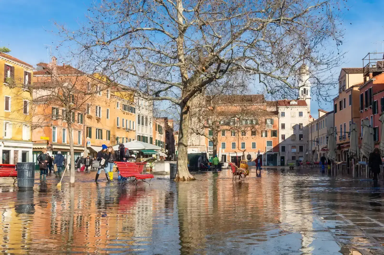
Venice’s relationship with water has always been complicated, but the balance has shifted noticeably in recent decades. The city sits on a lagoon and has been slowly subsiding for generations, a problem made worse by rising sea levels pressing in from the other direction. High-water events, known locally as acqua alta, have become more frequent and more severe, flooding St. Mark’s Square and low-lying neighborhoods with growing regularity.
Italy’s response has been the MOSE barrier system, a network of mobile floodgates designed to hold back the worst of the tidal surges. It has already prevented several serious floods since becoming operational, buying the historic center valuable time. Long-term projections remain less reassuring for outlying islands and lower districts, where engineers acknowledge that even the best barrier system has limits against a sea that keeps climbing.
Miami Beach, Florida
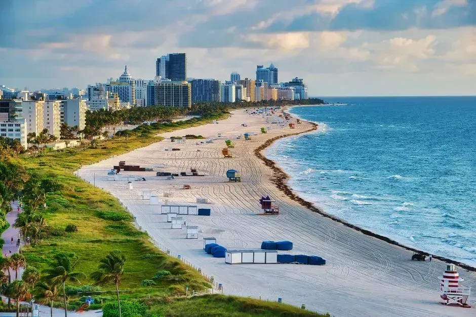
Miami Beach sits on a low, porous barrier island, which makes it especially vulnerable in ways that go beyond simple flooding. King tide events already push seawater into streets during clear weather, and rising groundwater has started intruding into the freshwater aquifer that much of South Florida depends on for drinking water. The city has spent heavily on raising roads and installing pumping stations to keep neighborhoods livable in the near term.
Engineering can only do so much when the underlying geology works against you. Porous limestone bedrock allows water to seep upward from below, meaning traditional seawalls offer only partial protection. Climate researchers who study South Florida generally agree that the region’s long-term outlook depends heavily on how quickly global emissions are curbed in the coming decades, rather than on any single infrastructure project.
