


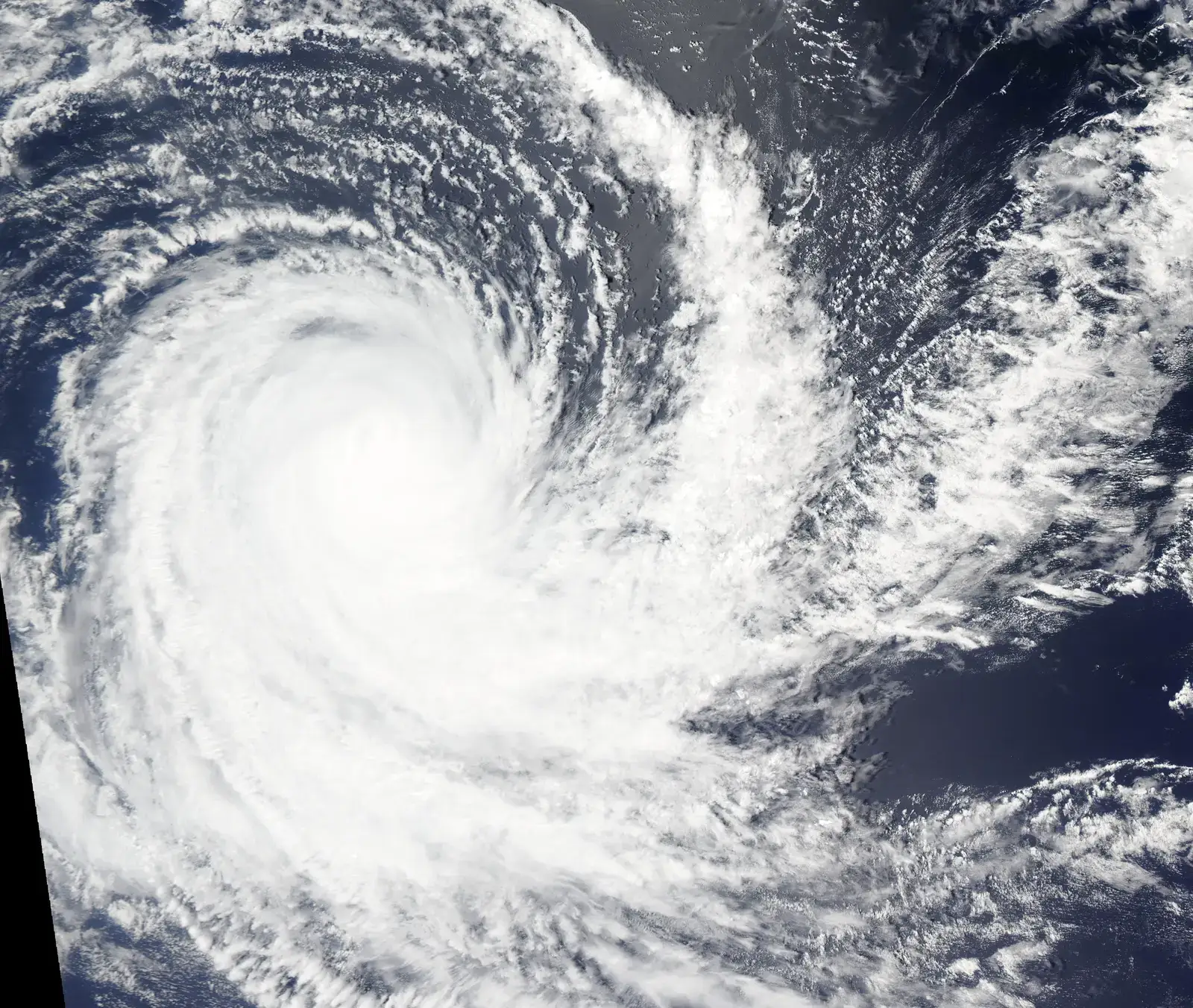
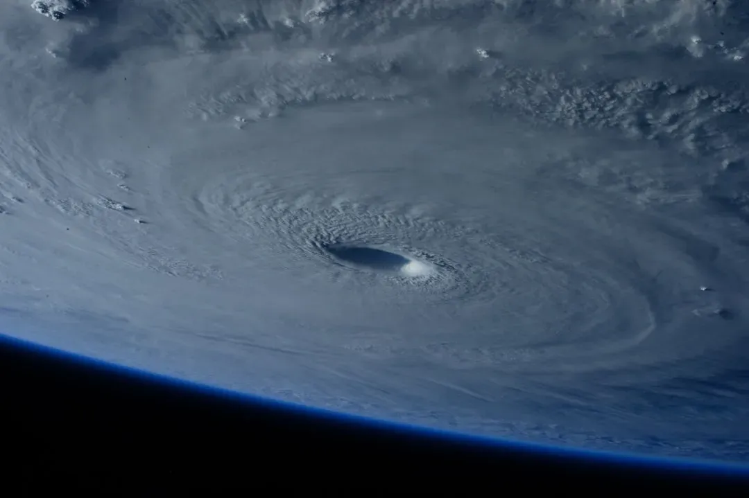
Something unusual is happening in the tropical Pacific Ocean right now, and climate scientists are paying very close attention. What started as a quiet transition out of a La Niña phase earlier this spring has rapidly accelerated into one of the most closely watched ENSO developments in recent memory. NOAA’s Climate Prediction Center has placed the ENSO Alert System on El Niño Watch, with an 82% chance El Niño emerges in the May–July 2026 window and a 96% chance it continues through Northern Hemisphere winter 2026–27. Those are striking numbers – and they keep rising with each monthly update.
What makes this situation feel genuinely different is not just the timing but the potential magnitude. NOAA’s latest outlook suggests there is an almost 60% chance this El Niño could become strong by fall, and at least a one-third chance it could become a “super El Niño,” one in which ocean surface temperatures are at least 2 degrees Celsius warmer than average. That would place it among only a small handful of events ever recorded. Here’s what the science says about how we got here, what’s driving this, and what it might mean for the world.
The Rapid Shift From La Niña to El Niño Watch
As of early April 2026, the El Niño–Southern Oscillation system was in a neutral phase, following the end of the 2025–26 La Niña. That transition has been faster and more emphatic than most forecasters initially expected. NOAA issued an El Niño Watch on March 12, citing favorable conditions for its development over the next six months. Within weeks, the pace of change in the tropical Pacific had already begun to exceed those cautious early estimates.
The central and eastern equatorial Pacific waters continue to warm toward El Niño following the La Niña that was in place since last summer. In its regular monthly outlook released May 14, NOAA-CPC said one model ensemble average suggests El Niño could form as soon as June. A June onset would be notably early, arriving well ahead of the typical late-summer or autumn emergence that forecasters had originally penciled in for this cycle.
What’s Physically Driving the Early Warmth

The ocean beneath the surface tells an especially revealing story. The warm reservoir was shaped by a burst of wind activity in early 2026. Normally, the Pacific trade winds blow from east to west along the equator. But in April, a pair of cyclones straddling the equator caused the wind direction to reverse, triggering a downwelling Kelvin wave – a pulse of energy beneath the ocean surface moving eastward – that has now reached the eastern Pacific, fueling intense warming off South America.
Climate scientist Daniel Swain says the predictive models are onto something because the volume and intensity of the subsurface warm water anomalies are about as large as we’ve seen in the historical record. Another factor boosting confidence in this intense El Niño are surges of westerly winds near the equator in the western Pacific – known as westerly wind bursts – which are pushing warm waters onto the equator and driving them eastward, contributing to rapid warming.
How Strong Could It Actually Get?
Several ensemble model forecasts suggest this El Niño could eventually top out over 2.5 degrees above average by autumn, placing it among the most intense on record. The European Centre for Medium-Range Weather Forecasts has published even more dramatic projections. The latest outlook from ECMWF shows water temperatures in a key region of the central equatorial Pacific potentially reaching 3 degrees Celsius above average late in the year.
University of Albany professor and El Niño expert Paul Roundy noted that “the present state is close to the conditions at the same time in 1997,” referring to the 1997–98 event that ended up being one of the handful of super El Niños since 1950. However, scientists urge caution. Michelle L’Heureux, a physical scientist at NOAA’s Climate Prediction Center, told ABC News that “there is substantial uncertainty in the ultimate strength of El Niño,” noting that while there is a 2-in-3 chance of a strong or very strong El Niño for the November–January 2026–27 season, there is still a 1-in-3 chance of an event weaker than that.
A Rare Breed: What “Super El Niño” Actually Means

El Niño’s strength is measured by how far water temperatures rise above average in a patch of the equatorial Pacific Ocean, and weak conditions develop once the temperature rises over 0.5 degrees Celsius above average. Water temperatures must be more than 2 degrees above average for it to be considered a very strong or Super El Niño. Events reaching that threshold are genuinely rare. There have been only five super El Niños since 1950, the last occurring in 2015–16. They also occurred in 1997–98, 1991–92, 1982–83 and 1972–73, with super El Niños also documented in 1888–89 and 1877–78.
University of Albany’s Paul Roundy wrote that “confidence is clearly shifting higher on potentially the biggest El Niño event since the 1870s.” That kind of historical framing is striking, though scientists are careful to note that forecasting confidence is still building. The current forecasts for 2026–27 still span a wide range in mid-May – from expecting weak to strong El Niño conditions – and how the winds behave in the coming weeks will determine what develops.
A Warming World Changes the Equation

Even setting aside the question of how powerful this El Niño becomes on its own terms, the backdrop against which it’s arriving makes it categorically different from past events. Climate scientist Daniel Swain said the effects of El Niño “will be amplified considerably by the now nearly 1.5°C of global warming experienced as of 2026,” adding that “in modern human history, we’ve never experienced a strong or very strong El Niño event amid pre-existing conditions that were this warm globally.”
A previous El Niño helped drive average global temperatures in 2024 to a record 1.55°C above preindustrial levels. Now, based on temperature datasets from five different research groups, Carbon Brief predicts that 2026 is likely to be the second-warmest year on record, virtually certain to rank among the four warmest, with a 19% chance of surpassing 2024. The development of a strong El Niño event later this year would substantially increase the chance that 2027 will be the warmest year on record.
Global Weather Impacts: What to Expect Region by Region
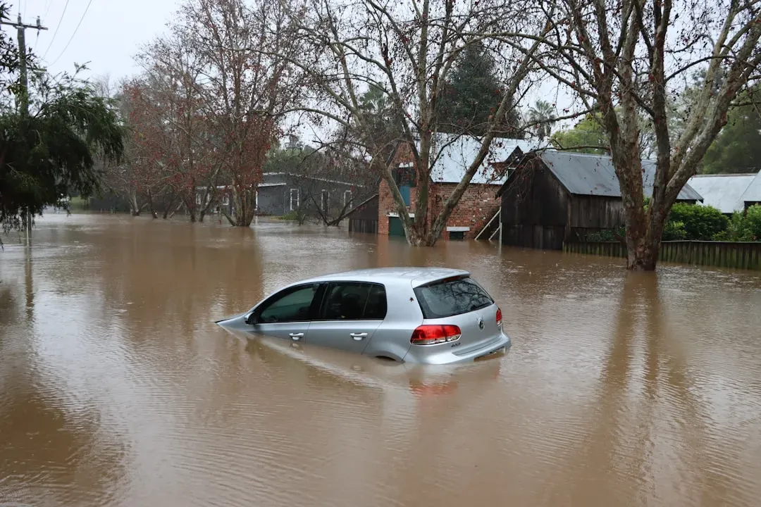
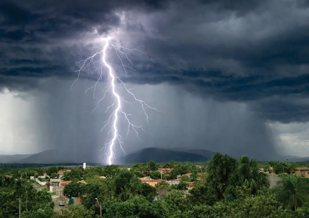
El Niño reshuffles weather patterns across virtually every inhabited continent. Droughts and heat waves can flourish in some regions, fueling wildfire danger and water supply concerns, while others are swamped by flooding rainfall. The summer monsoon season in South Asia could be weaker, and the fall and winter could bring drought conditions to parts of the Amazon and Australia, while in the U.S., parts of the South might see more rain and cooler temperatures, and the northern areas could experience warmer-than-average temperatures.
Winter 2026–27, from December through February, is where forecasters expect the most dramatic impacts, with strong El Niño events historically bringing 150 to 200 percent of normal rainfall to some regions. Other impacts arrive later, toward the end of the year when El Niño peaks, bringing extreme rainfall to parts of South America between November and January, while in Southeast Asia, scorching heatwaves often emerge even later, in April of the following year.
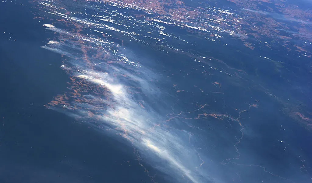
Wildfire Risk at a Critical Juncture
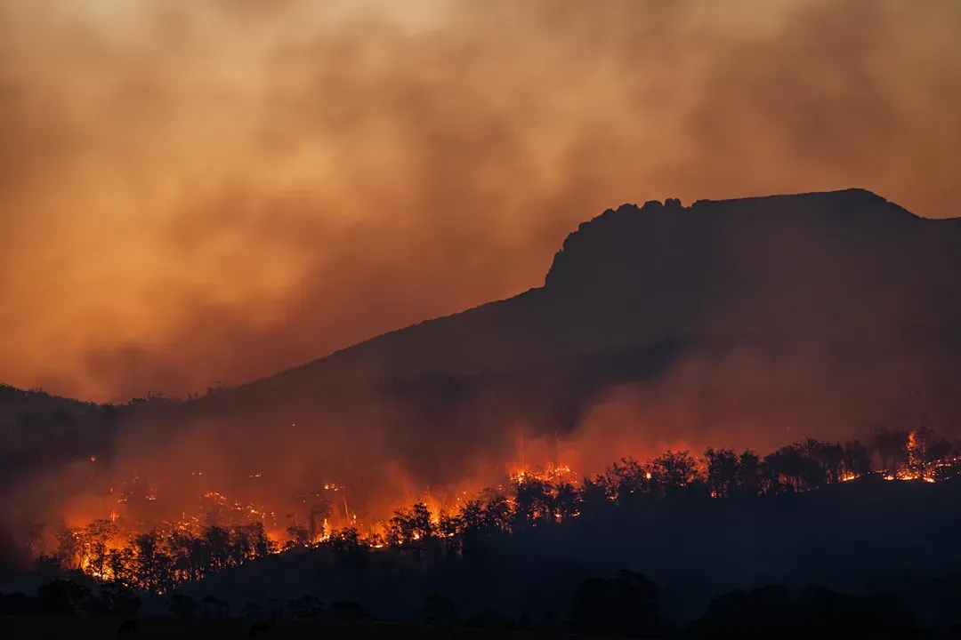
Even before El Niño fully takes hold, 2026 has already been a remarkable year for fire. Since the start of 2026, wildfires have burned more than 150 million hectares globally – double what burned in the same period in 2024 – with the WMO warning that the planet is “more out of balance than at any time in observed history.” That’s a deeply alarming baseline for what a strong El Niño could amplify.
The emergence of a powerful El Niño event could have a major effect on supercharging wildfires by increasing the likelihood of seeing severe hot and dry conditions in Australia, the U.S. and Canada, as well as the Amazon rainforest. One researcher noted that “the likelihood of harmful extreme fires potentially could be the highest we have seen in recent history, if a strong El Niño does develop.” Fire risk isn’t just a seasonal inconvenience; its downstream health and economic consequences can extend for months beyond the flames themselves.
The Hurricane Season Wild Card
Typically, El Niño impacts the Atlantic basin by increasing upper-level wind shear, which creates a more hostile environment for storm development and can reduce the overall number of tropical systems. Forecasters are largely aligned on this point for the 2026 season. The AEM/WeatherWorks meteorology team predicts 6 to 12 named storms, with 2 to 4 becoming hurricanes and 1 to 3 reaching major hurricane intensity. That’s well below recent averages.
Still, a quieter season on paper doesn’t guarantee safety. University of Miami professor Ben Kirtman noted that “if the onset of El Niño comes in a little late, then the effect on Atlantic wind shear would be minimal.” El Niño conditions do not guarantee a quieter hurricane season – they were in place during the peak of 2023’s season, but extremely warm ocean temperatures acted like rocket fuel, allowing systems to develop and thrive despite increased wind shear. In the Pacific, the story runs in the opposite direction, with eastern and central Pacific hurricane seasons typically more active during strong El Niños.
Why the Uncertainty Still Matters

It’s important to hold both truths at once: the signals are strong, and the uncertainty remains real. We’ve seen this scenario play out before – in both 2014 and 2017, forecast models were pointing toward strong El Niño conditions by midyear. In both cases, the anticipated wind patterns never fully materialized and El Niño either stayed weak or returned to a neutral state. The early signals were real, but the expected follow-through didn’t happen.
NOAA’s CPC said confidence in El Niño occurrence has increased since last month, but the strength forecast remains unresolved, with no peak-strength category exceeding a 37% chance. The strongest El Niño events in the historical record are characterized by significant ocean-atmosphere coupling through summer, but it remains to be seen whether that coupling develops in 2026. The coming weeks of wind and ocean behavior will be decisive – and scientists will be watching every data point closely as this situation continues to evolve.
Preparing Before the Peak
The science of El Niño forecasting has improved dramatically over the past two decades, and one of its greatest practical values is the lead time it gives communities to prepare. In regions like India, decisions about how to respond to El Niño risks cannot wait for more certainty – communities need to prepare water infrastructure now in case El Niño means the monsoon season brings too little rain. The window between a forecast and the onset of impacts is precisely when preparation is most effective.
For now, the clearest and most honest summary of where things stand comes directly from NOAA’s own scientists. Michelle L’Heureux of NOAA’s ENSO team stated there is “a 2-in-3 chance of a strong or very strong El Niño during the November 2026 to January 2027 season,” while cautioning that “these odds will shift in the months ahead depending on how El Niño evolves,” and that “there is still enough uncertainty that seeing a weaker outcome would not be a surprise.” In an era when background warming has already rewritten the climate record books, even a moderate El Niño arriving on today’s warmer baseline carries consequences that would once have required an extreme event to produce. Whatever strength this one ultimately reaches, the world is right to take it seriously now.