


The numbers alone are hard to ignore. In 2024, the U.S. experienced 27 weather and climate disasters that each incurred losses exceeding $1 billion, ranking second highest for the number of such events in a calendar year. Climate-driven disasters in the United States are becoming more common, with 90 major disaster declarations in 2024 – almost double the 30-year average of 55 per year.
The long-term rise in billion-dollar disasters reflects both the increasing frequency and intensity of extreme weather and the growing number of people, homes, and businesses exposed to these hazards. Accelerated development in fire-prone areas, along coasts, and in floodplains can multiply the damage from extreme events. Some parts of the country, though, are bearing a disproportionate share of that rising toll. Here’s where experts say vulnerability is climbing fastest.
Southern California: A Region Defined by Fire and Fragility
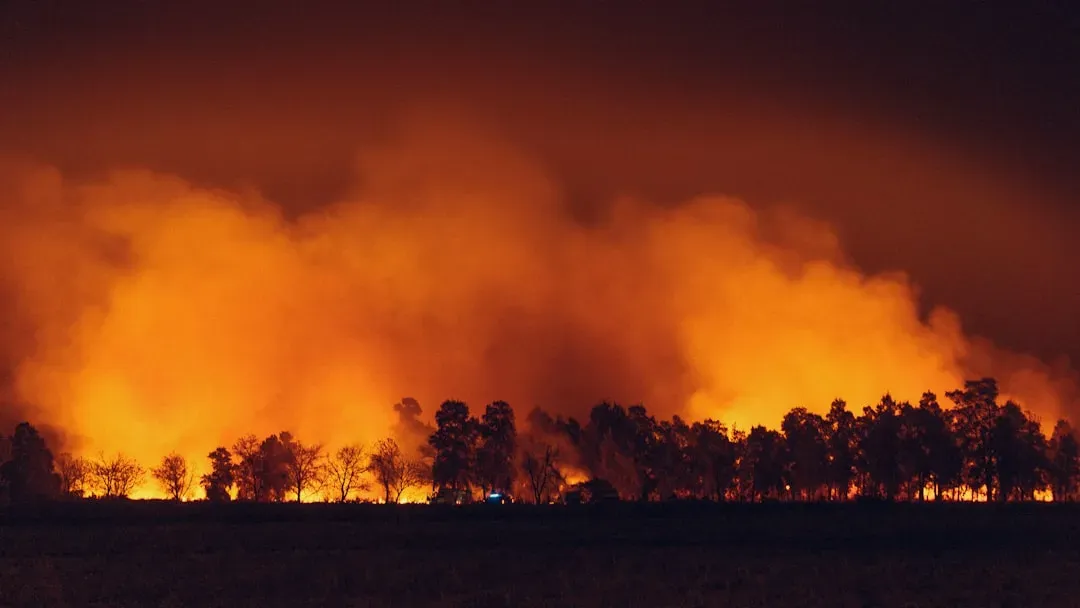
The January 2025 wildfires in Los Angeles were the costliest disaster of 2025, causing $61.2 billion in damage and becoming the costliest wildfire in U.S. history. Supercharged by global heating, more than a dozen fires raged across the Los Angeles metropolitan area and around San Diego, driven by hot Santa Ana winds reaching speeds of 100 mph. Hundreds of thousands of people were evacuated and more than 16,000 homes and other buildings were destroyed.
By late December 2024, most of Los Angeles County had entered moderate drought status, creating heightened fire vulnerability due to desiccated vegetation in what was traditionally the region’s wet season. Los Angeles is a prime example of how urban expansion into fire-prone areas creates heightened risk. Homes built near wildland areas are increasingly vulnerable to fires, especially during dry conditions. California’s largest utilities have also struggled to adapt, as have insurers, some of which have fled the market. That’s forced hundreds of thousands of homeowners to obtain coverage from the FAIR Plan, the state’s insurer of last resort for properties in high-risk wildfire areas.
Florida’s Gulf Coast: Storms, Surge, and Sinking Ground
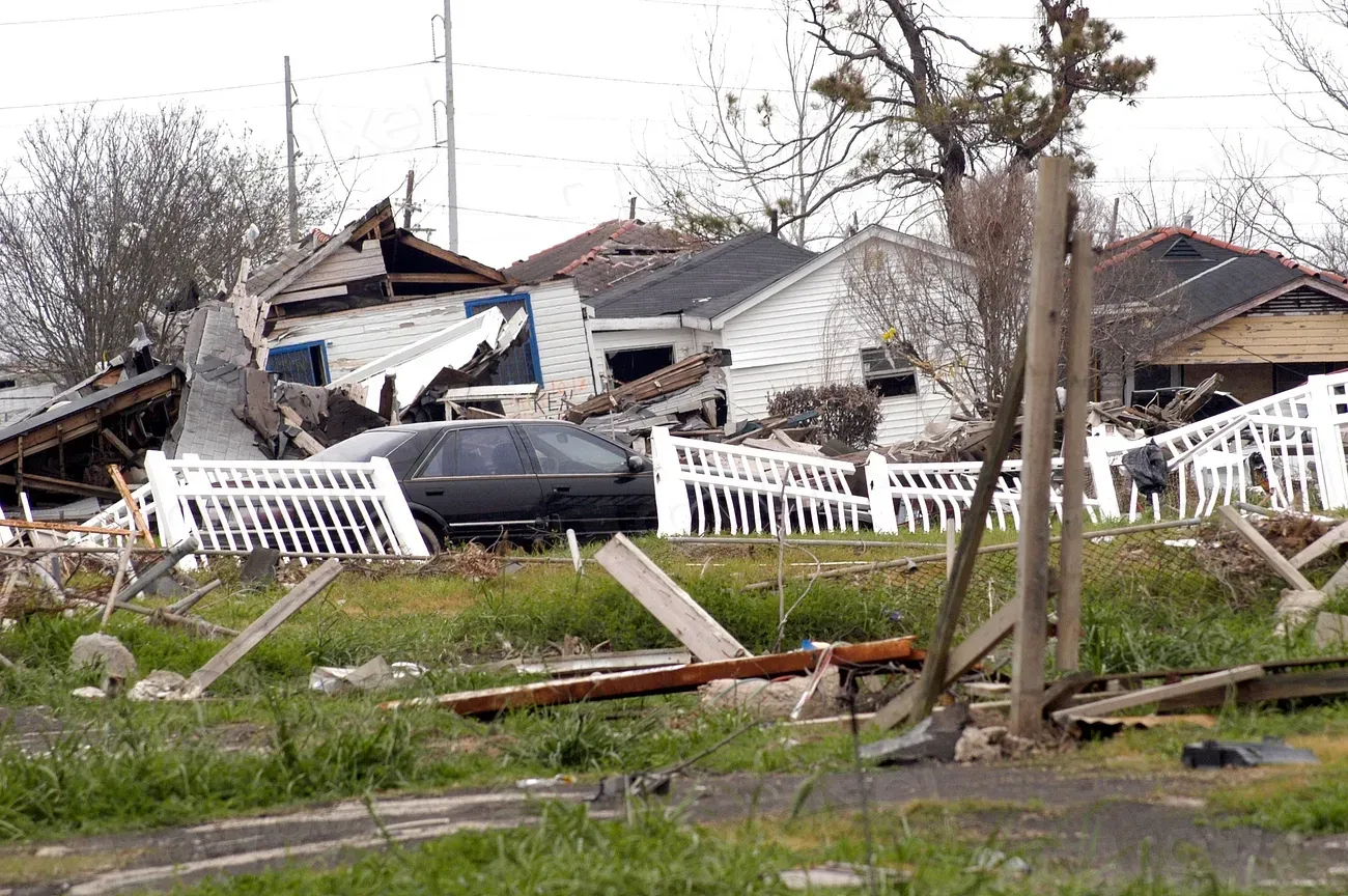
Hurricane Helene was the costliest event in 2024. It made landfall as a Category 4 storm in the Big Bend region of Florida, caused catastrophic flash flooding and power outages impacting millions of people from Florida to North Carolina, and resulted in at least 219 fatalities. Helene was the deadliest Atlantic hurricane since Maria in 2017, and the deadliest to strike the U.S. mainland since Katrina in 2005. The estimated total cost reached $78.7 billion.
Over the past few decades, global sea levels have been rising by a little more than 3 mm per year on average, but current rates of rise on the Gulf Coast exceed the global average. Some parts of the Gulf Coast are experiencing up to 10 mm per year of relative sea-level rise. By far, the greatest threats to Florida’s Gulf Coast come from hurricanes that are now developing more abruptly and becoming larger and more intense. It is not just the winds that threaten but the storm surges they generate. The low-gradient continental shelf fronting Florida’s entire west coast amplifies storm surges to a much greater extent than steeper coastal shelves.
South Florida and Miami: Sea Level Rise on the Front Lines
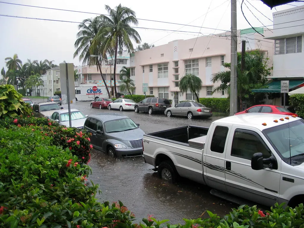
Climate change and sea level rise are long-term stresses that will amplify other issues in the county, from intensifying storm events and hurricanes to impacting human health and social vulnerability. By 2040, sea levels around Miami are expected to be 10 to 17 inches higher than 2000 levels. That kind of rise sounds gradual until you factor in what it does to storm surge during a major hurricane.
Analysis indicates that significant portions of the population, economic activity, and critical facilities are in contemporary and future hurricane storm-surge hazard zones. The addition of sea level rise to contemporary storm-surge hazard zones effectively causes population and asset exposure to be equal to or greater than what would be in the hazard zone of the next higher hurricane category. Across the northern U.S. Gulf Coast, the rate of relative sea level rise is greater than the global average, largely due to land subsidence, where the land is sinking due to physical and human activities.
The Southeast’s “Dixie Alley”: Tornado Risk Is Shifting Here
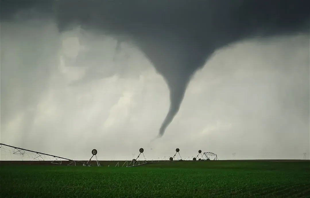
The geographic center of American tornado activity may have shifted hundreds of miles eastward into the densely populated Southeast. Now, in what is being called the New Tornado Alley, the risk to human life and property is significantly higher. Many experts argue that this shifting corridor now runs through the Mississippi River valley and the Southeast, including Alabama, Arkansas, Illinois, Indiana, Kentucky, Mississippi, Missouri, and Tennessee.
Night tornadoes are more frequent in states like Mississippi and Alabama. They are twice as deadly as daytime tornadoes, in part because people are asleep and more likely to miss critical alerts. The region also has a large share of the nation’s mobile homes, which aren’t designed to withstand tornadoes and if damaged, may disproportionately affect low-income residents. Climate change increasing severe storms in the Southeast further exacerbates the threat of year-round tornadoes, with milder temperatures extending tornado season well into the winter months.
Texas: A State Caught Between Drought and Deluge
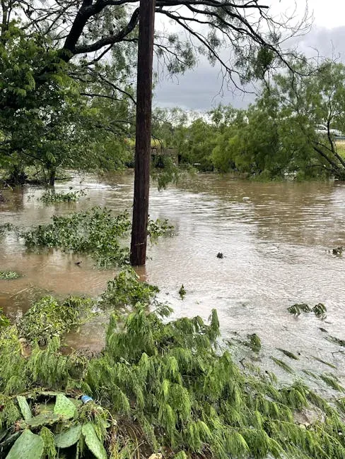
Weather whiplash of extraordinary proportions affected central Texas in early July 2025. An exceptional and prolonged drought that led to reduced agricultural yields, livestock losses, and low water availability was abruptly followed by a 1-in-1,000-year precipitation event. The 20 Texas counties included in the early July 2025 flood disaster declaration had been experiencing drought since late 2021, the second longest such uninterrupted period of drought in U.S. Drought Monitor records. This included 180 weeks of at least severe drought and 105 weeks with exceptional drought somewhere in those counties.
The U.S. saw a record number of flash floods in 2025, which included the deadly July floods in Texas. Heavier rainfall extremes and more inland flood hazards marked the year. Texas, Florida, and Louisiana disasters have each cost more than $300 billion in damages in inflation-adjusted 2024 dollars since 1980. The state’s geography places it squarely in the path of multiple converging climate threats at once.
The Pacific Northwest: Wildfires, Drought, and Low Snowpack
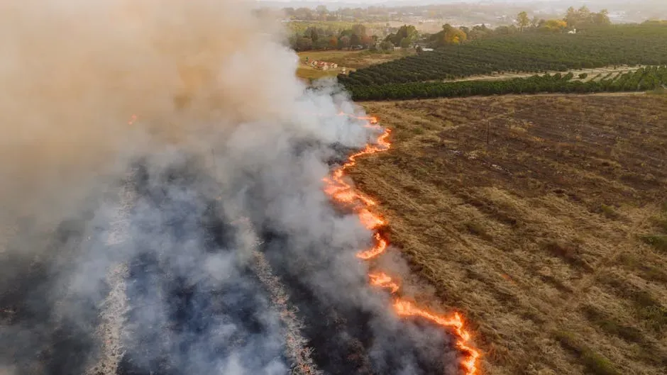
The Pacific Northwest, after Oregon’s warmest winter since 1934 and snowpack near one third of normal, faces heightened wildfire risk, with critically low soil moisture projected across parts of the Rockies and inland Northwest. Above-normal risk of significant wildland fires has been forecast in Hawaii, the Pacific Northwest, portions of California and Nevada, and New England, according to the National Interagency Fire Center.
Research shows that climate variability can alter the frequency and intensity of certain types of extreme weather – most notably the rise in vulnerability to drought and lengthening wildfire seasons in western states. More frequent hot, dry, and windy fire weather conditions are boosting wildfire risks across the U.S., and as the climate continues to warm, certain conditions favorable to thunderstorms are occurring more often, with severe weather activity expanding into historically less-active seasons and regions.
The Gulf Coast Beyond Florida: Louisiana and Compounding Disasters
Between 2011 and 2024, 40 states representing roughly four-fifths of the U.S. recorded ten or more major disaster declarations. In 28 of those states, every single county experienced at least one disaster. Louisiana consistently ranks among the most disaster-burdened states, facing a combination of hurricane strikes, subsiding coastlines, and chronic flooding that strips away land year after year.
The increasing number and cost of weather and climate disasters in the U.S. result from a combination of increased exposure, vulnerability, and changes in the frequency of some types of extreme weather. The rate of relative sea level rise along the northern Gulf Coast is greater than the global average, largely due to land subsidence where the land is sinking due to physical and human activities. That sinking ground, combined with intensifying storms, puts Louisiana’s coastal communities in a particularly precarious position with each passing decade.
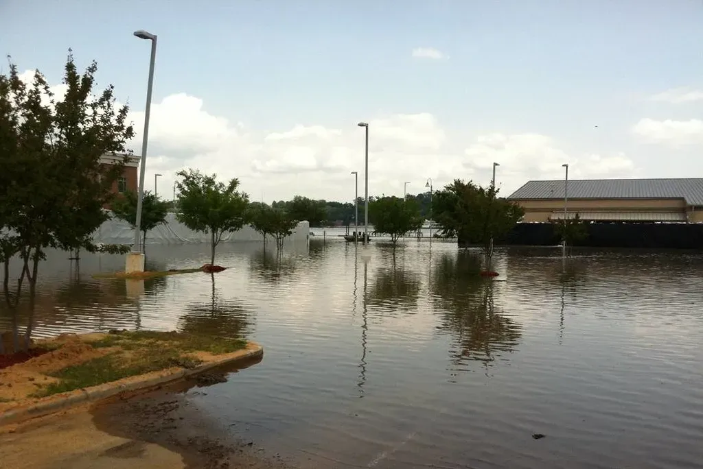
The Central Mississippi Valley: Flooding and an Understated Risk
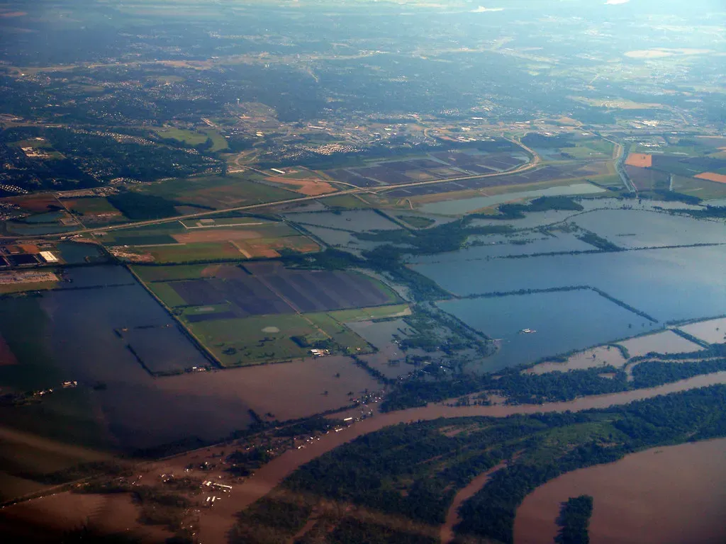
In April 2025, extreme heavy rainfall in the Central Mississippi River valley led to catastrophic flooding and widespread damage across Mississippi, Arkansas, Missouri, Illinois, Indiana, Kentucky, Tennessee, and Alabama. A rapid analysis found that human-caused climate change made this exceptional heavy rainfall more likely and more intense.
Extremely dry conditions across the Ohio River Basin and southern portions of the Midwest in mid-2025 led to rapid drought expansion and decreased flows on the Ohio River and portions of the Lower Mississippi River. By mid-September, the Ohio River was contributing only about eight percent of the overall water flow in the Lower Mississippi, compared to its typical fifty percent contribution. Climate change is supercharging the water cycle, bringing heavier rainfall extremes and higher inland flood risks across the U.S., with the air able to hold roughly four percent more moisture for every degree Fahrenheit of warming.
The Southwest: Heat, Prolonged Drought, and a Diminishing Water Supply
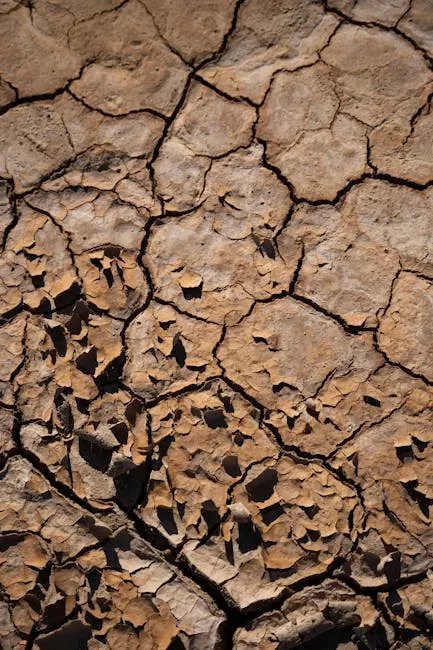
Much of the West started and ended 2025 in drought. From the catastrophic wildfires in Southern California to historic low-water levels on the Mississippi River and record-low streamflow in the Northeast, drought and its impacts touched nearly every corner of the country. Extreme low precipitation and record high temperatures over a four-year stretch ending in mid-2025 were principal drivers of drought in central Texas and the broader Southwest, with precipitation in the lowest tenth percentile and temperatures the highest on record.
Forecasters expect drought to expand across the West and south-central Plains as 2026 progresses. A recent study from the University of Chicago estimates a more than 90 percent chance that U.S. disaster damage between 2026 and 2030 will exceed $500 billion, and a more than fifty percent chance that it will surpass $1 trillion. For the Southwest, where water infrastructure was built for a different climate era, that trajectory represents a slow-motion crisis as much as a sudden one.