


- Phantom Energy Sucking Power 24/7 – 7 Home Electronics Quietly Inflating Utility Bills - November 14, 2026
- A Million-Mile Storm Raging for Centuries – 6 Violent Weather Wonders in Our System - November 14, 2026
- Animals Flee Hours Before the Tremor – 7 Natural Warnings Before Disasters Strike - November 14, 2026
Most people picture the San Andreas Fault as a slow, patient threat – something California lives with the way a city lives with flood risk, aware but not alarmed on any given Tuesday. The reality in 2026 is considerably more complicated. A run of recent research has revealed a fault system behaving in ways that challenge old assumptions, push stress measurements into historically unprecedented territory, and quietly rewrite what scientists thought they understood about how the “Big One” might actually unfold.
What follows isn’t speculation or Hollywood disaster framing. These are findings from peer-reviewed research, USGS analysis, and university studies published between 2024 and 2026 – and several of them have caught even veteran seismologists off guard.
1. Stress Levels Along the Southern Segment Have Reached a 1,000-Year High
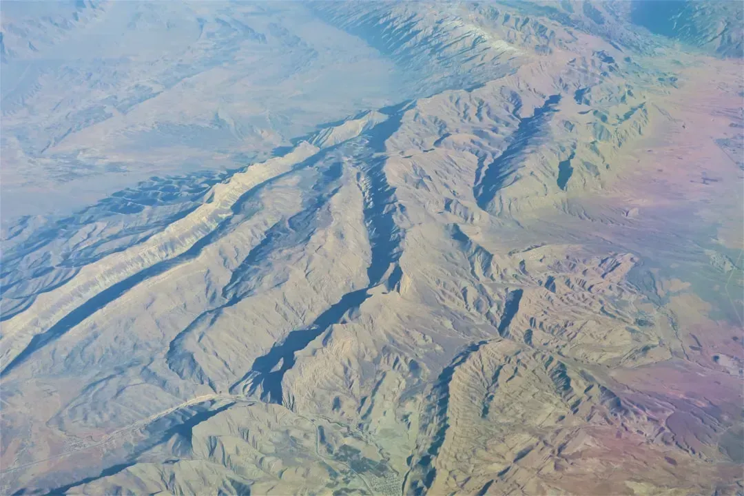
Tectonic stress along the San Andreas and San Jacinto fault systems in Southern California has now reached, and in some places exceeded, the highest levels seen in the past 1,000 years, according to research led by Earth scientists at the University of Hawaiʻi at Mānoa. That’s not a rough estimate – it’s the result of physics-based modeling that tracked stress accumulation across multiple fault segments over a full millennium. The study, published in the Journal of Geophysical Research: Solid Earth, has direct implications for seismic hazard assessments in one of the most densely populated and infrastructure-critical corridors in the U.S.
Less than 60 miles northeast of downtown Los Angeles, stress has been accumulating for more than a century along the southern San Andreas and San Jacinto fault systems. Both fractures make up the boundary of the Pacific and North American tectonic plates, which have been sliding past each other a few centimeters each year while other zones are locked. As a result, some segments of the faults have been building up tension like a coiled spring with nowhere to move. That image of a coiled spring is not a metaphor scientists use lightly.
2. The “Earthquake Gate” at Cajon Pass Is Wide Open

Researchers found that the Cajon Pass, where the San Andreas and San Jacinto faults meet, could act as an “earthquake gate” that determines whether a future rupture spreads across both faults. In simple terms, this junction can either contain a rupture or let it run freely from one fault system to the next. Researchers found that earthquakes passed through the junction when both sides of the pass had similar levels of high stress – and that is the configuration we are approaching today.
According to the simulation, the San Jacinto Bernardino segment stood out with the highest stress load anywhere in the 1,000-year reconstruction, registering 3.6 megapascals. That reading exceeds its previous peak from nearly 50 years ago. The Mojave South segment of the San Andreas recorded 2.8 megapascals and surpassed its own record stress load from a decade ago. Past simulations showed ruptures traveled through Cajon Pass when the stress difference between the two segments was only 0.3 megapascals. That gap is narrowing.
3. The Southern San Andreas Hasn’t Ruptured in Over 300 Years
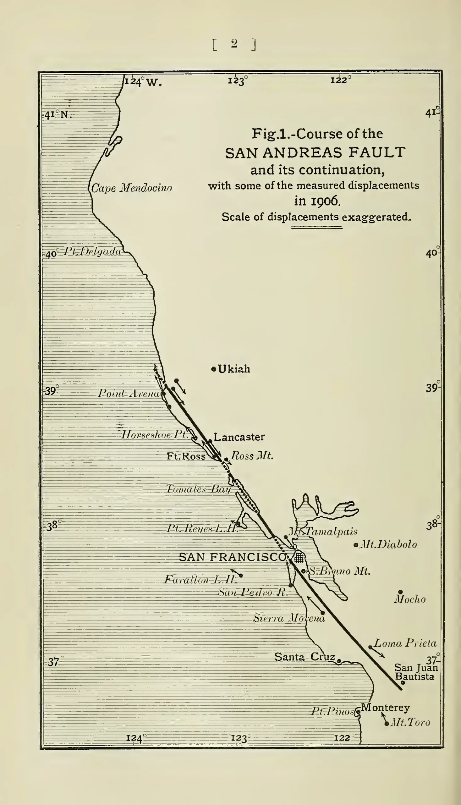
The Southern San Andreas Fault is one of the most closely watched seismic hotspots in the world, yet it hasn’t produced a major earthquake in more than 300 years. Scientists have long warned that the region is overdue for a significant rupture that could damage infrastructure and threaten lives. The average recurrence interval for major earthquakes on this segment is estimated at roughly 150 to 200 years, which means the fault is well past its expected reset point.
The Southern Segment – covering the Mojave, San Bernardino, and Coachella sections – which has not had a major rupture since around 1680 CE, is locked and accumulating strain. The southern segment, which stretches from Parkfield in Monterey County all the way to the Salton Sea, is capable of an 8.1-magnitude earthquake. At its closest, this fault passes about 35 miles to the northeast of Los Angeles. Such a large earthquake on this southern segment would kill thousands of people in Los Angeles, San Bernardino, Riverside, and surrounding areas, and cause hundreds of billions of dollars in damage.
4. The Cascadia Subduction Zone and San Andreas May Be Synchronized

Two of the most dangerous fault systems on the U.S. West Coast may be more connected than scientists once thought. New research suggests the Cascadia subduction zone and the San Andreas fault can “sync up,” triggering earthquakes within minutes or hours of each other. This rare synchronization could dramatically increase the scale of a major West Coast disaster. Instead of one massive quake, multiple regions could be hit at nearly the same time.
A team of researchers analyzed a trove of seafloor sediment from the region where the faults meet off the coast of northern California. Their findings, published in Geosphere, reveal that the fault systems have produced several synchronized earthquakes over the past 3,000 years. Researchers noted three cases within the past 1,500 years, including the most recent event in 1700, in which the data suggest the earthquakes occurred within minutes to hours of each other. The implications for emergency response are staggering.
5. A Hidden, Complex Fault Zone Is Being Revealed in Northern California
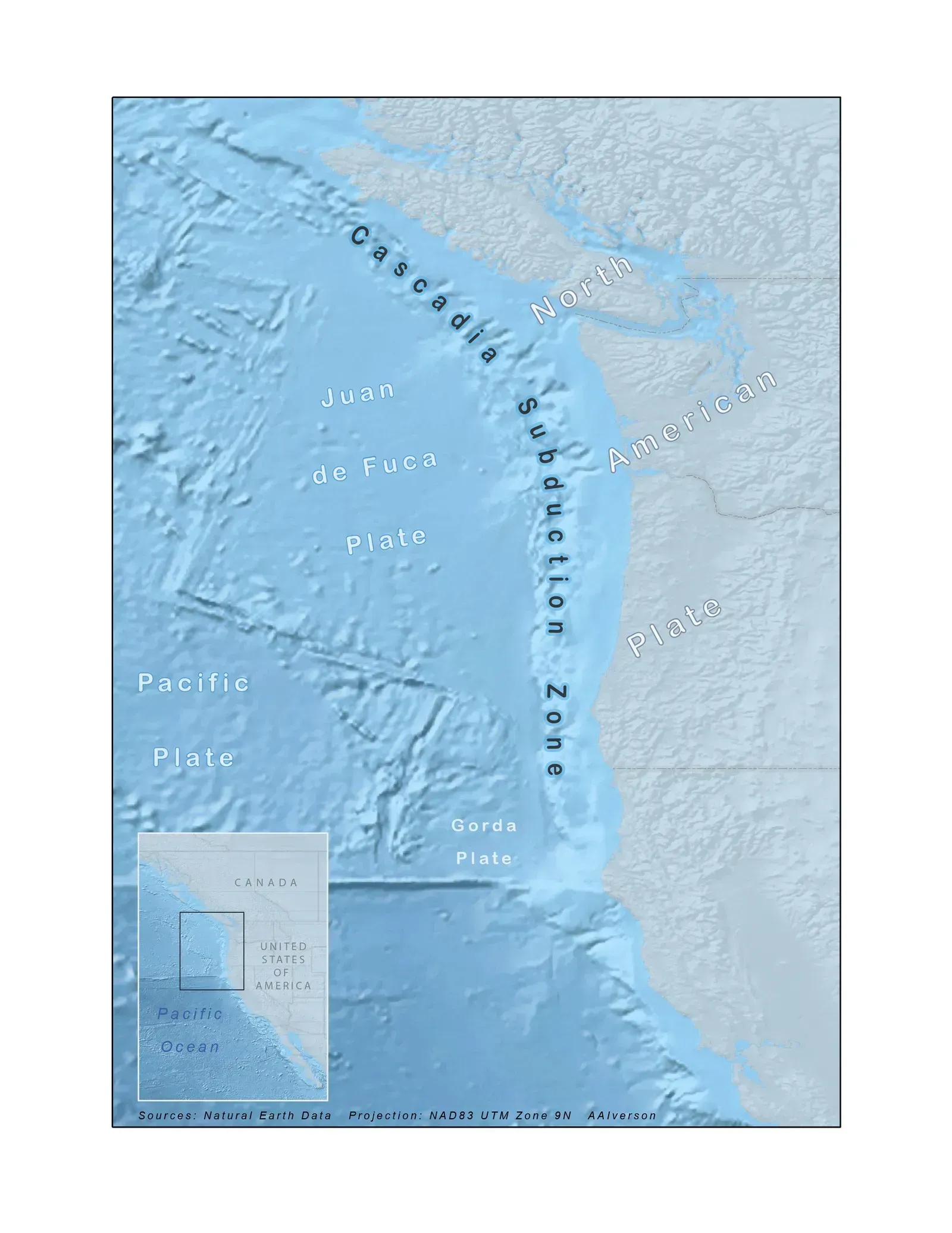
Scientists are uncovering a hidden and surprisingly complex earthquake zone beneath Northern California by tracking swarms of tiny earthquakes that are far too weak to feel. These faint tremors are revealing what lies beneath the surface where the San Andreas fault meets the Cascadia subduction zone, one of the most dangerous seismic regions in North America. What was assumed to be a relatively understood tectonic junction has turned out to be far messier underground than maps suggested.
At the southern end of the Cascadia subduction zone, a chunk has broken off the North American plate and is being pulled down with the Gorda plate as it sinks under North America. South of the triple junction, the Pacific plate is dragging a fragment of rock called the Pioneer fragment underneath the North American plate as it moves northward. The fault boundary between the Pioneer fragment and the North American plate is essentially horizontal and not visible from the surface at all. Structures you can’t see are among the most unsettling of all.
6. The Parkfield Segment Is Overdue Without the Expected Warning Signs
![6. The Parkfield Segment Is Overdue Without the Expected Warning Signs (Image Credits: Background map: This file was derived from: California ref 2001.jpg Detail (California)] of the United States 1:5,000,000 shaded relief map with state boundaries, forest cover, place names, major highways. Portion of “The National Atlas of the United States of America General Reference”, compiled by U.S. Geological Survey 2001, printed 2002. Downloaded from US section of the Perry-Castañeda Library Map Collection, University of Texas
course of San Andreas Fault traced from Map of active faults and historic ruptures in California (USGS Earthquake Hazards Program)
Note that all sources were originally generated and provided by the U.S. federal government and thus are in the public domain., CC0)](https://nvmwebsites-budwg5g9avh3epea.z03.azurefd.net/climatecompass247/6707bc38101b7dea6a3bc4838fda9d0b.webp)
Seismologists discovered that the San Andreas Fault near Parkfield in central California consistently produces a magnitude 6.0 earthquake approximately once every 22 years. Following recorded seismic events in 1857, 1881, 1901, 1922, 1934, and 1966, scientists predicted that another earthquake should occur in Parkfield in 1993. It eventually occurred in 2004. That already made it 11 years late. Now, more than 20 years have passed since the 2004 event, and the segment is again overdue.
Researchers suggest that the transitional segment of the San Andreas at Parkfield is now in the late part of its seismic cycle and current observations may all be relative to a state of stress close to criticality. However, the behavior of the attenuation parameter in the last few years seems substantially different from the one that characterized the years prior to the 2004 mainshock. In other words, the usual pre-earthquake warning signals are conspicuously absent this time – which is itself a puzzle that troubles researchers.
7. The Creeping Segment May Be Quietly Loaded With Risk
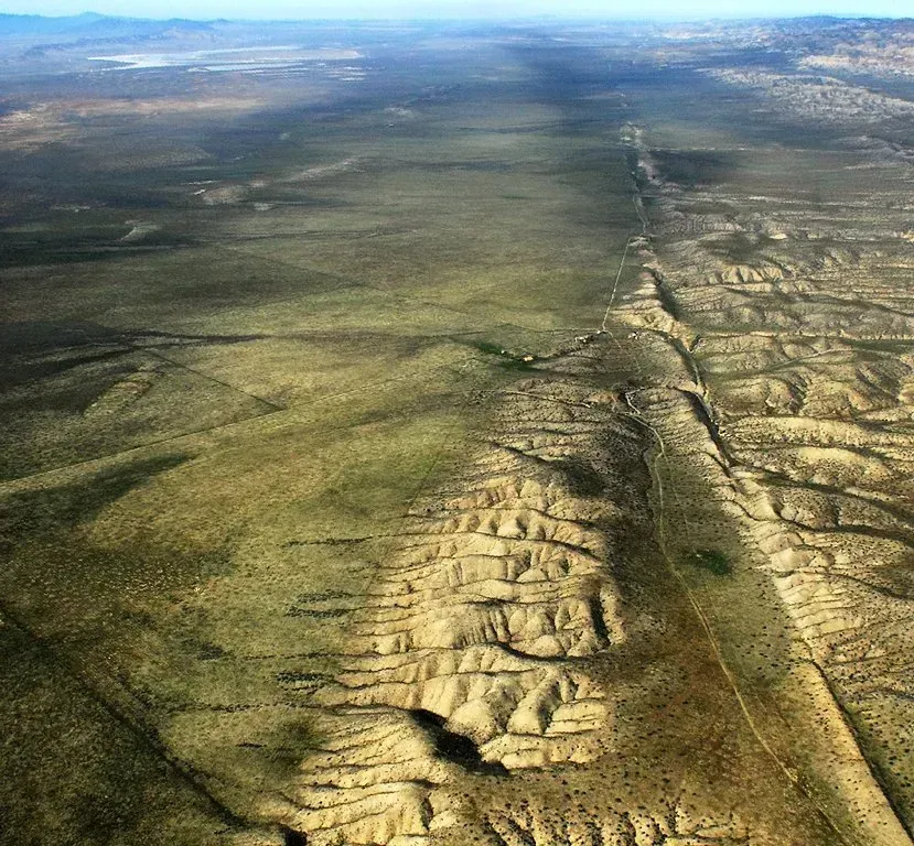
While the southern section of the fault and the parts through Parkfield experience earthquakes, the rest of the central section of the fault exhibits a phenomenon called aseismic creep, where the fault slips continuously without causing earthquakes. This sliding motion was long considered a safety valve of sorts. The newer picture is more complicated. While creeping segments are suggested to act as seismic rupture barriers, slow-slip events on these zones might promote seismicity on adjacent locked segments.
The 130-kilometer central segment of the San Andreas Fault in California is characterized by a fast creep rate of roughly 3 centimeters per year, and is surrounded by two major locked segments that were the sources of the magnitude 7.9 earthquakes of 1857 and 1906. Researchers propose that compaction-driven elevated pore fluid pressure in hydraulically isolated fault zones and subsequent frictional dilation cause the observed slow-slip episodes, and suggest that the 2004 Parkfield earthquake might have been triggered by a slow-slip event, which increased Coulomb failure stress by up to 0.45 bar per year. A mechanism that was once considered benign may be nudging nearby locked zones toward failure.
8. The Salton Sea’s Decline Is Altering Seismic Conditions at the Fault’s Southern End
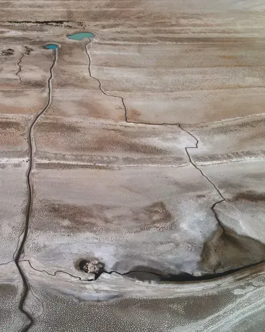
Research shows that for the last 1,000 years, major earthquakes emanating from the southern San Andreas Fault have coincided with periods when the basin that holds the Salton Sea filled with water to form the prehistoric Lake Cahuilla. Researchers found that when the Salton Sea basin filled, the lake’s weight bent the surrounding crust and its water penetrated deep underground, each of which altered the forces acting on the fault in ways that could help trigger a massive rupture.
This research suggests that the tight relationship between big-time seismic activity and the filling of the Salton Sea basin may also help explain why the southern section of the San Andreas Fault is long overdue for its next major shakeup. However, delaying the “Big One” may only give the fault more time to accumulate stress, potentially making the eventual earthquake more powerful. At the southern end of the Southern San Andreas Fault near Bombay Beach, a dense network of smaller faults has been identified beneath the Salton Sea. These so-called normal faults experience vertical movement rather than the sideways motion typical of the San Andreas. Seismic reflection data indicates that these normal faults have been active within the last 2,000 to 3,000 years.
9. A Joint Rupture of Two Major Fault Systems Is Now Considered a Realistic Scenario
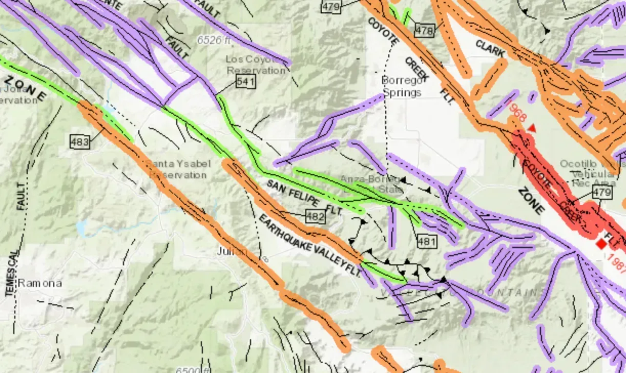
Fault interactions at Cajon Pass may pose a more significant hazard to nearby densely populated regions including Los Angeles, San Bernardino, Riverside, and Coachella Valley than previously recognized. For decades, worst-case planning focused on a single fault rupturing in isolation. That assumption is now being revised. Together, the San Andreas Fault and San Jacinto Fault accommodate roughly 90 percent of the North American-Pacific plate slip rate in Southern California and have hosted at least 36 earthquakes of magnitude 6.4 or larger in the last 1,000 years.
The magnitude 7.9 Fort Tejon earthquake in 1857 remains the most recent “Big One” in Southern California, rupturing over 330 kilometers of the San Andreas Fault System from Parkfield to just north of Cajon Pass. Researchers now report that such a quake could be more widespread and damaging than previously thought. Their study found that southern portions of the San Andreas fault and parts of the adjacent San Jacinto fault line are locked and loaded to their highest stress levels in 1,000 years, increasing the probability of a significant earthquake. The geography of catastrophe, it turns out, may not respect the boundaries scientists once drew around it.
The San Andreas Fault has always been California’s most famous geological companion – steady, geological, slow by human standards. What 2026’s research reveals is a fault system that is simultaneously older in its stress accumulation than at any point in modern memory, more structurally connected to neighboring fault systems than previously understood, and less predictable in its warning behavior than the models once promised. None of this confirms when or exactly where a major rupture will occur. What it does suggest is that the old mental picture of this fault – patient, isolated, manageable – may need to be quietly set aside.
