


- Top 8 Countries With the Clearest Night Skies for Astronomy - September 20, 2026
- 8 Everyday Products You Didn’t Realize Contain Microplastics - September 20, 2026
- Where Carbon Emissions Are Quietly Climbing – and Where They’re Falling - September 19, 2026
Choosing where to live involves a lot of tradeoffs. Cost of living, job markets, weather, community – these are the things most people weigh carefully. What often gets far less attention is the ground beneath your feet, the water rising at your doorstep, or the wind that could arrive with almost no warning. Natural disasters are not evenly distributed across the globe, and some places carry a burden of risk that’s hard to overstate.
Billion-dollar disasters are becoming more frequent due to climate change, and in 2024, there was less than two weeks between such events, compared to nearly two months in 1981. That pace isn’t slowing down. The ten places below are locations where scientists, geologists, and climate researchers have raised serious flags – not to cause panic, but to make sure the risks are clearly understood.
1. Miami, Florida – Where the Ground Itself Is the Problem
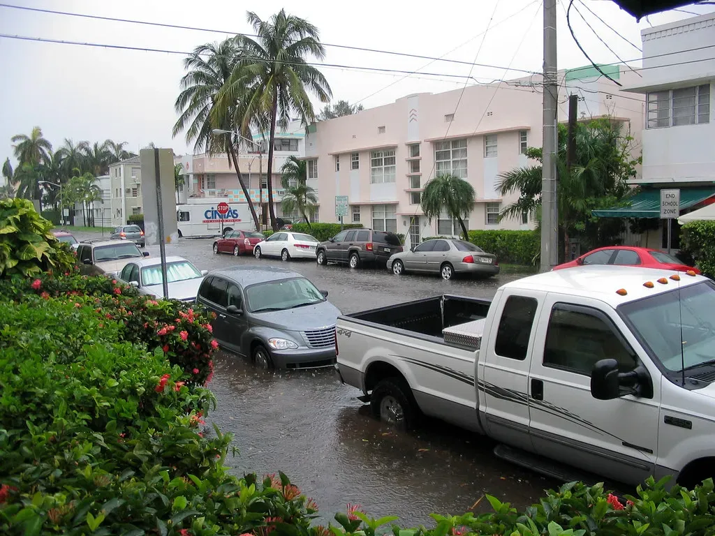
Climate change and the resulting projected rise in sea level put densely populated urban communities at risk of river flooding, storm surges, and subsurface flooding, and Miami finds itself in an increasingly vulnerable position, as compound inundation seems to be a constant and unavoidable occurrence due to its low elevation and limestone geomorphology. The city sits on porous rock that cannot be walled off from the sea in any conventional way – water simply rises through the ground.
Based on sea level rise projections from the Southeast Florida Regional Climate Change Compact, by 2060, sea levels are expected to rise between 14 to 26 inches higher than 1992 levels, creating impacts such as increasing coastal erosion, rising storm surge, more frequent King Tide flooding, and worsening urban flooding – with socioeconomic consequences including road inundation, property damage, business loss, and increased insurance costs. Average property-casualty insurance premiums in the Sunshine State have already risen to more than $4,200 a year, triple the national average, according to the Insurance Information Institute.
2. Los Angeles, California – Wildfire and the Overdue “Big One”
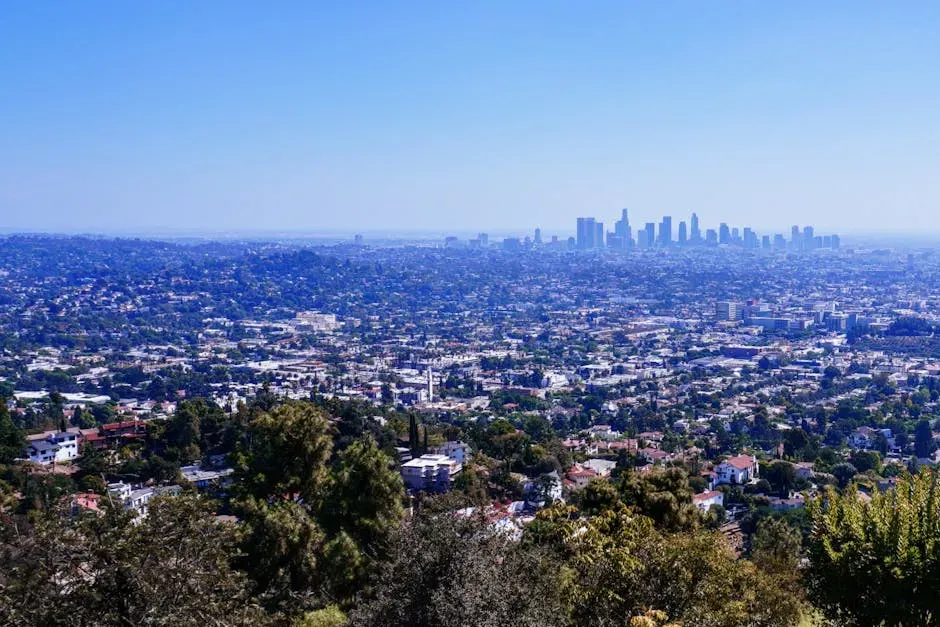
Geological evidence shows that major earthquakes on the southern portion of the San Andreas Fault tend to occur every 130 to 160 years, the last major rupture occurred in 1857, meaning the fault is now more than 150 years overdue for a major release of built-up energy. That framing is sobering, even if the word “overdue” doesn’t work like a calendar countdown.
When many think of natural disasters in Southern California, memories of the January 2025 wildfires in the Palisades and Altadena dominate the public imagination, but the truth is far more sobering: while wildfires will continue to shape the landscape and challenge readiness, a major earthquake capable of crippling Los Angeles in a single moment is not a matter of if, but when. A USGS scenario estimates that a major earthquake on the southern San Andreas Fault would cause over 1,800 deaths, 50,000 injuries, $200 billion in damage, and severe, long-lasting disruption.
3. New Orleans, Louisiana – A City Below Sea Level

New Orleans occupies one of the most precarious geographic positions of any major American city. Much of the city lies below sea level, protected only by a network of levees and pump systems – a reality that Hurricane Katrina exposed with brutal clarity in 2005. New Orleans is among the only areas of the country that carry a high risk of hurricanes, and both its island-style geography and low-lying terrain make it vulnerable to a broad range of disasters.
Looking at county-level risk data, the worst areas to live in the United States for natural disasters include California, Florida, and anywhere along the U.S. coast – and Louisiana’s Gulf Coast communities rank consistently among the most exposed. The combination of subsidence (the city is still slowly sinking), rising Gulf waters, and the increasing intensity of Atlantic hurricanes means the pressure on New Orleans’ defenses is growing every decade, not easing.
4. The Philippines – Caught Between Plates, Typhoons, and Volcanoes
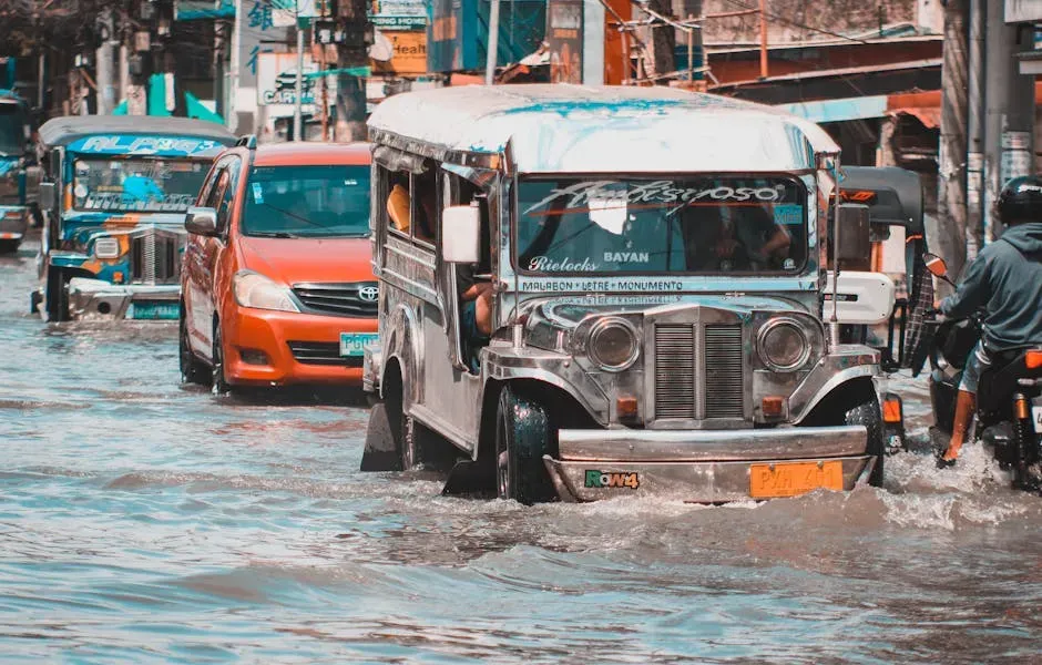
On February 6th, 2024, a landslide following heavy rainfall in Maco, Davao de Oro, killed at least 100 people, left 7,000 people affected, and some even went missing. That event was one of many that year, underscoring a pattern that repeats with grim regularity across the archipelago. The Philippines sits along the Pacific Ring of Fire, making it exceptionally vulnerable to seismic events as well as storm systems.
In 2024, the risk hotspots for natural disasters remained in the Americas and Asia, which together host eight of the ten countries with the highest global risk scores. The Philippines occupies a particularly dangerous spot within that picture, facing typhoons from the Pacific, earthquakes from tectonic activity, volcanic eruptions, and seasonal flooding – often in quick succession. It’s rarely just one hazard at a time.
5. Indonesia – 17,000 Islands, Countless Fault Lines
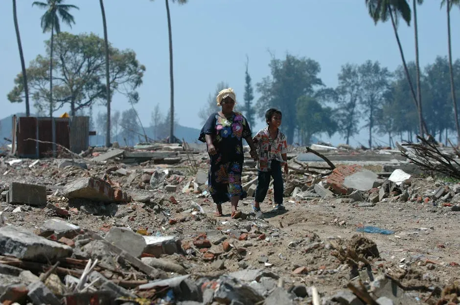
Located along the Pacific Ring of Fire, Indonesia has an even greater susceptibility to earthquakes than the Philippines due to being situated on three tectonic plates, and the surrounding Pacific Ocean means earthquakes can also trigger tsunami waves that pose further danger to the country. The 2004 Indian Ocean tsunami, which originated from an Indonesian fault rupture, remains one of the deadliest natural disasters in recorded history.
In March 2024, floods and landslides on Indonesia’s island of Sumatra affected up to 15,500 children and 40,000 families, with at least 263 people killed – and the monsoon season in Indonesia, which runs between November and March, regularly causes floods and landslides across the archipelago’s more than 17,000 islands. For residents in lower-lying coastal areas, the question isn’t whether flooding will arrive, but how severe it will be.
6. Japan – Earthquakes, Tsunamis, and Volcanic Unrest
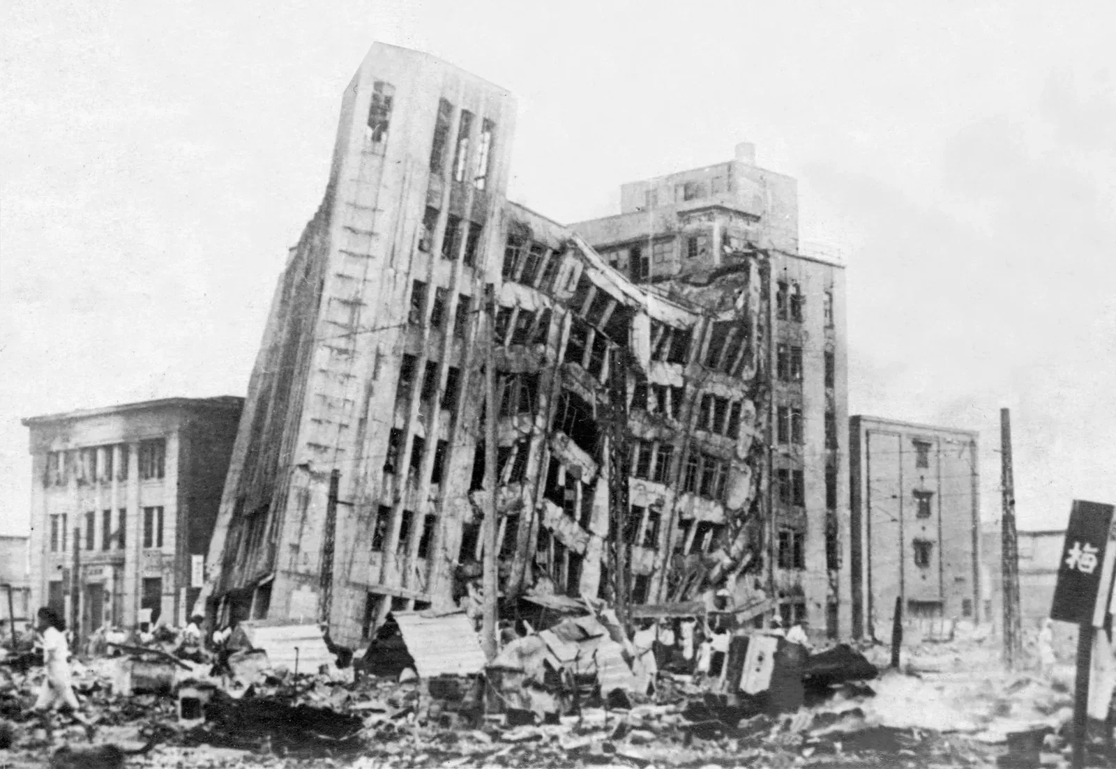
Due to Japan’s archipelago being located along the Ring of Fire, where various tectonic plates meet, Japan is susceptible to natural disasters such as earthquakes, tsunamis, and volcanic eruptions, with precipitation concentrated during the rainy and typhoon seasons, and heavy rainfall and flooding caused regularly by typhoons that hit between July and October. Japan’s disaster exposure is arguably unmatched among developed nations in sheer variety.
On January 3rd, 2024, a series of powerful earthquakes in western Japan killed at least 62 people as rescue workers struggled to save those trapped under the rubble of collapsed buildings. Japan has invested heavily in disaster preparedness and early warning systems, and those systems genuinely save lives. Still, the seismic exposure remains permanent and inescapable – a fact that shapes everyday life in ways that visitors rarely fully appreciate.
7. Colombia – Ring of Fire, Two Rainy Seasons, and Landslide Country
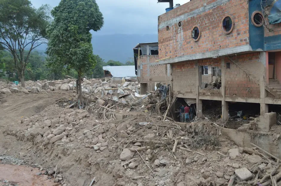
Due to the collision of the South American and Nazca Plates, Colombia is part of the Pacific Ring of Fire and the Andean Volcanic Belt, making it even more susceptible to earthquakes and volcanic eruptions, while its two rainy seasons – March to June and September to November – bring floods, landslides, and conditions that can become dangerous quickly. The combination of mountainous terrain and intense seasonal rainfall makes landslides a near-constant threat in certain regions.
In January 2024, at least 33 people were killed in a landslide resulting from intense rainfall in northwestern Colombia, a mudslide blocked a roadway connecting Quibdo and Medellin in the Pacific province of Choco, and dozens more were injured on a busy highway after mud engulfed countless cars on the road. The WorldRiskIndex 2024 noted that Colombia now holds the highest disaster risk in the Americas, a ranking that reflects just how persistent and layered its hazard profile really is.
8. Vietnam – Typhoons, Floods, and a Vulnerable Coast
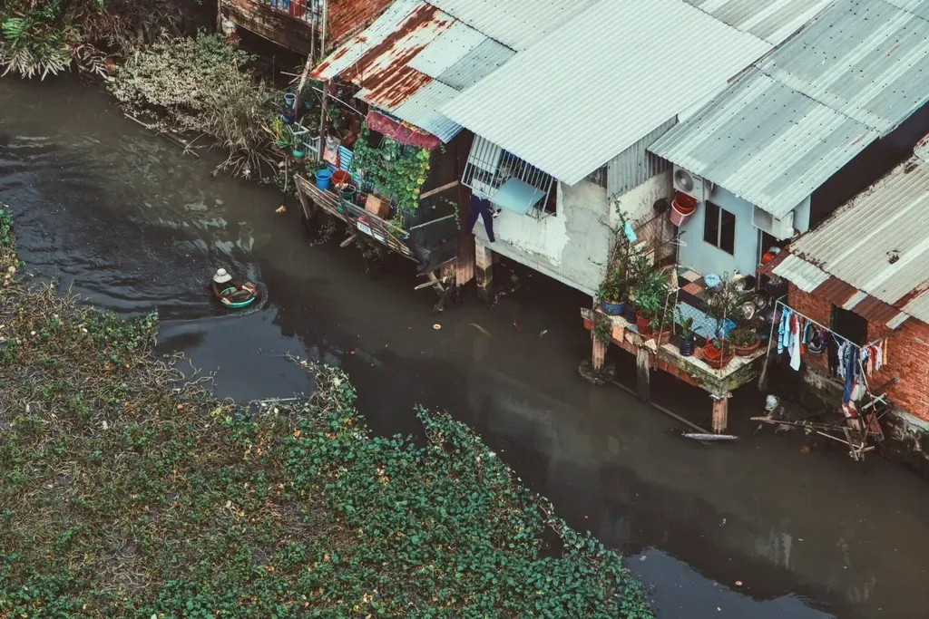
Thanks to the tropical monsoon climate of Southeast Asia and its diverse terrain, Vietnam is prone to natural disasters such as typhoons, floods, landslides, and occasional earthquakes, with disasters often peaking in the late rainy season from September to November, and storms capable of wiping out entire communities – a vulnerability that recent events have only reinforced. The country’s long, narrow coastal geography gives storms an enormous amount of shoreline to strike.
In November 2025, Typhoons Bualoi and Matmo caused heavy rainfall, and flooding devastated Bac Ninh, Cao Bang, Lang Son, Phu Tho, Thai Nguyen, and Tuyen Quang provinces. Vietnam has made progress in building sea walls and early warning infrastructure, but for communities in low-lying river deltas and coastal provinces, these improvements are in a constant race against intensifying storm systems.
9. India – Where Nearly Every Type of Disaster Applies
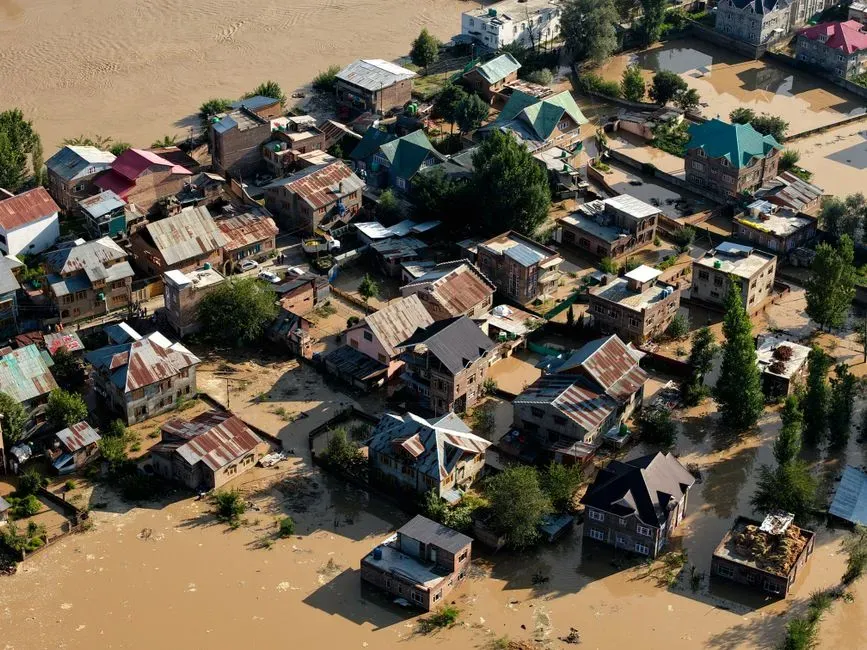
Twenty-seven of India’s 29 states are constantly exposed to floods, cyclones, droughts, earthquakes, and landslides, a susceptibility attributed to the country’s topographic features – including earthquake-induced landslides in the Himalayas, flooding-prone plains in the mainland, tsunami waves caused by tectonic movements in coastal regions, and tropical cyclones that occur from May to June and October to November.
India’s sheer scale and geographic diversity mean that rarely does a year pass without at least one region facing a serious natural disaster event. Rapid urban growth in flood-prone areas has pushed millions of people into high-risk zones, often without adequate infrastructure to protect them. Africa and parts of Asia continue to show some of the highest global vulnerability levels, with almost 80 percent of certain regions classified as high or very high risk areas – and India’s dense, geographically varied population means that even moderate events can carry enormous human consequences.
10. Mexico – Hurricanes on Both Coasts, Earthquakes in Between
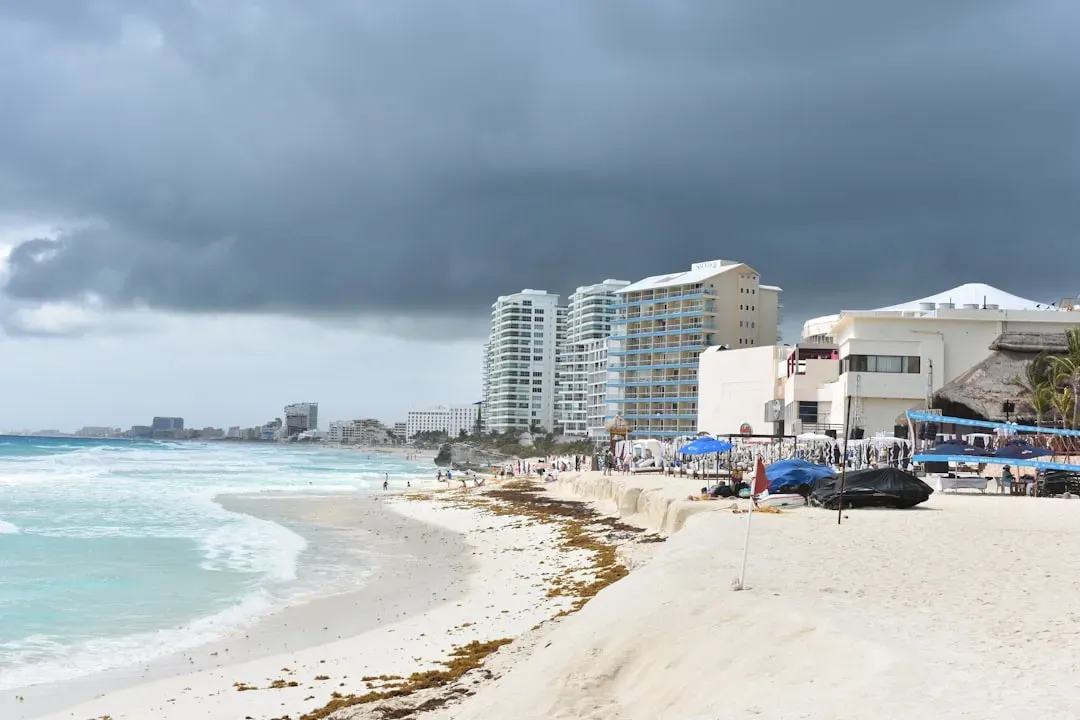
Due to Mexico’s Pacific Coast being located in the Pacific Ring of Fire, the country is prone to earthquakes, tsunamis, volcanic eruptions, and landslides, with earthquakes and tsunamis also causing secondary disasters like flooding, and a hurricane season lasting between June and November that brings severe storms, mudslides, and floods to coastal areas on both the Pacific and Gulf sides. Few countries are squeezed by risk from so many directions simultaneously.
In late October 2023, Acapulco was left in ruins with at least 27 people killed and four missing as a result of Hurricane Otis hitting the coast – a storm that intensified so rapidly it caught forecasters off guard. The WorldRiskIndex 2024 found that Mexico and Colombia traded places among the top disaster-risk nations in the Americas, with Mexico remaining among the highest-exposure countries in the world. For residents of coastal cities and towns near active fault lines, that exposure is a daily reality, not an abstract statistic.
None of these places are uninhabitable, and millions of people live full, meaningful lives in every one of them. Risk exists on a spectrum, and local preparedness, building codes, and early warning systems all make a genuine difference. What matters is that people moving to, or already living in, high-hazard areas make those choices with clear information rather than in spite of it. The earth doesn’t negotiate, but informed communities are far better positioned to hold their ground.
