
Most Americans picture earthquake country as California, and that mental picture isn’t wrong exactly, it’s just incomplete. The United States sits on a far more complicated patchwork of fault zones than the famous San Andreas alone, and some of the most consequential ones barely register in public awareness.
USGS scientists and their partners recently revealed through the latest National Seismic Hazard Model that nearly three quarters of the United States could experience a damaging earthquake. New tools and technology identified nearly 500 additional faults that could produce a damaging quake, showcasing the evolving landscape of earthquake research. The eleven zones below are among those now attracting the sharpest scientific attention.
1. The New Madrid Seismic Zone – The Midwest’s Hidden Threat
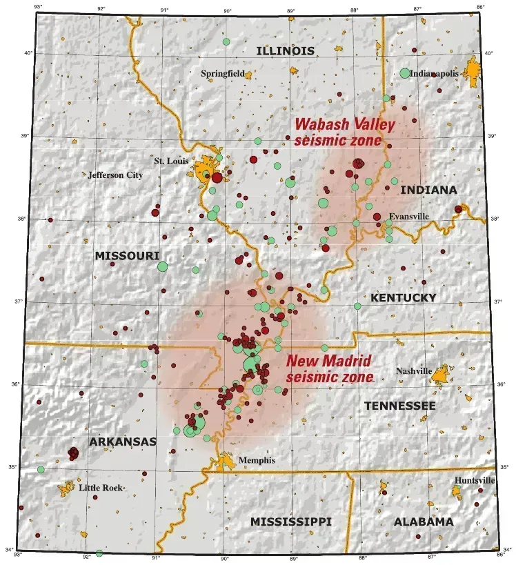
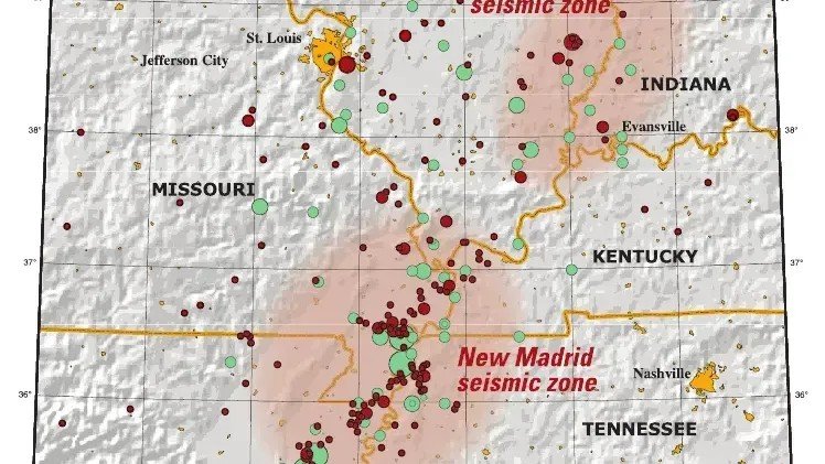
While not as well known for earthquakes as California or Alaska, the New Madrid Seismic Zone, located in southeastern Missouri, northeastern Arkansas, western Tennessee, western Kentucky, and southern Illinois, is the most active seismic area in the United States east of the Rocky Mountains. The zone is famous for a series of three major earthquakes, believed to have been magnitude 7.0 or larger, which occurred in the two-month period between December 1811 and February 1812, followed by hundreds of moderate earthquakes and thousands of smaller ones that continued shaking the area for several months.
Due to the nature of the bedrock in the Earth’s crust in the central United States, earthquakes in this region can shake an area approximately 20 times larger than earthquakes in California. The faults on which the earthquakes occur are buried beneath 100 to 200 foot thick layers of soft river sediments called alluvium, and the surface traces of these faults erode quickly or may be rapidly covered by new deposits, hiding evidence of earlier earthquake locations. Some scientists believe the probability of a large earthquake, magnitude 7.0 to 8.0, is roughly one in ten over the next 50 years.
2. The Wasatch Fault Zone – Utah’s Urban Danger
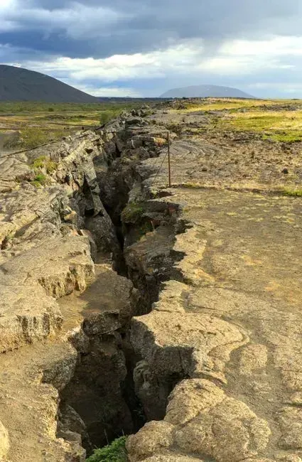
Utah’s Wasatch Fault extends about 240 miles along the western edge of the Wasatch Mountains, from southern Idaho to central Utah, running through Salt Lake City and other major population centers in the state. It is classified as a seismically active normal fault, meaning it is a fracture in the Earth’s crust that has shifted repeatedly over time. The Wasatch fault zone spans a north-south urban corridor where roughly four in five of Utah’s residents live and is capable of producing magnitude 7 earthquakes.
Research by Utah State University geophysicists found that although the Wasatch Fault dips sharply at Salt Lake City, it curves more gently at depth and is probably oriented at a much shallower angle at earthquake depth than expected, meaning that an earthquake rupture could lead to stronger, more intense shaking at the surface. Adding to the concern, the sediments underlying the Salt Lake Valley are thicker in places than previously thought, indicating that current seismic hazard models likely underestimate the amount of shaking Utah’s population center could experience in future earthquakes.
3. The Seattle Fault Zone – A City Built Over a Sleeping Giant
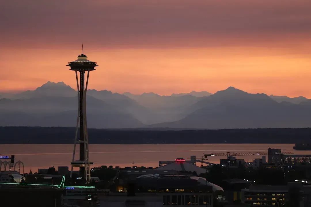
The Seattle Fault Zone is an approximately 70-kilometer-long, east-west-trending zone of south-dipping blind reverse faults within the Puget lowland region in Washington, and because of its proximity, it poses a significant earthquake hazard to the Puget Sound and Seattle metropolitan regions. The Seattle fault could generate something like a magnitude 7.2 earthquake, and a large event could trigger a tsunami up to 16 feet high that would strike the Seattle shoreline within seconds.
Beneath Seattle, overlooked secondary faults may be more active than previously thought, rupturing on much shorter timescales than the main fault, and these findings suggest seismic risk in the region could be shaped by subtle, harder-to-detect processes still not fully understood. Researchers reconstructing the histories of two recently identified secondary faults within the Seattle Fault Zone found that these smaller faults rupture approximately every 350 years, far more frequently than the main fault. The roughly four million people in the broader Seattle area live directly over this layered complexity.
4. The Ramapo Fault Zone – New York’s Quiet Concern
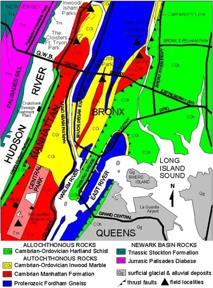
The Ramapo Fault runs through New York, New Jersey, and Pennsylvania, just miles from New York City’s skyline, and for years the region was thought to be geologically quiet, but a 2024 Columbia University study found subtle signs of stress accumulation along the fault. The last significant quake was a magnitude 5.1 in 1884, but minor tremors since have scientists concerned, and the USGS has listed the Ramapo as a fault of concern, noting that the high population density in its path could lead to severe consequences if a larger quake struck.
In April 2024, new ground-penetrating radar images revealed previously undetected fractures along the fault, deepening the sense of urgency, and with over 20 million residents in the metropolitan area, the Ramapo Fault is now under constant watch. The combination of aging infrastructure and dense urban development makes the consequences of even a moderate event here potentially severe.
5. The Eastern Tennessee Seismic Zone – The South’s Restless Floor

The Eastern Tennessee Seismic Zone snakes through Tennessee, Alabama, and Georgia and is now one of the most active earthquake areas in the eastern United States, with USGS data showing over 300 small quakes rattling the zone in 2024 alone, mostly under magnitude 3, but their frequency is raising eyebrows. In 2023, the USGS published new mapping showing that the zone extends farther north and south than previously thought.
Running beneath the Appalachian Mountains, the Eastern Tennessee Seismic Zone produces more small quakes than any other area in the eastern United States, and the largest recent event, a magnitude 4.4 quake in 2018, rattled nerves as far away as Atlanta. The region’s dense forests and rugged terrain mean landslides are a real risk during future earthquakes, and emergency managers are now mapping vulnerable infrastructure and updating response plans.
6. The Walker Lane Fault System – Nevada’s Emerging Plate Boundary
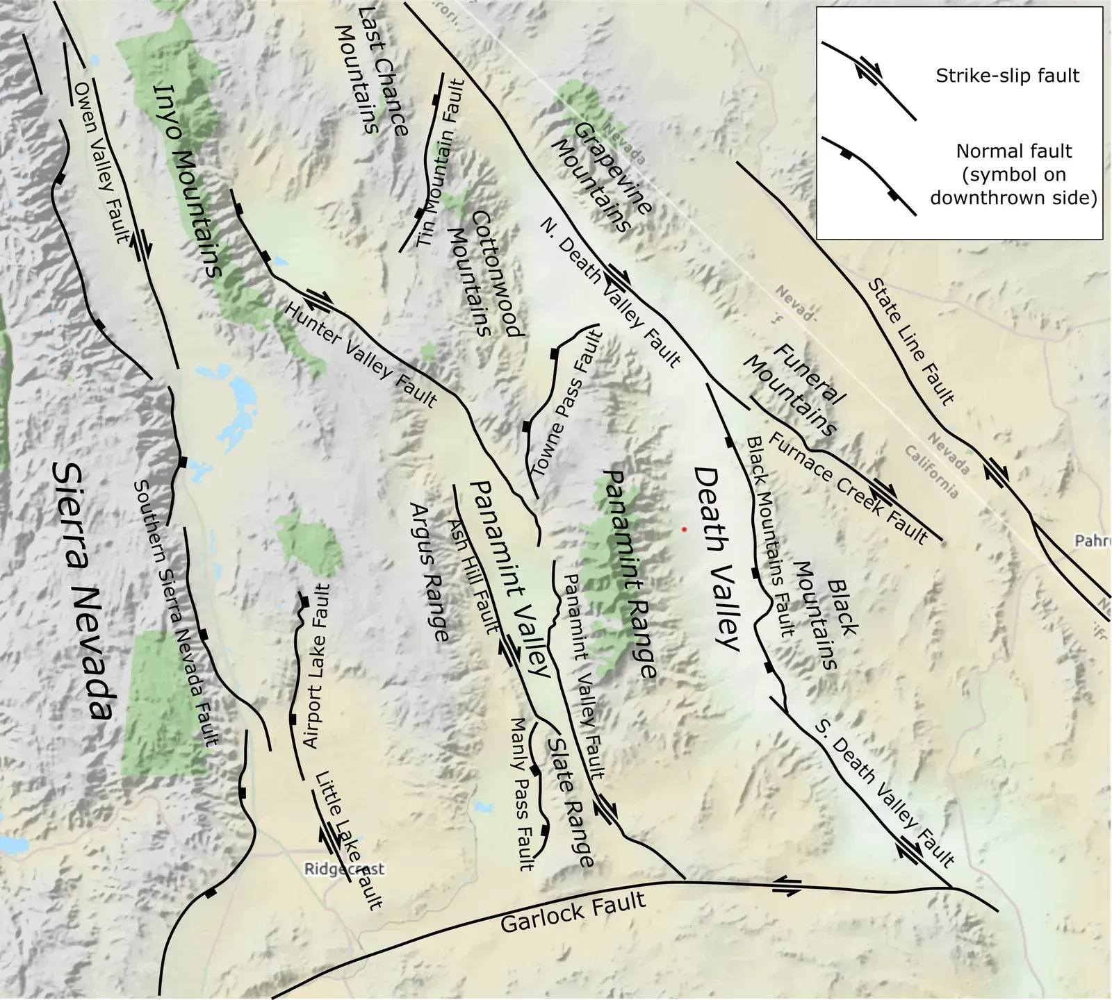
The Walker Lane Fault System, stretching from southern Oregon down through western Nevada, is responsible for about 20 percent of the Pacific Plate’s movement relative to North America, according to USGS data. The Walker Lane and Eastern California Shear Zone are characterized by numerous active faults, abundant seismicity, a history of large surface rupture earthquakes, and the potential to host more.
Geodetic modeling revealed that a 2024 magnitude 5.7 Yerington earthquake ruptured a left-lateral strike-slip fault within the central Walker Lane seismic belt, activating what turned out to be a previously hidden branch fault. The Walker Lane may represent an incipient major transform fault zone that could eventually replace the San Andreas as the dominant plate boundary. That long-term geological shift is already actively reshaping research priorities in the region.
7. The Cascadia Subduction Zone – The Pacific Northwest’s Deepest Worry

For decades, scientists have warned about the potential of the Cascadia Subduction Zone, a megathrust fault that runs offshore along the coast from northern Vancouver Island to Cape Mendocino, California. A major new research voyage found that the subduction zone is much more complex than previously understood, divided into four segments that researchers believe could rupture independently or all at once, with different types of rock and varying seismic characteristics meaning some segments could be more dangerous than others.
Many researchers have traced the last major event, an estimated magnitude 8.7 earthquake in 1700, using centuries-old records of tsunamis, Native American oral histories, and physical evidence in ghost forests drowned by saltwater. Recent FEMA risk assessments project that a full rupture here could be the deadliest natural disaster in U.S. history, with potential for over 10,000 deaths. Cities like Seattle and Portland have begun aggressive infrastructure retrofitting programs in response.
8. The Mendocino Triple Junction – Northern California’s Tectonic Crossroads

The Mendocino Triple Junction lies offshore from Humboldt County, where three major tectonic plates converge. South of this junction, the Pacific plate moves roughly northwest alongside the North American plate, creating the San Andreas fault, while to the north, the Gorda plate moves northeast and sinks beneath the North American plate through subduction. Scientists now say this area is far more complicated than earlier maps suggested.
The boundary between a hidden tectonic fragment called the Pioneer fragment and the North American plate lies almost flat, making it impossible to spot from surface observations, and this hidden structure helps explain why a 1992 earthquake occurred closer to the surface than expected. By revealing unseen plate pieces, this research changes how scientists view earthquake zones in northern California, and better maps of underground movement are now helping to improve hazard estimates.
9. The Bennett Valley and Maacama Fault Zones – Northern Bay Area’s Hidden Network
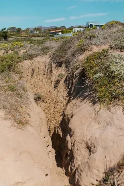
A January 2025 USGS study documented lidar-illuminated topographic features interpreted as evidence of recent surface fault ruptures related to distributed deformation along the Bennett Valley Fault Zone and the southernmost Maacama Fault Zone in the northern San Francisco Bay area. Together, these fault zones form a structural connection across the region. Their position in the densely populated North Bay makes even partial ruptures a serious concern for planners.
The Rodgers Creek Fault, which runs through Sonoma County and connects to this network, continues to reveal new active segments as scientists employ advanced mapping techniques, and its proximity to populated areas in Northern California makes ongoing mapping efforts critical for earthquake preparedness. Researchers are working to understand how these fault strands interact, since multi-fault ruptures can produce shaking far stronger than any single segment would suggest.
10. The Wallula Fault Zone – Washington’s Magnetic Anomaly
The Wallula Fault Zone is composed of a series of northwest-trending faults and folds that coincide with a prominent magnetic anomaly that extends uninterrupted for approximately 120 kilometers within the Cascadia back arc of southeastern Washington and northeastern Oregon, and it is part of the geologic structures associated with the topographic lineament known as the Olympic system. Its back-arc position, sitting inland from the main Cascadia zone, means it has largely escaped wide public attention.
The fault zone’s magnetic signature suggests deep structural complexity that scientists are only beginning to understand, and its potential for generating large earthquakes in a region with limited earthquake preparedness makes it a growing concern for seismologists. New seismic sensors and satellite-based radar techniques deployed in recent years are helping researchers put together a clearer picture of how much stress has been silently accumulating here.
11. The Wabash Valley Fault System – The Forgotten Midwest Seismic Belt
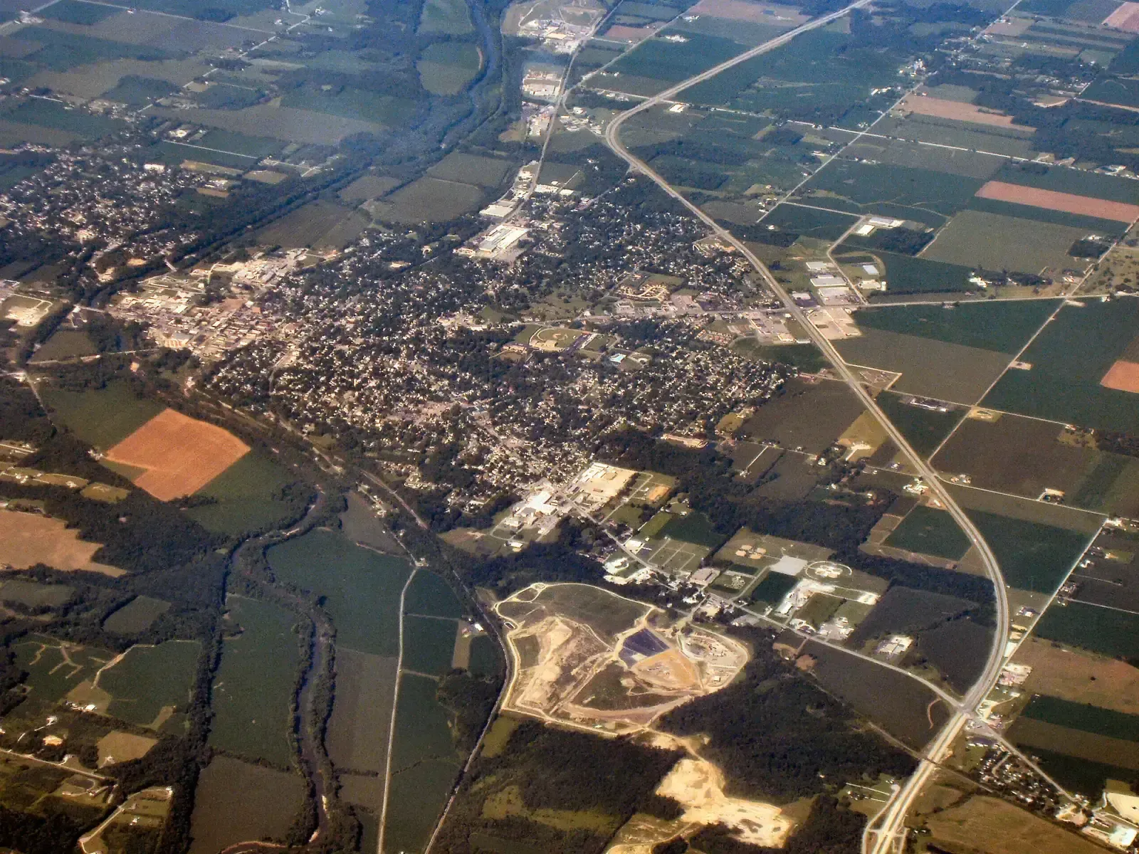
Numerous low to moderate intensity earthquakes have been recorded in a zone of diffuse modern seismicity spanning southwest Indiana, southeast Illinois, and northernmost Kentucky, and the structural elements within the zone include the Wabash Valley Fault System, the LaSalle Anticlinal Belt in western Illinois, and the Rough Creek-Shawneetown Fault System in northern Kentucky. The fault system has produced several earthquakes above magnitude 4 in the last 50 years and potentially several above magnitude 7 in the Holocene.
While earthquakes are far less numerous in the Wabash system than in the nearby New Madrid Seismic Zone, the seismic moment is nearly twice that of New Madrid over the past 50 years. The presence of seismically induced liquefaction features in the near-surface alluvial sediments of the region indicates that strong ground motion has occurred in the recent geological past. The combination of a largely unaware population and aging infrastructure in the surrounding communities is precisely what keeps geologists coming back to study this zone more carefully.
What threads through every one of these eleven zones is the same basic challenge: faults don’t announce themselves, and the geological record is often fragmentary. Scientists have calculated that around 49 million Americans are considered somewhat likely to experience a damaging earthquake in the next 50 years. The quiet zones on a seismic map are sometimes quiet simply because nobody has looked hard enough yet, and that is exactly why the research keeps expanding.

- The Shoreline Sucked Dry in Seconds – 5 Tsunami Signals Beachgoers Mistake for Low Tide - November 14, 2026
- 9 Dark-Sky Destinations Around the World Where the Stars Look Unreal - November 14, 2026
- The Fault Line That Never Slips – 7 Locked Seismic Zones Overdue for a Massive Release - November 14, 2026
