

- Atlantic Hurricane Activity Has Often Rebounded After Strong El Niño Years, Records Show - November 15, 2026
- The Planet Where It Rains Liquid Glass – 7 Alien Worlds Defying Known Physics - November 14, 2026
- Stars Consuming Entire Worlds – 6 Planetary Systems Swallowing Their Own Worlds - November 14, 2026
El Niño has a reputation as the Atlantic’s great suppressor. Strong events tend to raise wind shear over the tropical Atlantic and Caribbean, which makes it harder for storms to organize. NOAA says every Atlantic season that coincided with a strong El Niño since 1950 has produced below-normal activity, according to a Moody’s RMS summary of the agency’s outlook.
The following season often tells a different story. When El Niño fades, the brake comes off, and the Atlantic can bounce back quickly. This article looks at what the records show, where the pattern holds, and where it doesn’t.
Why El Niño Usually Holds the Atlantic Back
The main mechanism is vertical wind shear. Colorado State University’s 2026 forecast expected El Niño to drive well-above-normal vertical wind shear across the tropical North Atlantic and Caribbean. Shear tears apart the tall, organized thunderstorm columns that young hurricanes need.
NOAA also notes that in El Niño years, tropical cyclone development is generally shifted toward the Gulf Coast and subtropical regions, because the Main Development Region is relatively hostile. In other words, the usual breeding ground off Africa becomes a poor environment. The effect is a tendency, not a guarantee, as the next sections show.
The 2023 Exception That Proved the Point
The 2023 season showed that El Niño isn’t the only factor. It was the fourth-most active Atlantic hurricane season on record, with 20 named storms. It also had an above-normal accumulated cyclone energy rating of 148.2 despite the 2023–24 El Niño.
The reason was the ocean. That season had the most storms for an El Niño year on record, largely due to record-warm sea surface temperatures across the Atlantic. Warm water partly offset the shear, which is a useful reminder that El Niño competes with other ingredients.
What Happened in 2024, the Year After

When the 2023–24 El Niño faded, the Atlantic got busier still. The dominant El Niño event ended on April 16, 2024, and cool neutral ENSO conditions prevailed through the hurricane season. Colorado State University’s review also noted that the 2024 season had near-record warm sea surface temperatures across the Main Development Region.
The result was 18 tropical storms, 11 hurricanes, 5 intense hurricanes and an ACE index of 162. NOAA designated the season hyperactive, meaning total ACE exceeded 175% of the climatological median. Note that this was a rebound from an already active El Niño year, not from a quiet one.
A Rebound With an Odd Shape
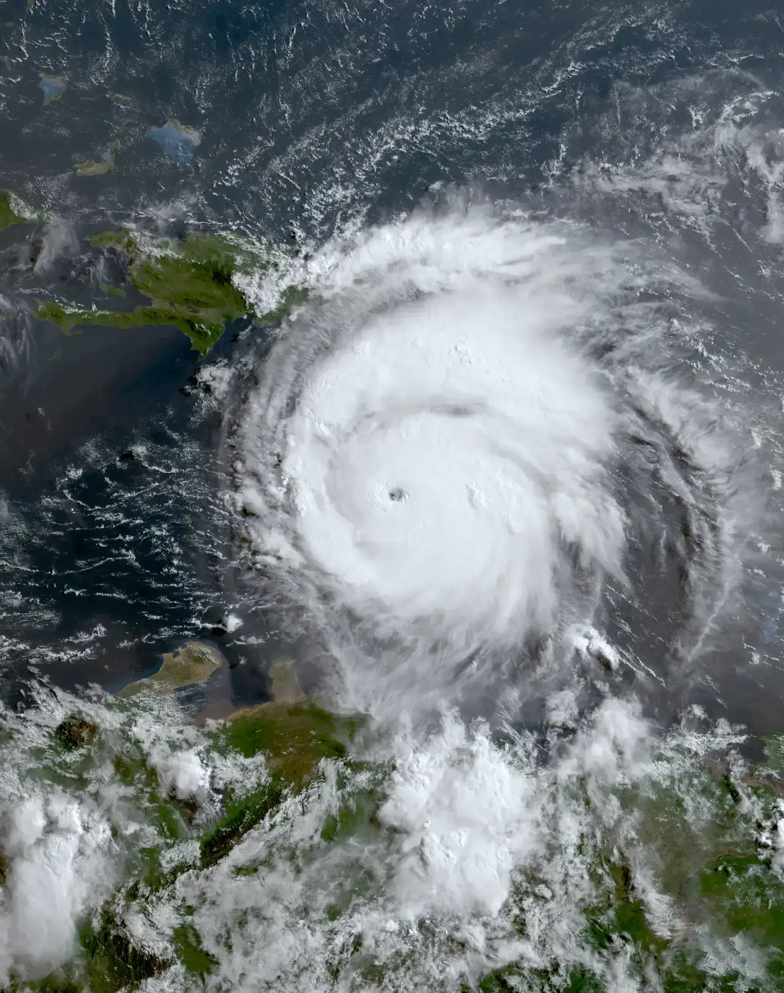
The 2024 season wasn’t uniformly busy. Hurricane Beryl became the earliest Category 5 hurricane in the Atlantic on record in July. Then an unusual four-week pause between August and September followed before Helene and Milton arrived.
One analysis found that, after Beryl dissipated, the period from July 9 to September 15 generated only 25 ACE units. Another analysis described the season as hyperactive overall, but with an unusually quiet peak season. Rebounds, it seems, don’t always follow a tidy script.
Older Examples Worth Remembering
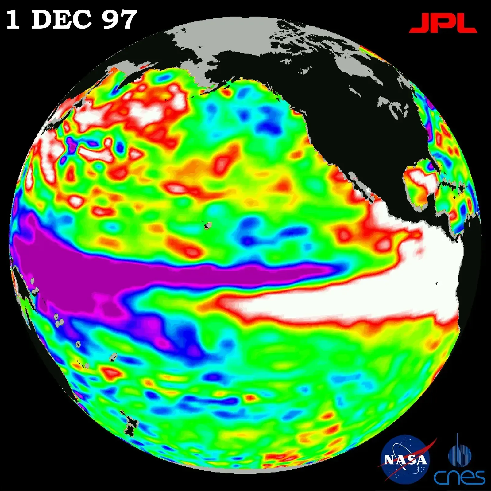
The pattern isn’t new. The 1997 El Niño was one of the strongest on record, and the 1997 Atlantic season was quiet. In 1998, as El Niño collapsed, the basin produced 14 named storms, including the destructive Georges and Mitch. The 2015 El Niño was likewise followed by a more active 2016, which included Hurricane Matthew.
I’m drawing these two examples from general climatology rather than from the sources gathered for this piece, so treat the exact storm counts as something to verify against NOAA’s hurricane database. The broader point is that years following a strong El Niño often include a shift toward neutral or La Niña conditions. Those conditions generally favor Atlantic development.
Why “Often” Doesn’t Mean “Always”
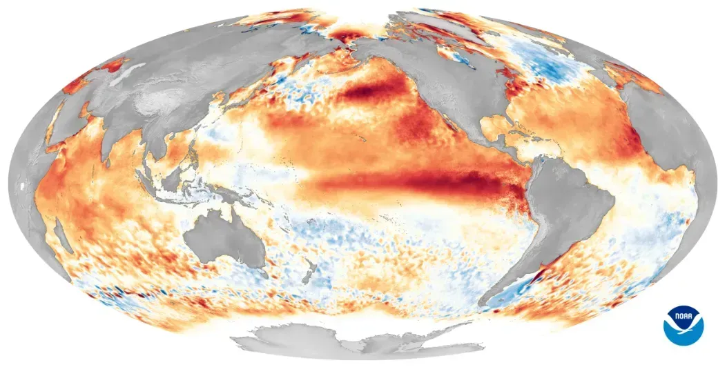
A rebound depends on what replaces El Niño and on Atlantic water temperatures. A season can still underperform if shear stays high or if the ocean cools. Seasonal forecasters are open about this uncertainty. NOAA’s Ken Graham said in 2026 that there is still uncertainty in how each season will unfold.
The evidence is also limited by sample size. Strong El Niño events are rare, so only a handful of “year after” seasons exist for comparison. That’s enough to see a tendency, but not enough to treat it as a rule.
The 2026 Season as a Live Test

This year gives a current look at the suppressive side. NOAA’s August outlook put the chance of a below-normal season at 75 percent. It also gave a 90% chance of El Niño developing into a strong or very strong event.
The season has so far fit that picture. Hurricane Isaias became the season’s first hurricane on October 8, tying 1905 for the latest first-hurricane date. The season officially runs through November 30, so final totals aren’t in. The 2027 season will be the real test of whether the rebound pattern holds again, especially if El Niño fades as many forecasters expect.
Conclusion

The records support a cautious version of the headline. Strong El Niño years suppress the Atlantic, and the years that follow often bring more activity, as 2024 did after the 2023–24 event. Ocean temperatures, shifting ENSO phases and plain chance all shape the outcome.
The takeaway for coastal residents is simple. A quiet El Niño season says little about the next one, so preparation shouldn’t depend on the last year’s count.
