

Buying a home in the American West used to mean trading a manageable amount of fire risk for spectacular scenery and outdoor access. That calculation has shifted dramatically. Insurance carriers are withdrawing from entire regions, mortgage lenders are growing cautious, and property values in the most exposed corridors are under real pressure. The physical danger hasn’t changed so much as the financial infrastructure around it has started to crack.
The highest-risk areas of California have effectively become uninsurable, and banks will not approve mortgages without home insurance. That dynamic is now spreading beyond the Golden State. The nine zones below represent areas where experts, insurers, and risk analysts consistently raise red flags for prospective buyers.
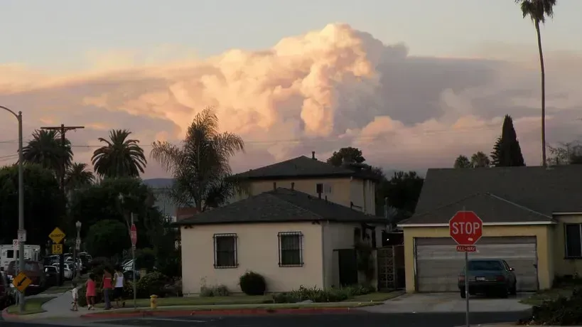
1. Pacific Palisades and Malibu, California
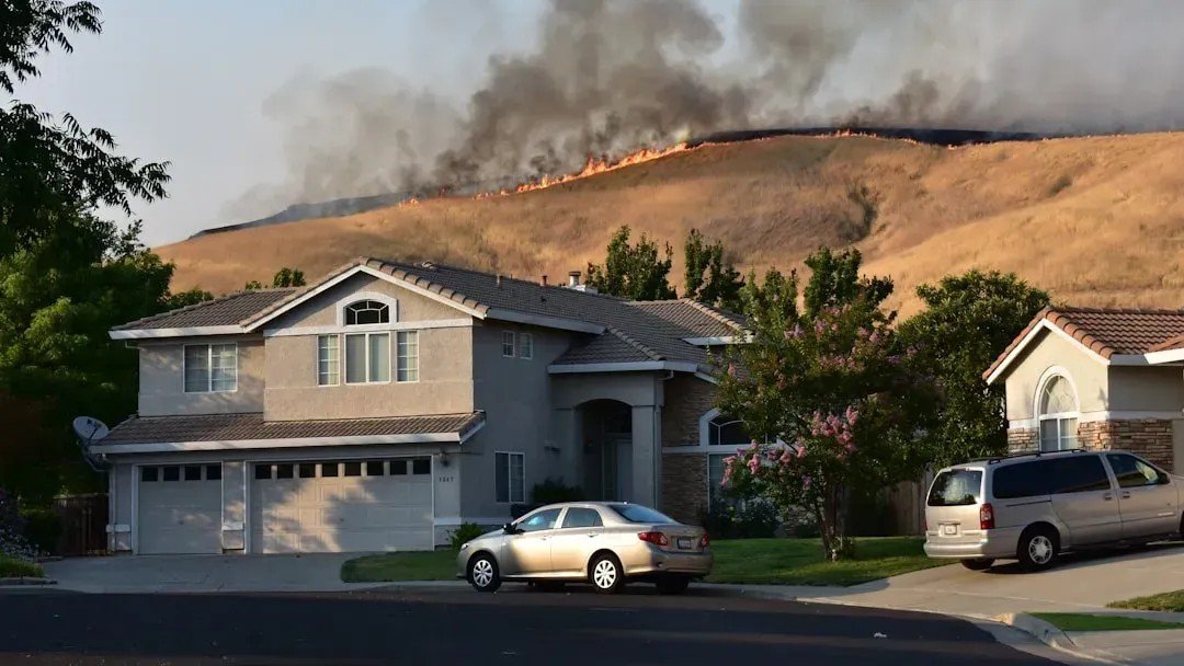
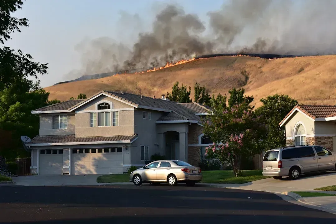
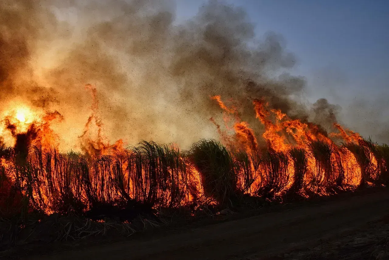
On January 7, 2025, two devastating wildfires broke out in Los Angeles, damaging over 13,500 properties and resulting in more than $40 billion in insured losses. Pacific Palisades sat squarely in the path of the Palisades Fire, one of the two blazes. The area combines steep canyons, dense chaparral, and reliable Santa Ana winds – a combination that fire behavior experts have flagged for decades.
Big insurance companies canceled hundreds of homeowners policies in the summer of 2024 in Pacific Palisades, which wildfires have now destroyed, leaving homeowners without protection. Homes in these areas had a median value of nearly $1.95 million, underscoring the concentration of wealth at risk when the blazes ignited. For buyers drawn to coastal luxury, the combination of catastrophic exposure and a collapsing insurance market makes these hillside addresses extraordinarily difficult to justify.
2. Altadena and Pasadena Foothills, California

The Palisades Fire and the Eaton Fire left such damage in their wakes that the communities of Altadena and Pasadena will face months of rebuilding challenges. The Eaton Fire tore through established neighborhoods that many residents considered safe simply because they had survived previous fire seasons. That assumption proved tragically wrong.
Roughly 94 percent of properties that burned were classified as having “severe” or “extreme” wildfire risk by First Street data, compared with only 21 percent identified as “very high” risk by Cal Fire maps, illustrating discrepancies in risk modeling approaches. The gap between official maps and real-world risk modeling is a serious warning for buyers. The Eaton Fire alone destroyed 5,418 structures in January 2025.
3. Los Angeles County’s Expanded “Very High” Fire Hazard Zones
In March 2025, CAL FIRE’s updated maps designated extensive areas in Los Angeles County as “Very High Fire Hazard Severity Zones,” including cities such as Los Angeles, Malibu, Pasadena, Santa Clarita, and Glendale. Los Angeles’s “Very High Fire Hazard Severity Zones” expanded from roughly 647,000 acres in 2011 to more than 817,000 acres in 2025. That’s a substantial increase in the footprint of formally recognized danger.
Areas where wind-blown embers can ignite distant structures now affect approximately 1.3 million structures in Los Angeles County. High insurance premiums and limited availability have contributed to slower sales across high-risk zones. For a buyer, slower sales mean longer holding periods if circumstances ever require selling – a risk multiplier that compounds the physical one.
4. Riverside and San Bernardino Counties, California
Based on Cal Fire’s Fire Hazard Severity Zone maps, large portions of Riverside County are rated as “Very High” for wildfire risk, particularly in regions such as the San Bernardino National Forest, the Santa Ana Mountains, and areas around Palm Springs and Temecula. FEMA ranks Riverside County as one of the highest-risk areas for wildfires in California, giving it a maximum risk score of 100 percent. The county is projected to lose an estimated $319 million each year due to wildfires.
Approximately 53 percent of buildings in San Bernardino are at risk of wildfire at a high-risk level. San Bernardino experiences increased drought conditions, contributing to heightened wildfire potential. These two counties draw buyers looking for more affordable inland alternatives to coastal prices, but the combination of relentless heat, frequent drought, and dense wildland vegetation creates conditions that are genuinely difficult to insure at reasonable cost.
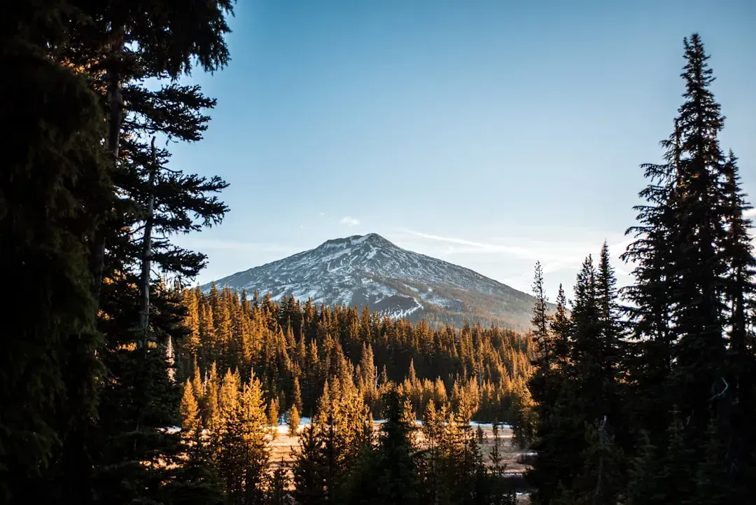
5. Colorado Front Range Foothills: Evergreen, Boulder, and Estes Park
Destructive wildfires are a fact of life in the Colorado Front Range, especially in the area around Evergreen and Conifer, which the Evergreen Area Chamber of Commerce lists as one of the ten areas most at risk of wildfire damage in the USA. The appeal is obvious – mountain views, pine forests, and proximity to Denver – but the risk profile is serious. Boulder’s code updates accelerated after the 2021 Marshall Fire, which destroyed roughly 1,100 homes countywide and prompted stronger mitigation standards and programs.
Colorado regulators note that several of the state’s five largest carriers are now writing fewer policies or declining coverage in foothill communities such as Evergreen and Boulder, while average premiums have soared nearly 60 percent in five years. Colorado holds the nation’s fourth-highest average homeowners premium at about $4,600 per year, up roughly 58 percent since 2018. Costs climb further in ZIP codes that combine wildfire and hail exposures, with some foothill and mountain areas reporting averages well above $7,500 per year.
6. Bend and Central Oregon Corridor
Austin, TX; Denver, CO; Bend, OR; and Flagstaff, AZ metropolitan areas all sit among the nation’s top 15 areas in number of homes with moderate-to-high wildfire risk. Bend has grown rapidly over the past decade, drawing remote workers and retirees with its high desert scenery. That growth has pushed development steadily deeper into the wildland-urban interface.
Oregon faces a similar insurance squeeze; major insurers have sharply pulled back from central, southern, and eastern counties, forcing many homeowners to hunt for last-resort coverage or pay quadrupled premiums. Oregon has over 600,000 homes in the Wildland-Urban Interface, and that number grows every year as development pushes into forested and rural areas. In practical terms, a buyer in Bend’s outer neighborhoods may find coverage difficult to obtain at any reasonable price.
7. Flagstaff and Northern Arizona’s Ponderosa Pine Belt
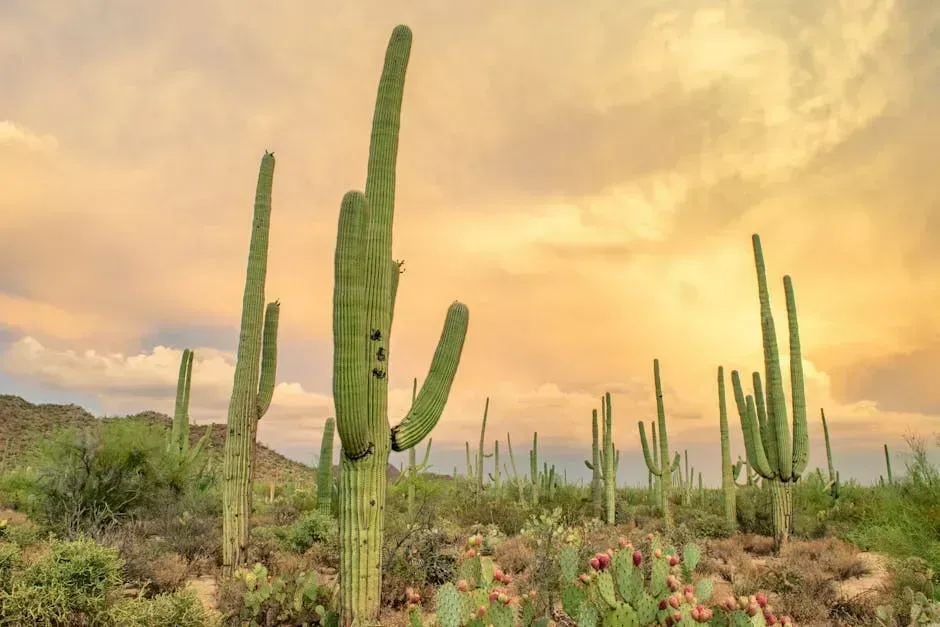
In southern Arizona, drought is making conditions ripe for dangerous wildfires. Flagstaff sits at roughly 7,000 feet in the world’s largest contiguous ponderosa pine forest. Those trees are beautiful in calm conditions and extraordinarily flammable under drought stress, which is increasingly the default setting across the Southwest.
Arizona carries expected annual wildfire losses of roughly $195 million, placing it fourth in the country behind California, Florida, and Texas. In 2022, Arizona saw a wildfire that destroyed 30 residences and burned more than 20,000 acres from mid-April to early July. Flagstaff’s surrounding communities in the WUI have faced repeated evacuations and growing difficulty securing standard homeowners coverage, making the area one of the more financially precarious purchases in the Southwest.
8. Texas Hill Country and the Eastern Edwards Plateau
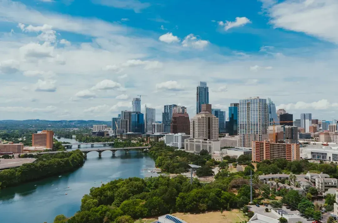
Texas is second on the list for the amount and danger of wildfires. The state has vast areas of wide-open land that can be purchased cheaply for residential, commercial, or agricultural use, yet roughly 7 percent of housing units are at risk of being damaged by a wildfire, with nearly 10 million total housing units. The Texas Hill Country – the rolling cedar and oak terrain west of Austin and San Antonio – draws buyers with its scenic landscapes and relatively lower prices, but the fire risk is real and growing.
Particularly in southern and western Texas, drought is making conditions ripe for dangerous wildfires. California leads by a large margin in expected annual wildfire losses at $1.4 billion, with Texas coming in third at $240 million annually. As Austin continues to expand outward into wildfire-prone terrain, buyers in the urban fringe communities surrounding the Hill Country face compounding risks from both the fire itself and an insurance market that is tightening fast.
9. The Wildland-Urban Interface Communities of Southern Oregon: Ashland, Grants Pass, and Medford
The 2020 Labor Day fires changed Oregon’s relationship with wildfire permanently. In a single week, over 1 million acres burned and more than 4,000 homes were destroyed, including entire neighborhoods in Phoenix, Talent, and Detroit. Southern Oregon’s Rogue Valley communities of Ashland, Grants Pass, and Medford sit in the heart of this repeatedly scorched landscape, surrounded by the Klamath and Siskiyou ranges.
As currently mapped, the wildland-urban interface in Oregon includes the whole or parts of many Oregon cities, including all of Roseburg, Ashland, and Grants Pass. After the 2020 fires, several major carriers restricted new policies in high-risk zones. A property that costs $2,500 per year to insure in a standard zone might cost $4,000 to $6,000 in a high-risk zone, or may require the Oregon FAIR Plan at even higher rates with limited coverage. For buyers drawn to southern Oregon’s mild climate and outdoor culture, the insurance arithmetic is increasingly hard to make work.
The pattern across all nine of these zones is strikingly consistent: physical fire risk, an insurance market retreating from exposure, and a growing gap between listed property values and the true long-term cost of ownership. The decision to build in fire-prone areas is usually made by developers and local officials, guided by large-scale zoning plans that often don’t take wildfire risk into account. Financially, many local governments are incentivized to keep allowing new development even in risky areas. Buyers who do their homework before signing – checking current risk maps, getting insurance quotes before making an offer, and understanding what FAIR plan coverage actually covers – are the ones least likely to regret it later.