


- Phantom Energy Sucking Power 24/7 – 7 Home Electronics Quietly Inflating Utility Bills - November 14, 2026
- A Million-Mile Storm Raging for Centuries – 6 Violent Weather Wonders in Our System - November 14, 2026
- Animals Flee Hours Before the Tremor – 7 Natural Warnings Before Disasters Strike - November 14, 2026
California
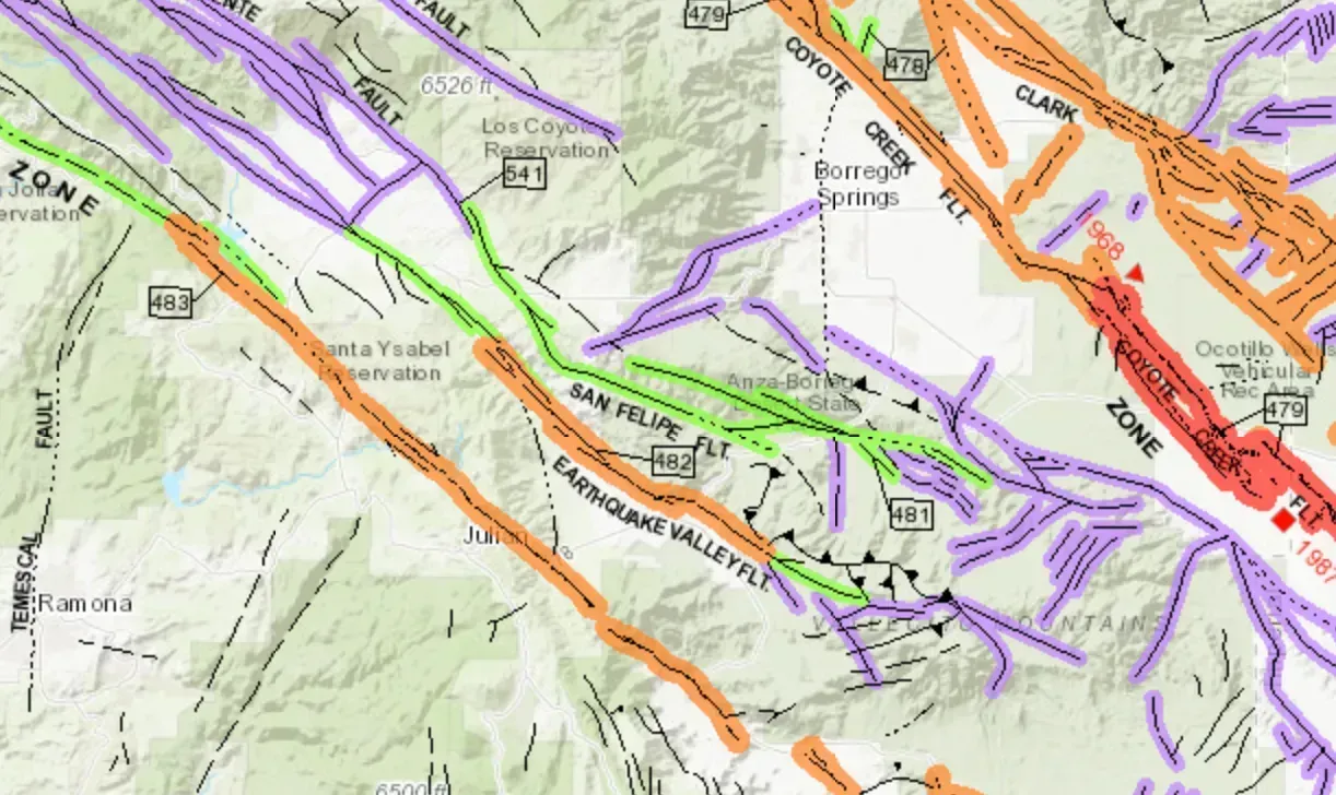
California remains the state most associated with earthquake risk, and the data still backs that reputation up. According to the National Seismic Hazard Model, seismic hazard is highest in California, southern Alaska, and Hawaii, with some regions carrying a 95 percent probability of a damaging earthquake within a century. The San Andreas Fault system runs through some of the most densely populated corridors in the country, from the Bay Area down through Southern California.
What’s changed recently isn’t the underlying geology so much as the resolution of the science studying it. The updated national model shows there is a chance for greater shaking in the seismically active regions of California and Alaska. Newer fault mapping and better soil data have refined exactly how much shaking specific neighborhoods should expect, which matters enormously for building codes and insurance planning in a state where the last catastrophic urban quake, Northridge in 1994, is still within living memory for many residents.
Alaska
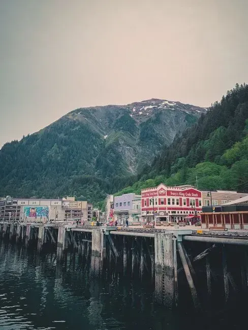
Alaska rarely gets the media attention California does, yet it sits in one of the most seismically active zones on the planet. The state’s southern coast lies along a subduction boundary where the Pacific Plate grinds beneath the North American Plate, a setup capable of producing some of the largest earthquakes ever recorded anywhere on Earth, including the 1964 magnitude 9.2 Great Alaska Earthquake.
The most recent nationwide hazard update didn’t downgrade this risk. If anything, it reinforced it. Scientists found there is a chance for greater shaking in the seismically active regions of California and Alaska compared to older models, a reflection of improved understanding of Alaska’s complex fault network rather than any sudden change in the ground itself. Anchorage, home to the majority of the state’s population, sits close enough to active faults that even a moderate event can disrupt daily life significantly.
Washington

Washington carries a layered risk that few other states share. It sits above the Cascadia Subduction Zone, but it also has shallow crustal faults running directly beneath its largest cities. The timing of past earthquakes indicates there is an 85 percent chance of a magnitude 6.5 or greater deep earthquake in the Puget Sound region within the next 50 years, along with a 10 to 15 percent chance of an approximately magnitude 9 earthquake on the Cascadia Subduction Zone.
The Seattle area faces its own dedicated hazard beyond the offshore megathrust. The Seattle Fault Zone poses a significant earthquake hazard to the Puget Sound and Seattle metropolitan regions because of how close it runs to the surface beneath a heavily built-up urban core. Combine that with the looming Cascadia threat, and Washington ends up facing more distinct earthquake sources than almost any other state on this list.
Oregon

Oregon shares the Cascadia Subduction Zone with Washington, but the numbers geologists use to describe its risk are sobering on their own. Scientists currently predict there is about a 37 percent chance that a megathrust earthquake of magnitude 7.1 or greater in this fault zone will occur in the next 50 years. That fault has been quiet since 1700, and the long silence isn’t necessarily reassuring to researchers who study its history.
The projected aftermath is what really sets Oregon apart in preparedness planning. Total economic losses in Oregon are projected to exceed 32 billion dollars, close to one fifth of the state’s gross product, with fatalities ranging from 650 to 5,000 and over 27,000 people potentially displaced. Coastal communities face an additional complication, since a Cascadia rupture would likely isolate them for weeks. With current preparedness levels, Oregon officials anticipate being without services and assistance for at least two weeks, if not longer, when the Cascadia Subduction Zone earthquake occurs.
Utah

Utah’s earthquake risk surprises a lot of people who don’t associate the Mountain West with major seismic hazard. The Wasatch Fault runs almost directly beneath the state’s population center. The chance of a magnitude 6.75 or greater earthquake occurring along the Wasatch Front in the next 50 years is 43 percent, while the probability of a magnitude 6.0 or greater earthquake is 57 percent.
What makes Utah’s situation particularly pressing is how concentrated the exposure is. Over 85 percent of Utah’s population lives within 15 miles of the Wasatch Front. Recent laboratory research has only added to the concern, since scientists studying the fault’s rock composition found it may behave in ways that intensify surface shaking. The fault curves more gently at depth than expected, meaning an earthquake rupture could lead to stronger, more intense shaking at the surface, with a greater chance of injury and destruction.
Tennessee
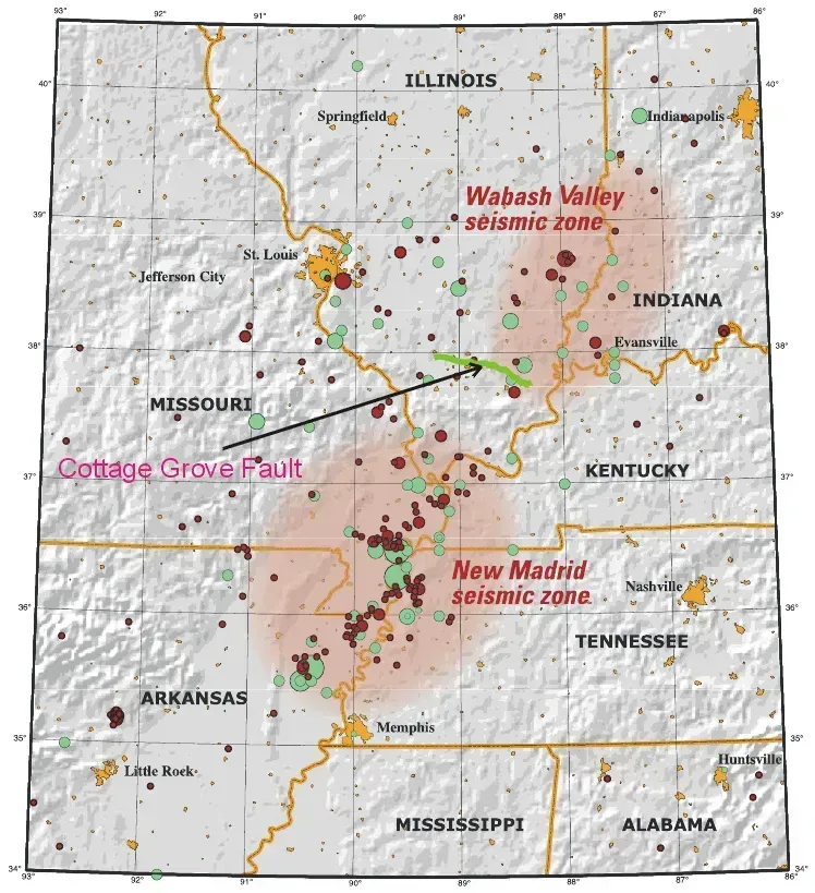
Tennessee’s risk comes from an unusual source: a fault system buried deep beneath river sediment rather than one visible at the surface. The New Madrid Seismic Zone, while not as well known for earthquakes as California or Alaska, is the most active seismic area in the United States east of the Rocky Mountains. Memphis sits close enough to feel the brunt of any major rupture.
The probability numbers are lower than California’s, but the consequences would be disproportionately severe given how unprepared the region’s older buildings are. Scientists estimate the probability of a magnitude 6.0 or larger earthquake occurring in this seismic zone within any 50-year period is 25 percent to 40 percent. Because the region’s bedrock transmits seismic energy so efficiently, a major earthquake in the New Madrid zone could shake an area up to 20 times larger than a similar quake in California, which is why federal disaster planners treat this fault as a national concern rather than a regional one.
Hawaii
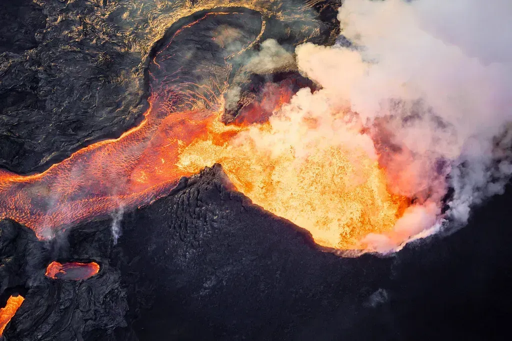
Hawaii’s earthquake hazard comes from a different mechanism than the rest of this list: active volcanism rather than a converging plate boundary. The islands still made the top tier of national hazard rankings for good reason. Seismic hazard is highest in California, southern Alaska, and Hawaii, with some regions carrying a 95 percent probability of a damaging earthquake within a century.
The Big Island in particular experiences frequent seismic activity tied to Kilauea’s ongoing volcanic processes, where magma movement regularly triggers shallow quakes that can be felt across nearby communities. Because Hawaii’s 1998 hazard model had gone decades without a full update, the most recent national assessment gave researchers their first comprehensive modern look at how vulnerable the islands’ infrastructure really is to strong shaking.
