


- Top 6 Countries With the Most Extreme Temperature Swings - September 23, 2026
- The Snowbird Backlash: Why Ski Towns Are Pushing Back on Winter Tourists - September 23, 2026
- 11 Ways Different Generations Have Adapted Their Homes to the Weather - September 23, 2026
Archaeology used to mean a shovel, a grid, and a lot of patience in the sun. That picture has changed dramatically. Today, satellites orbiting hundreds of kilometers above Earth are routinely uncovering civilizations that centuries of ground-level searching missed entirely. The technology reads the planet’s surface in wavelengths invisible to the human eye, picking up ghostly outlines of buried walls, vanished roads, and long-dried canals.
In recent decades, remote sensing has become an essential part of archaeological research, offering unprecedented access to data over vast and often inaccessible areas. Using a combination of optical, infrared, radar, and LiDAR sensors, satellites now assist researchers in detecting subtle anomalies on Earth’s surface that hint at buried structures, landscape modifications, or ancient human activity. The nine discoveries below stand as some of the most striking results of that revolution.
1. Sarah Parcak’s 3,000 Ancient Sites Across Egypt

One of the best-known examples in satellite archaeology is the identification of over 3,000 ancient sites in Egypt by space archaeologist Sarah Parcak. Using infrared satellite imagery, she and her team located 17 possible pyramids, 1,000 tombs, and entire settlement networks previously unknown. The scale of this single project reshaped what Egyptologists thought they understood about the density and reach of ancient Egyptian civilization.
These discoveries were possible because buried mudbrick walls retain moisture differently than surrounding soil. This difference affects the vegetation and surface texture, which can be picked up by satellites equipped with multispectral sensors. The scientific field of space archaeology is fairly new, and Parcak helped pioneer it. She is credited with being the first Egyptologist to use satellite imaging to identify new archaeological sites in Egypt.
2. The Lost City Grid of Tanis
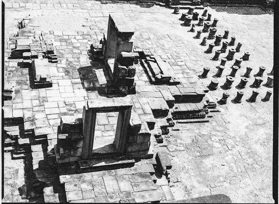
Exploiting subtle and often invisible differences in topography, geology, and plant life, Parcak used satellite imagery and other remote sensing tools to expose a stunning array of forgotten sites from multiple lost cultures. In Egypt, she and her team uncovered the city grid of Tanis. Tanis, a royal city of ancient Egypt, had been partially known through classical sources and early excavations, but its full urban footprint had never been mapped.
The outlines of structures completely invisible to human eyes, even those of trained archaeologists during traditional ground surveys, were made visible. Satellite remote sensing imaging demonstrated an ability to discern underground details that the naked eye simply cannot see above the surface. The Tanis grid discovery proved that entire city plans could be recovered from orbit without displacing a single grain of sand.
3. The Bolivian Amazon’s Hidden Urban Network
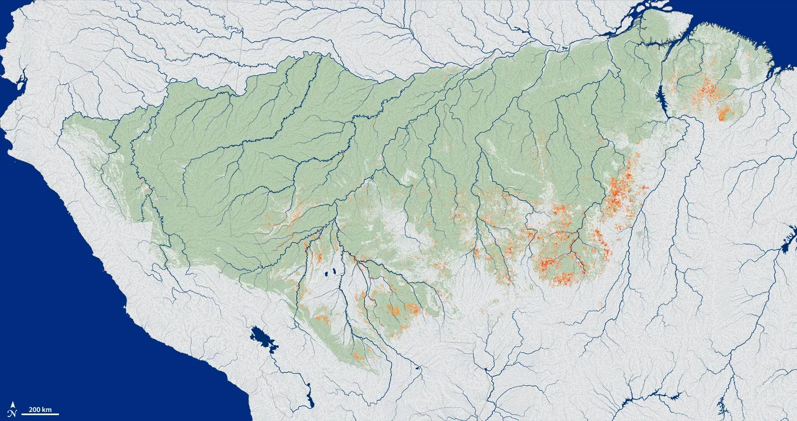
The use of airborne LiDAR technology enabled scientists to map out a vast network of urban settlements in the Bolivian Amazon. According to research published in the journal Nature, 26 interconnected sites were built by the Casarabe culture, which occupied an area of roughly 2,800 square miles between 500 and 1,400 C.E. This directly overturned the long-held assumption that pre-Columbian Amazonia was too flood-prone to support permanent, complex settlement.
The large settlement sites are connected to lower-ranked sites by straight, raised causeways stretching over several kilometers. Massive water management infrastructure, composed of canals and reservoirs, completes the settlement system in an anthropogenically modified landscape. The results indicate that the Casarabe culture settlement pattern represents a type of tropical low-density urbanism that had not previously been described in Amazonia.
4. The Maya Megalopolis Beneath Guatemala’s Jungle
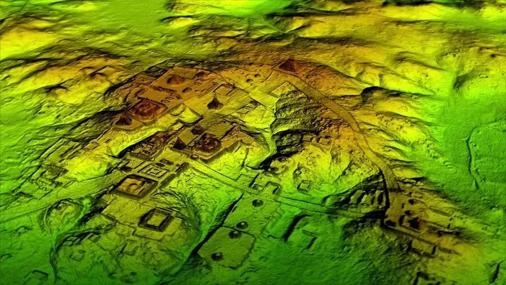
The PACUNAM project mapped more than 800 square miles of the Maya Biosphere Reserve in the Petén region of Guatemala, producing the largest LiDAR dataset ever obtained for archaeological research. The results suggest that Central America supported an advanced civilization that was, at its peak some 1,200 years ago, more comparable to sophisticated cultures such as ancient Greece or China than to the scattered city-states that ground-based research had long suggested.
In addition to hundreds of previously unknown structures, the LiDAR images revealed raised highways connecting urban centers and quarries. Researchers noted that with the new LiDAR-based evidence from Central America and Angkor Wat, scholars now have to consider that complex societies may have formed in the tropics and expanded outward from there. It is one of the most significant reframings of Maya civilization in the modern era.
5. Angkor’s Hidden Urban Landscape in Cambodia
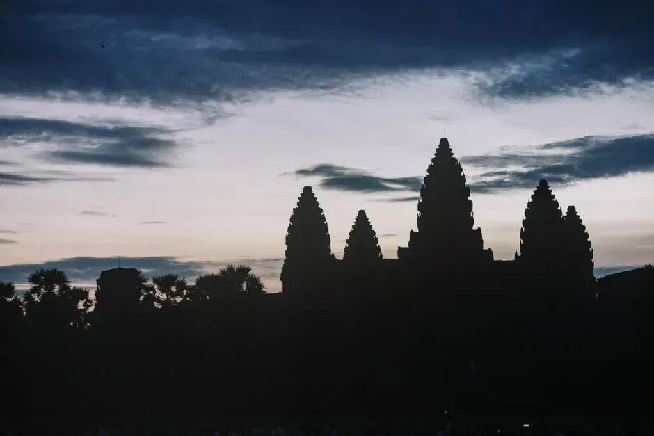
Previous archaeological mapping of the successive medieval capitals of the Khmer Empire at Angkor, in northwest Cambodia, from roughly the 9th to 15th centuries C.E., had identified it as the largest settlement complex of the preindustrial world, and yet crucial areas remained unmapped, in particular ceremonial centers where dense forest obscures traces of civilization. That changed when LiDAR was brought to bear on the region.
Using airborne laser scanning technology to create high-precision digital elevation models of the ground surface beneath the vegetation cover, researchers identified an entire, previously undocumented, formally planned urban landscape into which the major temples such as Angkor Wat were integrated. Satellite imagery also revealed vast networks of ancient water management systems at Angkor, showing that the city was supported by a sophisticated hydraulic network spanning over 1,000 square kilometers.
6. Buried Pyramids and a Lost Settlement Near Nasca, Peru
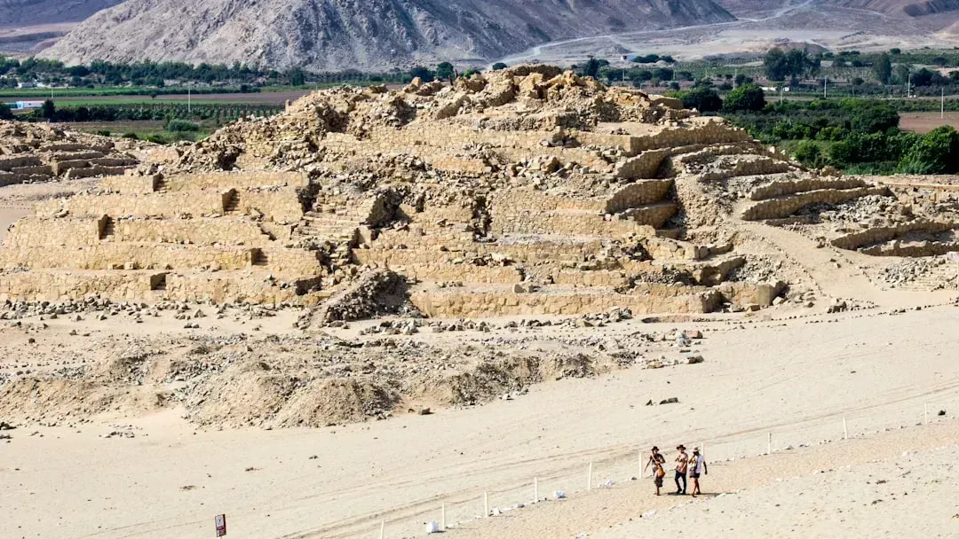
In Peru, an Italian scientific mission directed by Nicola Masini provided important results by using satellite imagery for both site discovery and the protection of archaeological heritage. By processing QuickBird images, a large buried settlement, including a pyramid, in the Nasca riverbed in southern Peru, near the Ceremonial Center of Cahuachi, was detected. The site had been hiding in plain sight, invisible from the ground yet clearly readable from space.
In the region of Lambayeque in northern Peru, which is strongly affected by clandestine excavations, satellite imagery has also been employed for mapping and monitoring archaeological looting. This secondary use of the same technology, protecting discovered sites from looters, has become nearly as important as the act of discovery itself. Remote sensing now serves both offense and defense in the preservation of ancient heritage.
7. Ancient Andean Hunting Traps Revealed in Chile
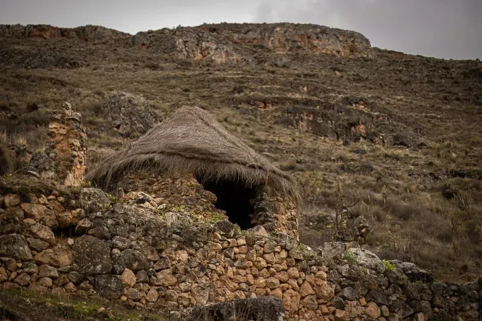
In Chile’s Camarones River Basin, satellite images led an archaeologist to 76 V-shaped stone structures believed to be “chacu,” large hunting traps. The ancient people who lived there used 500-foot-long stone walls to funnel wild vicuñas, small llama-like animals, into circular corrals. The structures were so spread across the terrain that no ground survey could have mapped them efficiently or completely.
Satellite images captured traces of these massive ancient hunting traps strewn across the Andes, while underwater mapping simultaneously brought sunken World War II warships back into view and uncovered a submerged port. The Chilean discovery, published as part of a wave of 2025 remote sensing findings, illustrates just how much ancient land use remains invisible without a view from above. The Andean hunters who built these walls left behind an infrastructure that only orbital eyes could fully comprehend.
8. Pre-Angkorean Structures and the Deeper Chronology of Khmer Settlement
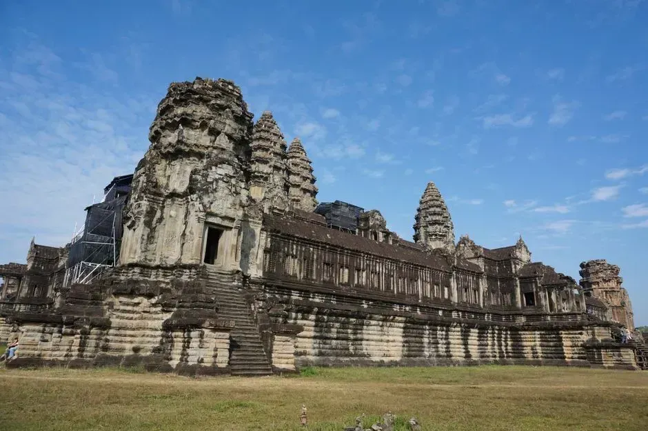
Researchers surveying near the famous 12th-century temple of Angkor Wat found a small mound that previous archaeological accounts from 1904 and 1911 mentioned only two temples about, making no mention of a distinct circular form. Using radar, they found four to six temple remains, including pre-Angkorean structures. This suggests occupation of the 12th-century site some 300 years earlier, radically changing accepted chronologies of Angkor.
Radar data also enabled researchers to detect a distribution of circular prehistoric mounds and undocumented temples far to the northwest of Angkor. The findings were made possible by the Airborne Synthetic Aperture Radar developed by NASA’s Jet Propulsion Laboratory, which experts said may revolutionize the way archaeologists view the ancient city’s development. What radar revealed here was not just new buildings, but an entirely different timeline for one of history’s greatest civilizations.
9. Rapa Nui’s Population Mystery Reconsidered Through Satellite Data
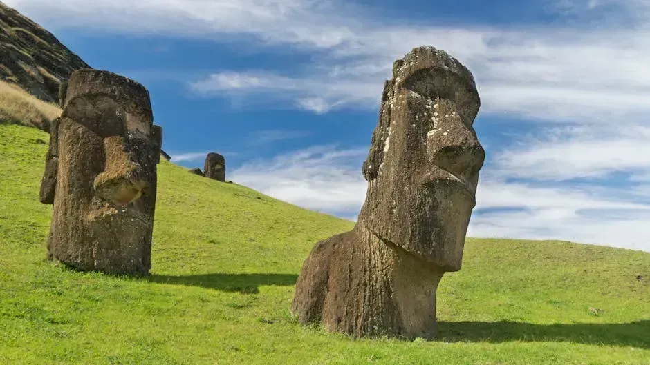
Contrary to popular belief, early Polynesian settlers of Rapa Nui, also known as Easter Island, might not have undergone a population boom that destroyed their civilization and the island’s environment. Ground surveys and satellite data hint that Polynesian islanders who arrived some 800 years ago set up a modest farming system and maintained a steady population of less than 4,000 until Europeans arrived 300 years ago.
Rapa Nui’s famous stone statues watched over a population that may have peaked at about 3,900 individuals, too few people to have triggered a previously hypothesized ecological disaster, a study suggests. This revision of the Easter Island collapse narrative is one of the quieter but more consequential results of satellite archaeology. It replaces a dramatic story of self-destruction with something more nuanced: a society that managed its resources carefully, visible only once researchers looked down from above.
What unites all nine of these discoveries is not the technology itself but what it demands of us as a result. As satellite imaging, including natural-color, false-color, and radar, has evolved and become more accessible, a scientific community that once measured the rise and fall of civilizations based on a few dig sites now discovers landscapes and features hundreds of kilometers long. Archaeological research now includes expertise from geography and earth science, and for some archaeologists, remote sensing has become as valuable as carbon dating. The picture of human history from above is still coming into focus, and what it shows keeps getting bigger.
