
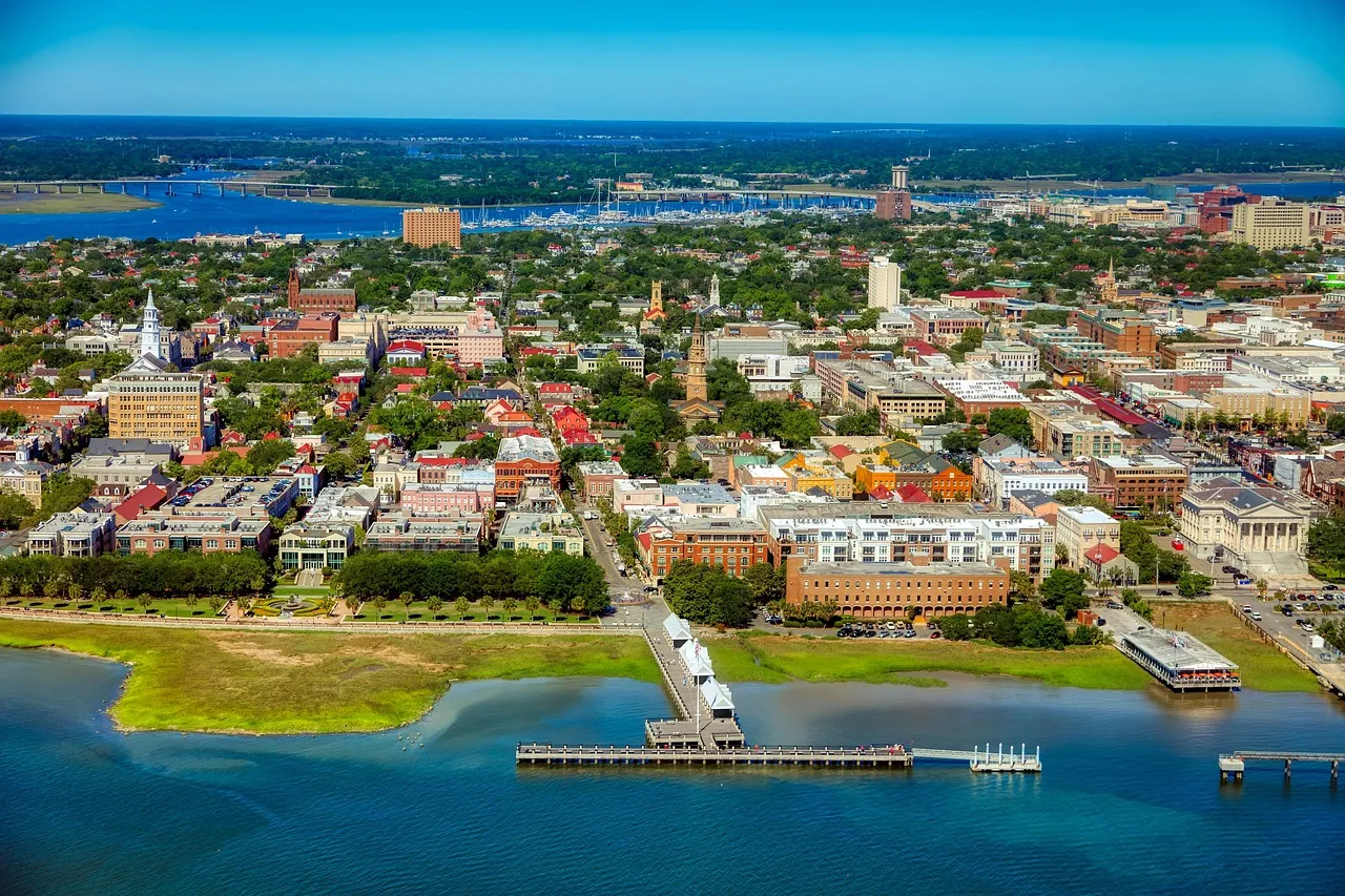
The headline sounds like folklore, yet parts of it have happened. Ground can lose its strength during an earthquake, and land covered in trees has dropped below tide lines or cracked open in a matter of minutes. Liquefaction is only one of the ways it happens, and it often works alongside other effects such as subsidence and landslides.
Liquefaction occurs when loose, water-saturated sand or silt is shaken hard enough that it briefly behaves like a thick liquid. Buildings tilt, pipes float upward, and sand erupts at the surface. The eight regions below have all shown this behavior, and several sit on faults that spent long stretches looking harmless.
Cascadia Subduction Zone, Pacific Northwest
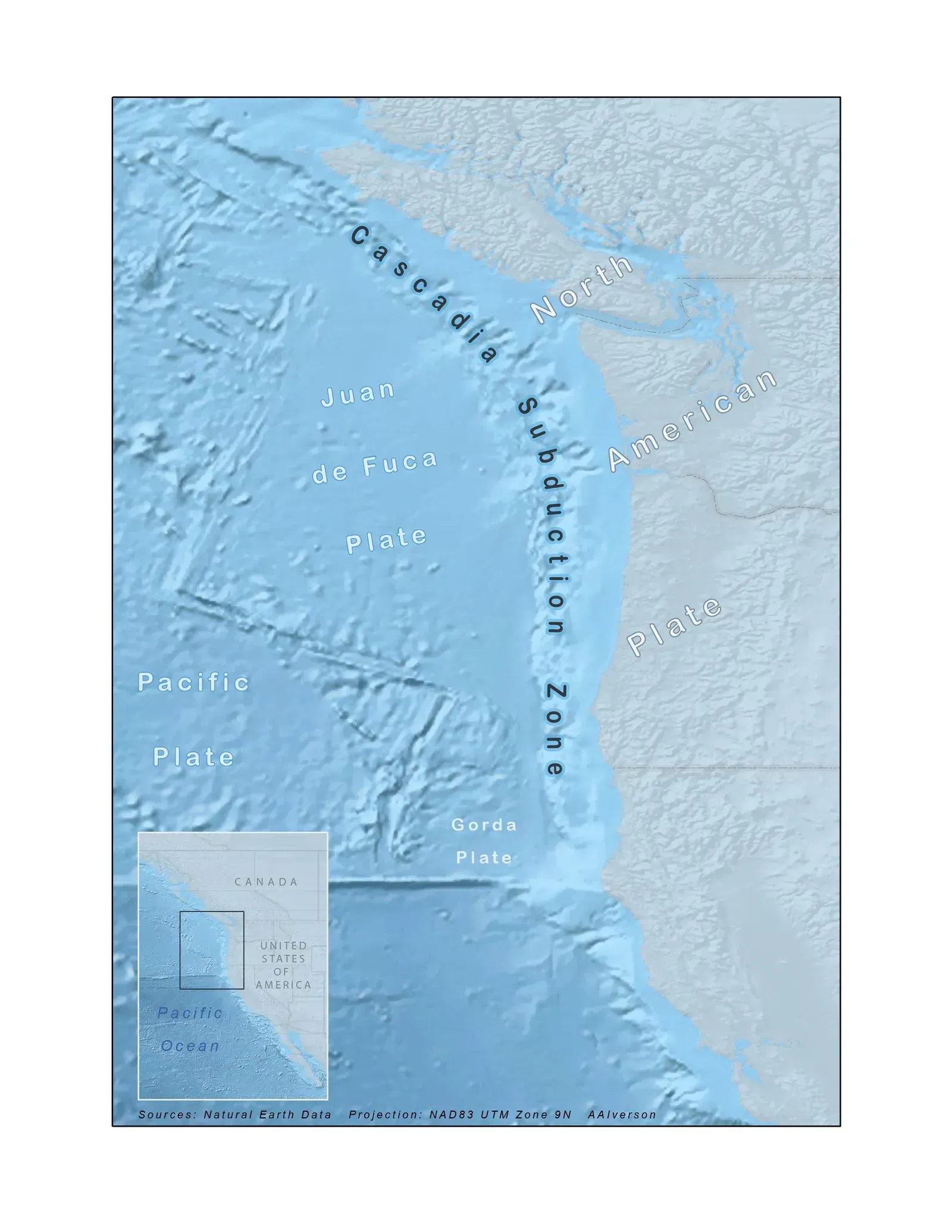
The Cascadia margin runs offshore from northern California to Vancouver Island, and it produced one of the best documented forest losses on record. Along the Washington coast, stands of red cedar were killed when the land dropped and tidal water flooded the roots. Tree ring dating places their death in the winter of 1699 to 1700.
Japanese tsunami records pin the causative earthquake to the evening of January 26, 1700, and it is generally estimated at about magnitude 9. The drowned trees are called ghost forests, and they are mainly evidence of subsidence rather than liquefaction. Still, buried sand layers and sand dikes in coastal sediments show that shaking liquefied soils there as well.
New Madrid Seismic Zone, Central United States
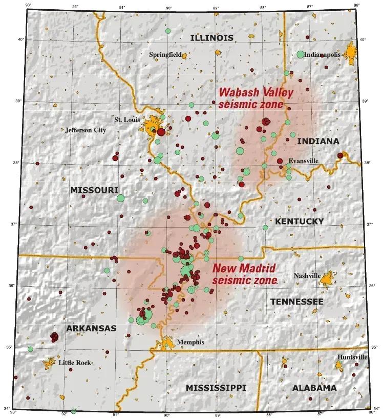
Far from any plate boundary, the New Madrid zone produced a series of powerful earthquakes between December 1811 and February 1812. Eyewitness accounts describe fountains of sand and water, and the landscape of the Mississippi Valley still carries thousands of sand blows from those events. Reelfoot Lake in Tennessee formed as land sank and the area flooded.
Forests were hit in the same way, with stands of trees dropping into standing water or being toppled by ground failure. The region is heavily populated today, and the soils are soft river sediments that liquefy easily. The U.S. Geological Survey continues to treat the area as a meaningful seismic hazard.
Charleston Region, South Carolina
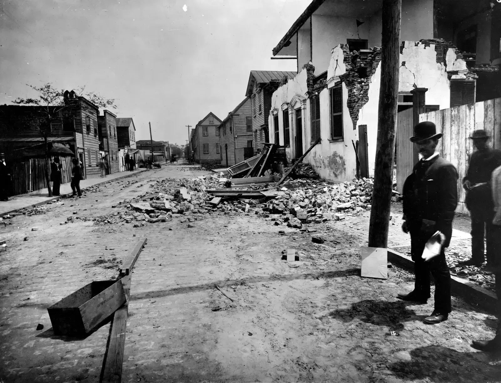
The 1886 Charleston earthquake is often cited as the most damaging in the southeastern United States. Its magnitude is usually put near 7, and geologists later found extensive craterlets and sand blows across the coastal plain. Those features are classic liquefaction signs, and some of them are preserved in the geologic record.
Paleoliquefaction studies have found older sand blows, which suggest that strong earthquakes have struck this region repeatedly over thousands of years. That is useful because the fault source is still debated. A quiet landscape, in this case, hides a long and uneven history.
Hayward Fault, San Francisco Bay Area

The Hayward Fault runs through densely built East Bay communities, and its last major rupture came in 1868. The USGS regards it as one of the most hazardous faults in the country because of how close it lies to so many people. Much of the shoreline around the bay sits on artificial fill and young mud, which are materials prone to liquefaction.
The 1989 Loma Prieta earthquake showed what that can look like. Although it came from a different segment of the San Andreas system, it caused liquefaction in San Francisco’s Marina District, where buildings stood on fill. State seismic hazard maps now flag liquefaction zones around the bay, and they guide where engineering studies are required.
Wasatch Fault, Utah
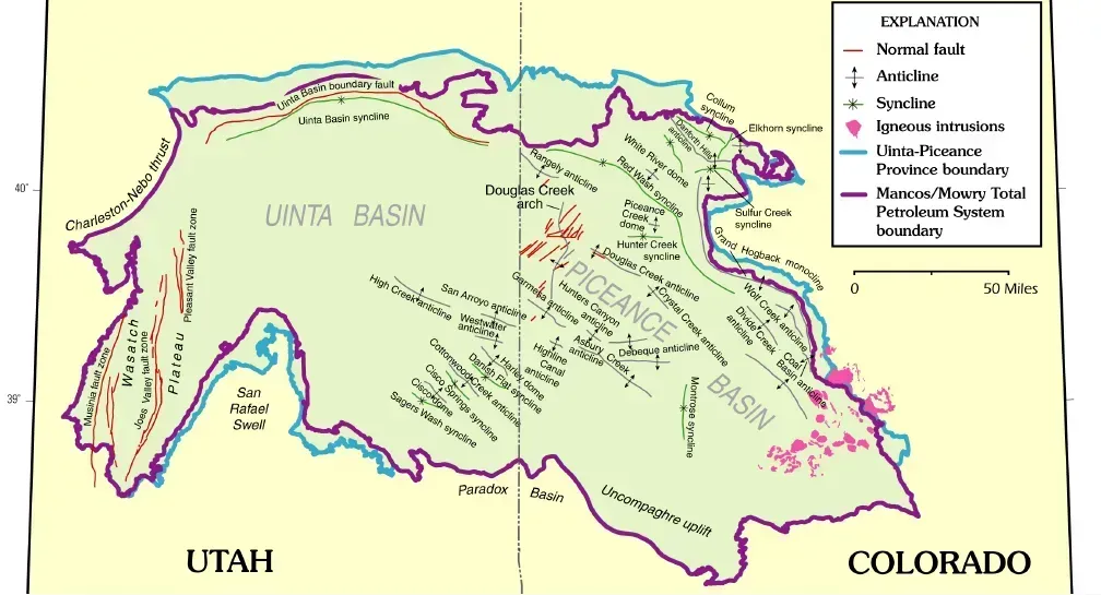
The Wasatch Fault follows the base of the mountains along the Wasatch Front, where most of Utah’s population lives. Its main segments have produced large earthquakes in the geologic past, and it is long enough to generate a magnitude 7 event. Salt Lake Valley is filled with lake and stream sediments, and a shallow water table in some areas raises the odds of liquefaction.
The Utah Geological Survey publishes liquefaction hazard maps for the valley, and they show higher susceptibility in parts of the lowlands near the Jordan River and Great Salt Lake. Most residents rarely think about it. The fault is quiet in historical terms, since no major rupture has occurred in the written record.
Greendale Fault, Canterbury, New Zealand
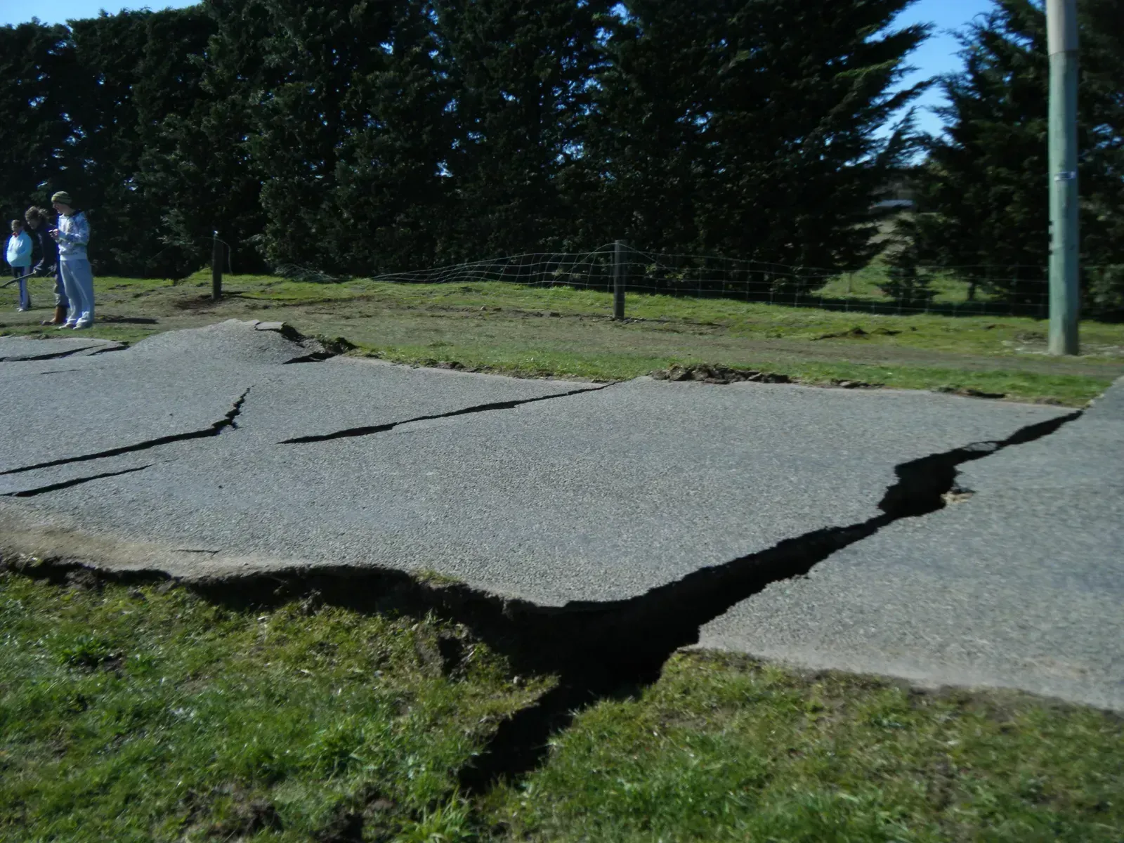
Before September 2010, the Greendale Fault was not known on maps, as it lay buried under the Canterbury Plains. It ruptured in a magnitude 7.1 earthquake, and the fault trace showed up at the surface as a set of ground breaks. A fault that went unnoticed, then, produced a damaging event.
The sequence continued with a shallower magnitude 6.3 shock in February 2011 near Christchurch. Large areas of the city were hit by liquefaction, with silt and sand covering streets and yards, and thousands of homes were damaged. Rebuilding in the worst zones led New Zealand to rethink how it zones land and designs foundations.
Palu-Koro Fault, Sulawesi, Indonesia
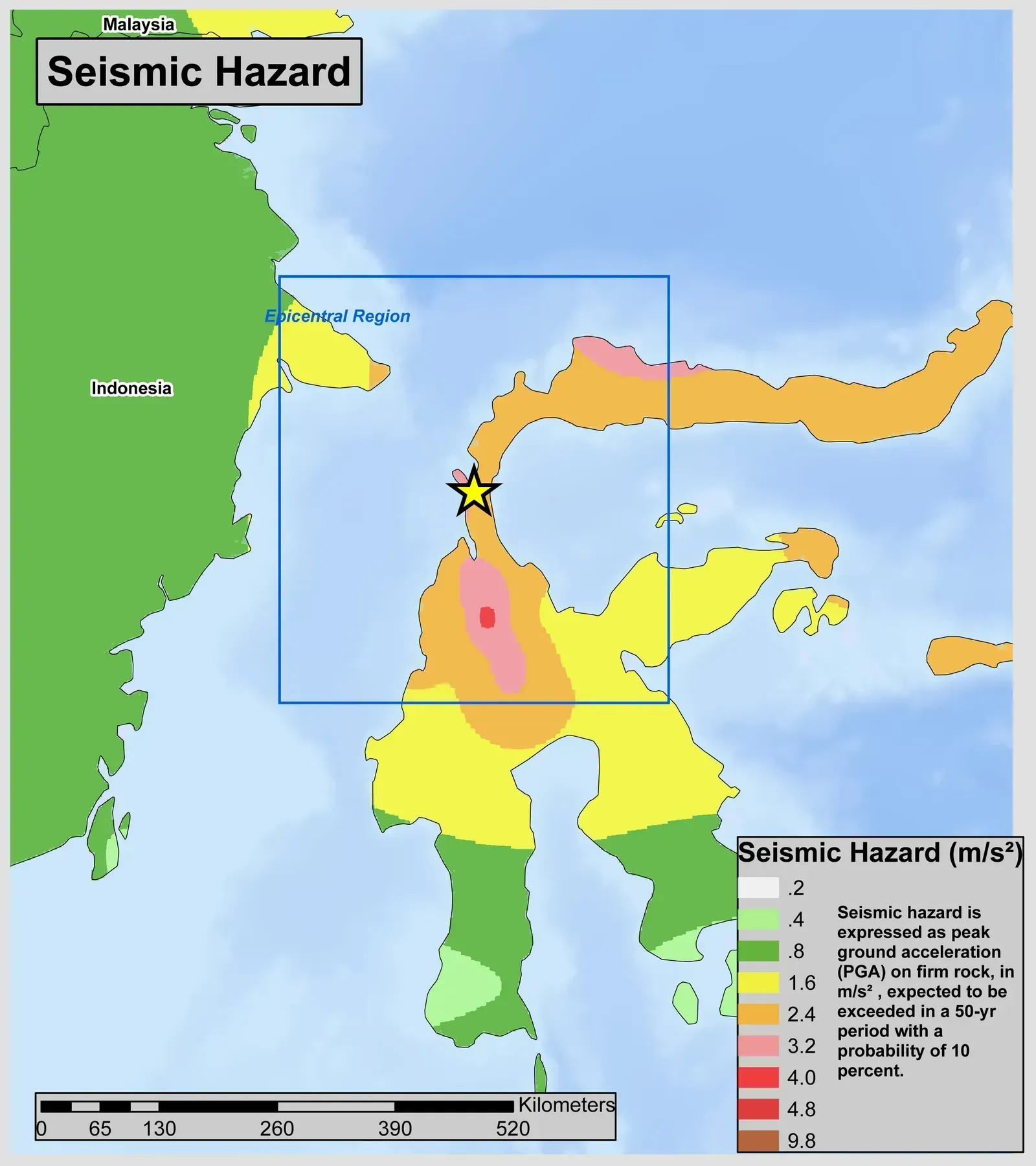
On September 28, 2018, a magnitude 7.5 earthquake on the Palu-Koro Fault struck central Sulawesi. In places such as Petobo and Balaroa, gently sloping, saturated ground flowed like a liquid, carrying houses and trees along with it. Whole neighborhoods were displaced or buried, and the event is widely studied as a case of liquefaction flow slides.
Researchers have used satellite imagery and field surveys to map the extent of these failures. Irrigation and groundwater conditions are thought to have contributed in some areas, though the details remain under study. The disaster showed that liquefaction can move earth over long distances, which goes beyond simple settling.
Noto Peninsula Region, Japan
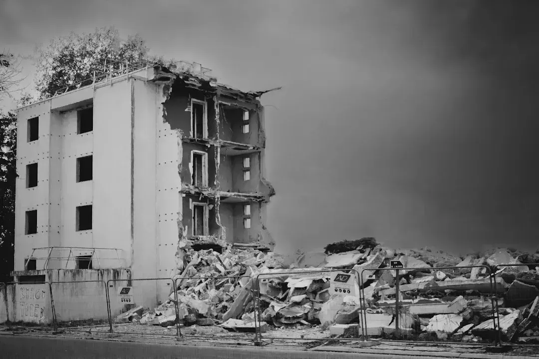
A magnitude 7.5 earthquake struck the Noto Peninsula on January 1, 2024, and shaking affected a wide stretch of the Sea of Japan coast. Liquefaction appeared well beyond the peninsula, including in Niigata Prefecture and in Uchinada, Ishikawa, where roads, utility poles, and homes were damaged. Sandy soils on reclaimed or lowland ground were especially vulnerable.
Japan has long experience with the problem, going back to the 1964 Niigata earthquake, and that history shaped its building rules. The 2024 event still exposed gaps, mostly in older neighborhoods and public infrastructure. Government and academic teams have continued to survey the damage in the years since.
What the Evidence Shows
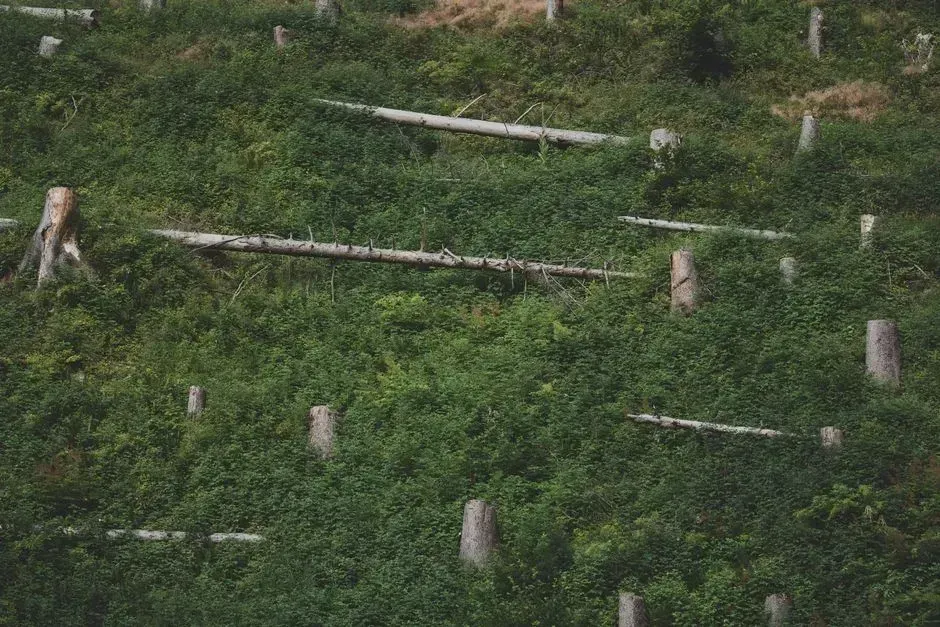
Liquefaction is real and well documented, but the idea of forests vanishing in one night is only partly accurate. Most of the dramatic forest losses on record come from subsidence, flooding, or landslides that occur together with liquefaction. The strongest pattern is geological: loose, wet sediments plus strong shaking tend to produce failure.
Mapping from agencies such as the USGS, the Utah Geological Survey, and Japanese and New Zealand authorities continues to refine where those conditions overlap. Faults that seem calm in recorded history are not necessarily inactive. Sand layers and drowned trees preserve the evidence of earlier events.

- The Shoreline Sucked Dry in Seconds – 5 Tsunami Signals Beachgoers Mistake for Low Tide - November 14, 2026
- 9 Dark-Sky Destinations Around the World Where the Stars Look Unreal - November 14, 2026
- The Fault Line That Never Slips – 7 Locked Seismic Zones Overdue for a Massive Release - November 14, 2026
