


- Forget the Sun Belt: 6 Northern Cities Booming as Climate Refuges - June 2, 2026
- 6 Coastal Towns Geologists Say Won’t Exist by 2060 - June 2, 2026
- The “Forgotten Risk” List: 7 Regions Sitting on Unstable Ground - June 2, 2026
Most people think of disappearing coastlines as a distant, abstract problem. The reality is considerably more immediate. Right now, in Alaska, Louisiana, England, Papua New Guinea, and beyond, entire communities are watching their land shrink – not over centuries, but over decades. In some cases, the countdown is measured in years.
Geologists and earth scientists have documented these losses with precision, using satellite imagery, erosion rate measurements, and sea level projections. What they’ve found is sobering: a handful of real, inhabited places are almost certainly past the point of no return. Here are six of them.
1. Newtok, Alaska, USA
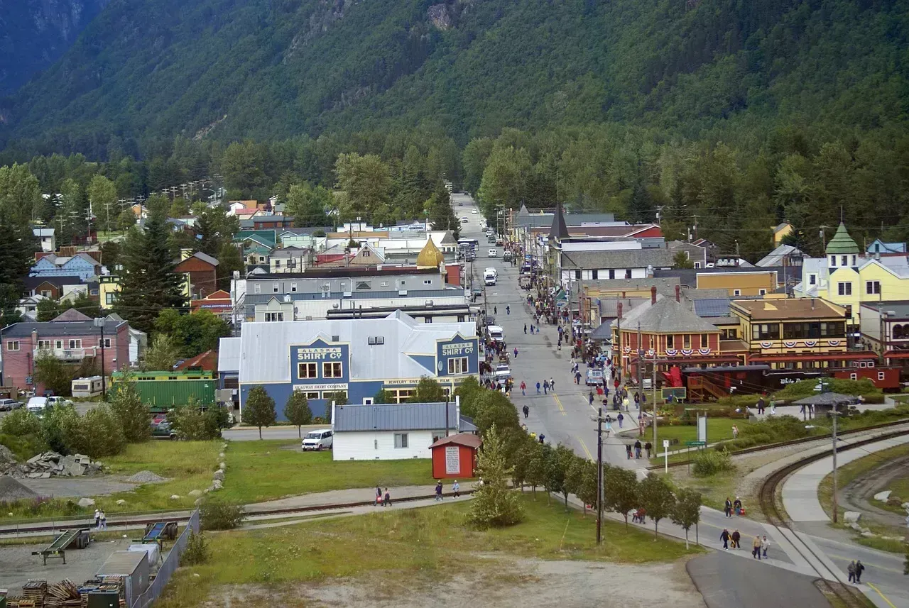
Newtok is a Native Alaskan village that is being forced to relocate as its shorelines erode, with erosion rates exacerbated by thawing permafrost, declining sea ice protection, increased storm surge exposure, and warming temperatures. The geology of the Ninglick River delta is particularly unforgiving here – the frozen ground that once held everything in place is softening, and the river is inching closer to the village every season.
Recent erosion rates in Newtok have averaged about 90 feet per year, and a shoreline erosion map based on historic aerial photos indicates the Ninglick River eroded from 36 to 83 feet per year upstream, with an average rate of 68 feet per year between 1954 and 2003. Moving the entirety of Newtok to its new location is anticipated to cost between $80 and $130 million, and relocation efforts have been delayed due to funding constraints.
2. Isle de Jean Charles, Louisiana, USA

The Isle de Jean Charles was once over 5 miles wide and 11 miles long, but today it has shrunk to just a quarter of a mile wide and 2 miles long. That is an almost incomprehensible loss of land in a single human lifetime. Hurricanes like Katrina flooded the area with salt water, ruining homes and causing land subsidence, while rising sea levels and man-made disturbances such as canal dredging for oil pipelines eroded the marshland to near nothingness.
Isle de Jean Charles has lost about 98 percent of its land to coastal erosion caused by sinking land and exacerbated by rising seas and increased storm surges, and the tribal community that lives there became the first to receive federal funding to help them relocate in response to climate change. The island, forsaken by coastal restoration plans, is expected to disappear by 2050, probably sooner as maps are outdated given accelerating erosion.
3. Happisburgh, Norfolk, England

Happisburgh, on Norfolk’s North Sea coast, is a village of about 1,400 people with roughly 600 houses, and although it is now a coastal village, it was once parted from the sea by the parish of Whimpwell, which has long since been eroded away. The cliffs here are composed of soft glacial till layered with silt and sand – geology that offers almost no natural resistance to wave action.
Nowhere is England’s coastal erosion problem more stark than at Happisburgh in Norfolk, where the coastline is eroding at an alarming rate of 8 to 10 meters per year in some places and is predicted to lose around 97 meters of coastal land in the next two decades if no action is taken. Satellite measurements show that the total land lost to the sea in just eight years, from 2017 to 2025, was 30,000 square meters, equivalent to four full-size football fields.
4. Shishmaref, Alaska, USA
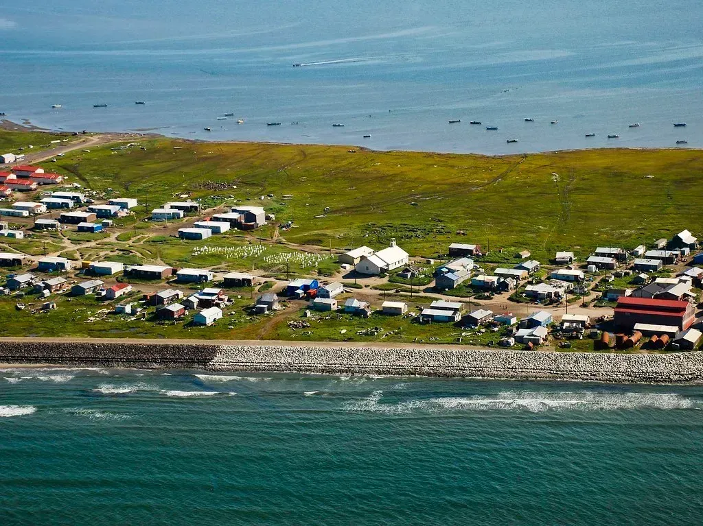
In Shishmaref, erosion is causing extensive damage, creating new dangers to residents, and deepening pressure to relocate. The village sits on a narrow barrier island in the Chukchi Sea, just below the Arctic Circle. Like Newtok, its geological foundation – permafrost – is thawing rapidly, leaving the shoreline structurally vulnerable to even modest wave action.
Shishmaref, a coastal town on the Bering Sea just below the Arctic Circle, is expected to disappear in the next 10 to 15 years, according to an Inupiaq resident whose family has lived there for generations. Erosion is causing extensive damage and deepening pressure to relocate, yet due to high costs and land constraints, tribal communities in Alaska have been experiencing serious difficulty moving to safer areas.
5. The Carteret Islands, Papua New Guinea
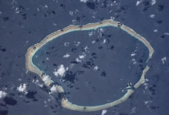
The Carteret Islands are Papua New Guinea islands located 86 km northeast of Bougainville in the South Pacific, comprising a scattering of low-lying islands with a total land area of just 0.6 square kilometers and a maximum elevation of only 1.5 meters above sea level. That razor-thin elevation margin leaves virtually no buffer against the rising Pacific.
Erosion has plagued the Carteret Islands for decades, and despite the construction of sea walls and the planting of mangroves, more than half of their land has eroded since 1994. King tides inundate the land, creating swamps, while areas that previously held food gardens are now under water and saline intrusion is destroying the drinking water supply. In 2007, CNN reported that the Carteret islanders would be the first island community in the world to undergo an organized relocation in response to rising sea levels.
6. Funafuti, Tuvalu (South Pacific)
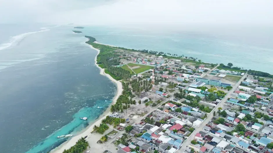
Tuvalu lies largely outside the main cyclone belt in the Pacific, and extreme sea level events there are highly correlated with broader Pacific climate patterns. The capital atoll, Funafuti, sits almost entirely at or barely above sea level. Global mean sea level has risen by about 0.17 meters over the past 100 years, with global rates accelerating from about 1.7 millimeters per year in the late 20th century to around 3.7 millimeters per year at present.
Whether global climate change and sea-level rise in the longer term will result in environmental thresholds beyond which reef landform change becomes unstable or untenable for communities living there is less well understood – but the trajectory is unmistakable. The consequences already include permanent land submergence, more frequent and intense flooding, coastal erosion, and soil and water salinization, and without meaningful adaptation, most low-lying areas face substantial risk from these threats regardless of their level of development.
What connects all six of these places is not bad luck. It’s a convergence of geology, physics, and time. Even if climate change mitigation efforts succeed in stabilizing temperatures in the coming decades, sea levels will continue to rise as a result of the continuing response of oceans to past warming. The land that took millennia to build is disappearing in a matter of years – and for the people who call these places home, that fact is not a statistic. It is the shape of daily life.