
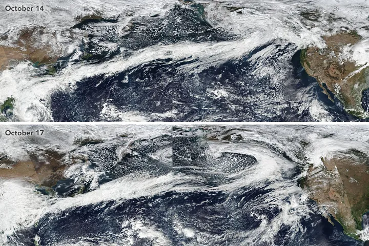
Weather forecasts have picked up a vocabulary that sounds like it belongs in a disaster movie. Words like derecho and bomb cyclone get shared widely whenever a big system rolls in, often with very little explanation. Some of them are older than most people assume, and a few have precise scientific definitions that get lost in headlines.
Here are seven terms you’ll hear more often, along with what meteorologists actually mean by them. Each one describes something specific, and knowing the difference can help you read a forecast with a clearer head.
Derecho
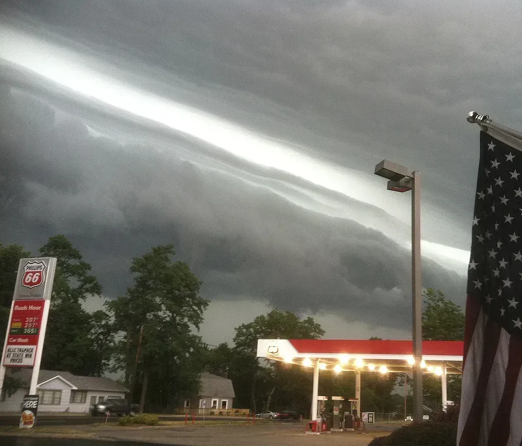
A derecho is a widespread, long lasting windstorm tied to a fast moving line of thunderstorms. The National Weather Service describes it as producing a damage path at least about 240 miles long, with wind gusts of at least 58 miles per hour along most of that path. The word comes from Spanish and means straight, which fits, because the damage is caused by straight line winds rather than a tornado’s rotation.
The August 2020 derecho across Iowa and the Midwest is the modern benchmark. It flattened huge areas of cropland and brought gusts above 100 miles per hour in parts of Iowa. Derechos are most common in the central and eastern United States during warm months, so they surprise people who expect big wind events only in winter.
Haboob
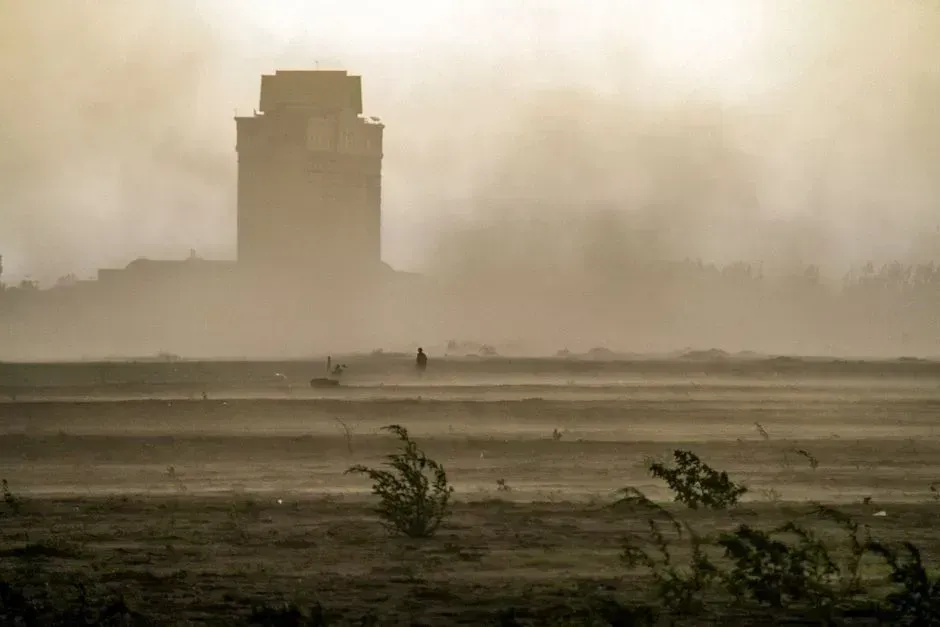
A haboob is a massive wall of dust pushed along by the outflow from a thunderstorm. Cold air rushes out of a collapsing storm, scoops up loose desert soil, and carries it across the landscape. The term comes from an Arabic word linked to blowing, and it was first used for storms in Sudan.
In the United States, haboobs are most associated with Phoenix and southern Arizona during monsoon season. A dust wall can climb to roughly a mile high and cut visibility to almost nothing within seconds. The standard advice from Arizona’s transportation officials is to pull off the road, turn off your lights, and take your foot off the brake.
Bomb cyclone
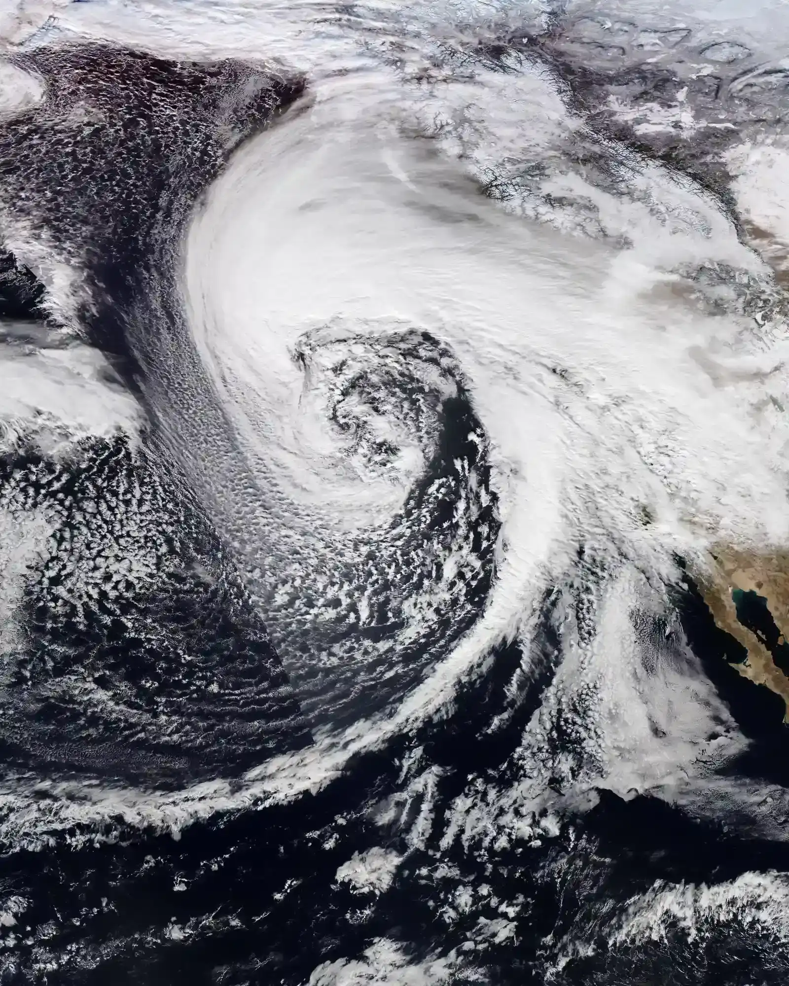
Bomb cyclone is the popular name for a storm that undergoes bombogenesis, meaning its central pressure drops very quickly. The usual benchmark is a fall of at least 24 millibars within twenty four hours, a threshold scaled to latitude. The term goes back to a 1980 paper by meteorologists Frederick Sanders and John Gyakum, so it isn’t a social media invention.
Rapid pressure falls tend to mean intense winds, heavy precipitation, and sometimes blizzard conditions or coastal flooding. These storms form most often over ocean waters along the East Coast and in the North Pacific. Not every bomb cyclone makes landfall, but when one does, forecasters take it seriously.
Atmospheric river
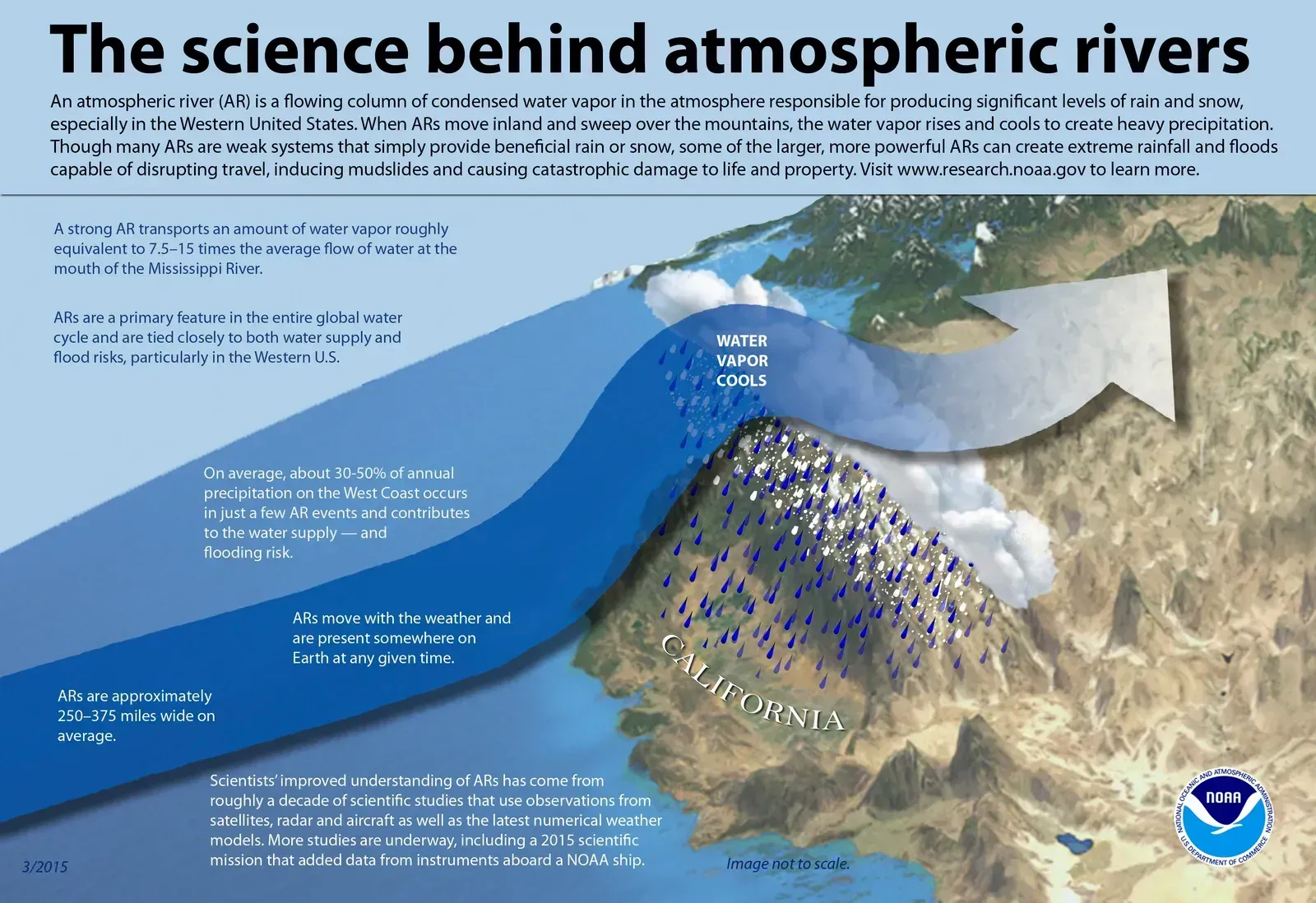
An atmospheric river is a long, narrow corridor in the sky that carries large amounts of water vapor from the tropics toward higher latitudes. NOAA compares the water they can carry to the flow of very large rivers. When that moisture hits mountains, it is forced upward and falls as rain or heavy snow.
On the U.S. West Coast, these systems supply a large share of annual precipitation, roughly a third to a half according to federal researchers. They can end droughts and cause damaging floods in the same season. The series of storms that hit California in the winter of 2022 to 2023 showed both sides clearly, and scientists now rate them on a one to five scale for strength and impact.
Polar vortex

The polar vortex is not a single storm. It is a large area of low pressure and cold air that sits over the Arctic and spins counterclockwise, and it exists all year, though it is strongest in winter. Most of the time it stays contained, held in place by a strong jet stream.
When the vortex weakens or stretches, lobes of frigid air can slip south into Canada and the United States. That’s what happened in January 2014 and again in February 2021, when severe cold stressed the Texas power grid. A cold snap on its own doesn’t mean the vortex is “broken,” only that part of it has wandered.
Heat dome
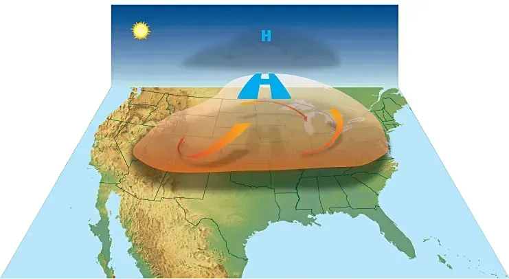
A heat dome forms when a strong area of high pressure parks over a region and stays there. Sinking air under the high warms as it compresses, and it also suppresses clouds and storms that might otherwise cool things off. The effect resembles a lid on a pot, which is where the name comes from.
The best known recent case is the late June 2021 event in the Pacific Northwest and western Canada. The village of Lytton, British Columbia, hit 121.3 degrees Fahrenheit, a Canadian national record. Heat domes can last days or even weeks, which is why they are linked to a high number of heat related illnesses.
Dew point

Dew point is the temperature at which air becomes saturated and water vapor starts to condense into dew. It is a direct measure of how much moisture is in the air, which makes it a better gauge of how muggy it feels than relative humidity. Relative humidity changes with temperature, while dew point stays more stable.
As a rough guide, dew points in the 50s feel comfortable to most people, and readings in the 60s start to feel sticky. Once they climb to around 70 degrees Fahrenheit or higher, the air feels oppressive because sweat evaporates poorly. Forecasters also watch dew point when judging thunderstorm potential, since more low level moisture gives storms more fuel.
Quick reference
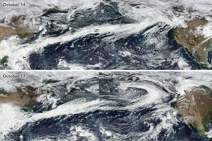
A derecho is a long swath of straight line wind damage, and a haboob is a dust wall driven by storm outflow. A bomb cyclone is a storm whose pressure plunges at least 24 millibars in a day.
An atmospheric river is a plume of moisture, the polar vortex is Arctic cold air that sometimes spills south, and a heat dome is stalled high pressure that traps heat. Dew point tells you how much moisture is truly in the air.

- Time Moving Measurably Slower Near Orbit – 5 Relativistic Quirks Astronauts Face - November 13, 2026
- 6 Things Scientists Monitor in Space That Most People Never Think About - November 13, 2026
- I Asked AI and a Waste Auditor How to Cut My Household Trash – Where They Disagreed - November 12, 2026
