


- Phantom Energy Sucking Power 24/7 – 7 Home Electronics Quietly Inflating Utility Bills - November 14, 2026
- A Million-Mile Storm Raging for Centuries – 6 Violent Weather Wonders in Our System - November 14, 2026
- Animals Flee Hours Before the Tremor – 7 Natural Warnings Before Disasters Strike - November 14, 2026
On the afternoon of March 27, 1964, most people in southern Alaska were winding down a holiday weekend. It was Good Friday, schools were closed, and many families were home or heading to church services. At 5:36 p.m. local time the ground began to move, and it kept moving for several minutes.
More than sixty years later, that event still holds the record as the largest earthquake in United States history. Its effects reached far beyond Alaska, and scientists still study it to understand how great subduction zone earthquakes behave.
A Quake That Lasted Minutes, Not Seconds
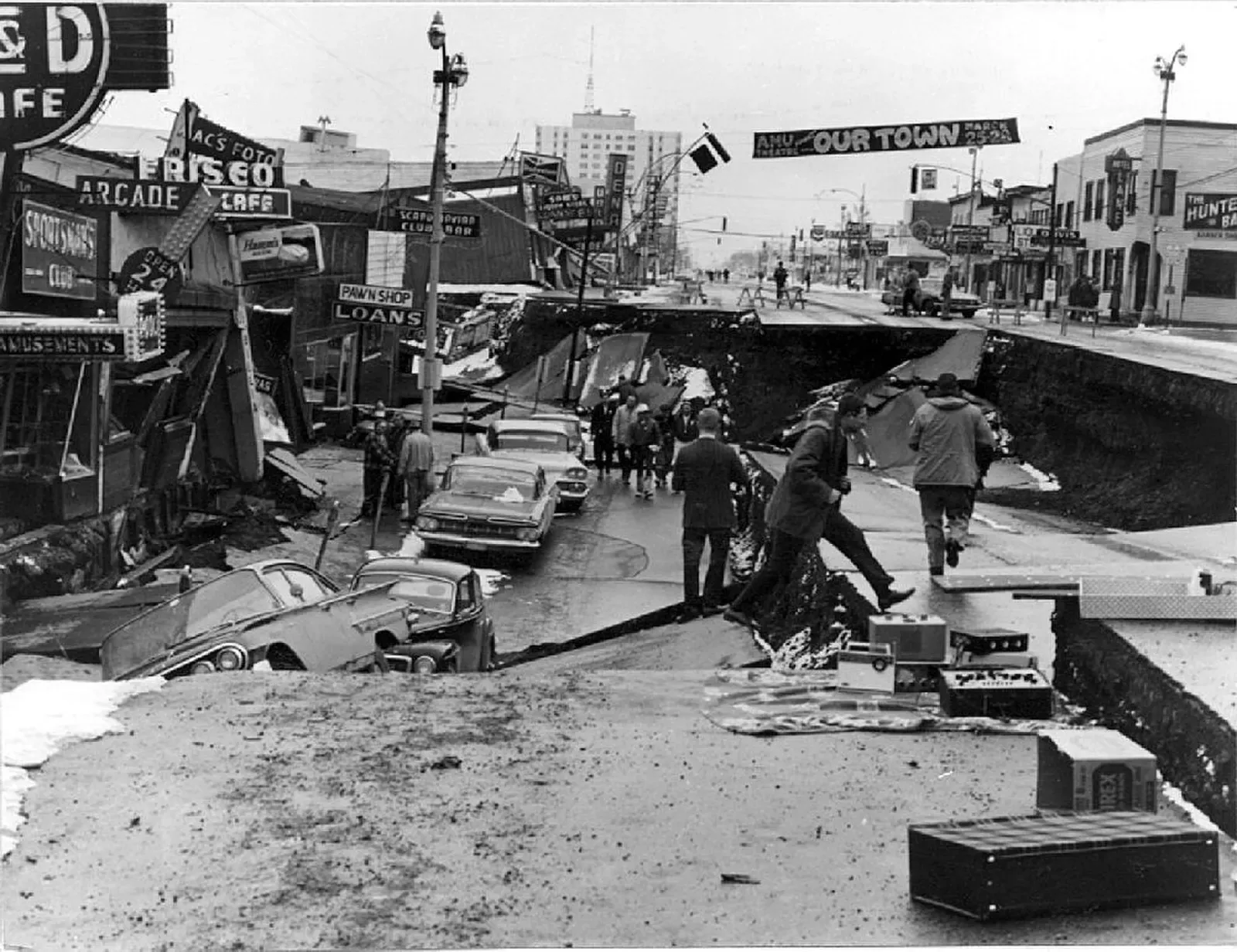
The U.S. Geological Survey lists the earthquake at magnitude 9.2, which makes it the second largest ever recorded anywhere in the world. Only the 1960 Chile earthquake was bigger. Most strong quakes shake for under a minute, but this one produced strong shaking for roughly four and a half minutes.
That length matters. Buildings and soil that might survive a short jolt can fail when the shaking goes on and on. Many of the worst failures in Alaska were tied to that long duration.
Where and How the Fault Ruptured
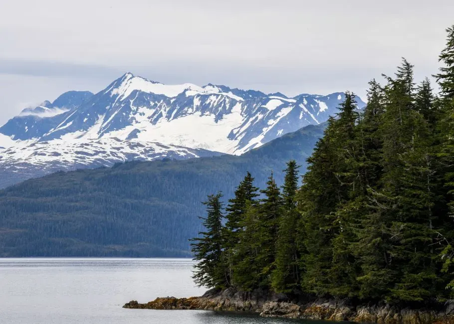
The epicenter was in the northern part of Prince William Sound, not far from Valdez, and the quake began at a depth of around fifteen miles. The cause was the Pacific Plate sliding beneath the North American Plate along the Aleutian megathrust. This kind of fault is called a subduction zone, and it produces the largest earthquakes on Earth.
The rupture stretched for several hundred miles, running from the Prince William Sound area southwest toward Kodiak Island. That is a huge stretch of fault to slip in a single event. It explains how the quake released so much energy.
Anchorage and the Landslides
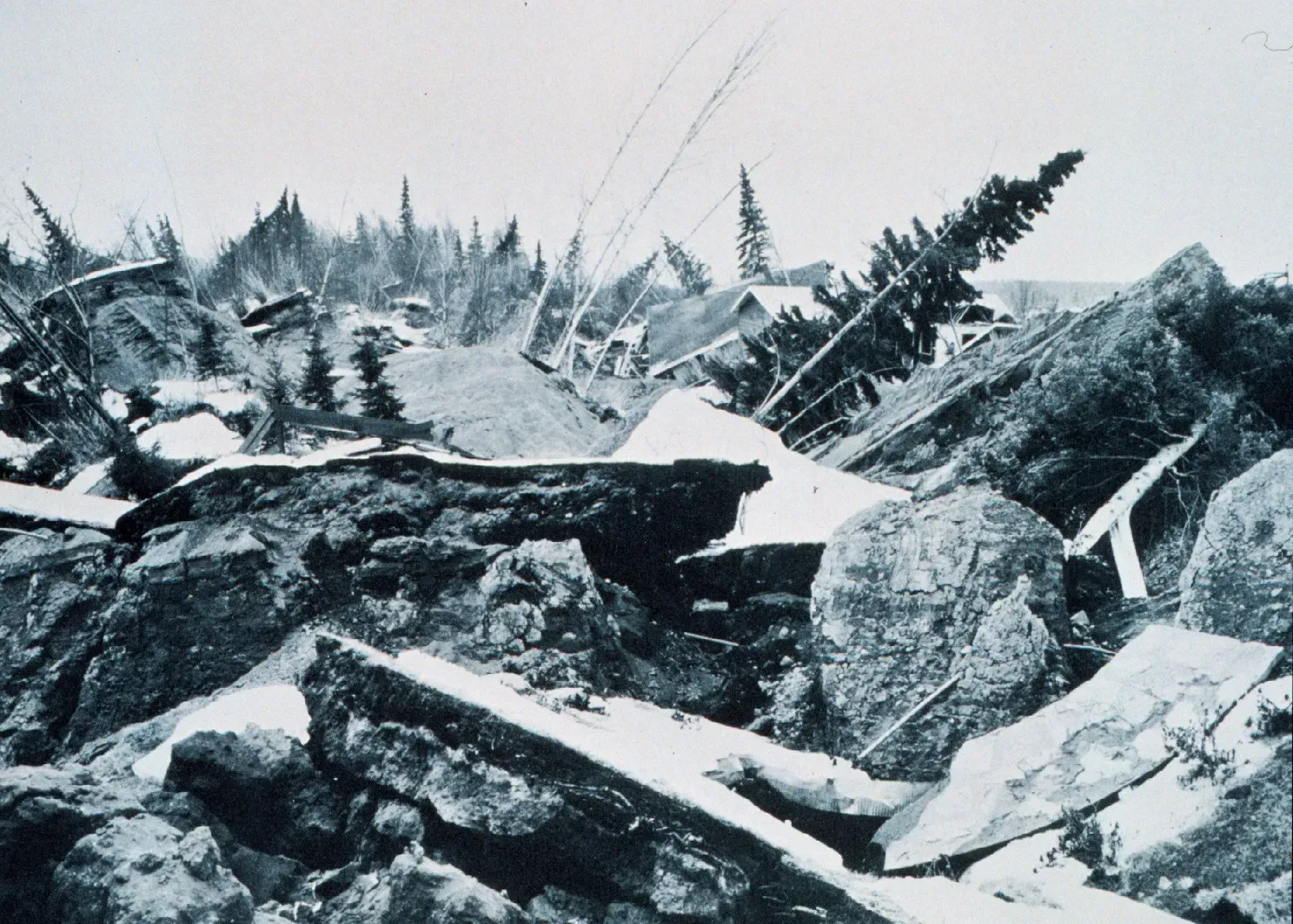
Anchorage sat about seventy five miles or so from the epicenter, and it suffered serious damage anyway. Downtown streets cracked, and parts of the business district dropped as the ground gave way. The most famous disaster was in the Turnagain Heights neighborhood, where a large block of land slid toward the water and carried homes with it.
Geologists later tied the failures to layers of clay that lost their strength during the long shaking. The lesson, that soft soils can turn treacherous in a big quake, shaped later building practices and land use planning in earthquake country.
Land That Rose and Land That Sank
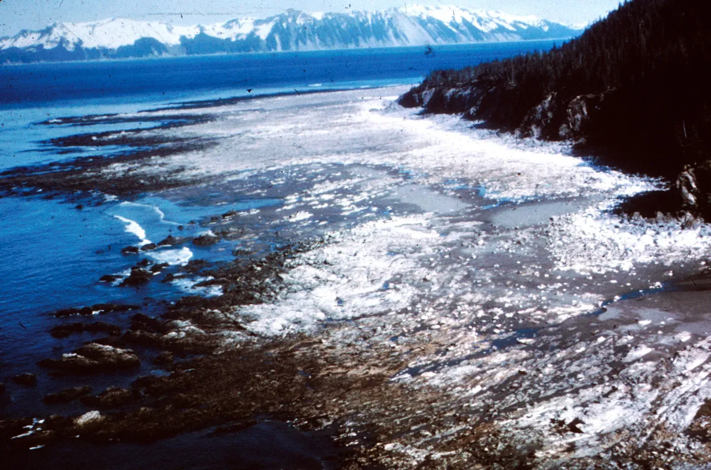
The earthquake permanently changed the shape of the coast. Some areas were pushed upward by many feet, and the greatest uplift measured about thirty feet or more on Montague Island. Other areas, including parts of the Kenai Peninsula and the Kodiak region, dropped by several feet.
For coastal communities, this meant harbors that were suddenly too shallow or neighborhoods that flooded at high tide. Scientists used these measurements to map how the crust deformed. Those maps became important evidence for understanding what happens above a megathrust fault.
Tsunamis in Alaska
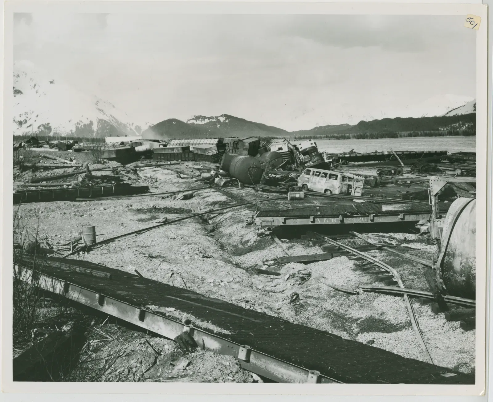
The shaking was only part of the danger. Underwater landslides and the seafloor movement itself generated waves that struck communities within minutes. Valdez, Seward, Whittier, and Kodiak were all hit, and the waves destroyed docks, boats, and waterfront buildings.
In Valdez, the damage was so severe that the town was eventually rebuilt at a new site on more stable ground. That decision shows how much a single event can change where and how people live.
Waves Across the Pacific

The tsunami also traveled well beyond Alaska. Waves struck parts of British Columbia, Washington, Oregon, and California, and the damage was heavy in Crescent City, California. Several people died in Oregon and California as the waves arrived hours after the quake.
The fact that people so far away were hurt highlighted a gap in warning capability. A wave that takes hours to cross an ocean can be announced in advance, if the right systems exist.
The Human Toll
The USGS puts the death toll at 131 people. Most of those deaths came from the tsunamis rather than from the shaking. Considering the size of the earthquake, the number was relatively low, which experts have often linked to the low population in the region and the timing of the event.
Property losses were still enormous. Roads, railroads, ports, and utilities were damaged across a wide part of the state. Recovery took years, and federal aid played a major role in rebuilding.
What Changed After 1964

The disaster pushed the United States to improve tsunami warning. Today the National Tsunami Warning Center in Palmer, Alaska, monitors earthquakes and sea level data to warn coastal communities. Its roots go back to the response to this event and the earlier need for better Pacific coverage.
The earthquake also became a reference point for researchers studying the Cascadia Subduction Zone off the Pacific Northwest, which is a similar type of fault. Engineers and planners continue to use lessons from Alaska in building codes, hazard maps, and evacuation planning. The 1964 earthquake remains the benchmark for what a great American earthquake looks like.
