


- Rivers Flowing Backward for Days – 6 Forgotten Quakes That Literally Bent Geography - November 13, 2026
- 9 Items Experienced Skywatchers Bring Along That Beginners Always Wish They’d Packed - November 12, 2026
- I Moved to Tornado Alley in Oklahoma – 7 Things I Did Not Anticipate About Storm Season - November 12, 2026
A climate baseline that keeps climbing
Every heat wave now forms on top of a warmer starting point than the one before it. Global temperatures from the past three years averaged more than 1.5°C above the pre-industrial level, and the last decade has been the warmest on record. That is not a one-off spike tied to a single weather pattern. It is a shifted baseline that makes it easier for ordinary spring warmth to tip into record-breaking heat.
Public health researchers have been saying for years that this shift would eventually show up outside the traditional summer window. As one UCLA physician who studies heat and health put it, “We always knew that climate change was going to bring more extreme heat days, and that was going to start earlier in the year,” and “I think we’re seeing that now.” That observation has aged quickly, given how the 2026 season has unfolded so far.
El Niño’s return tightens the odds
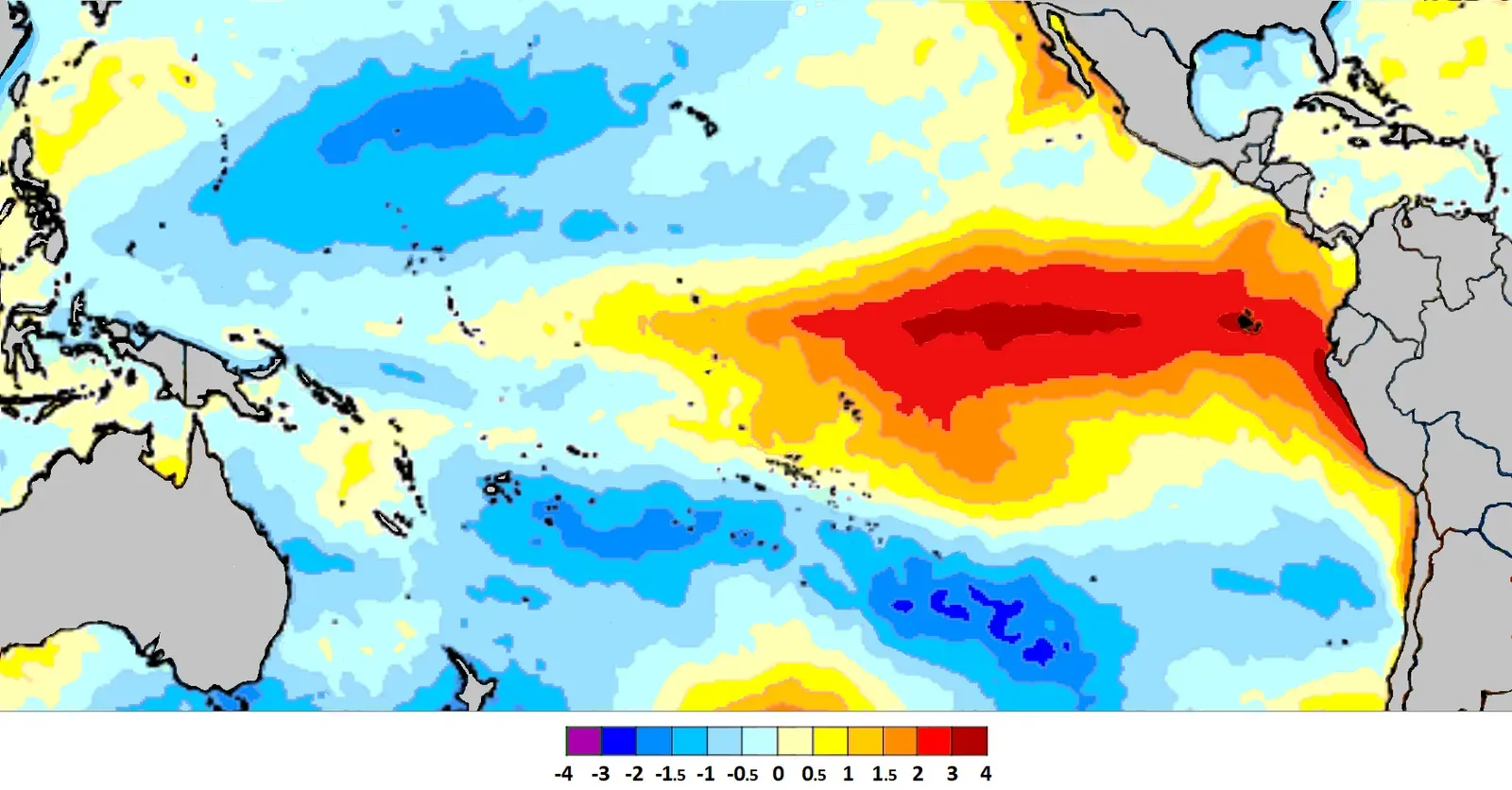
The ocean is playing an outsized role this year. By March 2026, forecasters were already noting that about 80% of the models cross the El Niño threshold by early fall, with just under 20% of the models remaining ENSO neutral and only a small minority showing a weak La Niña pattern. That momentum continued through spring and into summer.
By June, NOAA’s National Weather Service confirmed El Niño had developed in the tropical Pacific and predicted it would intensify to a moderate or strong level by fall. The World Meteorological Organization’s own outlook backed this up, noting a pronounced shift toward El Niño conditions, with probabilities reaching 80% for June to August 2026, while the likelihood of ENSO-neutral conditions had diminished to 20%. El Niño years tend to load the dice toward hotter global averages, which is one reason forecasters have been watching this transition so closely.
Why heat domes are forming earlier and lasting longer
The mechanism behind most modern extreme heat events is the heat dome, a stubborn zone of high pressure that traps warm air like a lid on a pot. Atmospheric scientists explain that a heat dome is a persistent high-pressure system created by sinking air, which warms as it descends, decreasing humidity and leaving clear, sunny skies that also trap hot surface air and keep it from rising and dissipating. The longer that lid stays in place, the worse conditions get underneath it.
What has changed is how long these domes now linger. Researchers point out that climate change is altering the behavior of the polar jet stream in ways that make heat domes more persistent, because when the jet stream buckles and slows, it can lock high-pressure systems in place for days or weeks. A PBS climate segment framed the trend bluntly, noting that heat domes act like a lid trapping hot air underneath and allowing temperatures to rise day by day, and for the last ten years they have been on the rise.
The warning sign: March 2026’s record-shattering Southwest heat dome

If anyone needed proof that the heat season is starting earlier, March 2026 provided it. An intense ridge parked itself over the American Southwest weeks before summer even began, and an unusually intense and early season heat wave shattered March temperature records across much of the region, with meteorologists warning the event could rank among the most expansive March heat waves in modern U.S. history. The numbers were startling for the time of year.
Multiple locations in Arizona and California hit 112 degrees Fahrenheit, smashing the previous record for the hottest March temperature ever recorded in the continental United States, and at least 14 states logged their hottest March day on record. Climate attribution scientists moved quickly on this one too. World Weather Attribution, an international research group, determined that the record heat was “virtually impossible” and 800 times more likely because of climate change from the burning of coal, oil and natural gas.
Europe’s spring that turned to summer overnight
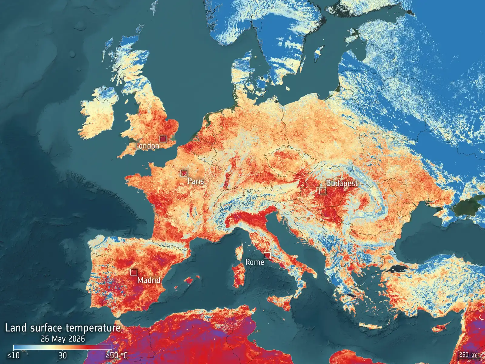
Europe’s 2026 season followed a similar script, just a couple of months later. Severe Weather Europe described how a massive and persistent high-pressure system trapped a hot air mass advected up from North Africa over Western and Central Europe, and in a matter of days the calendar month of May went from below-average to extremes, with a large part of the continent pushed straight into conditions typical of mid-July. The United Kingdom alone broke long-standing records by wide margins.
Kew Gardens in London recorded 35.1°C, and researchers noted that this broke the previous May record from 1922 by nearly 5°C and was also the earliest 35°C ever recorded in the UK, with the previous early-season record dating to June 26, 1976. By June, the pattern repeated on an even larger scale. Copernicus reported that June 2026 was the hottest June recorded for western Europe and the second warmest globally, with near-record temperatures driven by the highest sea surface temperatures on record for the month. Notably, the heatwave that hit much of Europe during the second half of June came only a few weeks after a particularly intense heatwave in May, with another heatwave emerging in early July.
South Asia’s heat season is starting before spring even ends

In South Asia, the shift toward earlier extreme heat has become almost routine in recent years, and 2026 pushed that trend further. Reporting from May 2026 described how a record-breaking, deadly heatwave sweeping South Asia pushed temperatures to dangerous highs, with countries including India, Pakistan and Bangladesh seeing readings approach or exceed 45 to 50 degrees Celsius. The timing was the striking part.
Researchers writing for Phys.org noted that this time of year is usually the peak before monsoon rains bring relief from June, but this year’s heat began earlier, with intense sustained heat starting in mid-April and daily maximum temperatures topping 46°C in many locations, running five to eight degrees above seasonal norms. India’s meteorological agency flagged the geographic spread too, warning that heatwaves are likely to be more frequent than usual along the eastern coast, in parts of the Himalayan foothills, and in the western states of Maharashtra and Gujarat.
Where the next wave is expected to strike first: the American West and Great Basin
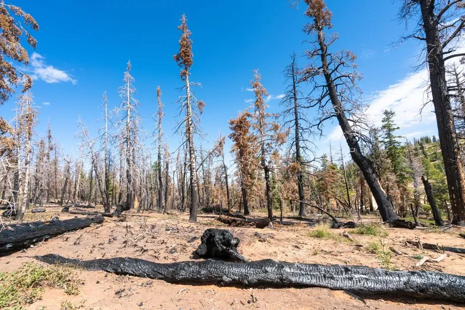
Long-range outlooks for the United States point squarely at the interior West as the region most likely to see the next major heat event develop first. AccuWeather’s seasonal forecast found that a hot summer is predicted across most of the contiguous United States, with almost no areas expected to have temperatures below the historical average for the season. Within that broad outlook, one region stands out.
The worst of the heat is expected to focus across parts of California, Idaho, Montana, Nevada, Oregon, Utah, Washington and Wyoming, fueling a widespread fire threat. AccuWeather meteorologist Brandon Buckingham summarized the risk this way: “Northwest, Great Basin wildfires can be destructive this summer, along with impressive heat waves and increasing drought conditions.” Given that this same region already broke records in March, forecasters are watching it closely as the likely starting point for the next major event.
Where the next wave is expected to strike first: Southern and Western Europe
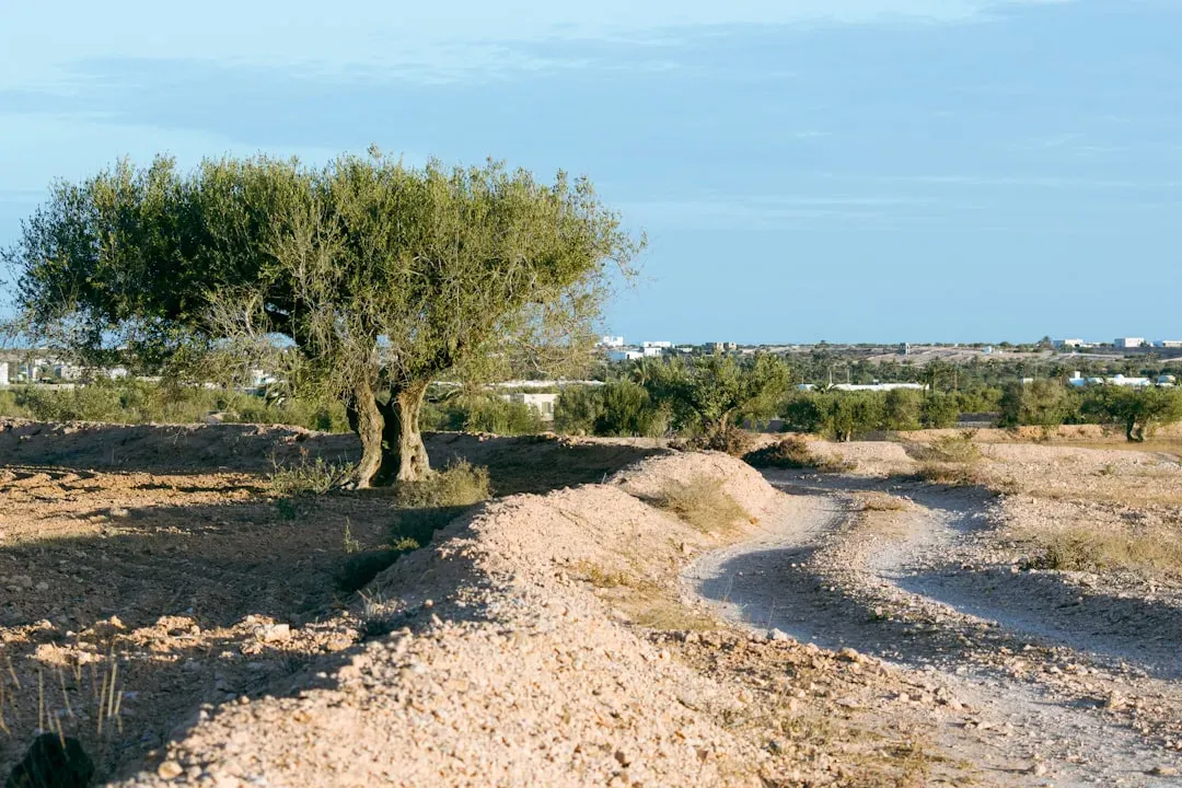
Europe’s Mediterranean rim, particularly Spain, Portugal and southern France, has emerged as the continent’s most consistent early hot spot. During the June 2026 event, Spain and Portugal pushed toward 44°C, with 42.7°C recorded at Pinhão in Portugal and Andújar in Spain on 21 June, the heatwave’s highest readings. France was not far behind, with highs of 40 to 44°C putting 49 of 96 mainland departments under the top heat warning, forcing hundreds of schools to close or cut hours.
The pattern has not let up since. By mid-July, Copernicus was already tracking a third distinct heat event in the space of six weeks, describing Europe as enduring its third heatwave in six weeks, calling the relentless succession of waves after spells in late May and record-breaking heat in late June a hallmark of a warming climate. The compounding effect on soil moisture and drought only raises the odds that the region’s next heat event arrives on an already stressed landscape, since widespread dryness combined with extreme heat contributed to wildfire activity in the Iberian Peninsula and southern France, against a backdrop of increasingly dry soils that began developing during May’s heatwave.
Where the next wave is expected to strike first: South Asia’s pre-monsoon corridor

The stretch of northern and central India, along with southern Pakistan, remains the place where extreme heat tends to arrive earliest in the global calendar, often weeks before the pre-monsoon season traditionally begins. A 2026 assessment found that India experienced an early onset of summer and extreme heat events, with 98 of the world’s 100 hottest cities located within its borders, and temperatures surging past 45°C across northern, central and eastern India. The human cost has already been severe this year.
By late May, reporting confirmed that a severe heat wave in India had killed 37 people from heatstroke as temperatures approached 50 degrees Celsius, with Uttar Pradesh cities recording the world’s highest temperatures. With a strengthening El Niño in play for the second half of 2026, regional analysts have flagged the possibility of conditions intensifying further before the monsoon arrives to break the pattern.
The takeaway

None of this means every region will see record heat every single year from now on. Natural variability still matters, and forecasts carry real uncertainty months in advance. What the pattern across 2024, 2025 and 2026 does suggest is that the traditional boundaries of “heat season” are eroding, with the American Southwest, Mediterranean Europe and South Asia’s pre-monsoon belt standing out as the places most likely to feel it first the next time a major heat dome takes shape. Watching those three regions closely, rather than waiting for the calendar to say summer, may be the more useful way to anticipate what comes next.
