

Where the heat stands right now
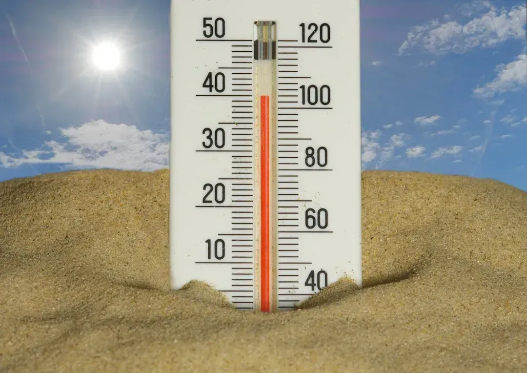
As of late July 2026, the country is dealing with its third significant heat dome of the season, and it’s not a small one. Roughly 80 million Americans from Dallas to the Dakotas are now under heat advisories as a third successive heat dome this summer locks over the central United States with no meaningful overnight relief in the forecast through at least early August. Forecasters describe this system as the most powerful currently active anywhere on the planet.
This isn’t happening in isolation. After 44 deaths and shattered temperature records in prior domes, NOAA warns of Level 3-4 extreme heat risk for the current event. Zoom out further and the scale becomes clearer: since late June, approximately 280 million Americans, more than 85 percent of the country’s population, have experienced above-average or well-above-average temperatures, while just 2.8 million have seen cooler-than-average conditions.
What a heat dome actually is
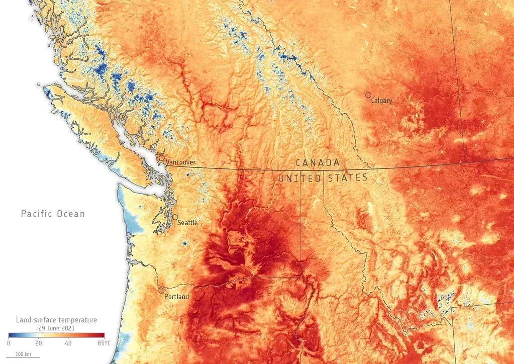
The term gets thrown around a lot, but it describes something specific. According to NASA, a heat dome forms when a strong ridge of high pressure lingers in the upper atmosphere, pushing hot air toward the surface and trapping it there. Once that lid is in place, the atmosphere basically stops cooperating with anyone hoping for relief.
The trapped air doesn’t just sit still, it gets hotter. Heat domes put the brakes on convection and suppress clouds and precipitation, which allows sunlight to reach the surface relatively unhindered and further elevate air temperatures. That’s why these events can drag on for a week or more instead of breaking after a single hot afternoon like an ordinary summer warm spell.
Counting the days: what forecasters are actually saying
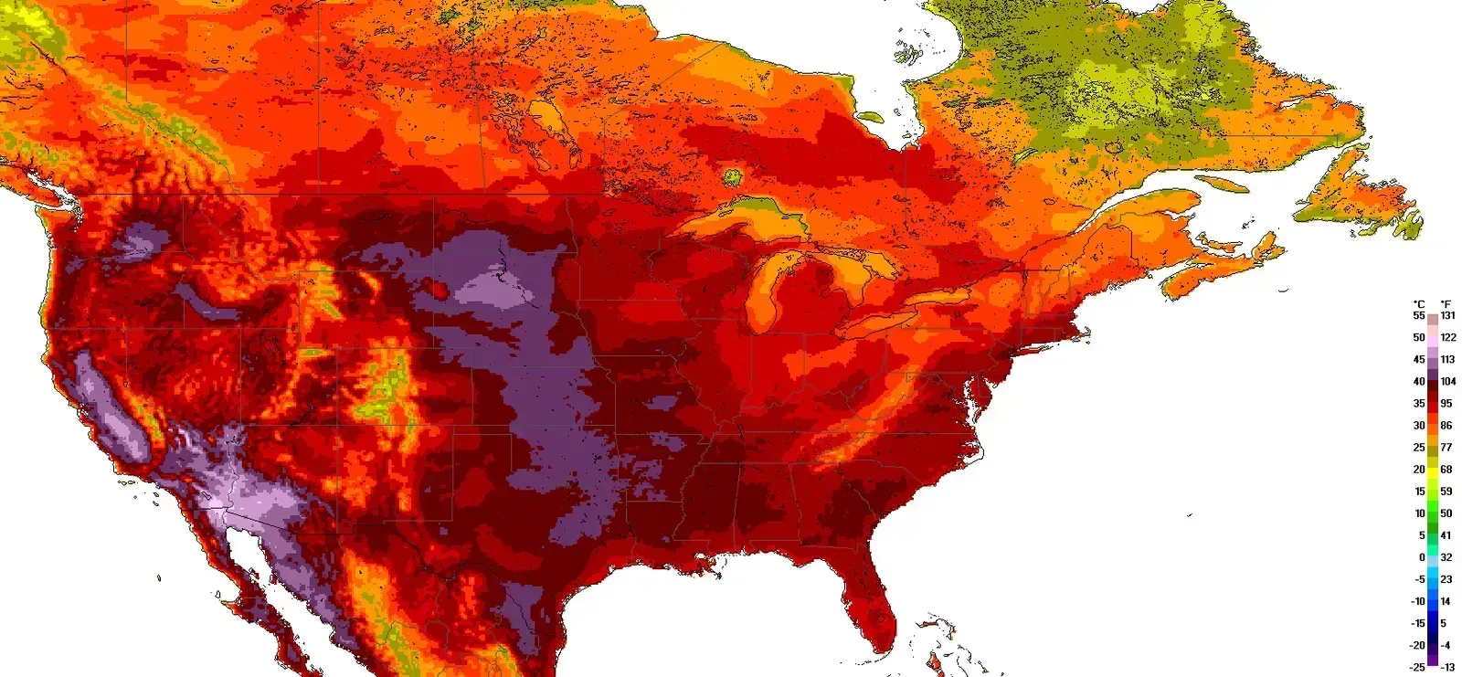
So how many days are we actually talking about? The honest answer is that meteorologists aren’t promising a quick exit. Reporting from late July indicates the current dome is expected to persist with no meaningful overnight relief in the forecast through at least early August. That puts the earliest realistic turning point somewhere in the first several days of August, not this coming weekend.
Longer-range outlooks aren’t much more comforting. Forecasters tracking the pattern into the second week of August expect temperatures to stay above the historical average across much of the central United States, meaning even after this particular dome loosens its grip, the broader pattern of heat isn’t likely to vanish overnight. NOAA’s own hazards outlooks have repeatedly extended the excessive heat window forward by a few days each time they’re updated, a sign that the system keeps reasserting itself rather than collapsing cleanly.
Why nighttime offers no real escape

One of the most dangerous features of this stretch isn’t the daytime high, it’s what happens after dark. Overnight lows in many affected areas simply aren’t dropping into a range the body can use to recover. As one meteorological summary put it, people die not from a single hot afternoon but because the body cannot recover when night temperatures stay elevated for days on end.
That danger isn’t theoretical. In Pennsylvania, the Berks County Coroner’s Office confirmed a 68-year-old man died on 2 July 2026 after trimming bushes outdoors in Bethel Township, where temperatures exceeded 100°F. His death was attributed to cardiac strain triggered by heat exhaustion, a reminder that heat-related fatalities often look like ordinary medical emergencies rather than dramatic heatstroke cases.
The human and economic toll so far
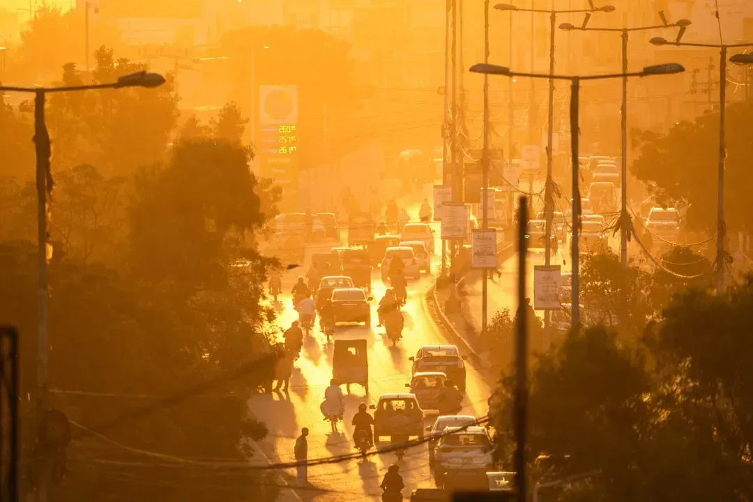
The numbers behind this summer are already sobering. The heat wave spanning the Fourth of July holiday alone produced at least 44 heat-related fatalities: 29 in New Jersey, 7 in Pennsylvania, 4 in Illinois, 3 in New York, and one in Mississippi, with an additional Mississippi death recorded just before the holiday. These figures sit inside a much longer trend line that has been climbing for years.
Nationally, heat-related deaths increased 117 percent from 1999 to 2023, jumping from 1,069 to 2,325 deaths, while heat-related mortality rates increased 16.8 percent per year from 2016 to 2023. Older adults and Black communities bear a disproportionate share of that burden, and Phoenix had already confirmed its first 2026 heat death in April, before summer even started.
Grid under pressure: power emergencies and blackouts

Extreme heat doesn’t just strain bodies, it strains infrastructure. During this summer’s heat events, the U.S. Department of Energy issued emergency orders under Section 202(c) of the Federal Power Act, authorizing PJM to push power plants past normal pollution limits and, as a last resort, force large data centers to switch to backup diesel generators during peak hours. That’s not a routine step, and it underscores how close some grid operators have come to real trouble.
This wasn’t a one-time move either. It was the third time in 2026 that federal emergency authority had been invoked for PJM’s territory. Separately, when severe thunderstorms finally broke the first major heat dome of the summer in early July, they left their own mark, causing over 1.3 million power outages and four fatalities, and possibly the largest hailstone in Connecticut state history.
A summer of three domes: how we got here
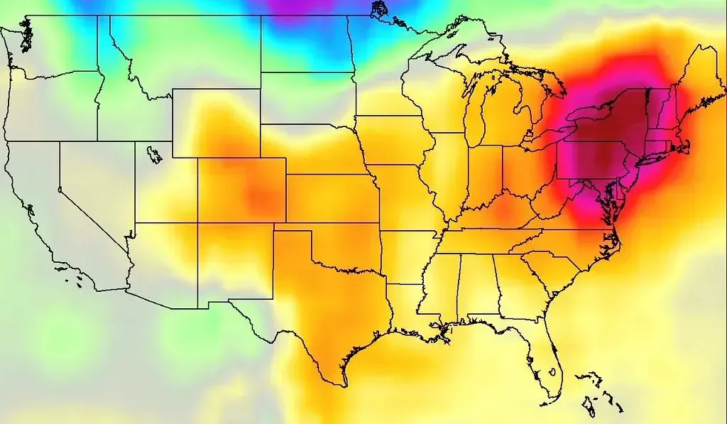
This year’s heat has arrived in distinct waves rather than one continuous blanket. The first dome peaked around the Fourth of July, when a peak of 106°F (41°C) was recorded in Atlantic City, New Jersey. It was eventually broken up by several rounds of severe thunderstorms that moved across the United States from July 4 through 6.
A second dome then settled over the western half of the continent, where seven communities set new records in Manitoba on July 12, and on July 22 twelve communities in British Columbia broke daily heat records, including Lytton, which recorded a temperature of 41.2°C (106.2°F). Around the same stretch, sites across the Mountain West logged historic milestones, including a Salt Lake City reading described as the highest in 152 years of record keeping. The current, third dome picked up almost immediately after, extending the pattern into late July with little pause in between.
It’s not just America: Europe’s own race against the heat
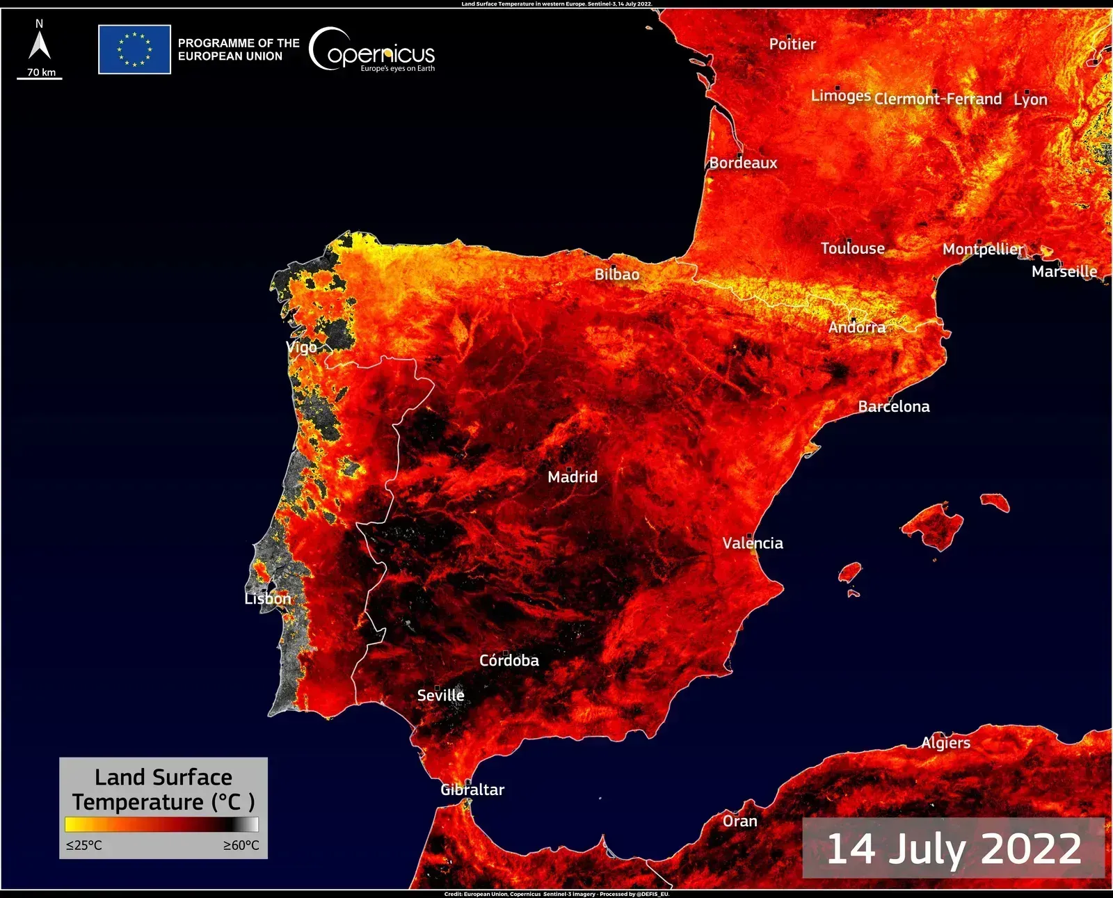
The United States isn’t the only continent watching the thermometer nervously. A new heat dome is now building over Western Europe, and forecasters expect it to intensify through the final days of July into early August. The new heat dome centers over the Iberian Peninsula and France, where the late-July into early-August peak will see widespread air temperatures surging past 40°C, possibly reaching levels up to 45°C in some areas.
The setup resembles what meteorologists call an Omega Block, a pattern with a high-pressure system in the core of Europe and two deep low-pressure systems on either side, one over the North Atlantic and the other over Russia. This follows an earlier, unusually early heat event in May, when parts of the United Kingdom and continental Europe broke springtime temperature records, an episode tied to at least 15 confirmed deaths in the UK alone.
How 2026 stacks up against recent record summers
Context matters here, because extreme summers have become the rule rather than the exception in recent years. The 2021 Western North America heat wave, still one of the deadliest on record, produced a peak temperature of 49.6°C (121.3°F) at Lytton, British Columbia, alongside an estimated 1,400 deaths. The following years weren’t much gentler: 2023 brought roughly 995 combined deaths across the continent, while 2024 saw a peak of 53.9°C (129.0°F) recorded at Furnace Creek, Death Valley, California, alongside more than a thousand confirmed deaths in the United States alone.
Measured against that backdrop, 2026 isn’t an outlier so much as a continuation. What stands out this year is less any single record-shattering temperature and more the sheer persistence of the pattern, three separate heat domes stacking up back to back, each one reloading the risk before the last one has fully cleared.
What comes next
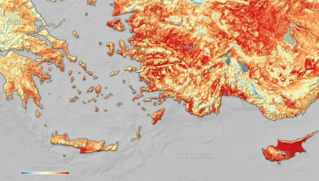
For now, the most reliable guidance points to early August as the point when this particular heat dome loosens its hold on the central United States, though background warmth is expected to linger into the month beyond that. Europe’s parallel heat dome is tracking a similar timeline, with its most intense stretch centered on the final days of July and the opening days of August. Anyone in the affected regions should plan around advisories staying active through at least the first week of the month, with the usual precautions, hydration, checking on vulnerable neighbors, and avoiding peak-hour outdoor exertion, remaining the most practical response until the pattern finally shifts.

- Insurers Ranked Every State by Climate Risk – This One Came in Dead Last - August 18, 2026
- I Asked 3 Water Engineers How Bad the Next Drought Will Be – Their Answers Didn’t Match - August 18, 2026
- The Real Reason Some Cities Are Becoming Unlivable in Summer – And It’s Not Just Heat - August 18, 2026
