


Something shifted in the atmosphere over the past few years, and not in a way that resolves itself after a single bad season. Meteorologists tracking storm behavior across the Atlantic, the Pacific, and the continental interior have started using a phrase more frequently in their briefings: this is the new baseline. It’s a quiet but significant admission from people whose job is to measure what’s normal.
The shift isn’t just about more storms. It’s about how they behave, where they stall, how fast they intensify, and how much rain they carry inland. Each of those changes, taken individually, might be dismissed as a statistical outlier. Together, they describe a pattern that’s harder to wave away.
Rapid Intensification Is No Longer the Exception
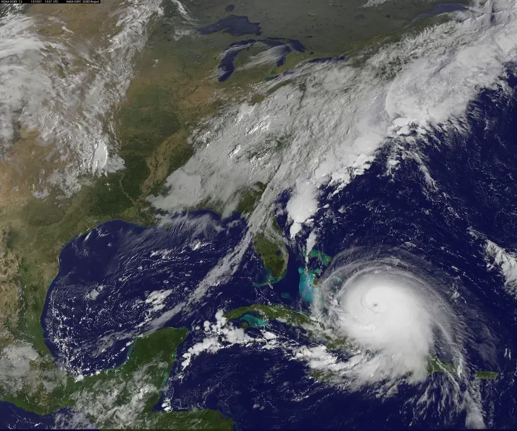
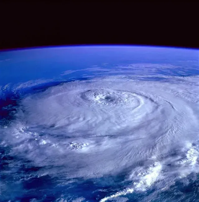
Meteorologists define rapid intensification as an increase in a tropical storm or hurricane’s maximum sustained winds of at least 35 mph in 24 hours or less. That used to be a remarkable event. It’s now almost routine. Seven hurricanes rapidly intensified during the 2024 Atlantic hurricane season alone.
Hurricane Helene ramped up from a Category 1 hurricane with 80 mph winds to a Category 4 monster with 140 mph winds in the 24 hours before landfall. Category 5 Hurricane Milton’s winds intensified by 95 mph in just 24 hours in the Gulf of Mexico. These aren’t coincidences. They’re symptoms of a warmer ocean providing more energy, more consistently, at the worst possible time.
Ocean Heat Is Rewriting What’s Possible

Since April 2023, global sea surface temperatures have been continuously hotter than any period on record, and by a wide margin. That sustained heat has fundamentally changed the fuel supply available to developing storms. Ocean warmth was either at record or near-record levels in the Atlantic Basin’s main development region for hurricanes, as well as the Gulf of Mexico in 2024.
Findings from a Climate Central analysis show that maximum wind speeds for all eleven hurricanes in 2024 were increased by 9 to 28 miles per hour because of elevated sea surface temperatures caused by climate change. It’s unlikely that Hurricanes Beryl and Milton would have developed into Category 5 hurricanes without the influence of climate change. That’s not a minor footnote. That’s a structural change to what these storms can become.
Atmospheric Blocking Is Getting Stickier
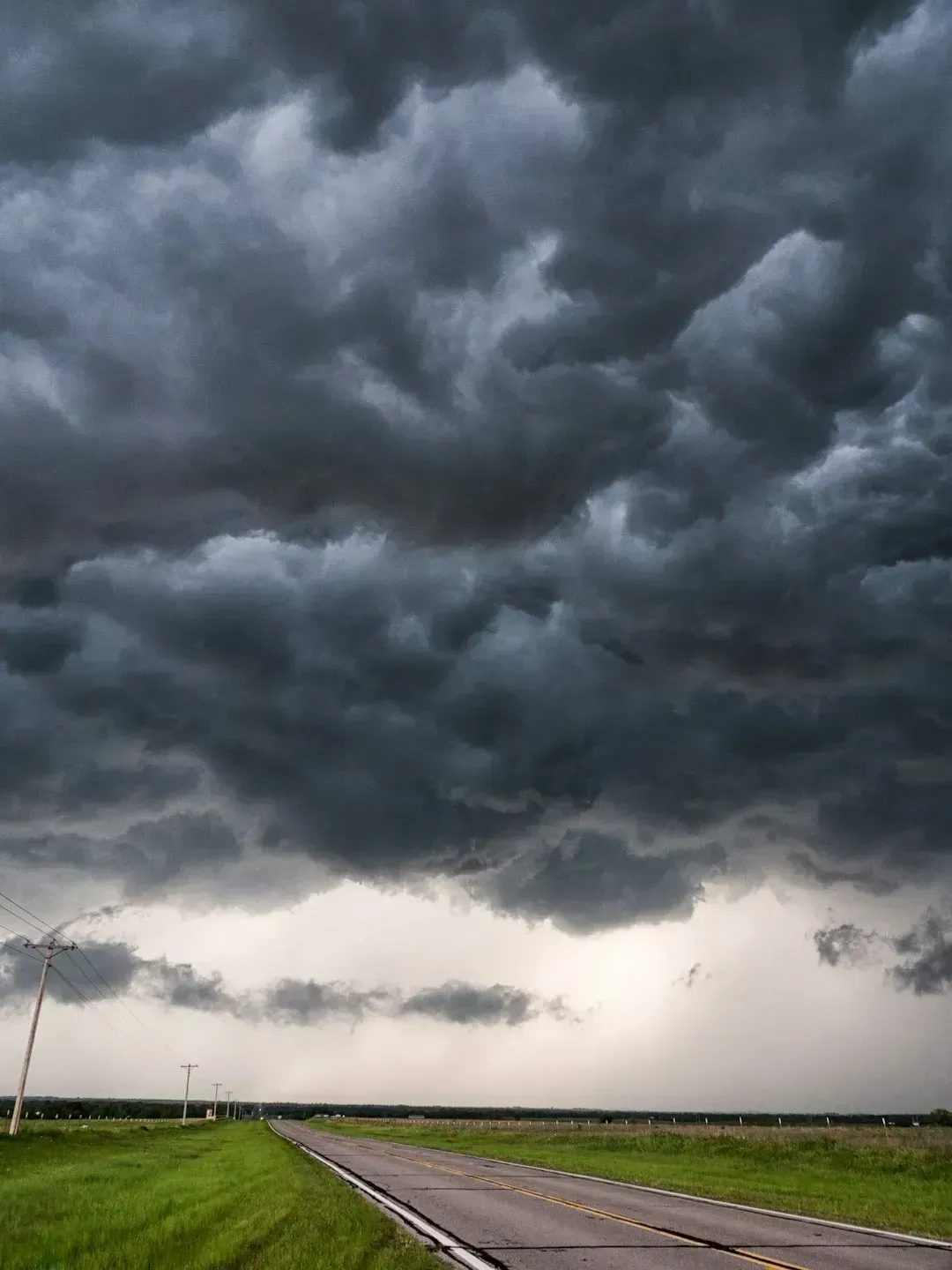
Climate change will increase the size of stalled high-pressure weather systems called blocking events, which are middle-latitude, high-pressure systems that stay in place for days or even weeks. This happens by increasing changes in planetary wave activity that causes the atmospheric equivalent of a traffic jam. When the atmosphere stalls, weather systems stall with it.
Depending on when and where they develop, blocking events can cause droughts or downpours and heat waves or cold spells. Blocking events caused deadly heat waves in France in 2003 and in Russia in 2010. Rice University researchers found that the area of blocking events in the Northern Hemisphere will increase by as much as 17% due to human-caused climate change. A larger blocking system means a larger footprint of extreme weather underneath it.
Storms Are Carrying More Water Further Inland
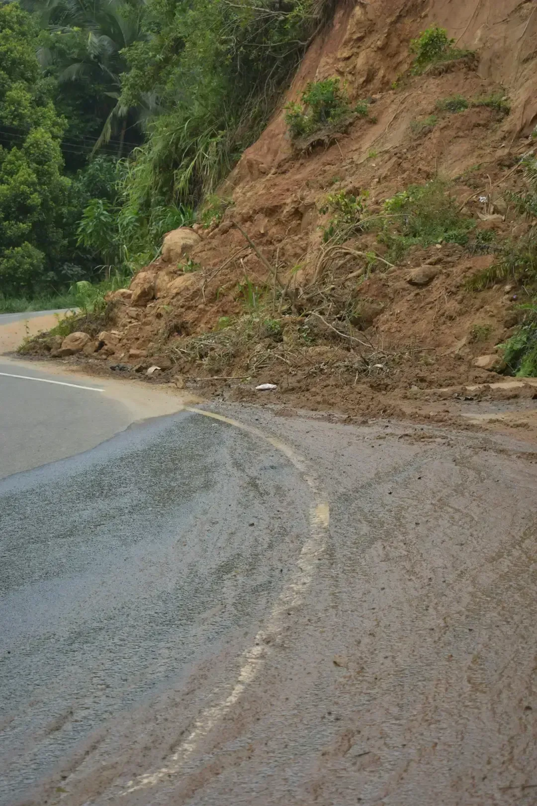
Hurricane Helene delivered 40 trillion gallons of rainfall to the southeast, leading to deadly flooding and landslides across the southern Appalachians. That amount of rainfall is enough to fill more than 60 million Olympic swimming pools and cover the entire state of North Carolina in 3.5 feet of water. The storm’s destruction wasn’t primarily coastal. It was hundreds of miles from the water.
Climate warming has a direct impact on precipitation via the Clausius-Clapeyron thermodynamic relationship: the atmosphere can hold 7% more moisture for every additional Celsius degree. The effect of this exponential relationship is to increase the intensity of the most extreme precipitation events, the events most likely to generate flash floods. That’s a straightforward physical mechanism. More heat, more moisture, more rain when a storm finally releases it.
The “Weather Whiplash” Pattern Is Intensifying

Central Texas experienced an extreme case of weather whiplash in early July 2025, shifting abruptly from a prolonged multi-year drought to a rare 1-in-1,000-year rainfall event that caused catastrophic flooding. The region had endured exceptional drought conditions since 2021, worsening agricultural losses, water scarcity, and land vulnerability. The ground, baked dry for years, had no capacity to absorb the sudden deluge.
A region that had been in severe drought for years was hit by a 1-in-1,000-year rainfall event in July 2025, killing over 100 people including 27 children. 2024 joined 2023 as the two hottest years on record. With the exceptional heat, weather and climate extremes were common across the world, and 2024 in particular saw a remarkable run of extreme precipitation events. The pattern of long dry spells broken by violent downpours is appearing with unsettling regularity.
Above-Normal Hurricane Seasons Are Becoming the Baseline
The 2025 season was expected to be above normal due to a confluence of factors, including continued ENSO-neutral conditions, warmer than average ocean temperatures, forecasts for weak wind shear, and the potential for higher activity from the West African Monsoon. All of these elements tend to favor tropical storm formation. The high activity era continues in the Atlantic Basin, featuring high-heat content in the ocean and reduced trade winds. The higher-heat content provides more energy to fuel storm development, while weaker winds allow the storms to develop without disruption.
In 2024, there were 18 named storms. Hurricane Melissa in 2025 was possibly the strongest storm on record in the Atlantic basin, producing a 252-miles per hour wind gust just above the surface, according to NOAA. Over the past five years, we have seen active and devastating hurricane seasons. The data points in one direction, season after season.
The Jet Stream Is Behaving Differently
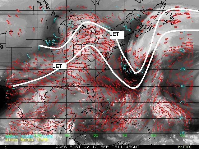
The global climate system now experiences shifts in atmospheric circulation, including changes to the jet stream’s patterns. These alterations can contribute to the formation of more persistent blocking patterns, which then translate into sustained extreme weather events on the ground. The jet stream has long served as a kind of atmospheric traffic director. Its erratic behavior now contributes directly to the stalling and looping of storm systems.
By anchoring Rossby wave ridges, blocking alters the distribution of temperature and precipitation, affects jet stream position, and modulates low-frequency climate variability on timescales from days to seasons. In summer, subsidence beneath blocking ridges yields clear skies, strong radiative warming and drought, while winter blocking drives cold spells through meridional advection of Arctic air. The same mechanism can produce a scorching drought in one season and a catastrophic cold snap in the next.
Forecasting Is Improving, but the Storms Are Harder to Predict
Rapidly intensifying hurricanes can be challenging to forecast, contributing to their high costs. AI-based weather models made significant inroads in the 2025 hurricane season. National Hurricane Center meteorologists consistently referenced the Google DeepMind model in their analyses. Technology is advancing quickly, though the storms themselves are becoming more erratic and extreme at the same pace.
NOAA’s National Hurricane Center can now issue tropical cyclone advisory products up to 72 hours before the arrival of storm surge or tropical-storm-force winds on land. NOAA’s Climate Prediction Center’s Global Tropical Hazards Outlook, which provides advance notice of potential tropical cyclone risks, has been extended from two weeks to three weeks. More warning time helps. Still, when a storm doubles in intensity overnight, even a longer forecast window doesn’t fully close the gap between prediction and preparation.
The Pattern Carries Real Economic Weight
In 2024, natural disasters worldwide resulted in an estimated $550 billion in economic losses, with flooding among the top threats. From 1980 to 2023, 177 landfalling Atlantic tropical cyclones rapidly intensified. The vast majority, roughly seven out of ten, of the 63 total billion-dollar tropical cyclones in the U.S. since 1980 rapidly intensified. The financial signature of this pattern is already written into the data.
Climate change caused the maximum wind speeds generated by roughly 80% of Atlantic Basin hurricanes from 2019 to 2023 to intensify by an average of 18 miles per hour. Storm damage rises exponentially as the winds increase. A storm that is somewhat stronger than it would have been in a cooler ocean is not a slightly bigger problem. It’s a categorically more destructive one, and insurance markets, infrastructure planners, and emergency managers are all quietly recalibrating around that reality.
What “New Normal” Actually Means in Practice
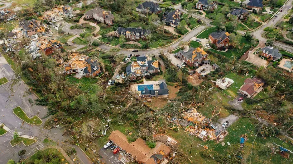
Weather made headlines on multiple fronts in 2025, including the deadly Texas Hill Country floods, a rare EF-5 tornado in North Dakota, Hurricane Melissa, and the emergence of artificial intelligence in forecasting. Each of those events, at a different moment in history, would have been considered a generational outlier. They all happened in the same twelve months.
The term “new normal” gets used so often it risks losing its meaning. In meteorology, it has a specific technical sense: it refers to the 30-year average that defines baseline climate expectations. That average is now being recalculated, and the storms of the past decade are going into it. Midlatitude atmospheric blocking events are important drivers of long-lasting extreme weather conditions at regional to continental scales, yet modern climate models consistently underestimate their frequency of occurrence compared to observations. If the models are still underestimating what’s happening, the actual new normal may be further from the old one than current projections suggest.